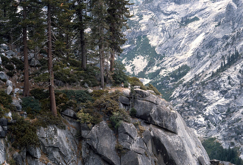
My first wife and I took a hike up the High Sierra Trail from Crescent Meadow near Giant Forest in August, 1986. I brought my old 35mm camera, and recently I had the slides scanned and uploaded to Flickr. Them as are interested can see the scanned slides here.
We spent the first night on the trail just short of Bearpaw Meadow; the second night at the largest of Hamilton Lakes; and the third night at Bearpaw Meadow on our way back out. This hike was the first 13.5 miles of a week-long hike I had taken ten years before with my Boy Scout troop.
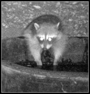
<-- ex-wife in that pic
I captioned these photos from memories of over 20 and 30 years ago as well as a topo map of the route.
You can download a Google Earth .KMZ file of this hike here.
To get the Google Earth track, I simply traced the High Sierra Trail in my National Geographic Topo! software, then saved the track as a .GPX file. Then I went to GPS Visualizer to convert the .GPX file to a Google Earth .KMZ file.
If you follow the track carefully, you can see it veers from the trail significantly at times (yes, you can actually see much of the trail in Google Earth), but that might be because the resolution of the Topo! track isn't more than 125 waypoints or so. Maybe a better approach might have been to create shorter tracks referencing each day of hiking, for better track resolution, except I don't actually know exactly where we spent the first night.
We did part of this hike with our scouts in Aug 2006! However, we started at Mineral King and headed south. Night #1 was Franklin Lakes. Night #2 was Little Claire Lake. Night 3 was Lost Creek Canyon at the Big Five Lakes Trail Junction. Night 4 & 5 was spent at Little Five Lakes. We hooked up with the High Sierra Trail in the Big Arroyo where we went over Kaweah Gap to Hamilton Lakes. We camped at exactly the same campsite where you stayed. Our second to last day's hike sent us past Bearpaw Meadow and through Redwood Meadow to Cliff Creek Camp for night 7. The next day we went over Timber(?) Gap back to Mineral King (from the north.) It was an incredible and unforgettable journey!
Soon I hope to post about the weekend before last and our Onion Valley hikes. Yesterday 7/27, my son, Chicken Legs and I did Cucamonga Peak. Seems like everyone is doing it! TR to follow.
Mike P wrote:We did part of this hike with our scouts in Aug 2006! However, we started at Mineral King and headed south. Night #1 was Franklin Lakes. Night #2 was Little Claire Lake. Night 3 was Lost Creek Canyon at the Big Five Lakes Trail Junction. Night 4 & 5 was spent at Little Five Lakes. We hooked up with the High Sierra Trail in the Big Arroyo where we went over Kaweah Gap to Hamilton Lakes. We camped at exactly the same campsite where you stayed. Our second to last day's hike sent us past Bearpaw Meadow and through Redwood Meadow to Cliff Creek Camp for night 7. The next day we went over Timber(?) Gap back to Mineral King (from the north.) It was an incredible and unforgettable journey!
That's kind of the opposite of what I did in 1976. We started at Giant Forest and came out at Mineral King, during the week of that year's Democratic Convention. When we got back to a car with a radio, we learned Jimmy Carter was the new Democratic nominee.
By the way, Ingrid and I did the entire High Sierra Trail (Giant Forest to Whitney Portal) in August of 2013. I thought I'd posted a trip report here, but I guess I didn't.
Also, a couple years later my father died and after going through my parents' stuff I found the slides I took when I hiked Giant Forest to Mineral King as a Boy Scout in 1976. I was shocked by what a crappy photographer I was then. Anyway, I scanned the slides and those are on Flickr as well: https://www.flickr.com/photos/simonov/a ... 2351889025


 <-- ex-wife in that pic