
There aren't too many geographical spots with a more cool name then Hurricane Deck. It has fascinated me for a while with its isolation and deteriorating trail system. Volunteers seem to work the trail sometimes and then at other times it just gets overgrown. This variability and uncertainty attracted me and the drive which is a minimum from LA of 2.5 hours kept me away. About a month ago I came up to the area for the wildflower bloom and realized that if I drove this distance for some flowers, my excuses for not doing this hike were used up.
The most important thing about this hike is to get the weather right as you don't get much higher then 3,500 feet and the ridge is all exposed. The western section is the longest of the segments so attracted me with the long drive to make this my goal. I got up at the ungodly hour of 4 AM to make the drive, getting there at exactly 7 AM. Surprisingly the parking lot was packed as it appears this is a very popular backpacking spot as the Manzana Creek is a fabulous place to camp out with very mellow hiking and lots of campsites.
I started downstream for about a mile or so and got to my first crossing of the stream that was at least 35 feet wide with knee deep water. I managed to dunk one foot completely in the creek trying to hop rocks and got most of my other foot wet, oh well, more about this later. Immediately after the first crossing you get to Potrero Trail which will connect with Hurricane Deck. The route climbs the west ridge in switchbacks and then follows it upwards towards the next large ridge line to the north, which is Hurricane Deck. I met some day hikers who were hiking up to a meadow that lay at a low saddle right before the final climb to the Deck. The growth on the south side was already brown. The trail while narrow with high fox tails was very evident. After the meadow with a cool rock formation you began the final haul up to the Deck. The final section was a bit overgrown but also very evident. From here there is a couple of old poles marking the junction.
The Deck is what I would call Topa Topa Junior. It has a very similar look. The hiking is slightly strange with you hiking right at the edge of the drop off to the south but since the north is so level the hiking is excellent. As expected the trail was faint along the deck but with the narrow ridge very easy to follow. I divide the Deck on the west side into three sections. You are at your highest point when you get to the junction so as you drop elevation, views dissipate. This makes the first section the most interesting and the most dramatic. I met some backpackers on this section who were pretty surprised to see me day hiking this section. The middle section is less dramatic but does have some nice drop offs. The last section you come off the main ridge and drop to a subsidiary ridge due to the rockiness of the main ridge. This last section of ridge is nothing worth talking about and has the most brush. Overall the trail while indistinct was easy to follow with minimal amounts of resistance.
The last section to get down to the Sisquoc river is the most annoying as you go through high grass meadows where you can't see the tread. This section has a slumping trail tread and filled with gopher holes and since you can't see where you're putting your feet, you keep on stumbling like an idiot. This section was on the north side and was quite green. Finally you make it down to the river and follow it downstream to the confluence of Manzana with Sisquoc. There apparently was a religious community that settled here around the turn of the 20th century and there are some abandoned ruins and grave sites that you can visit a little further down but it didn't really interest me.
I crossed Manzana Creek trying to stay on rocks and fell in again. On the other side is Manzana School Campground with some backpackers in the process of clearing out. This section is long at over nine miles from when you get down off the ridge back to the car. To make it more miserable I kid you not there are at least 40 creek crossings, as you can imagine I gave up on staying dry and just tramped through over and over again. The lower section has a lot of private property, with you even going through a ranch with some horses and burros, the homesteader actually lives down here it appears that he has a different dirt road that he takes. You also pass a 1913 cabin that is on some historic registry which the historians will be pleased about. Finally you pass all the private property signs turn back east and re-enter the San Rafael Wilderness. The hike while flat gets tiring with all the creek crossings and the length. It is quite amazing how flat this section of canyon is and how it goes on for miles with the gentle slopes. You pass some camping spots and again I passed some more backpackers. Finally I made it back to the junction with Potrero and had one last creek crossing. My feet at this point were as shriveled as prunes.
The whole hike was around 17-18 miles with about 3,000 feet elevation and other then the return was really delightful. I finished it in just under seven hours but didn't really have an extended stop. I might like to come back here and hike the eastern and middle sections. The middle in particular seems to be the most rugged but that'll have to wait until next year as the season is closing for this hike.
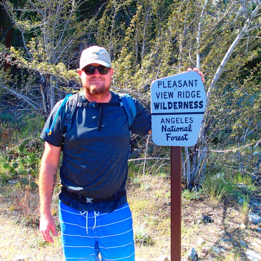
Hurricane Deck-West
-
tallsquirrel
- Posts: 25
- Joined: Thu Nov 16, 2017 6:37 pm
Wow that's quite a long hike. I did a one night trip to Manzana Schoolhouse a few years back. I tried to hike the west deck but kept loosing the trail and had to turn back. I did a trip to White Ledge and hiked the east deck and the trail was better. I love the backcountry wilderness areas of Santa Barbara. I consider them more remote and rugged than even the high sierras. There are fewer people and more wildlife. Lots of snakes and some feral donkeys. Even saw a mountain lion driving to the trailhead one time. Wish I could get there more. Definitely don't go in the summer!

