
I took over 5400 photos during this vacation (!), so the following Trip Report is intended to be only a tiny selection. The photos are chronological, but a lot of details have been left out.
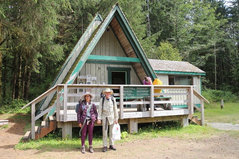
Day 0: We flew from San Diego to the city of Victoria on Vancouver Island, stayed in a hotel, then took an eight hour bus ride to the far end of the trail, where we were issued our permit after an official orientation class. We scheduled it so that we would stay overnight at the local campground in order to get an early start the next morning.
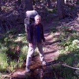
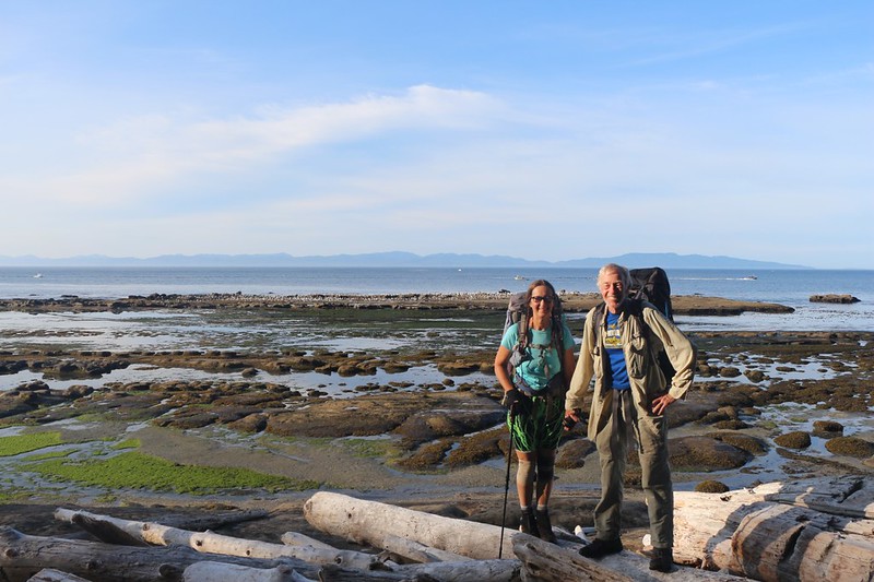
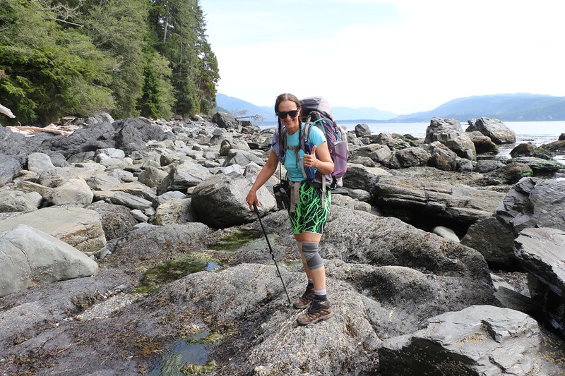
We started our West Coast Trail (WCT) hike at the Northern end, at the Pachena Bay Ranger Station
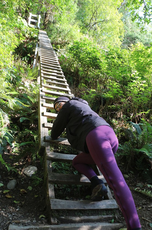
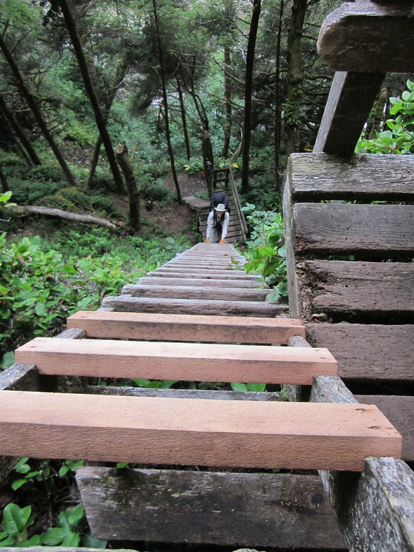
We decided to check out the first ladders on the WCT as a day-hike - very sturdy but also very tall - hold on tight!
Day 1: We started the main hike the next day. The first 12 kilometers were in the forest. Note that we tried to hike on the beach whenever possible, but the trail went in the forest when there were impassable headlands or places that were sensitive to the height of the tides, which were quite large (over ten feet).
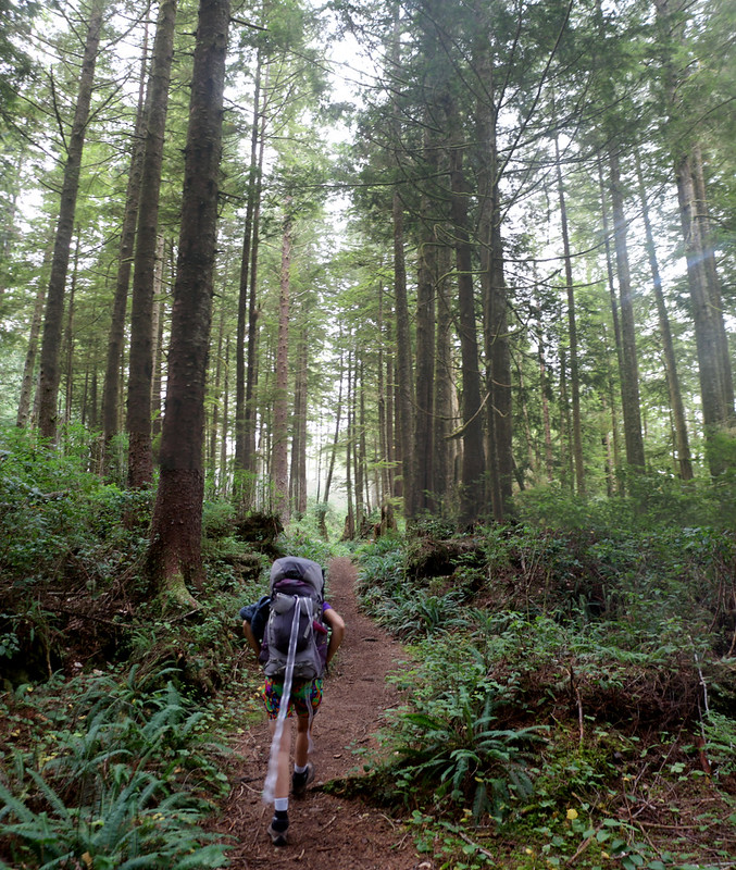
Tall trees and a soft trail through the misty forest
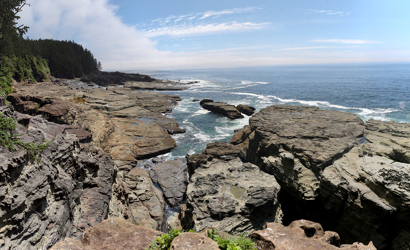
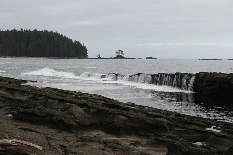
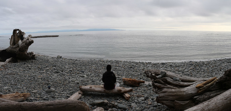
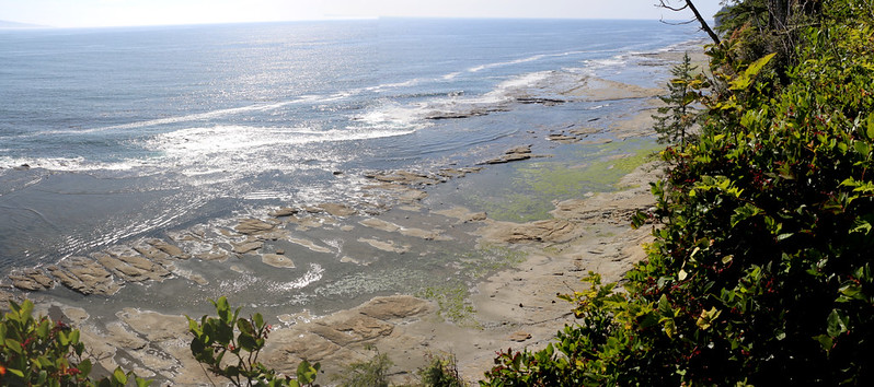
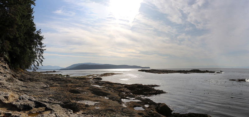
Panorama view from the lookout spot above Sea Lion Rock
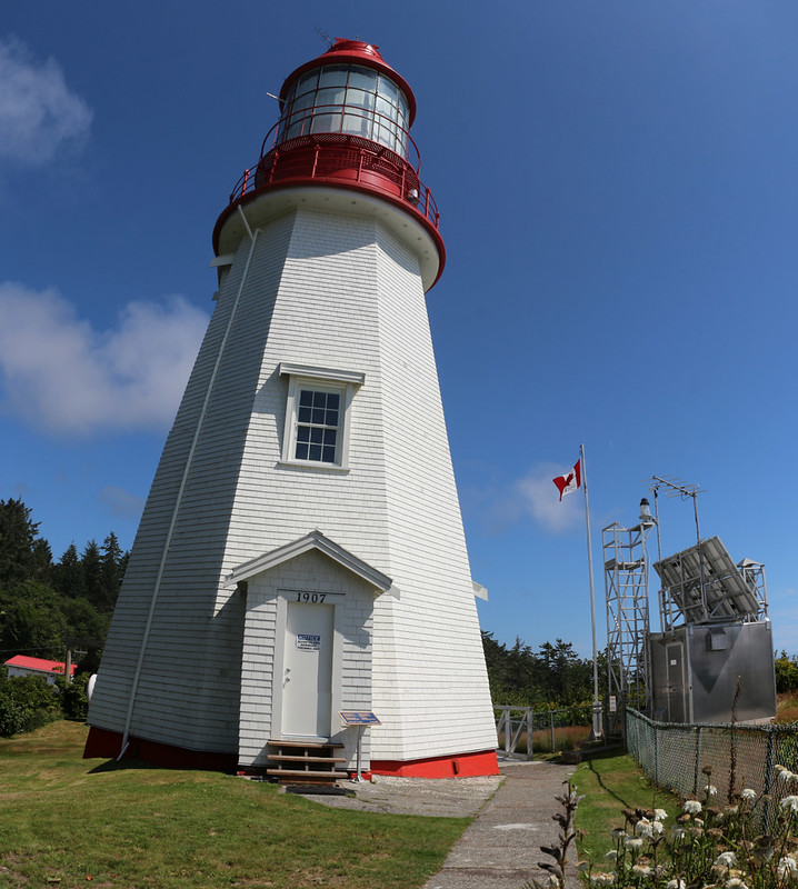
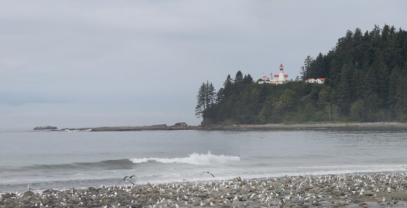
Pachena Point Lighthouse, built in 1907, still has the original Fresnel Lens inside, but is no longer used. The modern light is on the steel tower.
The trail dropped down to the beach soon after the point.
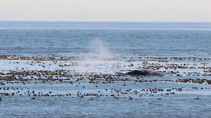
A whale blowing spray as it cavorts amongst the kelp offshore at Michigan Creek
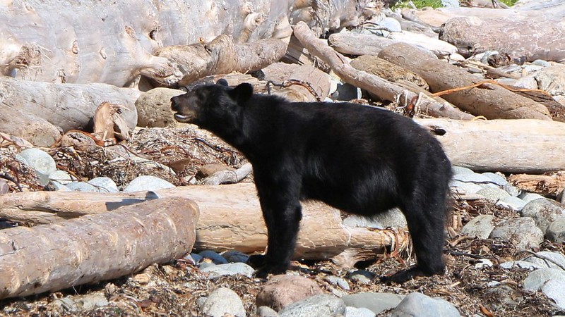
We met two yearling bears on the beach south of Michigan Creek, and we had to walk out on the rocks to get by
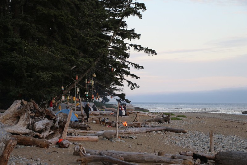
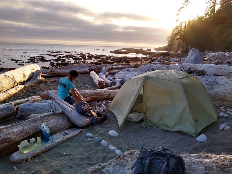
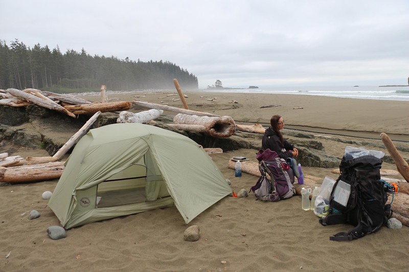
Campfires and Camping on the Beach at the Darling River Campground
The spot was was a bit crowded, compared to our usual wilderness style, but everyone was super-friendly (this is Canada, after all). It had a two-story composting outhouse and bear lockers for our food. We set up our tent directly on the beach, above the high tide mark. Technically, you can camp anywhere on the beach, but we didn't want to carry bear cans, so we stuck to the official spots.
Day 2: Almost every morning started with mist. It settles on everything, so you need to keep your gear inside with you, or put on a pack cover. As for the trail: First we hiked on the beach, then the forest, then the beach, then the forest. And we ended up in one of the prettiest spots I've ever camped in.
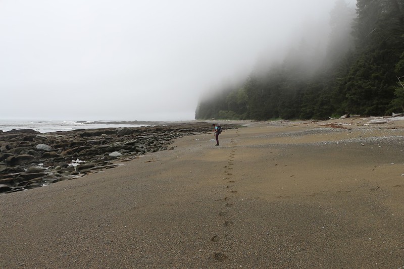
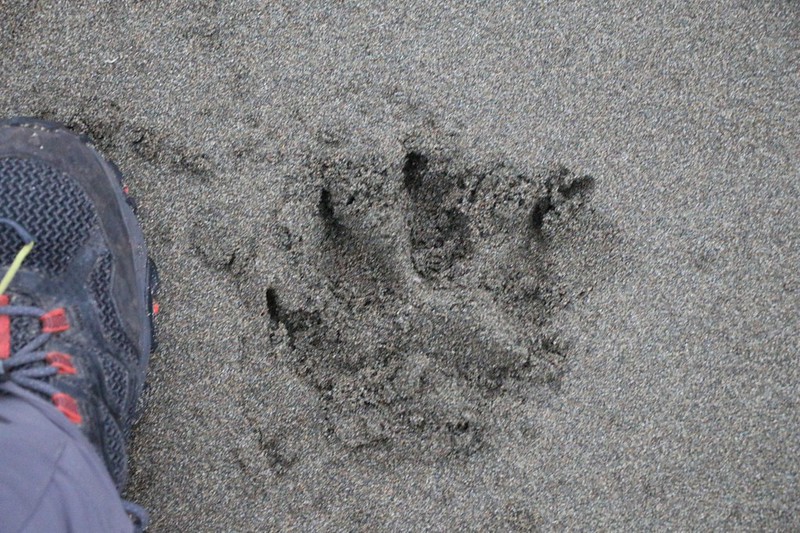
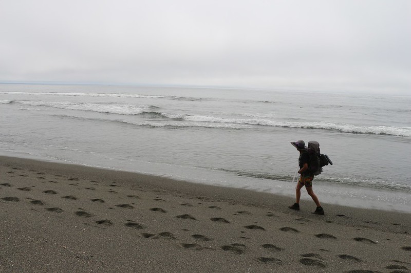
Footprints on the beach
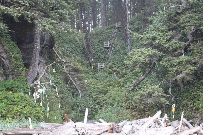
This trail is famous for its ladders. We had to climb almost 300 feet from the beach near Tsocowis Creek
Looking north along the coast from the shore at Trestle Creek
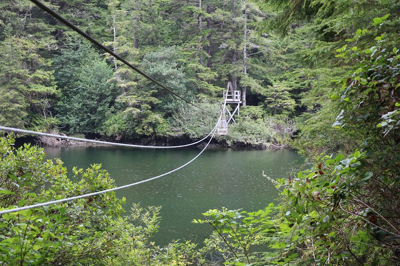
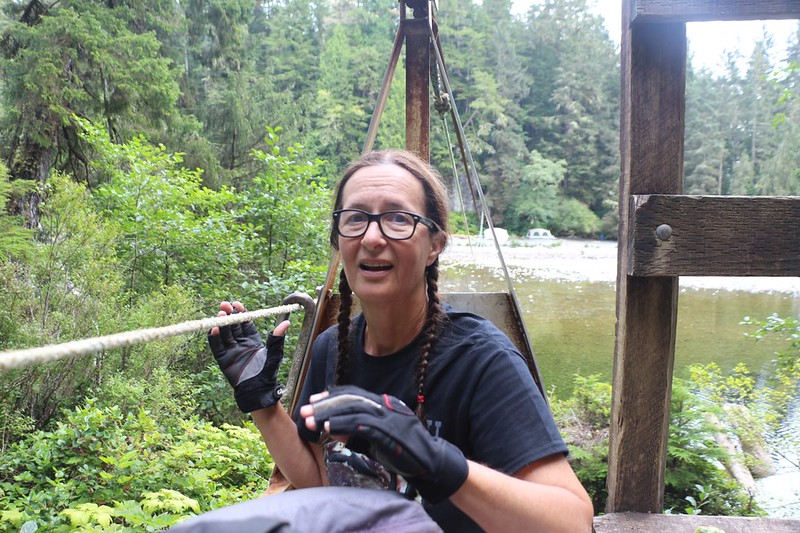
View of the 2-Person Cable Car over the Klanawa River. It coasts on down to the middle when you let go, but then you have to pull yourself up to the other terminal, hand over hand on the rope!
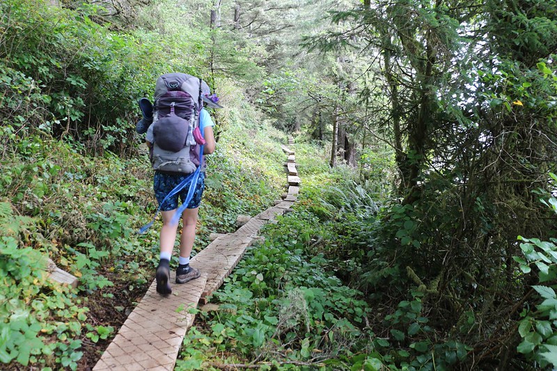
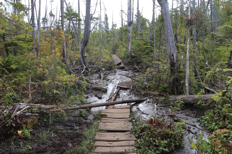
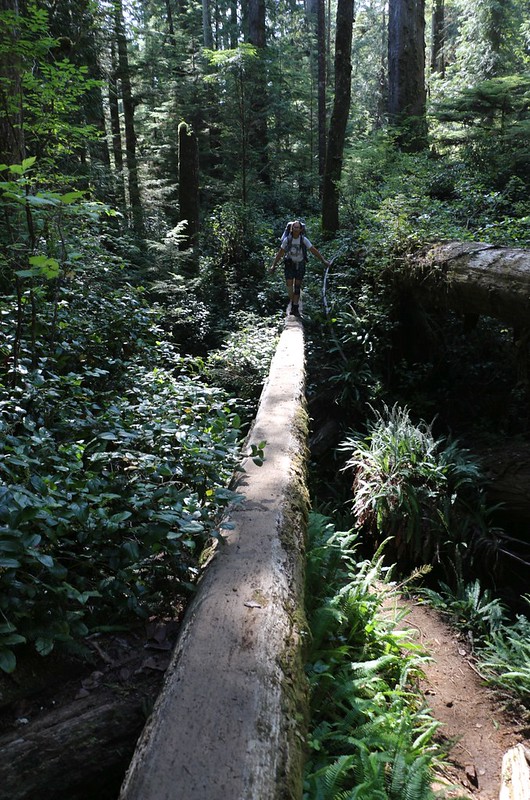
We continued hiking in the forest south of the Klanawa River. Lots of cool wooden walkways. Some are new, some are old, some are missing entirely.
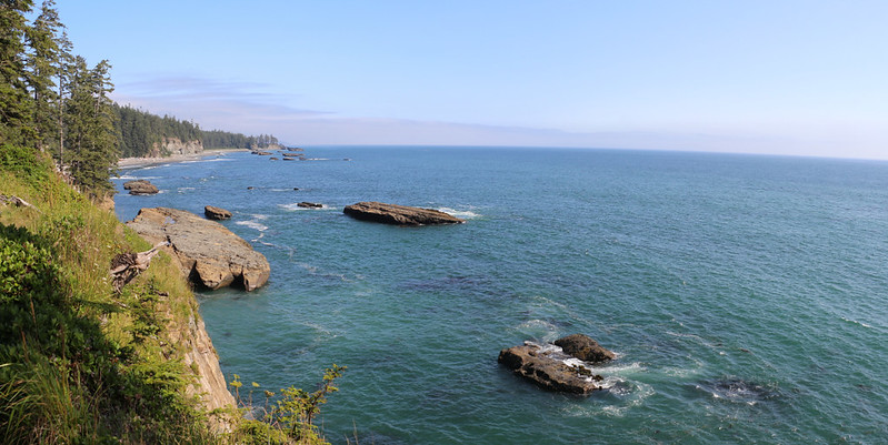
Looking south along the rocky coast from a high bluff as we near the Tsusiat River
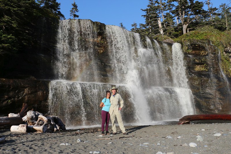
Posed shot of the two of us in front of Tsusiat Falls, at the 25 km mark. It falls directly on the beach.
Our tent and campsite on the beach at Tsusiat Falls in the afternoon light
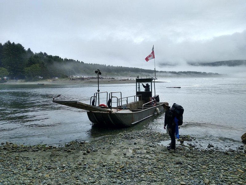
Day 3: We scheduled a short day, only 7 km. After hiking mainly on the beach, we took a boat ride (the permit fees cover this ride) across the Nitinat Narrows, then stayed in a cabin at the Crab Shack, which was operated by a "First Nations" family.
We didn't climb the four sets of ladders up the bluff at the Tsusiat Campground - we headed south on the beach
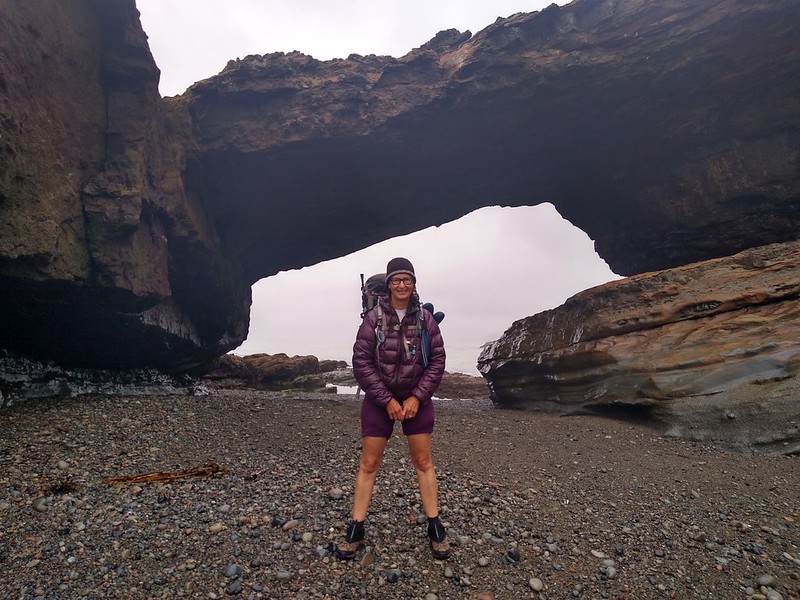
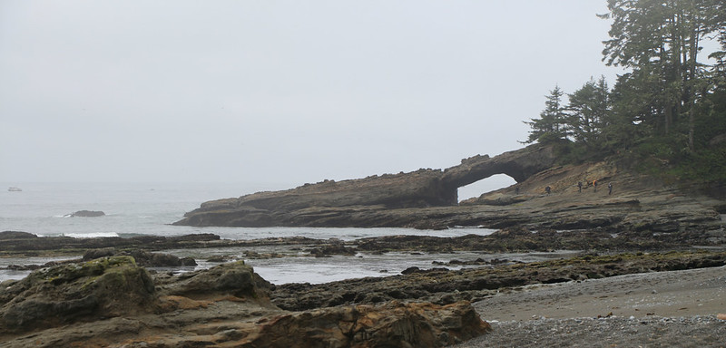
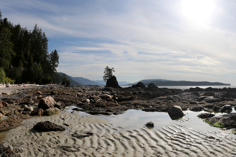
Vicki at Tsusiat Point, with its natural bridge. Passable at tides below 7 feet.
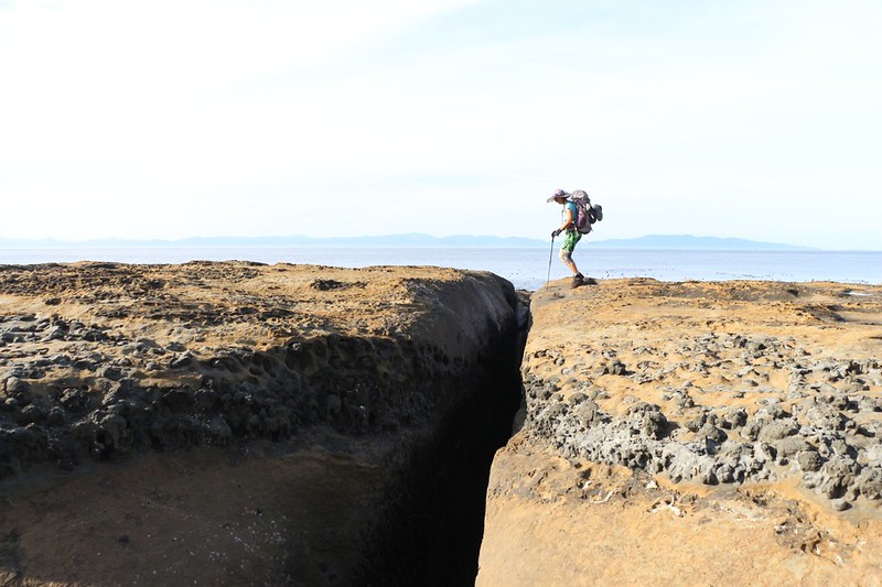
Looking back at another group of hikers as they climb over the rocky shore at Tsusiat Point
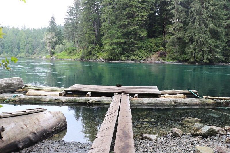
The boat dock on the northern (west) shore of Nitinat Narrows where we had to wait for the ferry boat
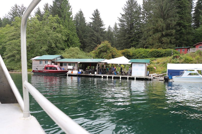
We arrived at the Crab Shack and boat dock right about lunch time
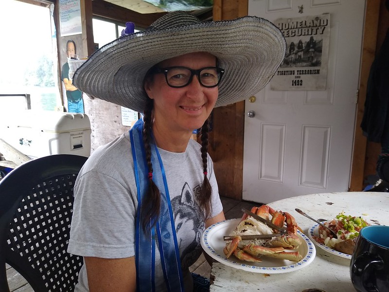
Happy Vicki eating her Dungeness Crab - much better than trail food!
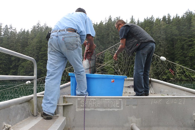
They took us out in the boat and pulled in the first salmon of the season - it weighed 18 pounds!
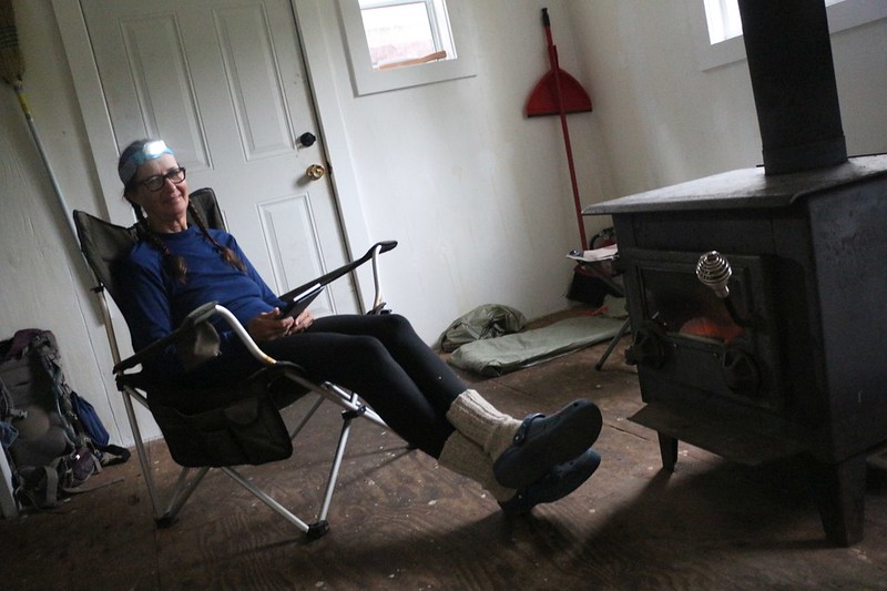
Vicki is enjoying the heat of the fire in our cozy romantic cabin
Day 4: We had breakfast burritos at the Crab Shack, then hiked another 10 km to the campsite at Cribs Creek. We were mostly on the beach, but not all the time.
The Wooden Suspension Bridge over the Cheewhat River. Supposedly the water in this river tastes nasty. We didn't try it.
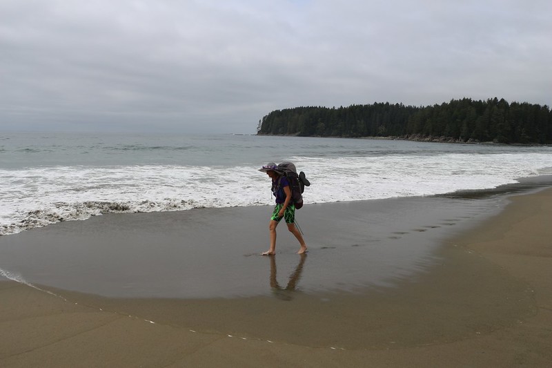
Vicki hiking barefoot on the soft sandy beach south of the Cheewhat River
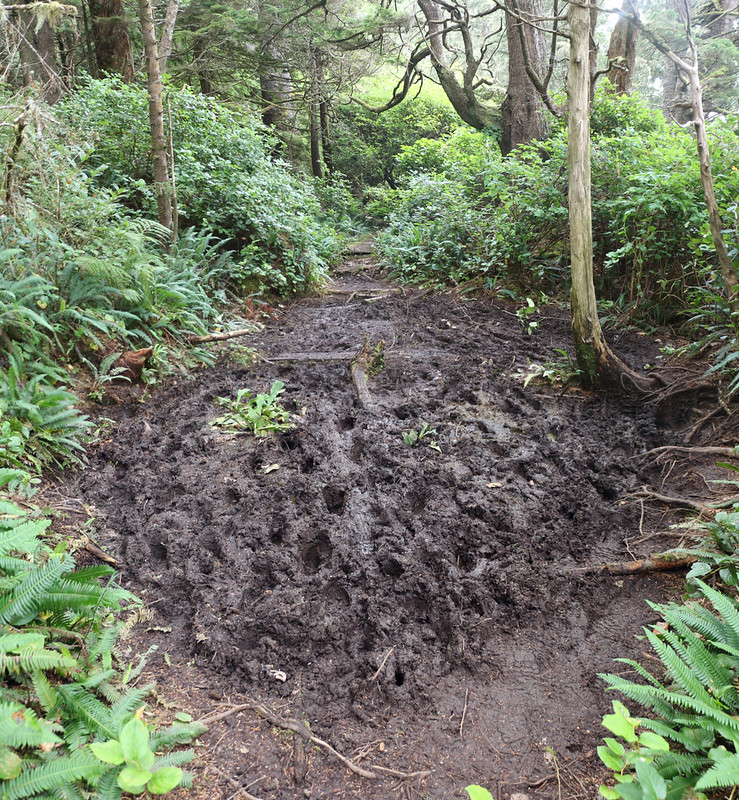
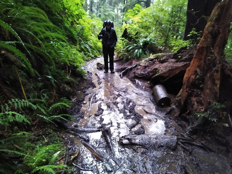
There were plenty of mucky mud patches on this section of forest trail
A wave breaking over the Cribs Rocks at Cribs Creek
Our tent and campsite on the beach at Cribs Creek. We camped across the creek from the main crowd and had the place to ourselves.
Day 5: We hiked nine more kilometers to Walbran Creek at the 53 km mark. We tried to stay on the beach the whole time but it became loose gravel and the slogging really got to us, so we headed into the forest near the end.
Large Bear Track in the sand that we discovered near our tent in the morning
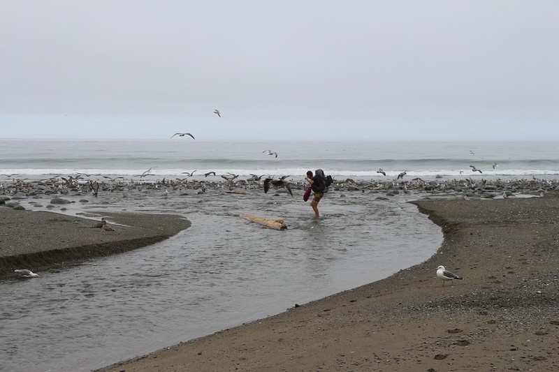
Vicki carries her shoes in a dry bag as she crosses Carmanah Creek amidst plenty of seagulls
Zoomed-in view of Carmanah Point and the lighthouse, from Carmanah Creek
Slogging on the gravel beach as we neared Vancouver Point - deep footprints mean hard work!
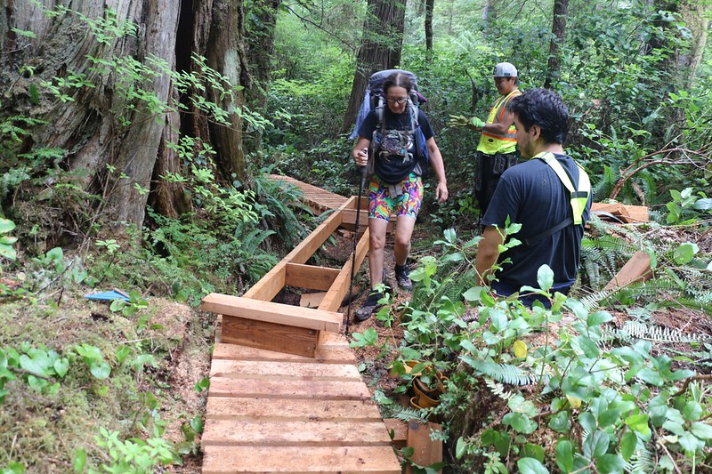
We met with a First Nations Trail Crew building new wooden walkways just west of Walbran Creek
We joined with another group and it made the Cable Car crossing much easier: They helped pull!
Panorama view from our campsite at Walbran Creek looking out over the ocean, with Washington across the way
Day 6: This day was spent entirely within the forest, so we got the full measure of crazy WCT trailbuilding. Lots of ladders, lots of bridges, lots of walkways, and tons of mud!
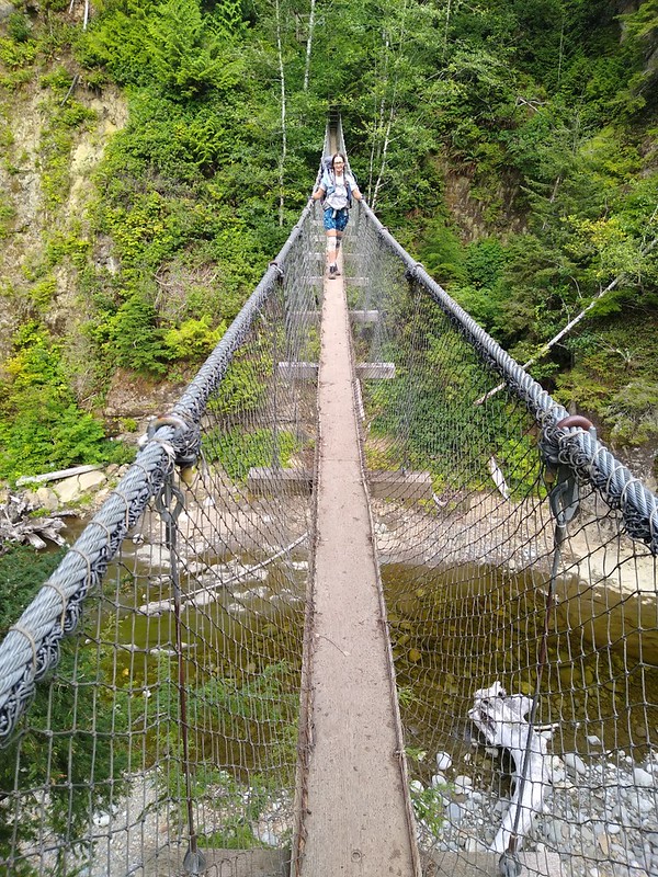
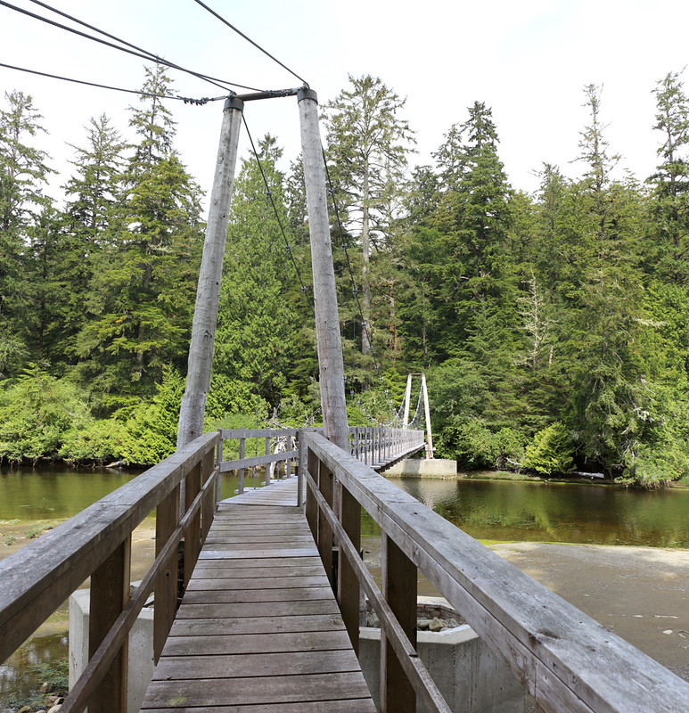
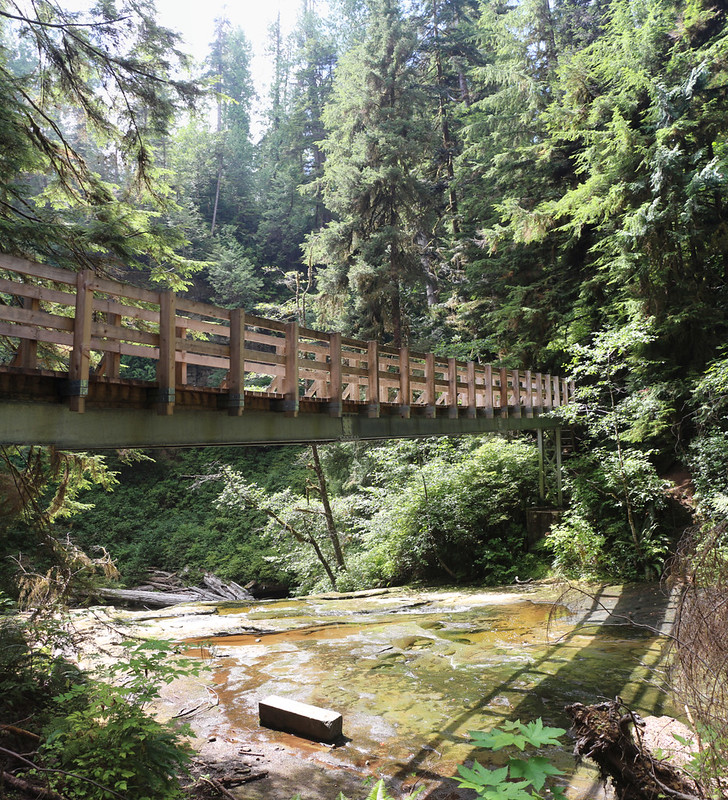
Looking back at Vicki as she crosses the 75 meter suspension bridge over Logan Creek.
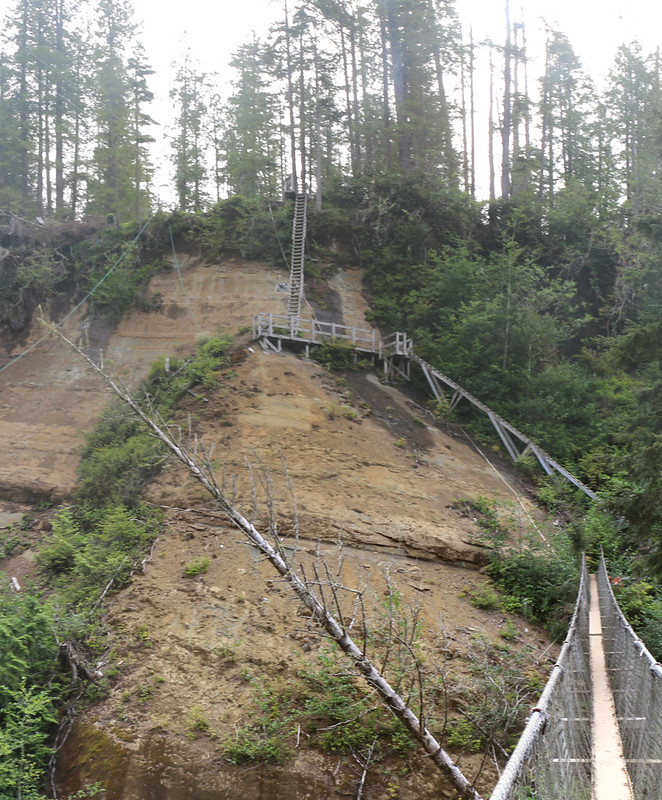
The insane set of ladders on the south side of the suspension bridge
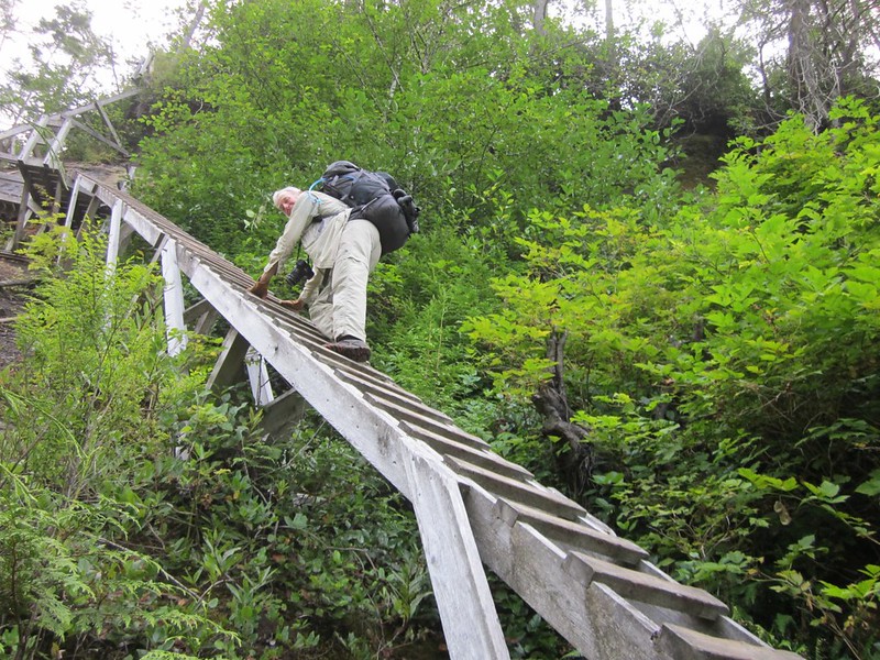
This ladder was one of the scariest on the entire trail - both by angle and exposure - Hold on tight!
The wooden platforms rotted and sank into a bog between Logan and Cullite Creeks
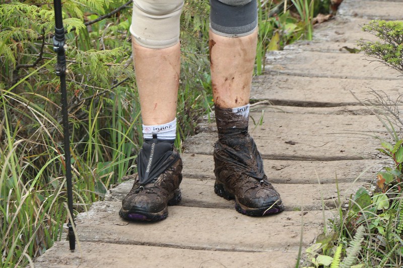
Vicki missed her footing in a boggy section and sank into the stinky mud. Yuck!
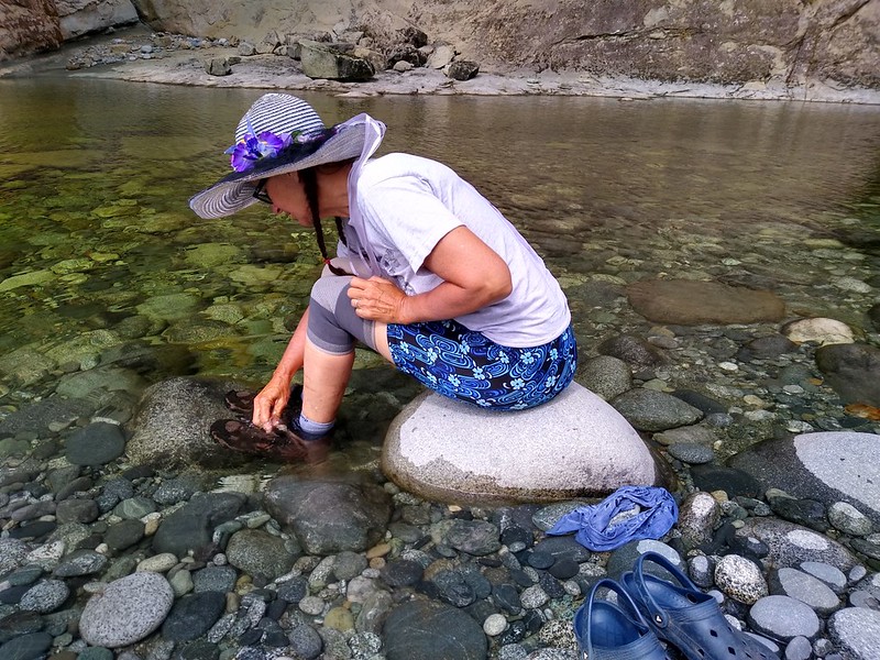
At Cullite Creek, Vicki had to wash her shoes out vigorously to get the bog stink out of them - it was only partially successful
Sturdy steel beams support the wooden bridge over Sandstone Creek
We came upon a beautiful view of the coastline after hiking for miles in the forest, as we neared Camper Bay at the 62 km mark
This fallen log was flattened on top and is now a part of the trail. Logs ARE the trail more often than you would ever believe!
Day 7 This was just about the best hiking day on the entire trip. A tide below 6 feet allowed us to hike on a rocky shore around Owen Point and through a sea cave to the other side. Then we had to scramble over tumbled, seaweed-coated boulders for a mile before making it to the final night's campsite at Thrasher Cove.
Vicki and I at "Beach Access A" east of Camper Bay, as we begin the fun hike toward Owen Point
Vicki getting ready to hop across a narrow but deep Surge Channel
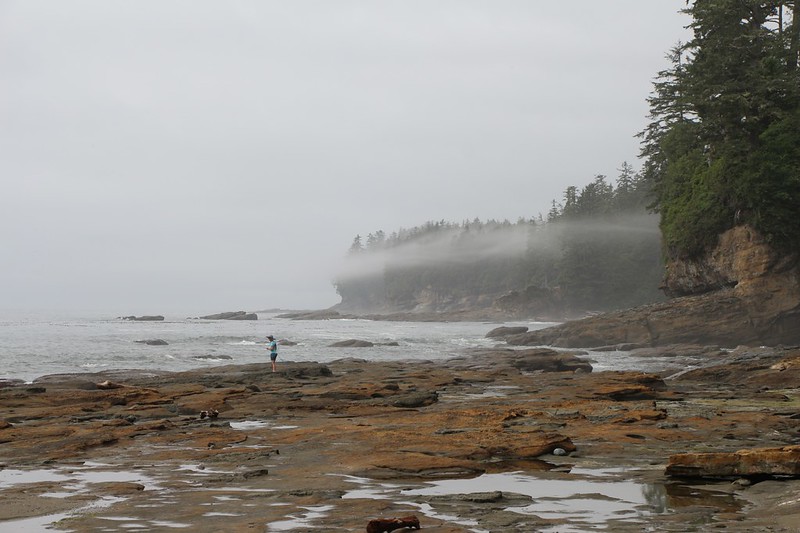
We're rounding the corner at Owen Point, with Port Renfrew in the distance on the left
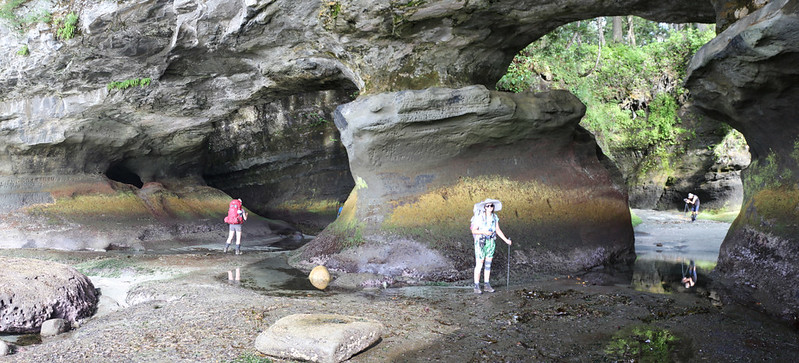
Owen Point and the Hole in the Rock
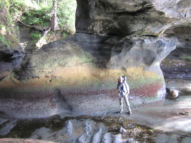
Vicki's photo of me from the sea cave's window with plenty of colorful rocks
Looking northeast at Port San Juan (a large inlet of water) from Owen Point
Vicki is happy to discover barnacle-encrusted boulders which have excellent traction for hiking. Just don't fall!
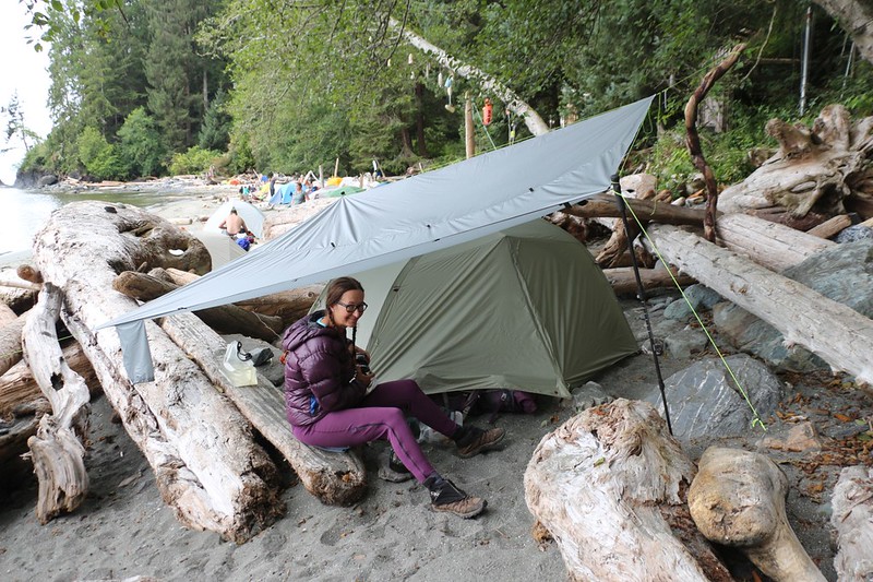
It was supposed to rain that final night so Vicki set up our 10'x10' tarp over the tent in proper PNW style
Day 8: After continuous rain since midnight, we were able to pack up our completely dry tent under the 10x10 tarp! It was great. Then we headed up a LOT of ladders, to eventually reach the trail's highest point at 700 feet elevation. The final 6 km of trail were on extremely difficult terrain and took us over 6 hours to complete.
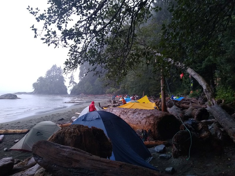
It rained all night and Thrasher Cove looked very soggy first thing in the morning
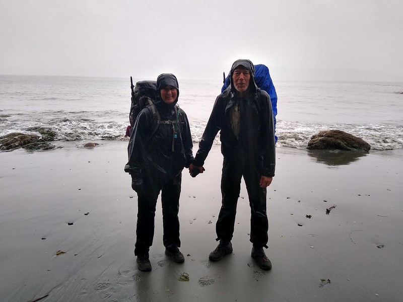
Vicki and I standing in the rain on the beach at the Thrasher Cove Campsite
The West Coast Trail looks a lot wetter and muddier when its raining!
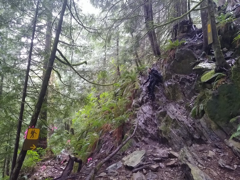
Yes, that horrible rocky wall is actually the West Coast Trail, and it needed two signs to make people believe it!
We arrived in time for the final ferry boat that would take us across the Gordon River to Port Renfrew
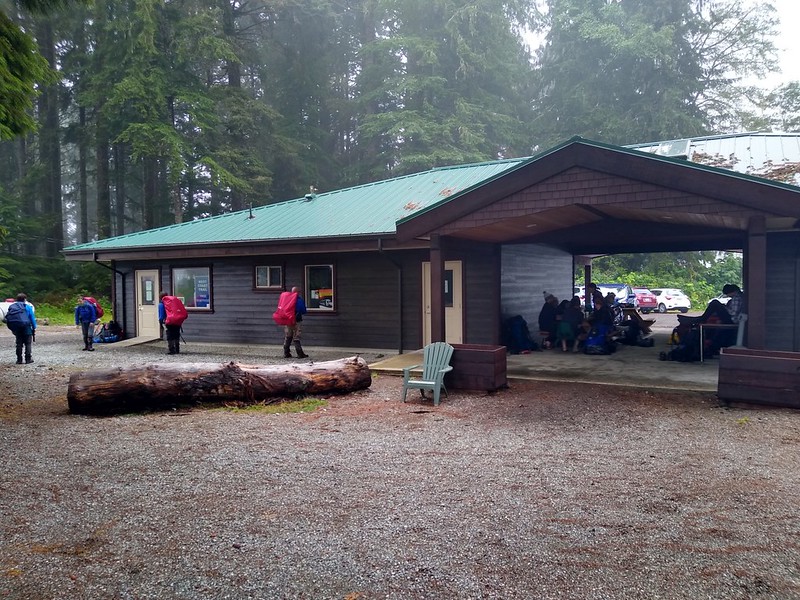
Pacific Rim National Park Ranger Station in Port Renfrew.
We took showers in the campground by the Ranger Station, and dried our wet clothes in a dryer. We even ate some real food! Then we waited for the three hour bus ride back to Victoria and our hotel. We flew back to San Diego the next morning.
All in all, it was an absolutely beautiful trip, and well-worth all the logistics involved in planning it. Highly recommended!
NOTE: This TR was about one percent of the photos I took.
Check out my Flickr Album Page if you want to see the ten percent of the photos (500-ish) that were actually worth a darn. Luckily, nobody but me can look at the other nintey percent!
And if you want the full story (a very long read which includes a subset of the 500 photos) then check out my blog/website page.
A map of the hike can be found on my CalTopo Page
Official West Coast Trail Website on Parks Canada.
Happy hiking!


