Kern Peak

Archived TRs for Sierra Nevada ranges.
Post Reply
User avatar
dima
Posts: 1302
Joined: Wed Feb 12, 2014 1:35 am

Post by dima »

I compensate for the brevity of this trip report by including a ginormous panorama.

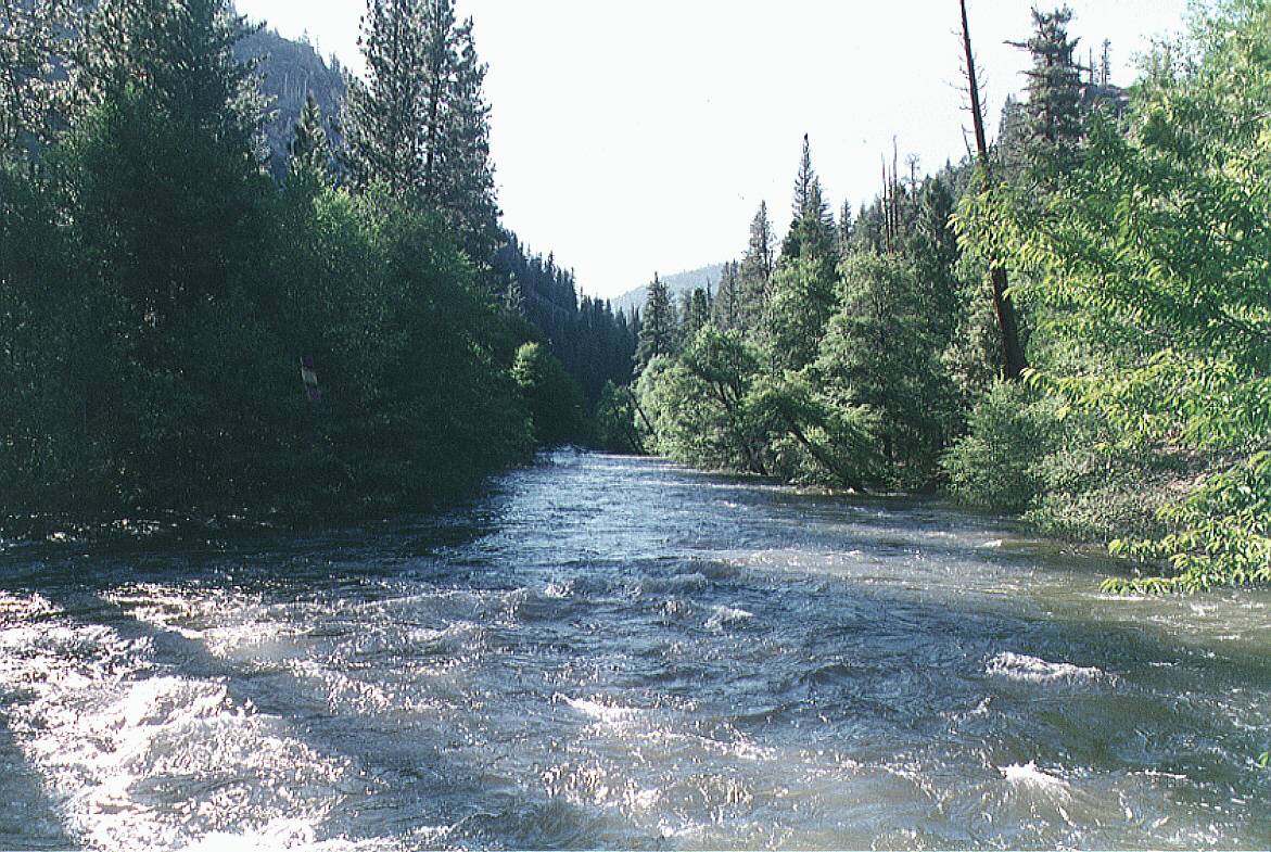
We went out to the Golden Trout Wilderness for the long weekend. Drove up from the Owens Valley to Kennedy Meadows, and past it to Blackrock trailhead. Everything is paved and open. Trailhead is just below 9000ft. We hiked North to Casa Vieja meadows, then past that to Redrock Meadows. Camp. Trail is in good shape. About 9 miles. No significant climbs or drops; maybe ended up gaining ~ 1k ft with the up/down. Lots of water everywhere. Small snow patches here and there, but it's all minor. The meadows are nice.

Image

Image

After a very cold night (the water in the bottle froze!) we broke camp, and hiked North. At the pass over the Toowa range (10020ft) we turned left to ascend cross-country towards Kern Peak. It's a nice, open forest. Easy going. The main ridgeline of the peak runs North-South, but we were approaching from the East, so you end up running into the main ridge at a steep, rocky bowl

Image

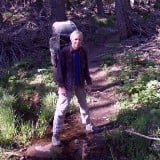
I climbed the rib on the left. It's an easy class-2 thing. Then you're on the main, mostly tree-less ridge.

Image

And after a surprisingly-long walk you can look down on everyone from the peak. There was a fire lookout here. It doesn't really exist anymore, but lots of debris remains. Another thing that remains is the views. Click for the extra-large image.

Image

Lots and lots of peaks whose name I don't know. It was a clear day, and you could actually see the main ridgeline of the San Gabriels to the South. The little bit of snow that remains on the top of Baldy reflects light well, and you could see the faint ridgeline to the West, to Vincent Gap and Baden-Powell. This didn't come out in the photo, sadly. But trust me! One USGS disc wouldn't suffice for this peak, so it has 3:

Image

Image

Image

We descended via the South ridge, taking it all the way to the saddle at ~9800ft. It's a nice cross-country descent; open forest most of the way. Some boulders and brush towards the bottom, but nothing really difficult. At the saddle is the trail between Cold Meadows and Redrock Meadows. We went left towards the camp to pack up and go home. Trail's clear and easy to follow.

When we were finally ready to go, it was late, and 2 of us decided to break up the return trip by camping another night at the Jordan hot springs. The trip there is ~ 5 miles, 2000ft down Redrock Creek. Then about 5 miles and 2000ft up the next day. I only had a paper map, so it took some figuring out to find the trail. Eventually we found it. It goes over the saddle NW of the Indian Head rock

Image

This trail isn't nearly as good as the others. The area on top is overgrown in spots, but mostly ok. The bottom half or so is in a burn area. Much more overgrown with whitethorn, and the trailbed is gone in places. It's a game of find-the-next-pink-flag. We made it eventually. The place is big, but the area with the springs is fairly small. Somehow it wasn't overrun, so we took a dip in the springs, camped another night, and walked out the next day.

If you randomly climbed the same peak that day, add your $0.02!
User avatar
Uncle Rico
Posts: 1386
Joined: Thu Mar 20, 2008 7:48 pm

Post by Uncle Rico »

Nice pano. Beautiful country. The McNally fire that burned that area around Indian Head was in 2002 I believe. Guess the trail was never fully restored after that.
User avatar
JeffH
Posts: 1146
Joined: Sun Nov 28, 2010 7:09 am

Post by JeffH »

I agree with Rico, great pano shot. I recognize Whitney, Langley and Cirque on the far right part of it but those are the easy ones.
"Argue for your limitations and sure enough they're yours".
Donald Shimoda
User avatar
Tom Kenney
Posts: 351
Joined: Sat Sep 29, 2007 7:51 pm

Post by Tom Kenney »

If you keep going down Nine Mile Creek (from Jordan) to the Kern River, there's an amazing cabin there (mostly stone!) with a covered outdoor kitchen right on the river bank. This is the view up-river from the 'deck' of the kitchen:

Image
User avatar
Tom Kenney
Posts: 351
Joined: Sat Sep 29, 2007 7:51 pm

Post by Tom Kenney »

JeffH wrote: I agree with Rico, great pano shot. I recognize Whitney, Langley and Cirque on the far right part of it but those are the easy ones.
Yeah, mind-bending! The Needles and Merlin Dome are dead-center. Merlin is the broad dome with dark cleft facing camera, The Needles are the rocks to it's right, opposite the ridge so they mostly are hidden. The Upper Kern Rd is the road cut at Merlin's base.
User avatar
jfr
Posts: 147
Joined: Sat Dec 12, 2009 3:01 pm

Post by jfr »

Nice panorama! You can check out the peaks visible from there using Peakfinder
https://www.peakfinder.org/?lat=36.3086 ... ern%20Peak

If you haven't purchased it yet, get the $5 Peakfinder Earth App and pre-load it with all the peaks in California over wifi. It works without cell signal after that. There's a link to it on that page. This app is one of the best five dollar bills I've ever spent, and I'm a cheap b@$+@rd, so that ought to tell you something. :D I fire it up on top of every peak I climb.

BTW, I hiked into the Golden Trout Wilderness last year on Labor Day from Horseshoe Meadows, and now I'm sorry I didn't get anywhere near Kern Peak...
My hiking trip reports: https://hikingtales.com/
User avatar
dima
Posts: 1302
Joined: Wed Feb 12, 2014 1:35 am

Post by dima »

Tom Kenney wrote: If you keep going down Nine Mile Creek (from Jordan) to the Kern River, there's an amazing cabin there (mostly stone!) with a covered outdoor kitchen right on the river bank. This is the view up-river from the 'deck' of the kitchen:

Image
Nice view. The cabin is abandoned? It's a weird area. It's wilderness, yes, but there're private inholdings and grandfathered ranching operations. So you have old, abandoned cabins AND all the meadows are full of cow pies. I'm sure there're non-abandoned cabins around there somewhere.
User avatar
dima
Posts: 1302
Joined: Wed Feb 12, 2014 1:35 am

Post by dima »

Kern peak will still be there next time!
User avatar
Tom Kenney
Posts: 351
Joined: Sat Sep 29, 2007 7:51 pm

Post by Tom Kenney »

dima wrote: Nice view. The cabin is abandoned? It's a weird area. It's wilderness, yes, but there're private inholdings and grandfathered ranching operations. So you have old, abandoned cabins AND all the meadows are full of cow pies. I'm sure there're non-abandoned cabins around there somewhere.
Sorry for the late reply.

I cheated and looked at a map just now, 'cause I forgot. It is named 'Painter Camp' on the 7.5' quads. Goggle Earth places it at these coords:

11 S
378383.00 m E
4009323.00 m N

Your question prompts me to research a bit. I'll update with what I find. It was interesting to me at the time, but got buried by slightly neater stuff later on. Seems to be a public facility, no private inholding marked on the map.

It's one of those places that is very out of the way. The cabin is well-constructed, like the Lon Cheney cabin with older technology (slightly smaller stones). Glass windows. There is a broad 'paved' deck along the river, and the cabin sits on one side, with a covered kitchen/dining area on the river edge, with railing. There is a storage shed with trail building tools (shovels, mattocks, mcclouds, rakes, picks). There's a corral. Can't recall what else was there. This photo was from IIRC spring 1994, very heavy snow year. The river was flooding, and almost level with the deck.

Upriver from this location, a dead-end trail climbs and drops 200m over a buttress, then continues to Hell's Hole. This is actually a delightful open ponderosa forest with supreme giants of the species.

At the time the guy I hiked/climbed with knew a lot about Miwok, Paiute, Shoshone trade routes and camps. We found several sites on that trip with big obsidian chip piles. We also pissed off some cowboys who forgot to ride point on their herd. Their cows slowly and silently appeared out of the woods while we were resting at Cold Spring on the trail to Trout Meadow Stn. We shooed them off gently, and hiked on. Within an hour the cowboys were behind us, razzing us for being so inconsiderate.
Post Reply