
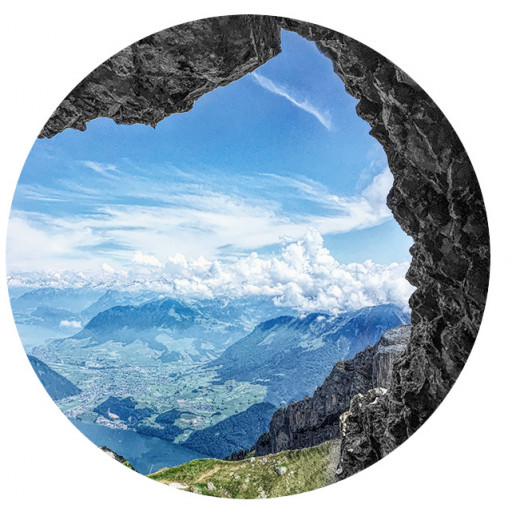
Castro Peak is the highest point in the middle of the Santa Monica Mountains and has been closed for about 20 years from public access by some radio tower magnate who closed access just because. I have never been up there because of the lack of access but decided to do some recon with my significant covert ops experience. This landowner has been particular about making sure no one get access with large metal gates with barbed wire on the top and cameras. It feels like they are protecting the Hope Diamond versus allowing friendly hikers to enjoy their craft.
I needed to hike another high point above Kanan-Dume road but that wasn't going to be a proper hike so after I hit the high point above the tunnels. I hiked along the Backbone Trail to Latigo Canyon Road and then from there to the turnoff for the old fireroad that used to lead up to Castro. The actual private parcels are only certain sections of the road but not other areas so technically if you don't take the road the whole way you don't hike on private property. Of course this write up is hypothetical regardless. As you reach a tight switchback you will begin the final climb before the fence. There are actually three ridges that all look doable to get to the top. The first right at the switchback looks very promising with some brush with deer tracks but otherwise pretty clear. The next ridge is more brushy and would have to be accessed via a drainage on the left. The third right at the gate has the least brush but is the steepest route up. Anyway if people are into hoping to get to the top of Castro those are the easiest ways in my opinion but you should definitely not take them otherwise you will be going on private property at the top, so do not do this hike.
If you wanted to get to the top of Castro Peak


-
David Martin
- Posts: 85
- Joined: Sun Nov 08, 2020 7:08 pm
Thanks for the write up! It brings back memories.
A few years ago, in the middle of hiking the Backbone Trail (in sections) with my wife, I noticed Castro Peak and envisioned walking up to it. A few days later I put together a loop route, combining a chunk of Backbone Trail with fire roads that I saw in satellite views. It was summer, with very warm evenings, and a full moon was coming up. I decided that this would be a beautiful romantic night hike, and asked my wife to try it with me. She's quite adventurous and open to nearly any outdoor activity but doesn't much like walking in the dark, and one trail section goes through a closed-in swampy area that she didn't like. Still, she humored me by saying ok.
So we drove out there at night after dinner. The moon was mostly obscured by clouds and she didn't enjoy that low, closed-in area at all, but we passed through it and turned right on a fire road, heading up. After climbing and passing a gate with a no trespassing sign, we found ourselves blocked later on by a much more serious fence (which you probably saw) and some very stern warning signs. We were (or at least I was) tempted to scale that one too and go for it but in the end we just turned back. My lovely, adventurous, trusting wife was, understandably, very unhappy with me and my crazy ideas that night. There was not much conversation as we headed back to the car, especially along the dark, closed-in section that she now had to pass through again. It was a few days before domestic bliss returned to my life and I could only blame myself. I learned that even a big, obvious walking path seen on a map might turn out to be a really bad bet, especially at night, and especially with a spouse who dislikes hiking in the dark.
I still have the marked-up satellite view map that I created, printed, and brought out there. Maybe I should post it here for a laugh.