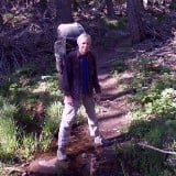
This is a short but worthwhile jaunt in the Santa Susana Mountains. Mileage will be maybe 5 miles with 800 feet elevation gain but the hike will take you between 2.5-3 hours. The hike begins at Mentryville which is off Pico Canyon in Santa Clarita. You will have to park outside the park if you want to avoid paying a fee. Mentryville is the home of the first oil well in So Cal and can be visited up canyon. There are a couple of old homes from when there was a community up here that are kind of cool to mosey around. The road through the canyon is paved and when it starts to climb out of the canyon it turns into a dirt road that climbs the ridge to an overlook. That overlook can be connected to the Wiley Canyon area which is another hike for another day. I had tried to climb Sand Rock Peak the first time using this route however the ridge was too brushy and the peak too far away for me to be interested in the time and effort it would take.
Looking at Peakbagger I saw that others had accessed the peak from the bottom which required less distance. As you walk on the paved road there is an obvious canyon that opens up to the left which has a trail. Take this trail until the end where there is a table on an exposed hillside. You will see directly across from you a ridge going up to the east. Hiking back 150 feet or so to get closer to the canyon you can drop into the streambed and crossover to an easy access to this ridge. This ridge climbs at a moderate incline. The ridge itself is pretty nicely covered with brush interspersed with grasses. There will need to be some brush busting to get up the ridge. The right side nearest the edge sometime has a deer trail that avoids brush but sometimes there is no way around it. The top is particularly annoying but fortunately this is not San Gabriel brush but standard chaparral which for the San Gabriel crowd is annoying but easily doable. You finally top out on the main ridge in a small clearing with a barbed wire fence that you'll need to get around. Not sure what they were fencing off on top of this ridge but there it is.
Now you are on the ridge that will lead you to Sand Rock. A steep bump is in front of you staying to the east side will avoid some of the brush but again brush and you will become one as you bust your way up to the top of this point. At the top of this nob you can see the final ascent to Sand Rock which doesn't look easy. Fortunately there is a clear bypass, once again used by animals that allows you to contour around the steep sides and clamber up grassy slopes to the back side. From here you are on a narrow ridge with an awesome drop off on the east side so you stick to the west side when plants get in the way. Finally there is one rock to clamber over and the next is the summit with drop offs on three sides on this airy summit. The views are of the Santa Clarita Valley but still pretty nice.
On the way back I had left a duck to remind myself of the spot to connect to the contour around the peak but could not find it with all the brush. I instead elected a steeper way down and hit on the use trail fortunately and made my way back along the ridge. With gravity the brush was less of an issue and I found my way down much quicker then my way up. All in all a worthy peak for the distance required.