
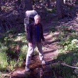
The trail is only 25 miles long, and most folks do it in three days. But we're retired now, and self-professed wimpy hikers. If we were going to drive twelve hours from San Diego to far northern California, then we were going to get our money's worth. So we opted to hike it in seven days. 3.6 miles/day with almost no elevation gain! Ultra-wimpy. This equation yielded plenty of time to relax on the beach. We also chose June because the Winter rains would hopefully be finished and it would still be snowy in the Sierra (which we planned to hike in July). Our reservation was for the northern trailhead, hiking south. This is the preferred route, as the prevailing winds blow from the northwest, In life, it's better to have the wind at your back.
The Lost Coast Trail is located in Humboldt County, within the King Range National Conservation area, which is administered by the Bureau of Land Management. Much of the "land" portion of the trail is in the King Range Wilderness, while the oceanic region is within the Rocks and Islands Wilderness. There were also a few inholdings of private land with cabins, and the rules simply asked us not to tresspass. Easy enough to do.
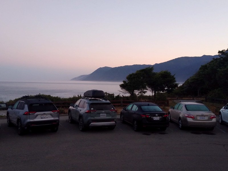
So we got our gear together and drove north, staying the night in the BLM campground at Mattole Beach in Petrolia, CA. The plan was for me to drive south in the early morning to the destination terminus, where I would leave our car and catch a pricey shuttle bus back to the northern end. That way we could finish the hike whenever we wanted. Still, we were committed to hiking the full 25.3 miles, but we could handle that.
Day 1: Mattole Beach Trailhead to Sea Lion Gulch
I left my car in Shelter Cove, and at 6:30am I boarded a shuttle van north, for another two hour drive back to Mattole Beach
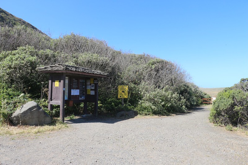
Information kiosk at the Mattole Beach Trailhead, as we began our trek
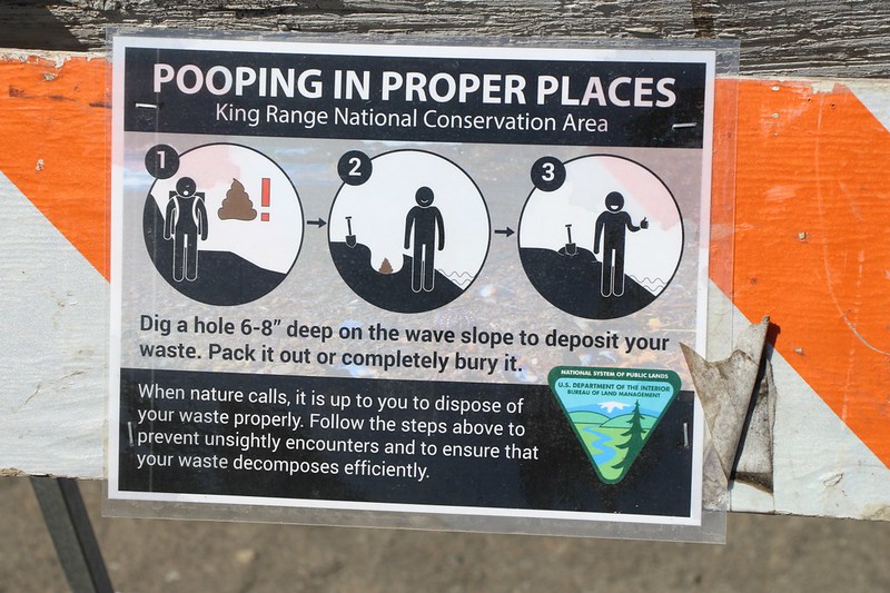
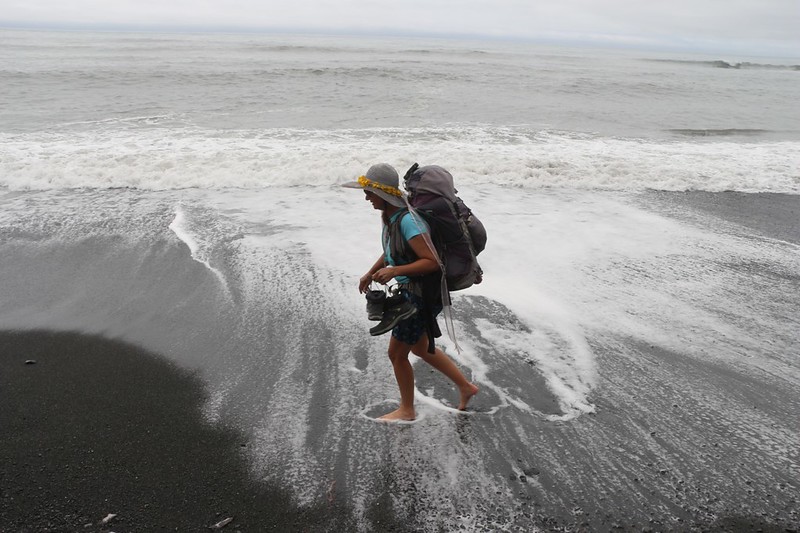
On the Lost Coast Trail you are instructed to bury your bodily wastes on the wave slope - yes, directly on the beach!
I don't know if it was Covid, or the 30 person/day quota, or people not bothering to cancel their reservations, but there weren't many hikers out there in June 2021, so pooping on the beach wasn't quite as em-Bare-Ass-ing as it might have been. Except when we were at a crowded campsite at high tide. That's when it got a bit tricky.
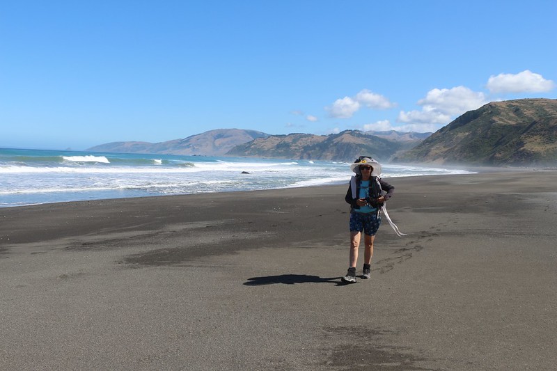
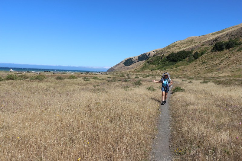
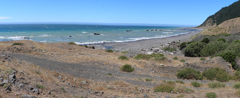
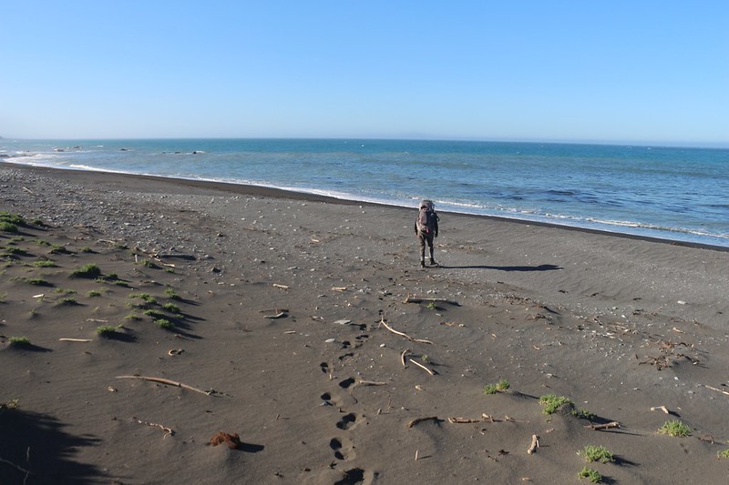
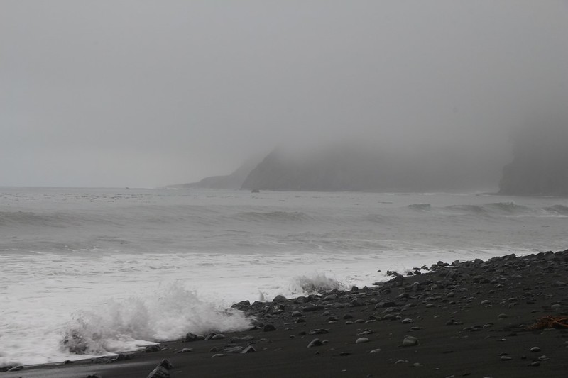
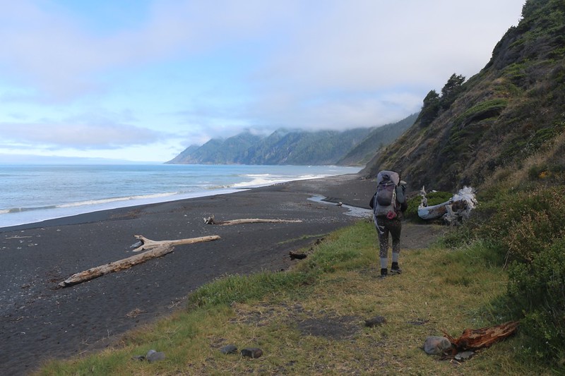
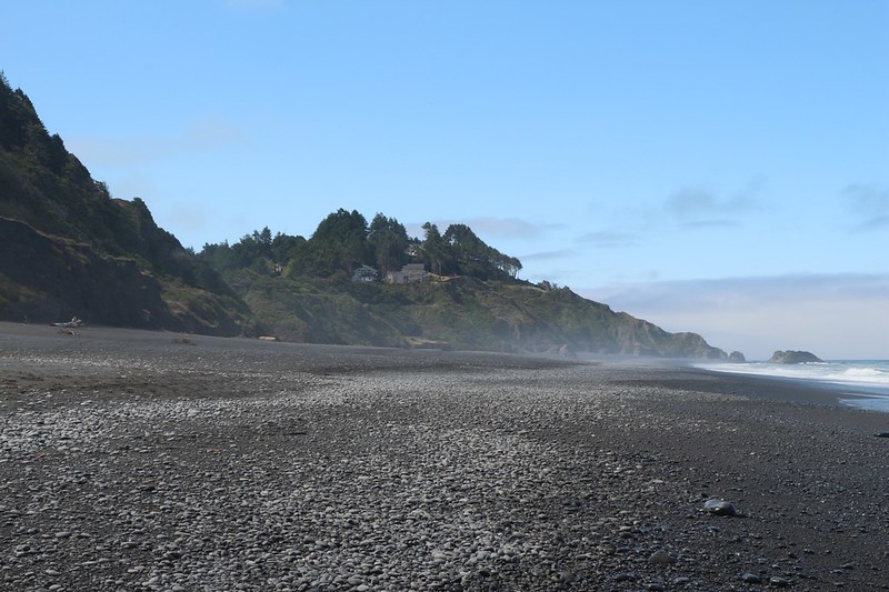
Hiking the beach with Cape Mendocino on the far left and Mattole Beach on the right
Cape Mendocino is the most western point in California, and is known by sailors for its treacherous weather and seas.
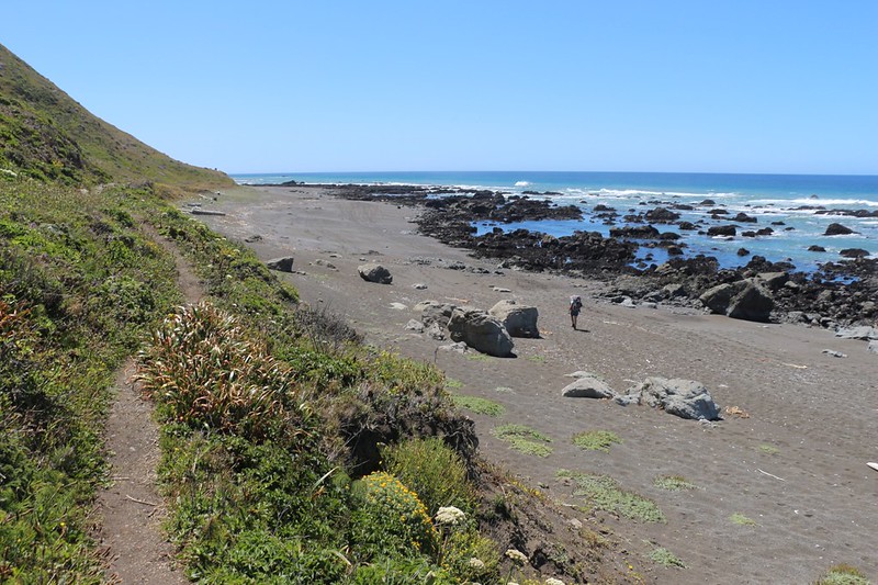
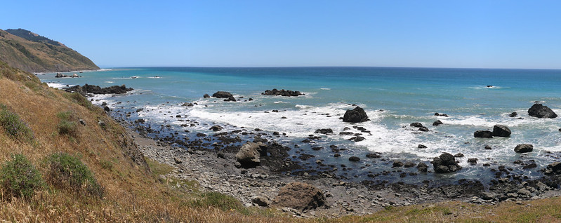
There are many large rocks along the beach and just offshore near Punta Gorda
The trail stays high above the beach near Punta Gorda, but at low tide Vicki was able to hike down there.
It was much faster to hike the inland trail, but I discovered some poison oak up there, so I went back to the sand. Punta Gorda was the first section of trail which was impassable at tides above 3 feet. It was low when we hiked by.
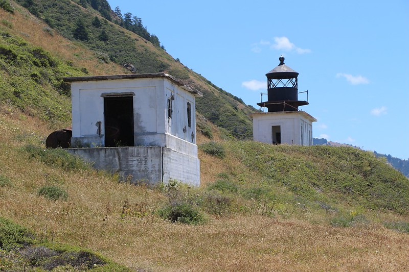
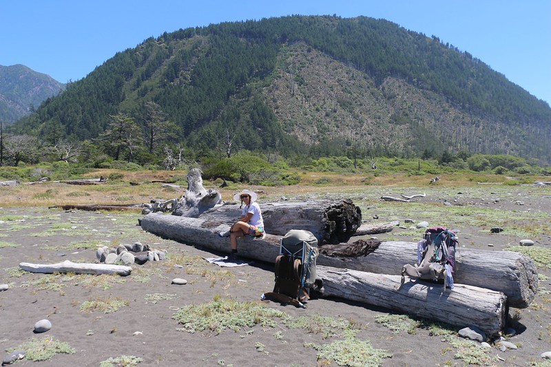
We put down our backpacks to take a lunch break at the Punta Gorda Lighthouse
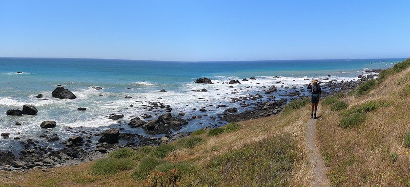
Looking northwest from the high inland trail with the offshore rocks down below us as we neared Sea Lion Gulch
Everyone has to take the inland trail along here. It climbed almost 200 feet! We nearly got altitude sickness - ha ha!
Sea Lion Gulch, our destination for the night, is on the far left
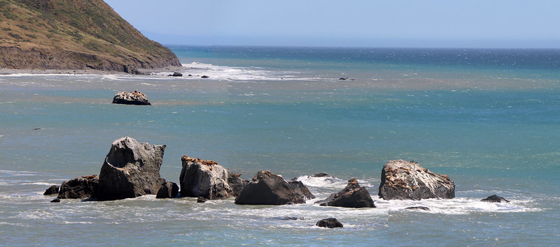
Sea lions were basking in the sun on the offshore rocks, and they were pretty darned noisy. All night long!
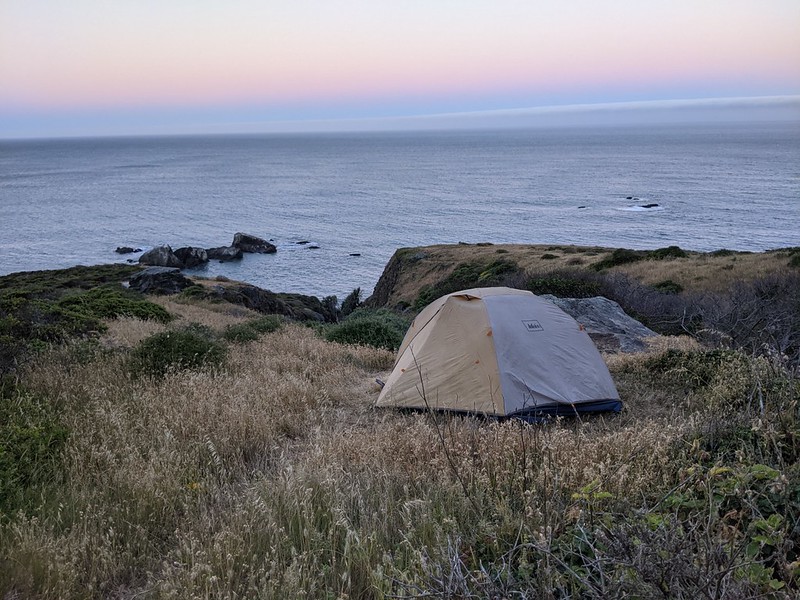
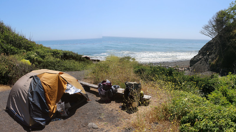
The main camp at Sea Lion Gulch was already full so we found a spot up the hill near another small gulch and creek
We ended up with more privacy and a better view. Excellent!
Day 2: Sea Lion Gulch to Randall Creek
The high inland trail descended to the shore via the gulch itself. This was the start of the second high-tide-inaccessable zone of the LCT, and it was about four miles long. Our plan for the day was to hike that four miles, almost all of it on the beach.
Our tent in the morning at Sea Lion Gulch
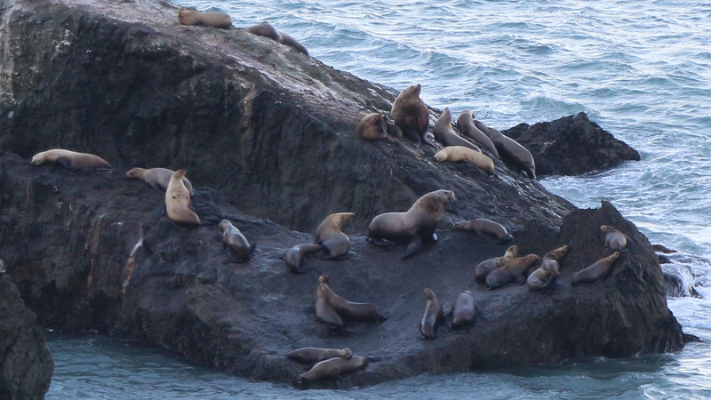
Zoomed-in view of the many noisy seals and Sea Lions on one of the large rocks just offshore
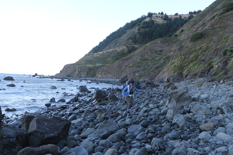
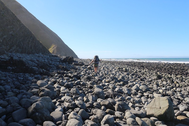
The so-called "beach" south of Sea Lion Gulch was made of baby-head boulders - we hiked slowly to save our ankles.
You can see the tents on that lower ledge left of center - we camped behind the next higher ridge.
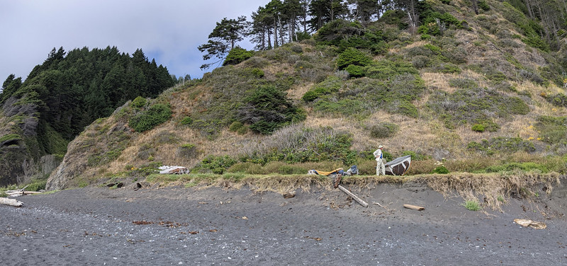
Panorama view looking south over an inland section of the trail, with some old structures down below.
We could have stayed on the beach the whole way, but we wanted to check out this area. Then we had a heck of a time scrambling down the steep bluff to the beach.
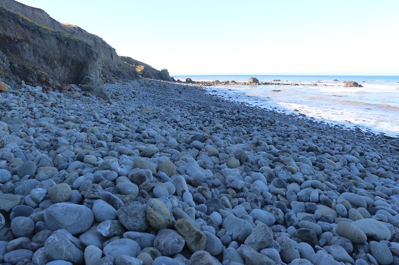
These boulders on the Lost Coast Trail were some of the slowest hiking we'd done thus far
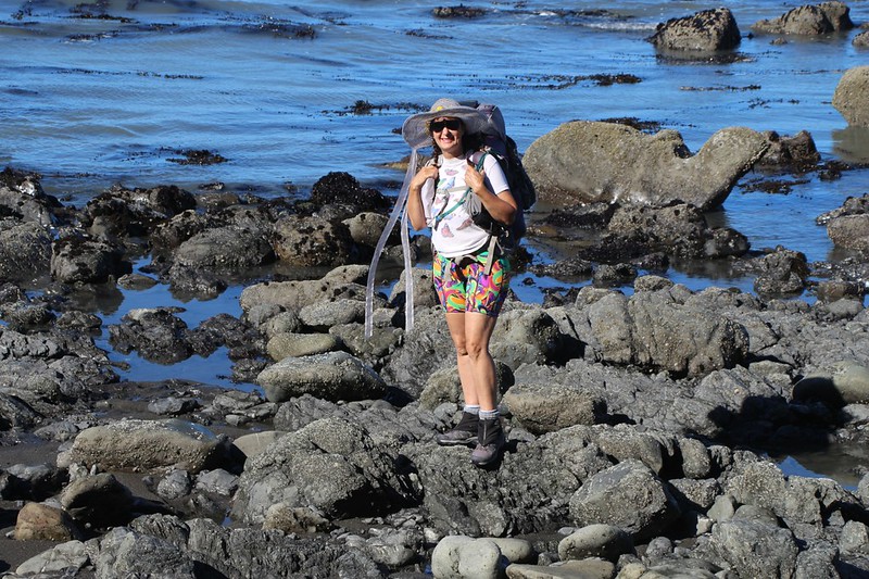
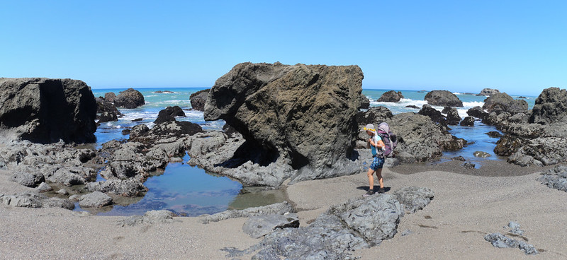
Happy Vicki checking out the sea life in the tidepools along the rocky beach at low tide
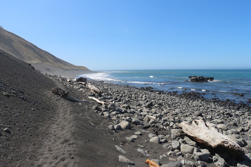
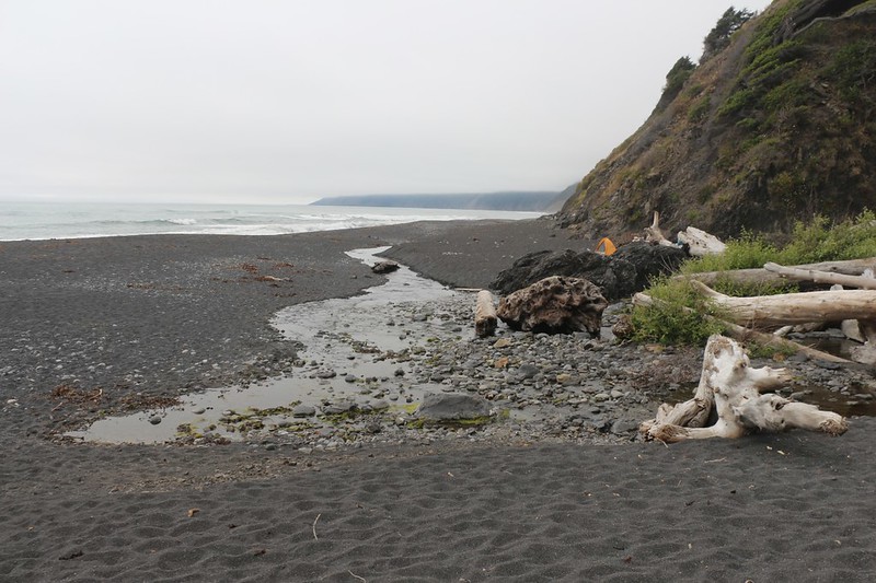
Yet another stretch of babyhead boulders, as we neared Cooskie Creek
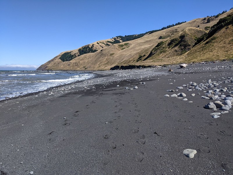
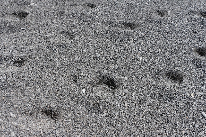
The sand turned to gravel, and became deep and sloggy, as you can see by the footprints - a real chore to hike
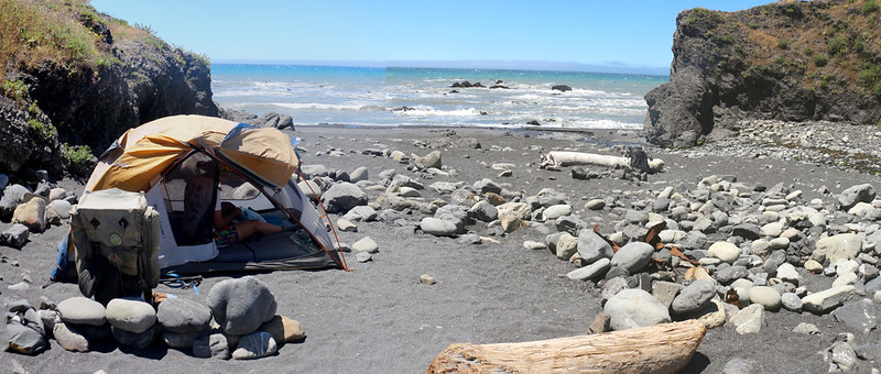
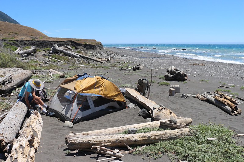
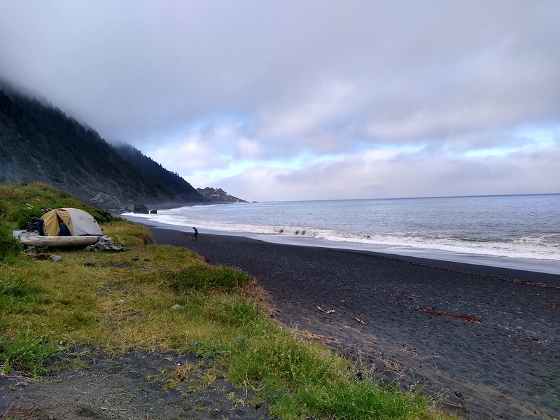
Panorama shot of our tent set up for max airflow on a hot day at the Randall Creek campground
Sunset light at high tide - nobody else will be arriving from the north today
Day 3: Randall Creek to Kinsey Creek
It looked to be yet another hot and sunny day, which was most unusual on the LCT. We were only complaining a little bit. At least there was a breeze.
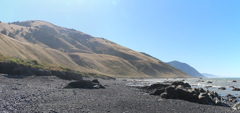
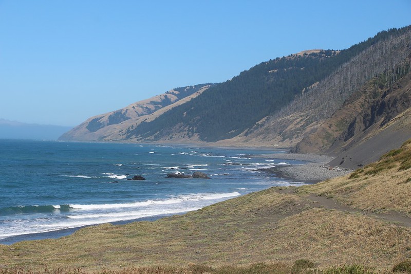
Spanish Ridge and Spanish Hill were on the left as we continued south from Randall Creek
The cleft with trees marks Randall Creek and the long grassy ridge is Spanish Ridge
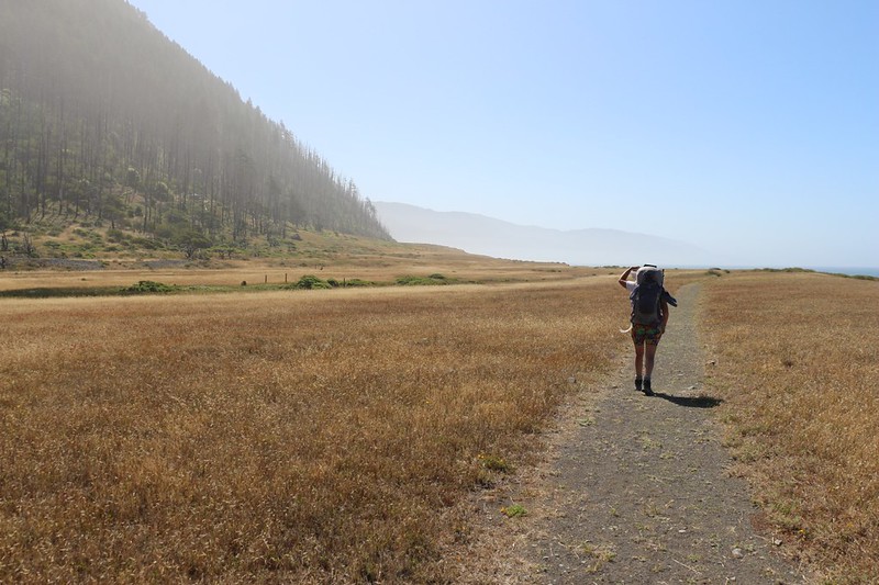
It was hot and dry up on Spanish Flat and Vicki wondered why the Lost Coast Trail was so far from the ocean
We saw other folks hiking really fast up there on the flat, so we decided to try the inland zone, but not for long. It was hot and there was yet more poison oak (and ticks!), so we headed back down to the beach.
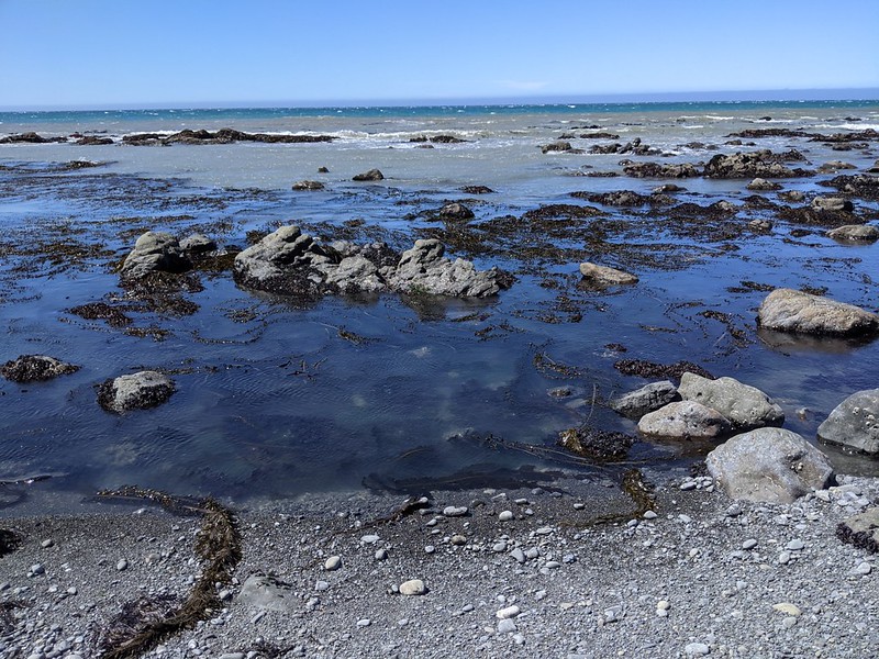
At low tide the shoreline rocks were exposed, showing seaweed tendrils and tidepools
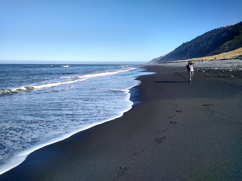
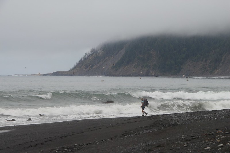
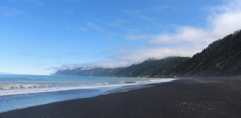
Looking south from Oat Creek along the beach
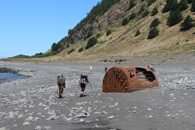
We met other groups heading north, into the wind, near a big rusted boiler from a shipwreck.
We also met two young dudes backpacking while carrying surfboards strapped to their packs! Supposedly, there are two rarely-visited surf breaks on this trail. Bucket list items for surfers. Too bad for them that they were heading upwind.
We arrived at Kinsey Creek around noon and wandered around looking for the best spot. This one up here was too windy.
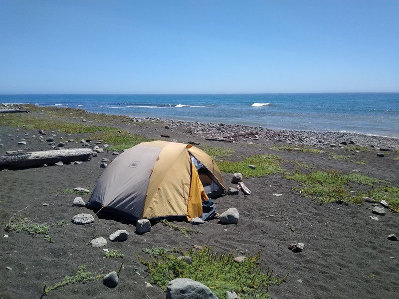
We set up camp directly on the beach. When faced with a choice, I always chose the beach.
It was hot, with gusty winds, so we stayed inside in the shade and read our books. We had to put big boulders on the corners of the tent for the wind.
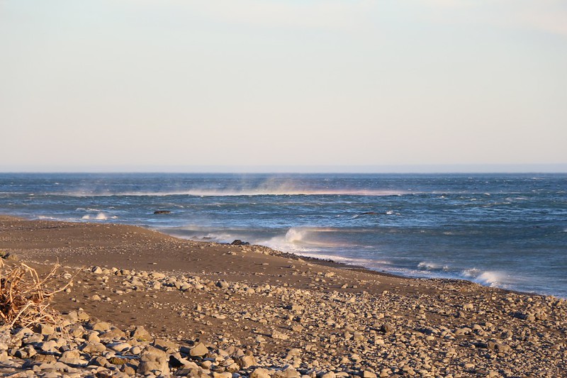
Rainbows in the mist as the offshore gusts met the northwest wind, forming wild siroccos on the ocean
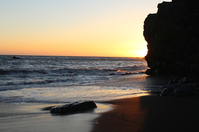
Sunset colors from the Kinsey Creek Campground
The wild gusts died down around midnight, but when they hit (every fifteen minutes or so) they would fling coarse sand at the tent and shake it furiously. We got some sleep, but it wasn't great.
Day 4: Kinsey Creek to Big Flat
We followed a dirt road south that led to private land, then we headed back to the beach - yesterday's wind had filled in all the footprints
Good firm sand at low tide made for easy walking (it was short-lived) - the private home was off to the right
This wasn't an easy beach to hike, with a steep slope and perfectly wrong-sized rocks which shifted underfoot
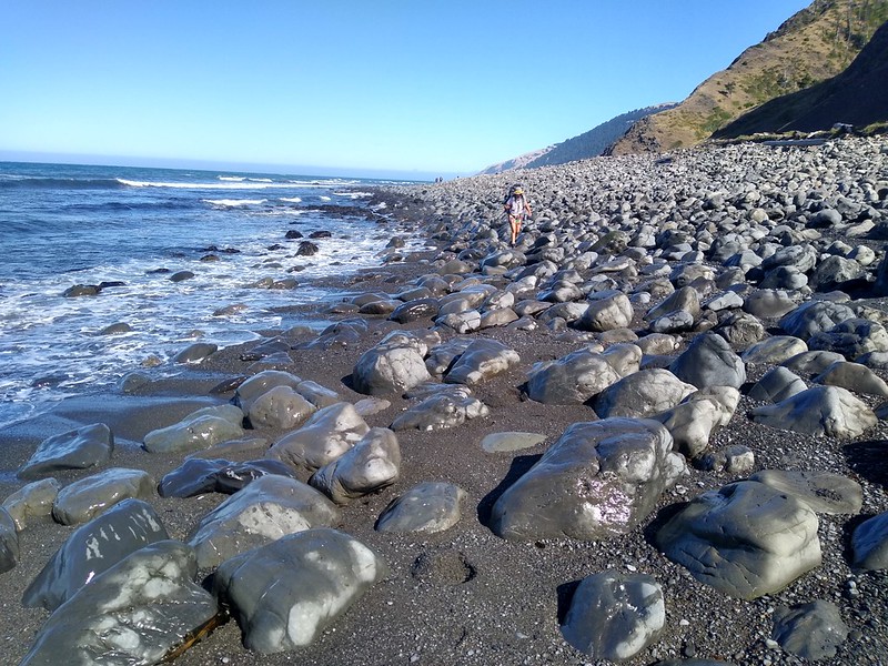
Even at low tide it's tricky to walk this talus-like beach south of Big Creek
I decided to check out the inland path, the official Lost Coast Trail, while Vicki stayed in the boulders by the ocean
I got my good views up there, with Randall Creek, Spanish Ridge, Kinsey Creek, and Kinsey Ridge to the north
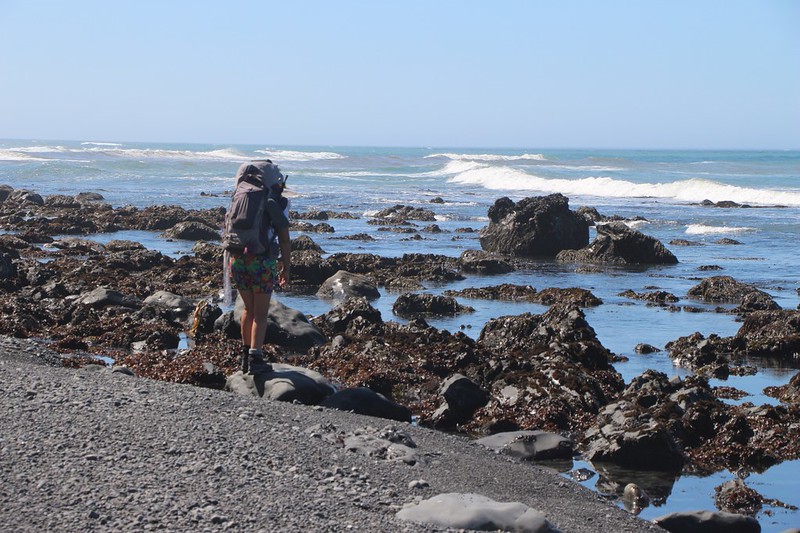
After that, I headed back to join Vicki along the coastline, where we were treated to more tidepools - we love them!
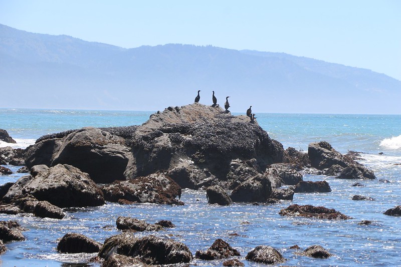
Zoomed-in shot of Cormorants on a large offshore rock near the point at Big Flat
We took a lunch break in the sun on some driftwood logs up on Big Flat. There was a two-story house back by the hillside
After checking out the inland campsites at Miller Flat we decided to set up our tent near the ocean. Camping on the beach!
Looking south over waves breaking on the steep stony beach at Miller Flat - the rocks made cool knocking sounds as the waves receded
It was seriously hot that day. so Vicki took a quick dip in Big Flat Creek, but the water was too cold to go much deeper
Sunset at Miller Flat, looking over Big Flat - night was very welcome after spending the hot afternoon hiding in the shade
Day 5: Big Flat to Buck Creek
Heading south on Miller Flat toward private land and an airstrip, where the trail had to head down to the beach again
The airstrip had a Jolly Roger flag for a windsock. Aarrrrr!
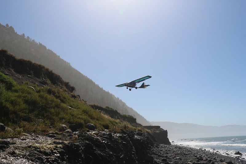
View of a pusher-prop ultralight airplane as it came in for a landing on the airstrip
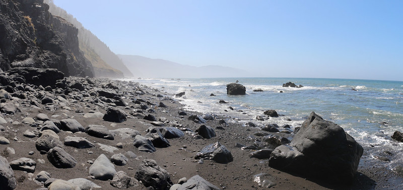
Hiking the southern low-tide-only section - there was no inland trail along here, just cliffs
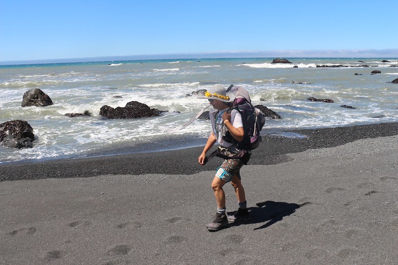
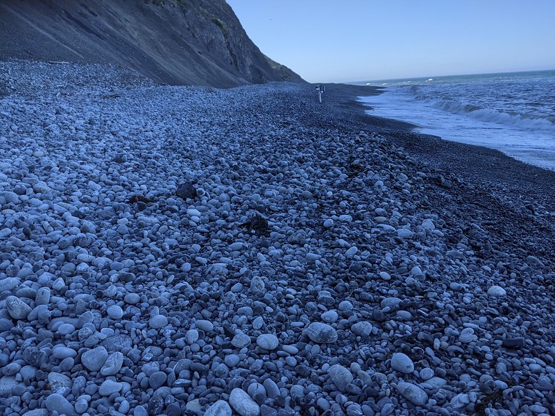
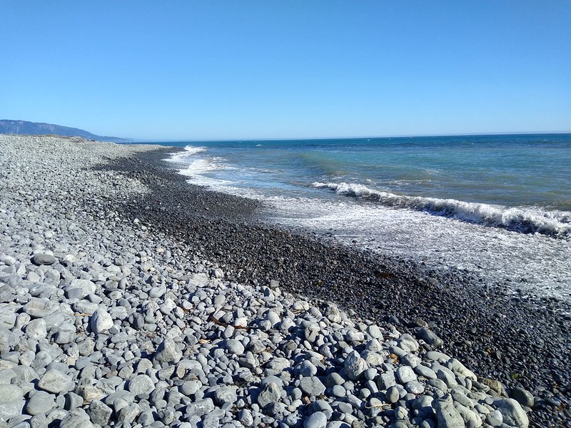
The gravel beach made hiking difficult, a real slog, as our feet sunk down into the shifting pebbles
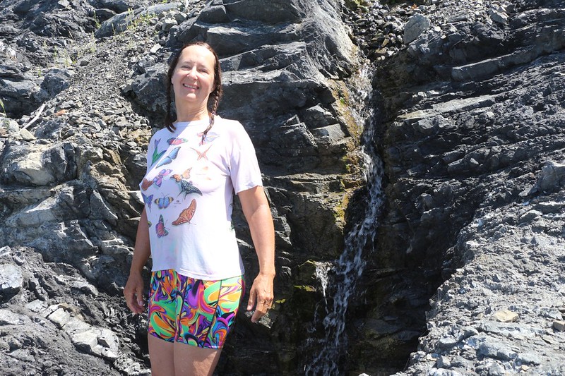
Vicki soaked her hair to cool off under a small waterfall
I did it, too, but nobody wants to see the picture of me doing it
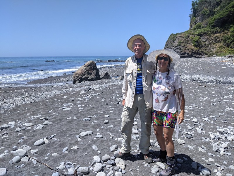
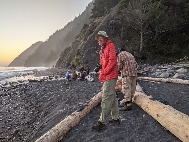
We asked another hiker to take a rare photo of the two of us, at Shipman Creek
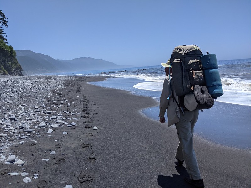
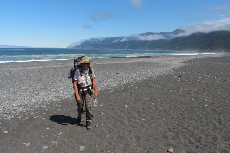
Me, hiking along on the firmer wet sand near the low-tide line, with my huge 1972-era backpack
Most of the campsites at Buck Creek are inland, higher up in the gorge, and they offered fine views of the ocean
Everyone in camp came down to the beach for dinner and sunset.
This campsite is within the four mile long high-tide-impassable zone, so once the tide came in we were all trapped for the night!
We joked that it sounded like the plot of a murder mystery. Yes, being imprisoned in this lovely spot was truly a tragedy.
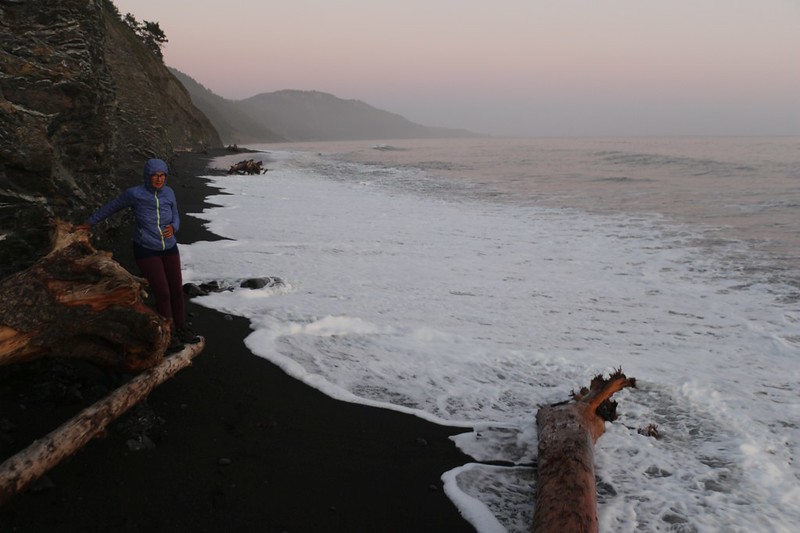
Vicki had to time her dash carefully at high tide, in order to go to the bathroom on the wave slope as the rules require
There were a couple of deeper alcoves in the cliffs to the south that were too high for the waves to reach (except during a full moon), and we all took turns running down there.
Day 6: Buck Creek to Horse Mountain Creek
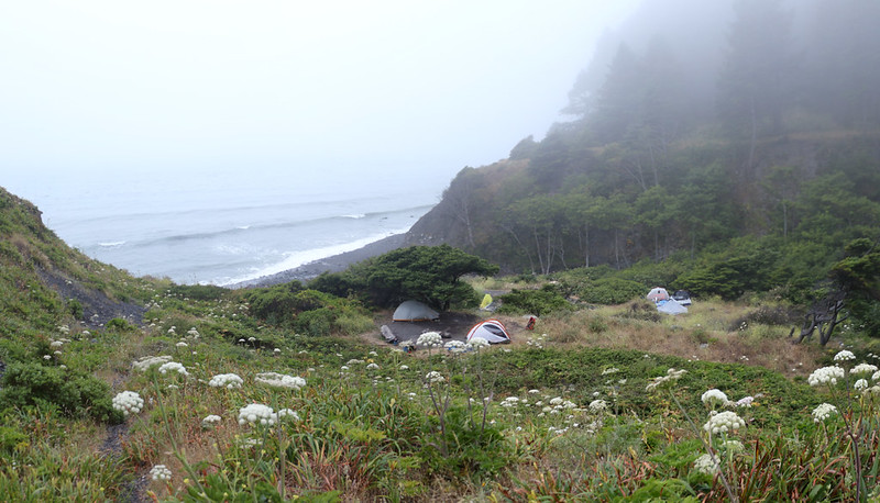
We woke up early, and climbed up a ridgeline on an old road behind the camp, because the tide was still too high. We were hoping to get a good view either north or south along the coast, but it looked as though the heat wave had finally broken. It was cool and foggy. Proper Lost Coast Trail conditions! But it wasn't good for visibilty.
View back downhill at the Buck Creek campground from the trail that leads up toward Saddle Mountain
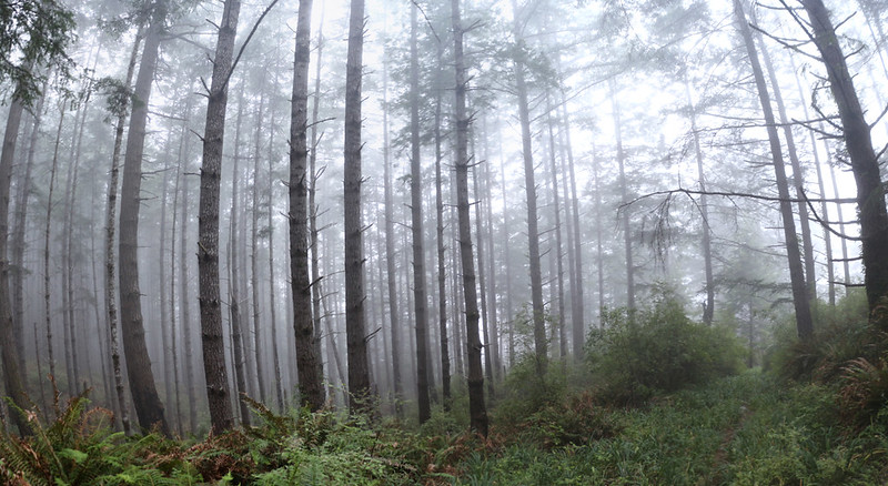
Panorama shot within the foggy forest.
We hiked a mile and climbed 1000 feet, but we never cleared the fog, so we headed back down.
After that, we packed up our soggy tent and got ready to hike. It was 10am and everyone else had already left.
Yesterday, a group of guys had built a tublike pool on the creek not far from the beach - deluxe glamping!
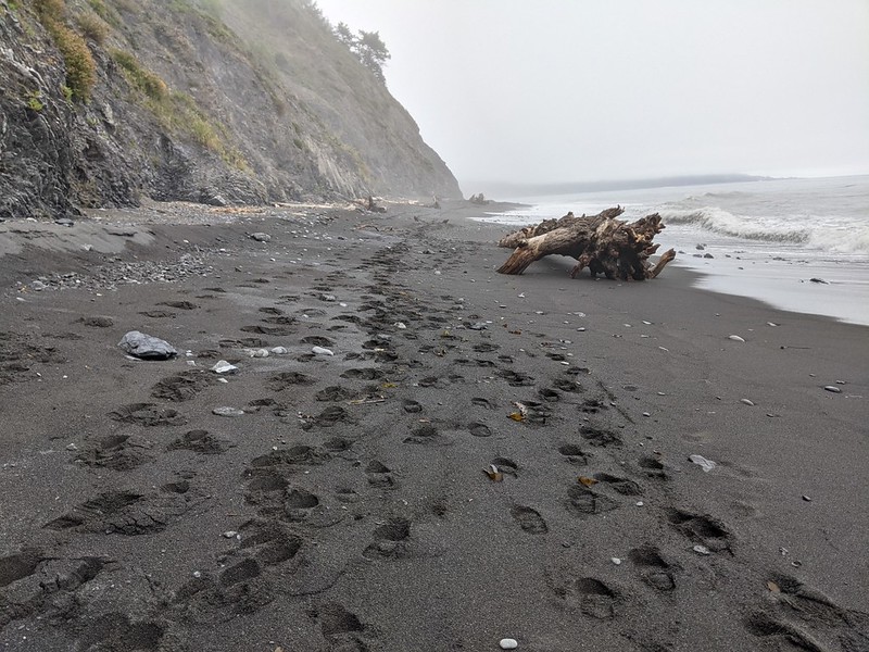
There were lots of footprint on the beach as we left camp - we were slackers
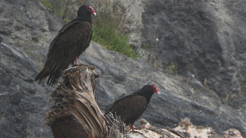
Zoomed-in view of two Turkey Vultures sitting on a driftwood log. Plenty of dead stuff to eat on the beach!
View north in the fog toward Big Flat - this is still the high-tide-impassable zone
Vicki straddling a huge driftwood log on the stony beach in the Tidal Flat section, which floods during high tide
Me and my DSLR. Ancient backpack but carbon-fiber bear can - I like the contrast of old and new
Zoomed-in view of Vicki and the surf, with Big Flat in the far distance to the left
Yes, the water was cold, but it felt good on Vicki's tired feet - sometimes you just gotta free your toes!
Our camp at Horse Mountain Creek - I tended the tent while it dried out from last night's heavy dew and fog
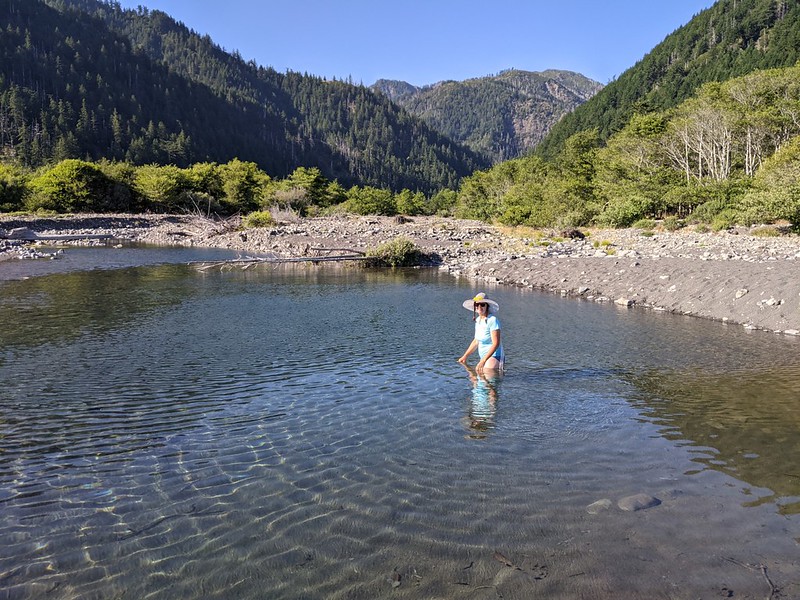
We had two nice neighbors and we met them while getting some fresh water from the creek
It turned out that all four of us were retired, which is why we pitched camp so close to the trailhead. The only people who plan to leave early are the ones who have to go back to work tomorrow!
Day 7: Horse Mountain Creek to Black Sands Beach Trailhead
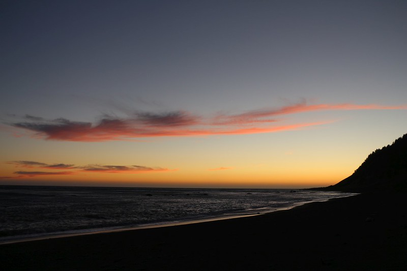
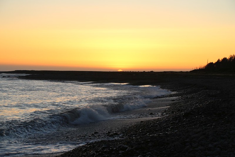
Dawn color in the clouds offshore
We only had two miles to hike, so we didn't get out of camp until after 9am. It was our last day on the Lost Coast Trail
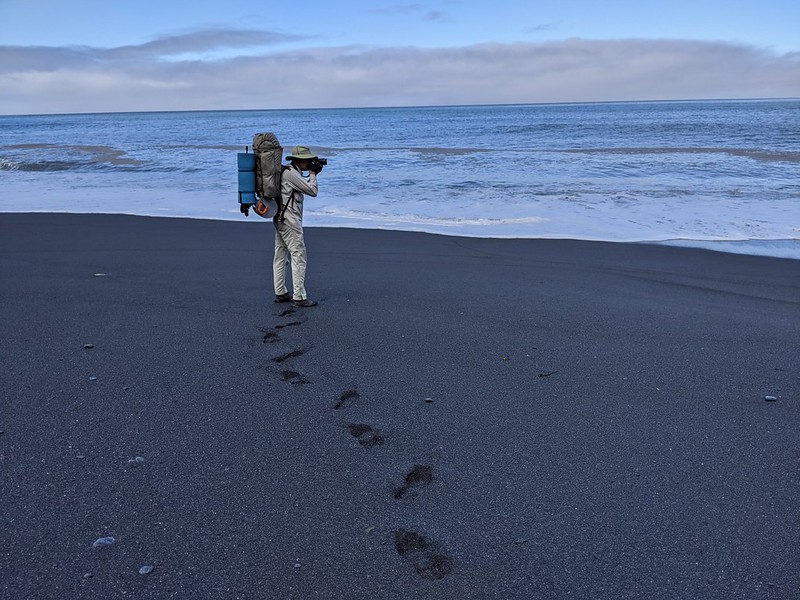
Me taking a photo on Black Sands Beach - see how deep my footprints are - the gravel sand makes for slow walking
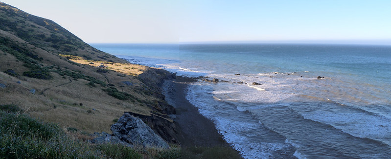
Panorama view north over the curving coastline, from the southern end of the trail
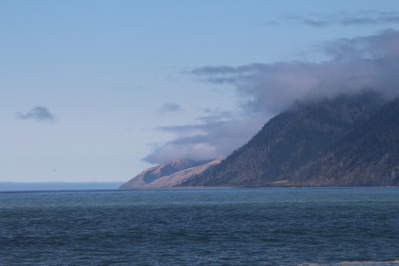
Zoomed-in view north all the way to Punta Gorda, Spanish Ridge, and Big Flat - most of the Lost Coast Trail
Zoomed-in view of the southern, Black Sands Beach trailhead at the town of Shelter Cove
Happy Vicki arriving at the southern terminus. We made it!
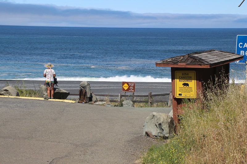
I left Vicki and the heavy backpacks down at the trailhead while I hiked up the hill to the backpacker parking lot
We spent the rest of the day driving north on Highway 101. We visited Humboldt Redwoods State Park. where they cared for some seriously beautiful trees. Then we went to the town of Garberville, where we had a motel reservation. After a long hot shower and some fresh clothing, we treated ourselves to some dinner at a restaurant, like civilized human beings. There are reasons why we love civilization, and these are two of them. There are other reasons why we head back out into the backcountry to escape!
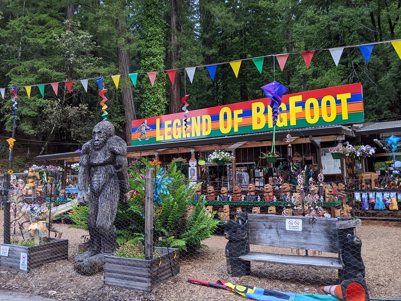
No trip to the redwoods is complete without Searching for Bigfoot!
After that, it was a long, twelve hour drive back to San Diego. We both agreed that this hike had been worth it.
Then we began to get ready for the next trek. We had a very busy Summer planned, and that's why it took so long for me to sort through the photos and finish this trip report. I was too busy taking even more! I usually spend the cold months digesting the previous Summer and planning out the next. I'd apologize to the forum for the delay but I'm really not sorry: I had a great hiking season!
Topo map and GPS tracks on my CalTopo Page
Also, if you have the time, there are plenty more photos and videos on my Flickr Page
Happy hiking!
.


