I dunno what else to call these mini bike tour missions so I'm calling em attacks, like the Sierra one I did last year. Like last year, I'm knocking out the hard hill climbs in any given region by riding out there and back, carrying just what I think I need for the mission. Gibraltar Road is a big deal in cycling hill climbs and descents, so that was my primary objective on this trip. There are a handful of other big-deal roads in SB, but I can't knock em all out in one trip, so I pick em off little by little. I determine which ones to attack by keeping a route as logical and easy to navigate as possible: gotta ride to Santa Barbara, then hit a couple roads, then ride back. I initially figured I would take a mountainous route on the way there since I'm a bit tired of the coastal route, but Kris and John came along, so I had great company that made the coastal route fun again. No more boredom on the coast. I would ride out to LA, meet Kris and then John, ride to the coast via Venice Blvd, then up the coast route to Santa Barbara. We would ride up Gibraltar, bivy, then take Camino Cielo to Stagecoach down to the 154 into Los Olivos, then up Figueroa Mountain, down the east side, back to 154, then reverse course taking nearly the same exact route home. Very simple route and execution. Simplicity is important to me in making a route as I don't get distracted by my phone and can do some thinking.
I set off early on Friday morning for a long city stage of riding. Met Kris and had some breakfast, then we headed into LA proper to meet John, where he led us out of LA down Venice where we hit the bike path and took it north. Malibu is long as it always is, but wasn't too bad. Their signs say 21 miles of scenic beauty or something like that, and I just think those are 21 long miles of dodging trash cans, trying not to get doored, and avoiding getting smoked by some dipshit in a Mercedes. It's always a bit of a relief to get to the Missile Park near Point Mugu, cause the most stressful part for me is over.
Some E2 Hawkeyes were flying around the airbase as well as some French or British attack or ASW aircraft I can't remember the designation of. Musta been some sorta airshow. Very cool. Didn't think the E2 would be that fast down low. Anywho, we kept on riding north past Ventura and I think we might've reached Carpenteria by sundown. That city is the southern edge of Santa Barbara, and it's a nice clean little town. I eyeballed the maps on my jacked up old phone and picked a route to reach Gibraltar Road. We figured we would bivy somewhere up in the hills above Gibraltar or whatever seemed good. Gibraltar was a nice, slow, somewhat steep climb, and we put our headlamps on and began scanning for a bivy spot. We found an excellent one not far from Gibraltar Rock, and we were quite happy to settle down into our bags and get some rest.
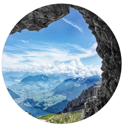
Nobody harassed us that night. We weren't far from the road, nor were we hidden per se. I get the vibe that SB is way more chill and people don't really care or do dumb shit up here too much. We got a casual start and rode up to Camino Cielo to head west to Figueroa Mountain Road. Camino Cielo is an excellent ride, better than anticipated. I always compare things to GMR or GRR, and this was sorta like a coastal version of GRR with more ups and downs and a little more twisty. It truly is a 'sky road', with excellent views of the coast to the south and into the Los Padres to the north. The pavement is rough enough to be fun, smooth enough for road bikes. A light bicycle pays off here and makes the short climbs easy and the quick descents really put a grin on your face.
Right before you hit the 154 intersection, there's a fire station on the right/north. They've got water, so the boys filled up while I waited at the 154. I got ahead of em on the descent (outstanding descent!) and planned on getting water at Cold Spring Tavern. The descent to 154 is short but really dope, with super fast kinks and steep grades, especially mid corner. It was my first time so I was cautious, but I was still able to rip it pretty fast. Excellent brakes pay off bigtime here (I don't have em). We crossed the 154 to Stagecoach Road, and descended to Cold Springs Tavern, where Kris got us coffee and we chilled by the fireplace. Real cool joint, this place. They were cooking up brisket out front, and a buncha motorcycle dudes were getting beverages and being all joyous and shit. I felt we were a bit behind schedule, which isn't a big deal, but Figueroa is a pretty decent sized hill so we headed out down to the 154 which we took to Los Olivos, a wine tasting town. We picked up some supplies, then headed up Figueroa Mountain Road north outta town. A nice gentleman on a dope older mountain bike talked with us for a minute and bade us farewell. Soon after we passed Neverland Ranch, which no longer has a sign out front but you'll find it if you keep yer eyes peeled. There were notes to Michael Jackson written on the rocks out front from fans, and some security was patrolling in SUV's.
The climb up the road was quite steep in places, with some very steep corners. Really beautiful area with grass and oaks, small valleys with ranches and dry creek beds. It's quite a long climb at a low speed, but pleasant in the cool weather with no damn flies. I'm sure that's a big deal in the summer. We made it to the summit at sunset, and enjoyed the view while getting some food down. Once the sun went down the temps followed, so we put some layers and gloves on and began the descent. We were taking this road in a clockwise direction, which meant a longer shallower angle on the descent. I had initially planned to go counter clockwise as the climb would be longer but easier, and the descent steep and technical. Doing so meant no resupply before heading up, so we changed it up, which was easy and meant less highway riding on the way out. The descent was still very fun, starting off dropping down the mountain to the intersection with Happy Canyon on some predictable corners, followed by a right turn on Happy down straights down a canyon with some rough pavement making for much more interesting movement. There are potholes here and there, which in the dark with a good set of lights are easy to avoid at speed and make it a lot more fun than if it was in excellent shape. You have a small climb on the way out, followed by more excellent easy descending to the road.
We made a left onto 154 for the slog back up to a bivy site on Camino Cielo or thereabouts. I made the decision for us to stay on the 154 instead of getting back onto Stagecoach, as it's shorter and less steep on 154 as it has a huge bridge that crosses a valley. It's a toss up between stressful but short and easy 154 or quiet and steep Stagecoach. I figured making it physically easier would be a nice change, but I think in the end Stagecoach is the best choice. It's almost always worth it to take the less trafficked route in my experience. We got to the intersection with Camino Cielo and rode up to the fire station for water and a break. We planned to bivy anywhere along the road beyond the general area houses were in, and after a while we found a big concrete water tank atop the ridge. There's a flat spot next to it with lotsa broken glass, so we cleaned it up and got comfy. It was in the 30's or so that night, pretty chilly, and my feet went numb in my 30* bag. Shoulda brought my comfy socks, but I was trying to go light. It's always a balance, and you have to get uncomfortable to know what to do next time. It's okay to go a bit light with comfort and sleep gear on short trips, but if you don't sleep well you don't recover well, which makes the following day/s harder. It's always a balance, and I think the move is to bring comfy warm sleep socks whenever the temp is in the 40's or lower at night. They're light and don't take up much space. I spent a lot of time climbing in my 20's being cold and miserable so I'm done with that except for special circumstances.
We woke up at a casual pace once again, ate, and enjoyed the awesome views from our spot. We had a bit more of Camino Cielo to ride before reaching the top of Gibraltar Road, so I took off at a slow morning pace and warmed up for what was to come. I intentionally go a bit slower in the morning on trips like this so I can warm up and avoid injury, and let myself wake up more naturally since I'm not really much of a morning person without coffee and a bigass breakfast. Camino Cielo was just as dope going eastbound as it was west, and we reached the top of Gibraltar. I was pretty excited to descend down this road, as I had been researching it for some time leading up to this day. I adjusted my crummy, annoying brakes, and we pointed downhill. I put the power on right away and took a fast line that allowed me more recovery room for my shitty brakes. This road kicks ass! Steep but not outrageously so, you get tight blind corners leading into kinks connected into straights with great sight lines and an intuitive line entering the next blind corner. They're tight, but not too tight, and there are no surprises. My wide Gravelking slicks gave excellent traction and feel on the good quality pavement, and the surface was clean. The views were outstanding as expected, but I didn't dare interrupt this descent to take photos. It felt like a rally stage in Europe. If I lived nearby I'd be up and down this thing all the time. I stopped and waited for the boys at the stop sign where the road enters the neighborhood and commented out loud at how dope this road was.
We had a little more of Gibraltar left to descend through the neighborhood, which we took at a chill pace, and then took this road and that road out to downtown for coffee and Chinese food. Got some more supplies and worked our way out of town to Carpenteria and the bike path south. Not a whole lot to say about the way back, other than it was chill until Malibu when traffic picked up and we got real hungry. We took California Avenue to the Del Taco in Santa Monica where I got 2 chicken tacos and 4 bean and cheese burritos, which I had been craving for days. They took my order and John's order in the drive through on our bikes, but then told Kris they couldn't take his until we told them they just took two dudes bike orders. What's the point? Our money isn't real enough? Christ. We got our food and devoured it on the front step of the building. Kris navigated us south to Venice Boulevard, which we took back towards John's. We bid him farewell and headed further east to where Kris split, then it was up to me to hate riding through El Monte and other beautiful environs to get home. I just wanted to be home at that point. I had to take a crap so bad and was sick of city riding. Finally pushed my bike through the front door a little after midnight and rapidly entered the bathroom.
Some numbers for y'all:
Day 1: West Covina to Gibraltar Rock: 141mi 5,800ft gain
Day 2: Figueroa Mountain Stage: 90mi 10,800ft gain
Day 3: Camino Cielo to WC: 145mi 4,700ft gain
A good trip with the boys. Thanks for coming out, and thank you guys for reading. Painted Cave and Refugio roads are next on the menu, and maybe doing Figueroa Mountain counter-clockwise. We may take the van out there and hit that stuff next time. Another possible item on the menu are the majority of the Malibu roads, which are also steep and make for excellent descending.