
It was pretty dang glorious above it!
The plan was an easy hike down to Inspiration Point, to locate the spot where a photo of my great, great grandparents was taken in the early 1930s, when they rode the Mt Lowe Railway. I'd done this hike once before, in 2019, but I'd become confused that there was no viewing tube "locating Mt Wilson" at Inspiration Point (where I was told the photo was taken), but that there *was* one on Mt Lowe Summit. I compared some photos I'd taken previously from Mt Lowe Summit, and found that the ridgelines did match up pretty well. I figured the fact that they weren't exact was due to angle and camera lenses. But then Sean advised me (rightly) that it was indeed taken in the vicinity of Inspiration Point, so of course I had to go see it for myself.
Despite it being a boring, rocky old fire road, I still love hiking Mt Lowe Road. It was only about 76 degrees, but at 3pm with all its exposure, we were quite warm. Unsurprisingly, since I hadn't been up there in awhile, I noticed many new rock slides after all the storms. The west end of Muller Tunnel itself is also more eroded than when I last saw it. We stopped to admire some freshly fallen Wilson Diorite. Look at those crystals!
Slides and more slides everywhere:
As we neared Inspiration Point, it became clear we were in the right spot. The break you see in the background of the old photo is just a ridgeline, and while it has filled in a bit, it is still markedly the same. It always blows my mind how quickly some things change in the mountains, and how slowly others do. It would seem the old viewing tube was right at Inspiration Point, likely on the other side of the trail (since it seems my ancestors are standing directly in front of some chaparral).
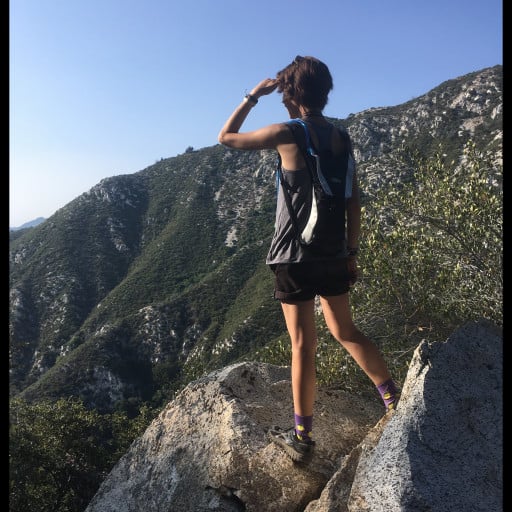
The view from Inspiration Point:
Clouds filling in Grand Canyon, about 4,000' where level with the trail at Granite Gate:
We stopped briefly at the campground on the way up. I'd heard they'd replaced the old vault toilet with a nicer compost one, but of course, it is as disgusting as ever. Anyone know what the random viewing tube near the campground used to point at? Everything is overgrown now, but perhaps you once could see to Granite Gate?
We didn't stay for sunset, but I bet it was fantastic!


