Alright, so I was talking about the route with a few people, trying to answer the big questions:
- Which bike to bring
- How to approach the point on top of the Ken Burton trail
Descending down Ken Burton means you're stuck with a bike at Oakwilde, with no easy options to get back to ACH. My friends looked at a map, and were planning to take Dark Canyon out, with the understanding that they would be hiking the whole time, and that it would be slow. This was unappealing, and I wanted to see if I could stash the bike off ACH, grab the point on foot, and come back to the bike. This would avoid Dark Canyon, and shave off distance, and make for an easy climb up on ACH, instead of going up the dirt on the Fern Truck Trail. Descending to the Arroyo would be slow, but short. Running up and down Ken Burton could be slower or faster than riding, depending on how rough it is, and how skilled of a cyclist you are, and how beefy your bike is. I scouted this a few days earlier to check out the conditions, and then could compare the two approaches, using the measured travel speeds wherever possible:
Code: Select all
** Ride: Fern truck trail, Dark Canyon
| what                                      | distance(mi) | gain(ft) | time (min) | Speed estimate (mph) |
|-------------------------------------------+--------------+----------+------------+----------------------|
| ACH bottom to Fern truck trail junction   |          3.4 |     -100 |       13.6 |                   15 |
| Fern truck trail junction to top of Ken B |          5.4 |     1700 |        60. |                  5.4 |
| To book                                   |           .5 |     -100 |         6. |                    5 |
| Down Ken B                                |          1.5 |    -1000 |        18. |                    5 |
| Dark Canyon                               |          1.5 |      560 |        45. |                    2 |
| Climb out of Dark Canyon                  |          1.5 |      440 |       22.5 |                    4 |
|-------------------------------------------+--------------+----------+------------+----------------------|
|                                           |         13.8 |     1500 |      165.1 |                      |
#+TBLFM: @2$4..@II$4=($2/$5)*60::@>$2..@>$4=vsum(@I..@II)

** Hiking via Red's shortcut:
| what                              | distance(mi) | gain(ft) | time (min) | Empirical speed (mph) |
|-----------------------------------+--------------+----------+------------+-----------------------|
| ACH: bottom to Red's              |          4.6 |     1300 |         40 |                   6.9 |
| Red's down to Oakwilde            |          0.7 |     -800 |         20 |                   2.1 |
| Up Ken B                          |          1.5 |     1000 |         30 |                    3. |
| Down Ken B                        |          1.5 |    -1000 |         18 |                    5. |
| Red's up from Oakwilde (estimate) |          0.7 |      800 |         30 |                   1.4 |
| ACH: Red's to Dark Cyn            |            1 |      200 |          8 |                   7.5 |
|-----------------------------------+--------------+----------+------------+-----------------------|
|                                   |          10. |     1500 |        146 |                       |
#+TBLFM: @2$5..@II$5=$2/($4/60)::@>$2..@>$4=vsum(@I..@II)
Talking to the FAST people at the end of the day, it seemed like avoiding the rough stuff was the way to do it, except even more so. They biked up Fern Truck Trail to grab the point, but then turned around to go all the way back to the bottom of the ACH, and re-gained the lost elevation on the smooth pavement. Crunching those numbers tells me that AT OUR EXPECTED SPEEDS, this would actually be the slowest option of the 3:
Code: Select all
** Ride: Fern truck trail to book, then back and ACH
| what                                      | distance(mi) | gain(ft) | time (min) | Speed estimate (mph) |
|-------------------------------------------+--------------+----------+------------+----------------------|
| ACH bottom to bottom of Fern truck trail  |          3.4 |     -100 |       13.6 |                   15 |
| Fern truck trail junction to top of Ken B |          5.4 |     1700 |        60. |                  5.4 |
| To book                                   |           .5 |     -100 |         6. |                    5 |
| Back to top of Ken B                      |           .5 |      100 |         6. |                    5 |
| Back to bottom of Fern truck trail        |          5.4 |    -1700 |       32.4 |                   10 |
| Back to ACH bottom                        |          3.4 |      100 |       13.6 |                   15 |
| ACH: bottom to Red's                      |          4.6 |     1300 |        40. |                  6.9 |
| ACH: Red's to Dark Cyn                    |            1 |      200 |         8. |                  7.5 |
|-------------------------------------------+--------------+----------+------------+----------------------|
|                                           |         24.2 |     1500 |      179.6 |                      |
#+TBLFM: @2$4..@II$4=($2/$5)*60::@>$2..@>$4=vsum(@I..@II)
I brought my "light" bike: a steel-frame Surly Cross-check. I didn't bother out to swap out my tires, so I ran with the 40mm Schwalbe Marathon Supremes that I'm using for commuting. These are road slicks, so clearly not the best choice here, but I was planning on avoiding the gnarliest stuff, and REALLY didn't want to be swapping out tires. Also, these aren't tubeless.
Seeing people's route choices during the ride made clear to me the implications of my contributions to OpenStreetMap. In their route planning, people see the routes on the map, without a clear idea of what they are like. Hence people hiking out via Dark Canyon, and trying to take their bikes down the Station Ridge trail. I am sorry
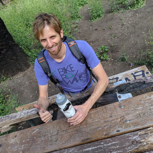
Alright, so here's what I did: https://caltopo.com/m/P4G3Q (.gpx file attached below). We rode to the point in the Verdugos first, and I ran up to grab it. Then we rode to Red's shortcut and did the scramble and the run to grab the point on top of Ken Burton. Here's Norvan on the descent:

A group was checking in (by ripping out pages corresponding to their bib number out of a book):

The book itself looked thrilling:

I climbed up the Old Dark Canyon trail to Clemens Junction: some hike-a-bike, but pretty short. Views of Big T from the saddle:

Here you can clearly see the Condor peak trail. I grabbed the nearby checkpoint, and descended Grizzly Flat road and trail down to Vogel Flat. I've never been there before, and it is EXCELLENT. Rough riding, and all that, but it's a hiking trail, which is quite nice. At the bottom are some sandy sections and a few river crossings. Nothing I couldn't handle. Then you climb 1600ft up the Condor Peak trail to the next point. This is REALLY shitty at the start, and I was very close to stashing the bike and running again, but fortunately conditions improved before I pulled the trigger on that, and most of the trail is actually rideable and nice. After dropping the pressure in my tires, even the un-ideal bike and tires were sufficient. Here's a shot of the trail, with another rider coming down:

Finally, I was at the book

With another rider stoked to be done

I then turned around, and got a flat half-way down. After fixing the flat, I was thinking about how I never seem to get interesting mechanicals: only flats and such. This problem was immediately addressed: on the descent down Big T, I pulled the lever to switch into the big ring on the front, and nothing happened. I then found the problem:

Wow! I've never even heard of this happening. I don't recall, but this might be the original housing that came with the bike, in which case it has seen MANY miles, and I really should have replaced it already anyway. For the rest ot THIS event, this just meant that I was stuck in the lowest gear on the front, which just limited my top speed a bit. That's fine. I crossed Big Tujunga on Oro Vista Ave, and climbed up Doane Canyon Rd to Yerba Buena Truck trail. There's a massive washout that has a trail bypass. Past that it's medium rough, and eventually, very steep. Looks nice

It started to get dark here, and I realized that I messed up my lighting situation. This is my commuter bike. It has a generator-powered light with a long, but not wide beam pattern. I did not bring a headlamp also, which I REALLY should have done. This means that I cannot see to the side (switchbacks are a problem), and the light gets dim when moving slowly (hike-a-bike). Fortunately it really got dark right at the top of the last climb


I descended the Oak Spring trail to the next book, watching the nice colors in the distance


The book didn't have my page number explicitly written, which is probably fine


I finished the descent in the dark, and took the little detour to the last book:

Now I was done, and descended down Little Tujunga back to the shop. Teamed up with another group of riders, trying to get back before the 19:30 cutoff time. We made it back to at 19:35, for a well-deserved beer and burger.
So yeah. Bike is good. The scrambling-and-running sounds strange, but turned out to be the right choice. To make it the wrong choice I need to get much stronger, or to optimize the bike setup. I probably will do neither of those