The Fake Mt. Fuji

TRs for the San Gabriel Mountains.
Post Reply
User avatar
Sean
Posts: 3712
Joined: Wed Jul 27, 2011 12:32 pm

Post by Sean »

This forum has had a trip report about the real Mt. Fuji in Japan. But it seems we've neglected the fake one above Henninger Flats. Personally I think it's a ridiculous name for a minor bump which maybe, sort of resembles the real Fuji, but only if you disregard scale, squint your eyes, hold your breath, and quickly glance at it from the immediate west. From any other side, it looks unremarkable. Like this...

Image

Or like this...

Image

If you want to see it from Henninger Flats, you'll have to hike up there yourself. I approached starting down from Mt. Wilson.

Image

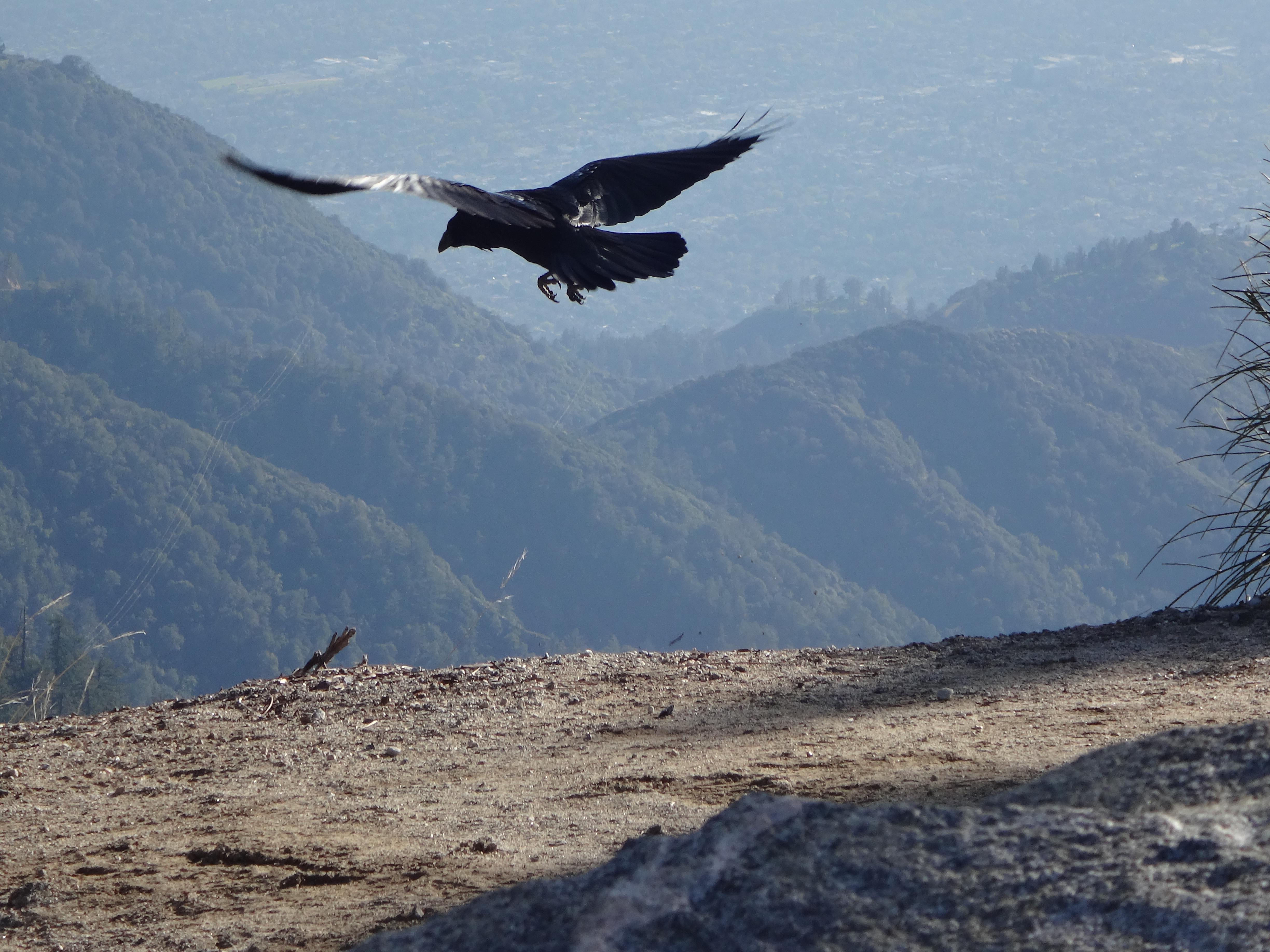
This bird also launched off of Mt. Wilson.

Image

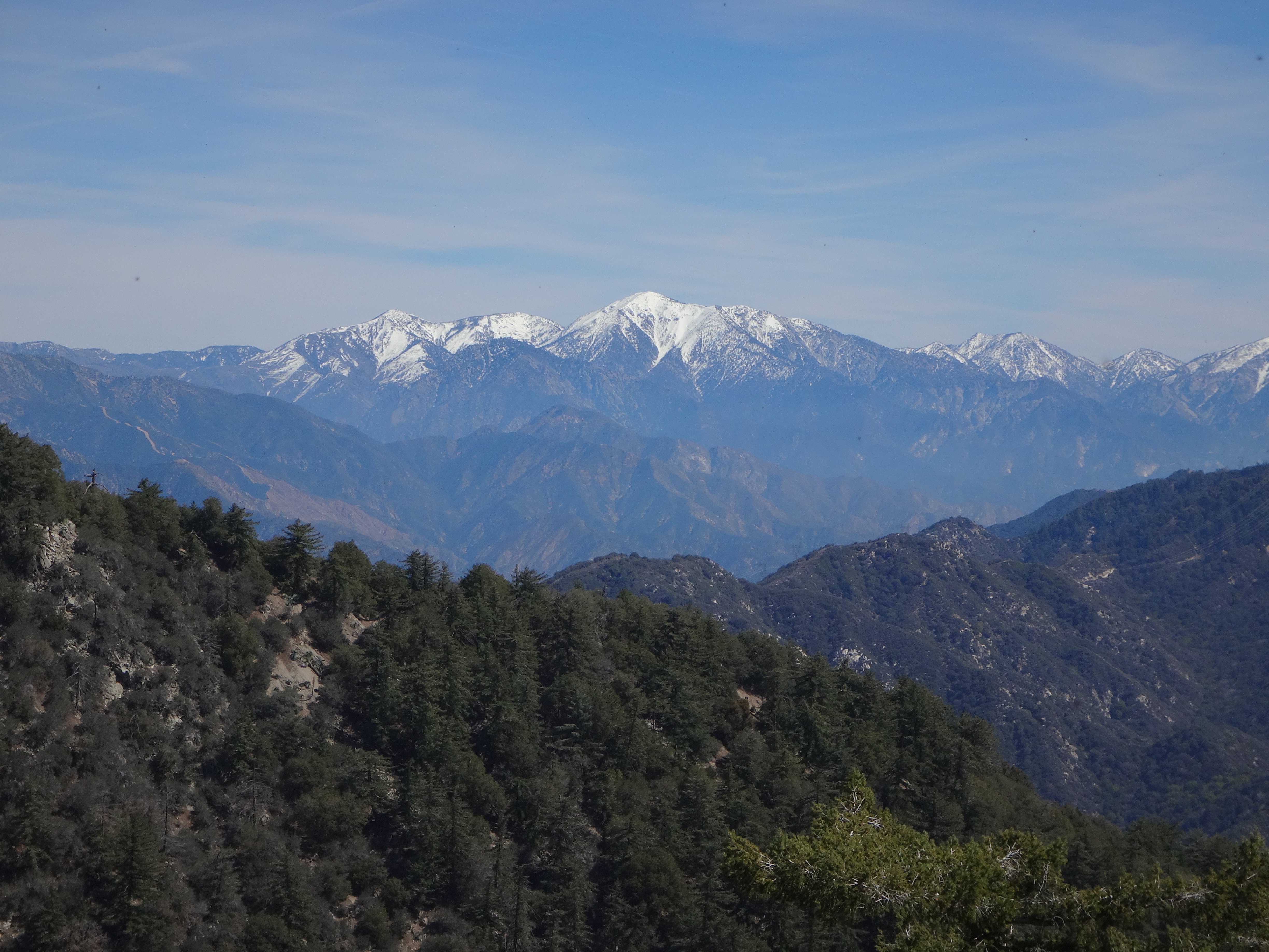
It's about four miles one-way to fake Fuji, if you take the singletrack from Wilson down to the old toll road. I don't recommend this route unless you really like fire roads but really hate starting at Eaton Canyon. Or you want to catch a long-distance view of Baldy with snow on top.

Image

Anyway, after putting in the four miles, and dropping about two thousand feet of elevation, I reached the scruffy service road that goes up to the summit area.

Image

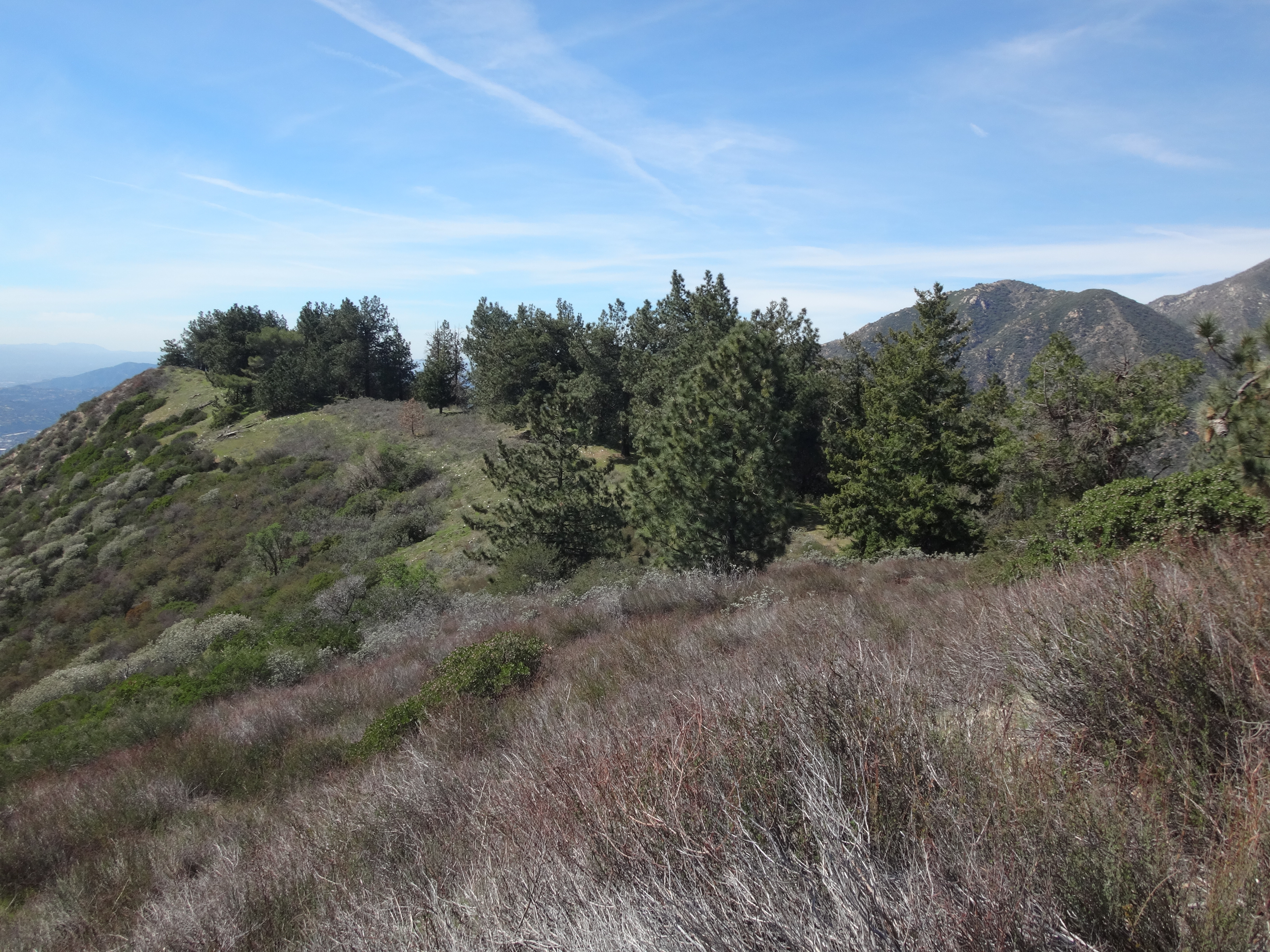
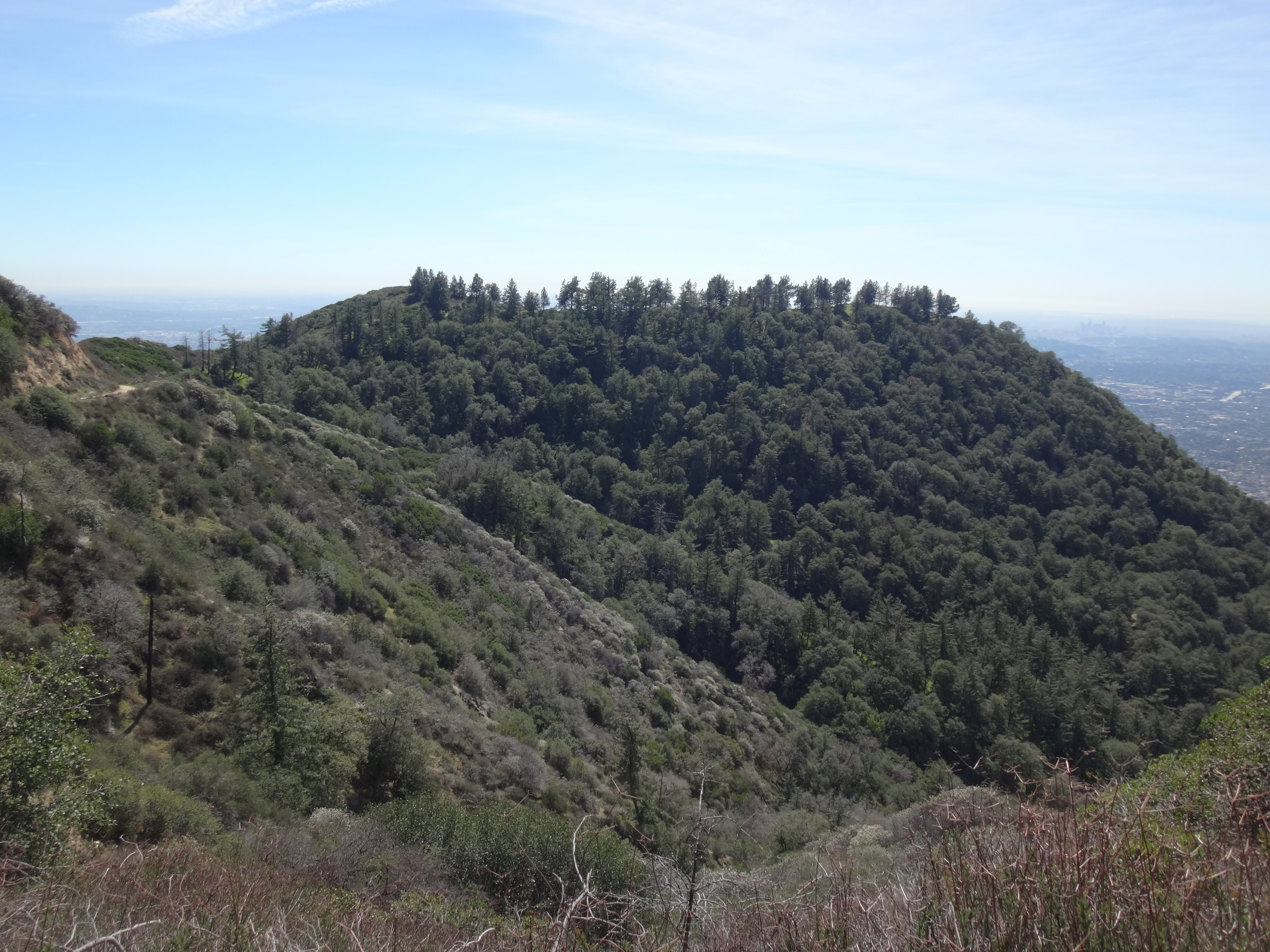
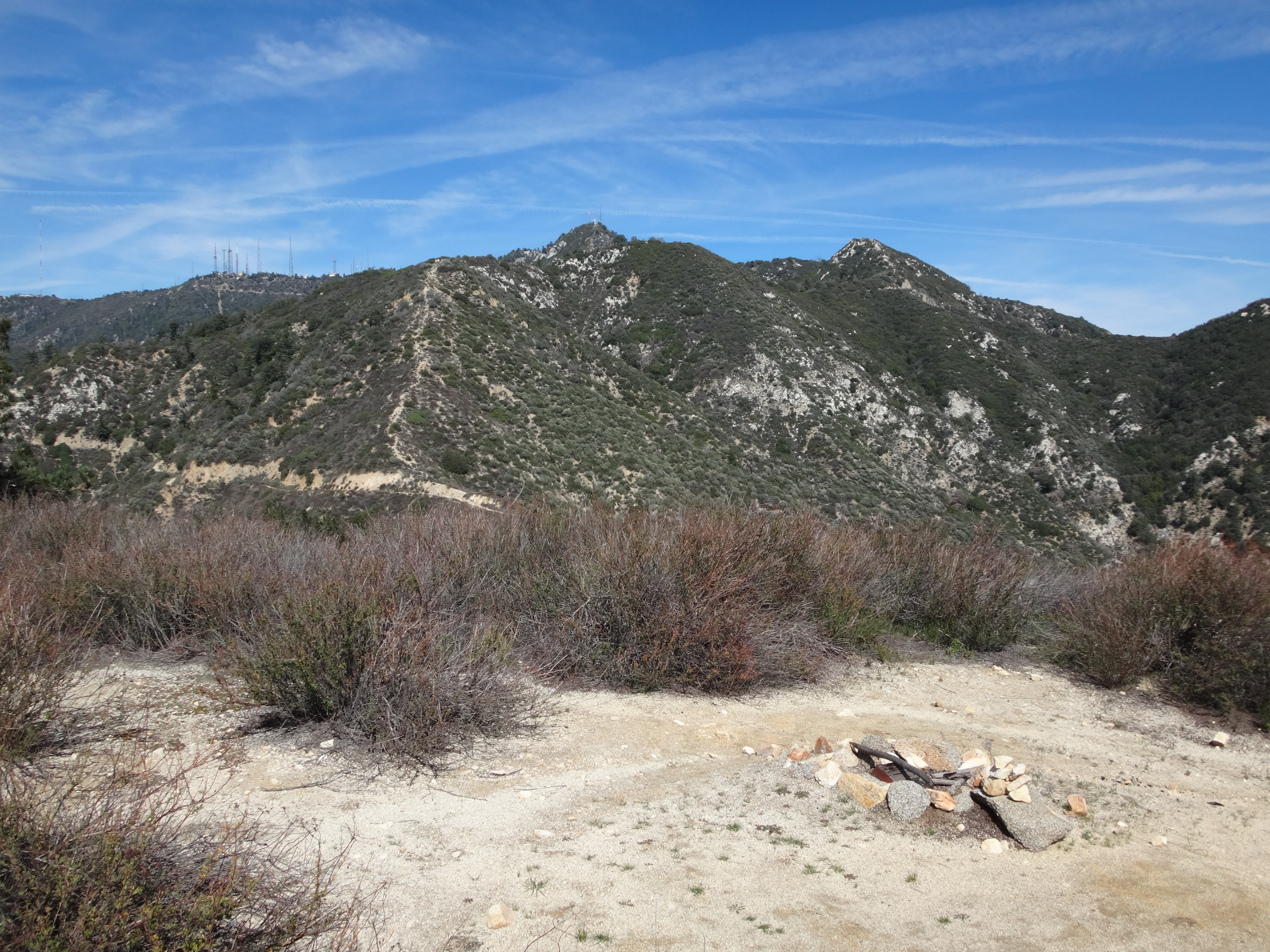
Fake Fuji is marked on the USGS topo as 3681'. It is the little rise at the east end of a flat, tree-lined stretch of ridge about a quarter-mile in length.

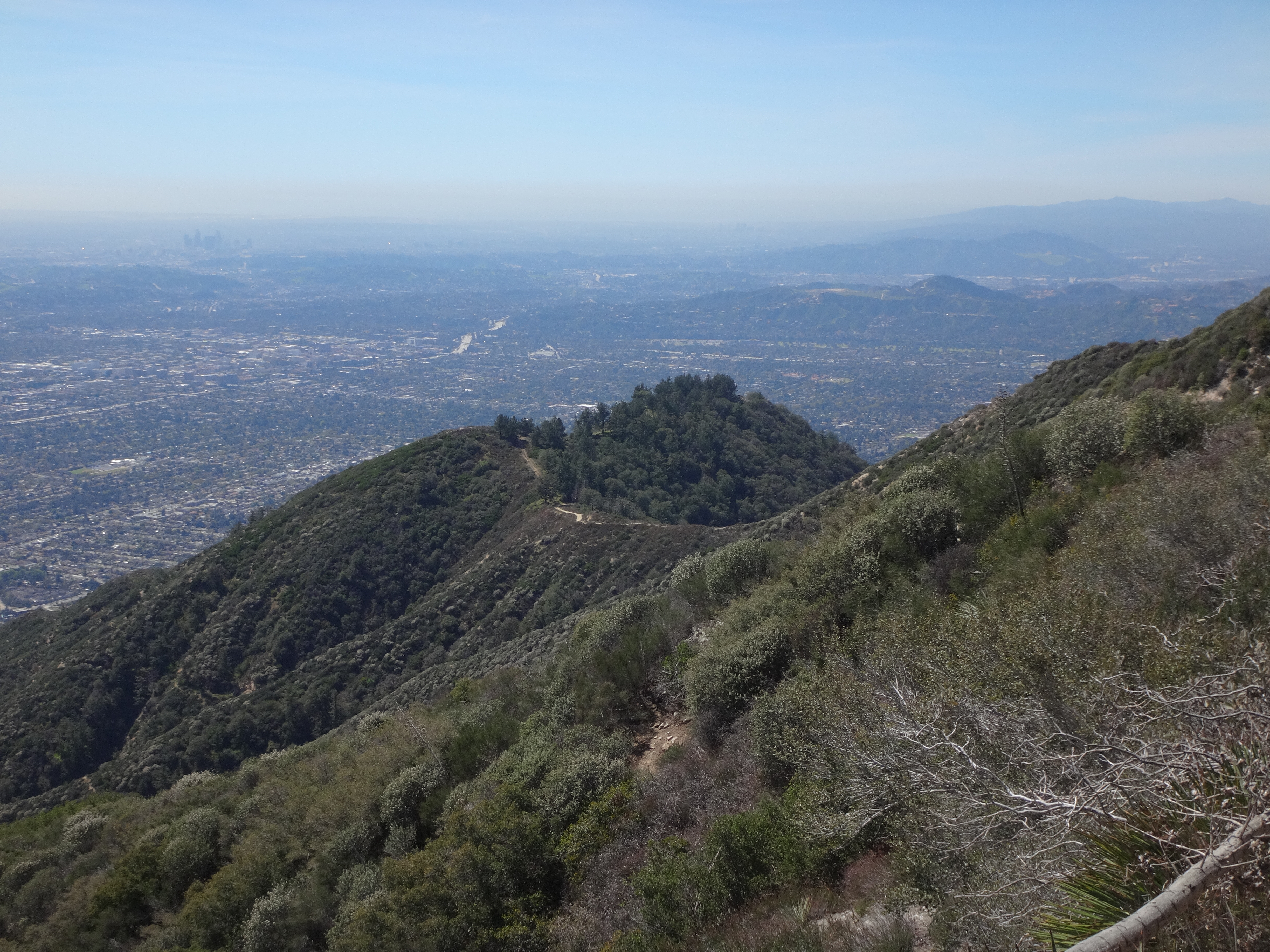
On the summit I found a fire ring and a couple planks of wood. The view of Wilson and Harvard was clear.

Image

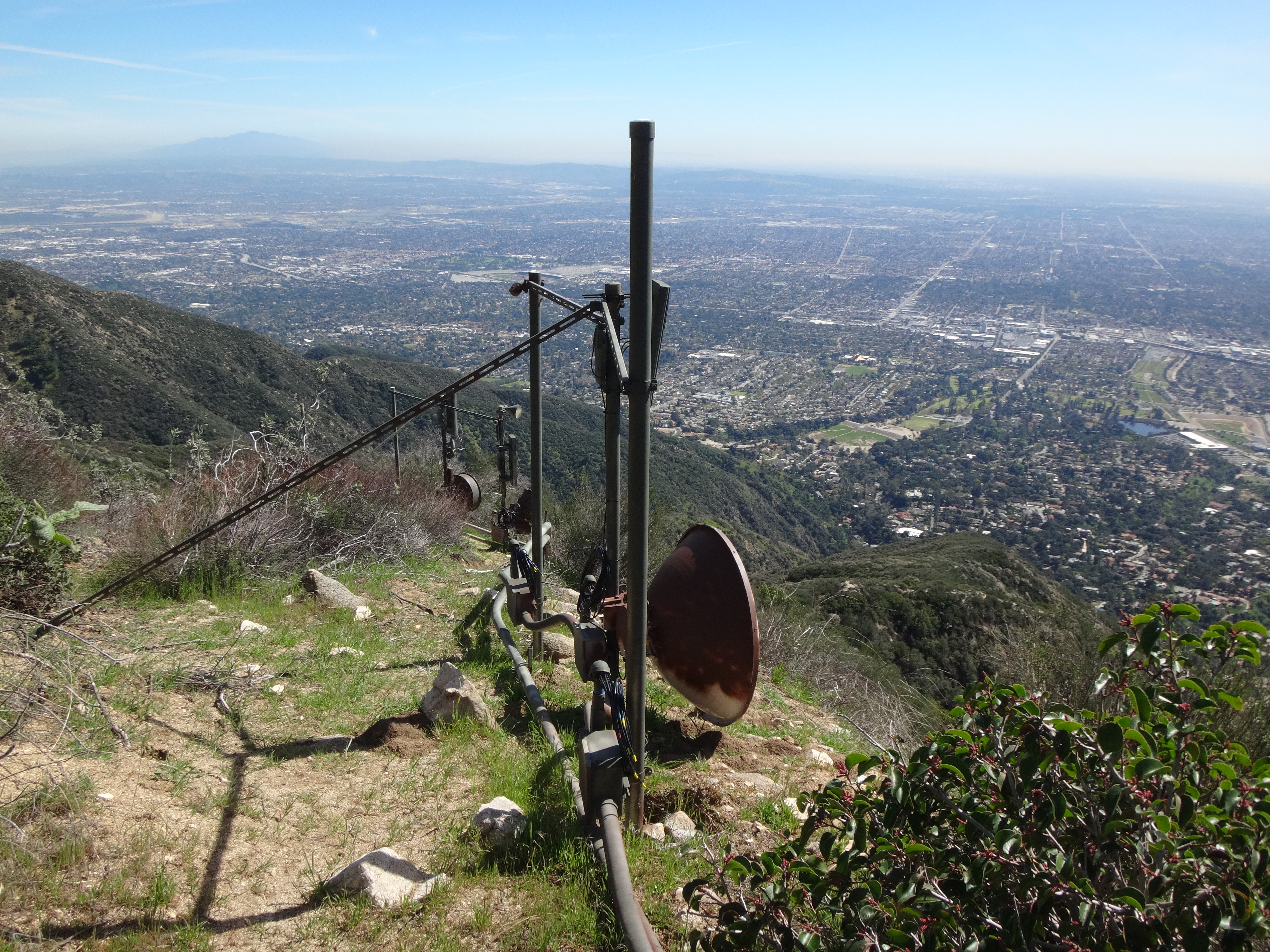
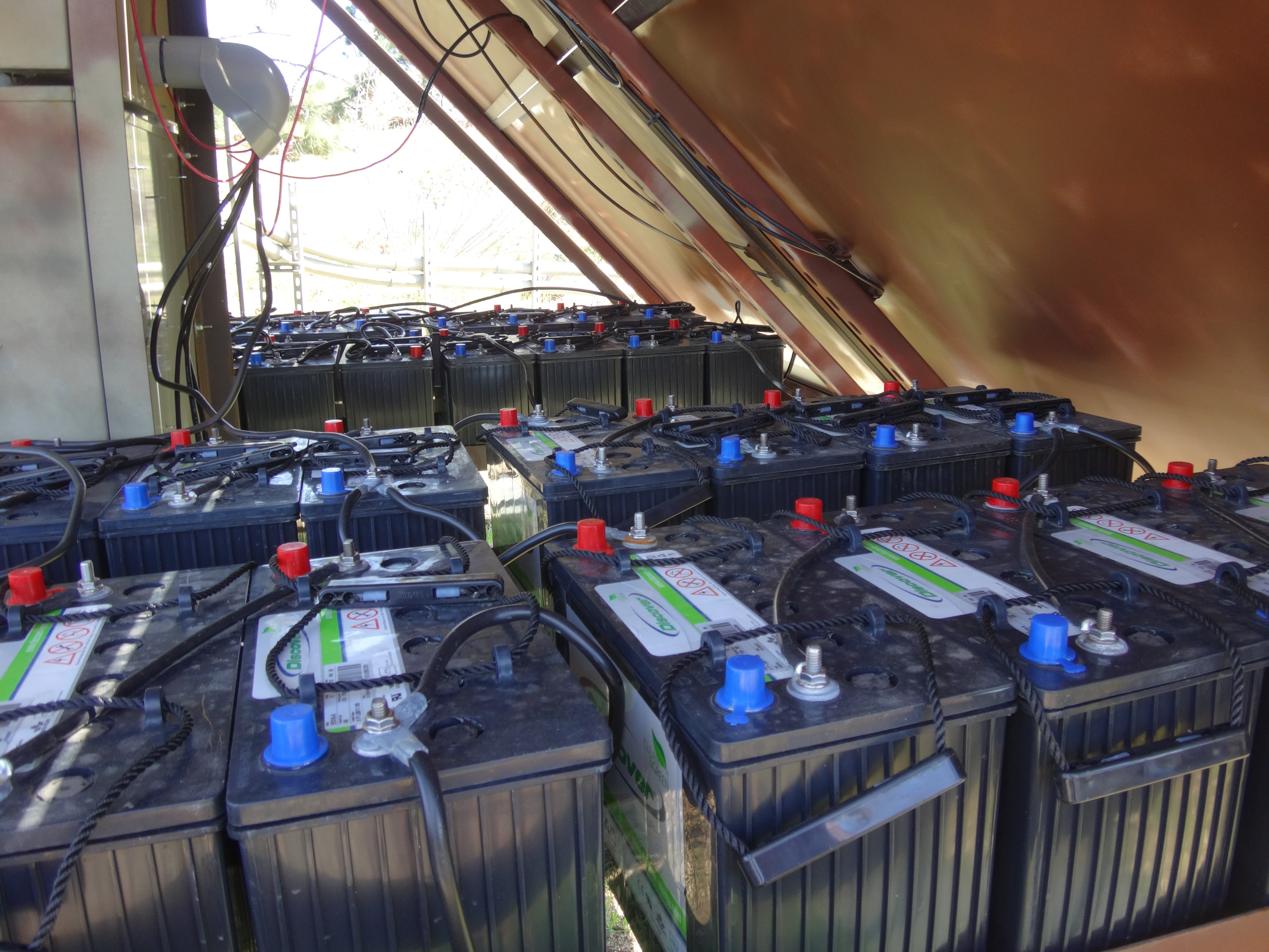
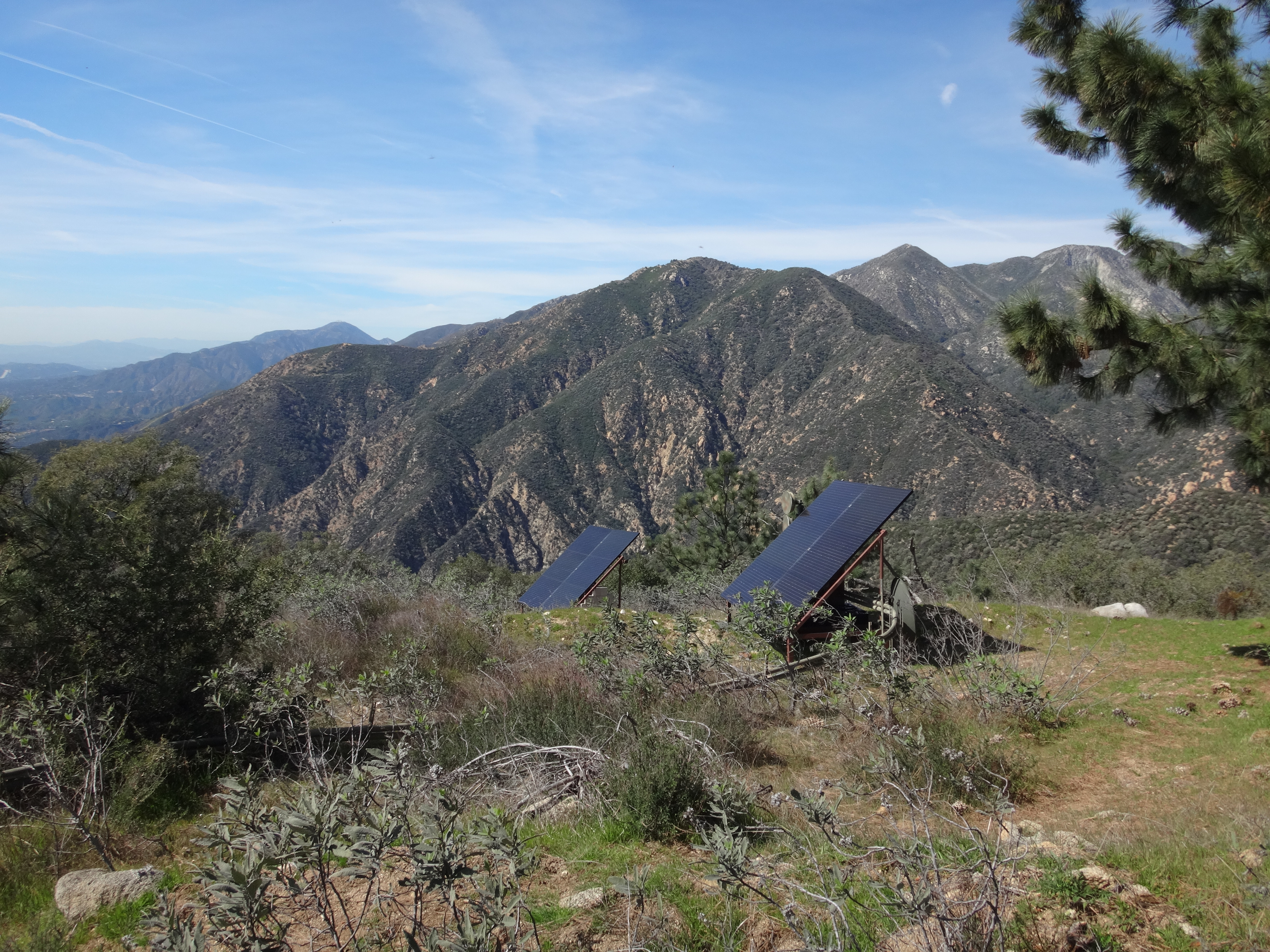
At the west end of the flat the rough service road leads to some electronic equipment and solar panels.

Image

Image

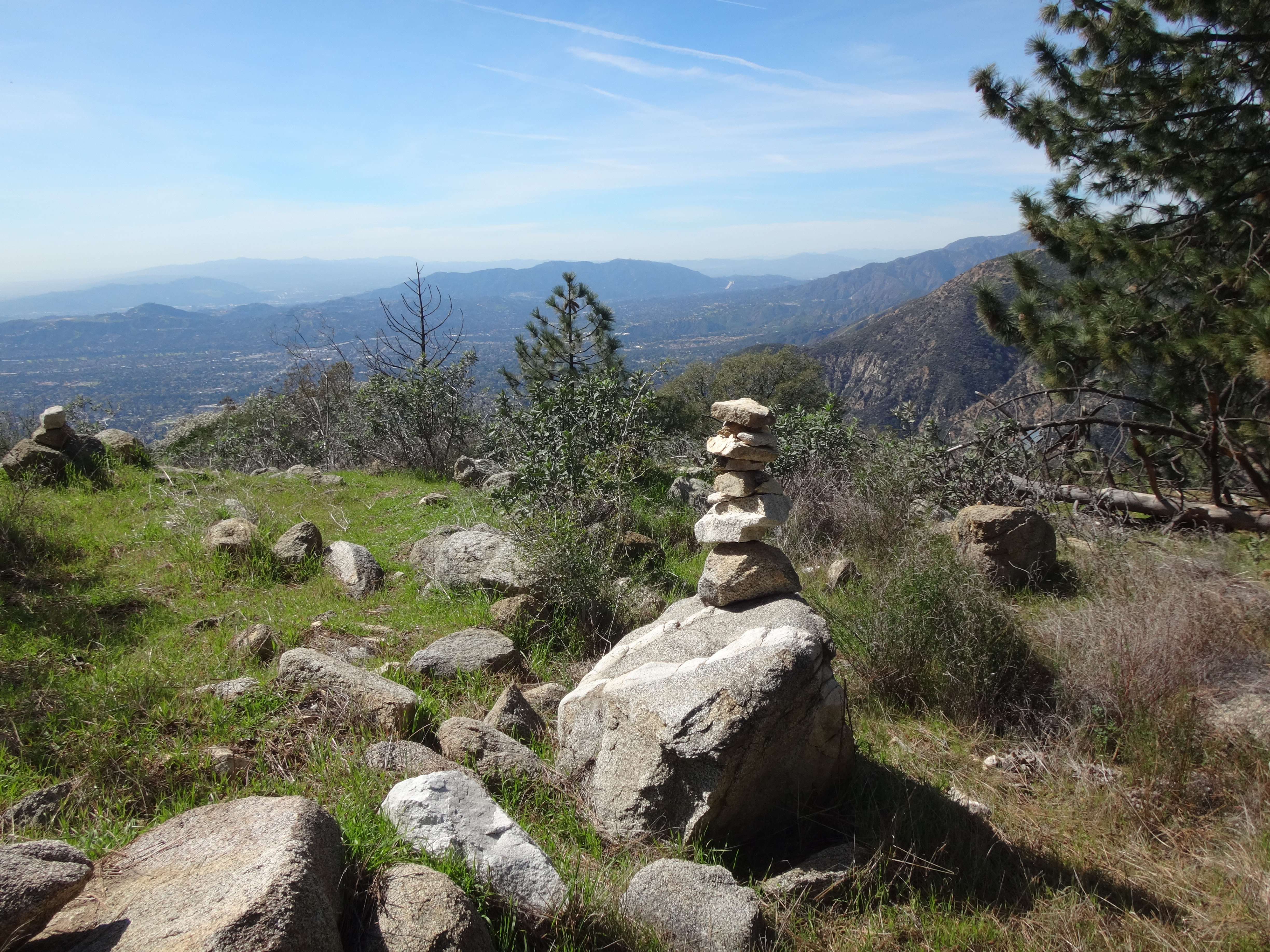
Someone spends a lot of time up here building rock towers.

Image

Looking across Eaton Canyon, there is a nice view of the ridge between West Fuji and Mt. Muir.

Image

I sat in the grass under a tree and enjoyed a sandwich before heading back to Mt. Wilson. On the way down the non-biting flies were slightly annoying. But on the way up they left me alone, probably because the temperature had chilled a bit.

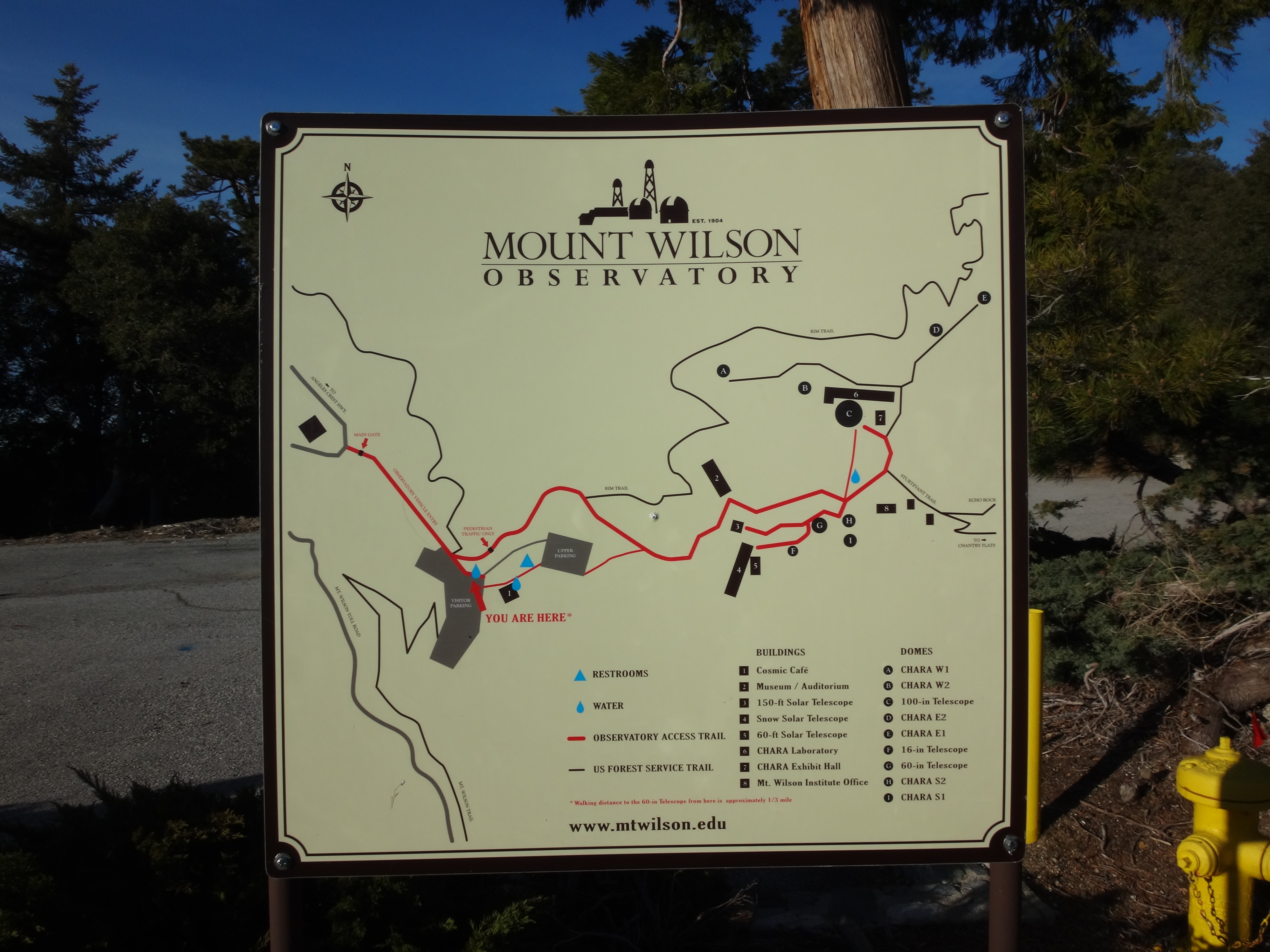
Also, FYI: at Mt. Wilson, the faucet next to the parking lot was working.

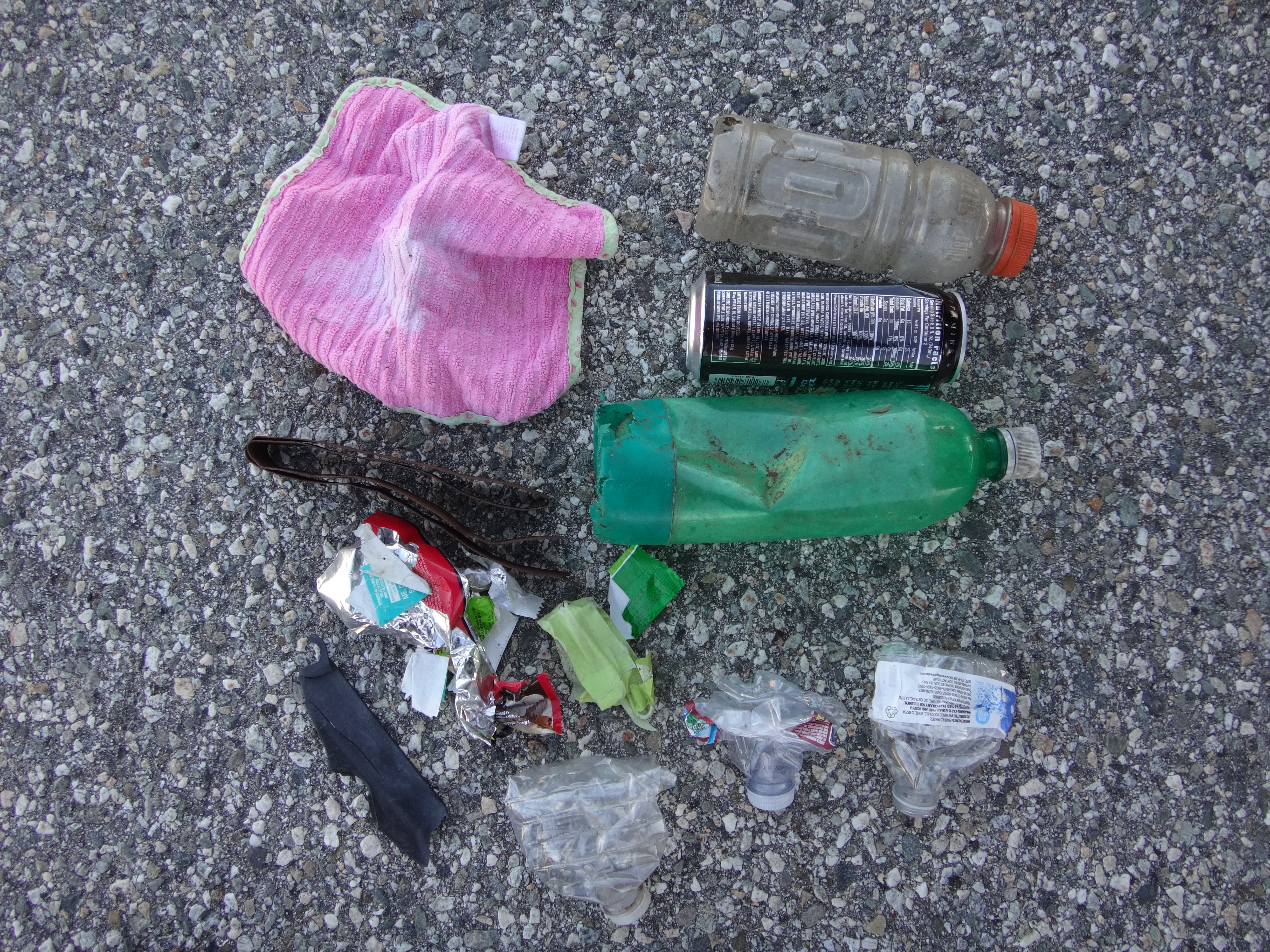
Garbage picked up and packed out: one wash cloth, five plastic bottles, one aluminum can, a metal clamp, a scrap of hard plastic, and four food wrappers.

Image
User avatar
Girl Hiker
Posts: 1297
Joined: Fri Apr 04, 2014 7:46 am

Post by Girl Hiker »

I want to go to the fake Mt. Fuji
sound like fun!
User avatar
Uncle Rico
Posts: 1386
Joined: Thu Mar 20, 2008 7:48 pm

Post by Uncle Rico »

All I hear is Fugee this, Fugee that, where Fugee at? 8)

https://youtu.be/didPqFooDuw
User avatar
daveb
Posts: 6
Joined: Tue Mar 05, 2013 8:42 pm

Post by daveb »

yeah, Robinson says somewhere that some people of Japanese ancestry lived at the upper Fuji Camp in the 1920s.

There are signs of the old direct trail from Fuji Camp to this summit... but the only practical way to attain it nowadays are via Mt Wilson Toll Road, or using the ancient Pasadena Glen Road... About 2 years ago i used the latter route - it was fun.
User avatar
Sean
Posts: 3712
Joined: Wed Jul 27, 2011 12:32 pm

Post by Sean »

daveb wrote: yeah, Robinson says somewhere that some people of Japanese ancestry lived at the upper Fuji Camp in the 1920s.

There are signs of the old direct trail from Fuji Camp to this summit... but the only practical way to attain it nowadays are via Mt Wilson Toll Road, or using the ancient Pasadena Glen Road... About 2 years ago i used the latter route - it was fun.
Is there public access to the Pasadena Glen Road? I haven't checked it out yet.

Also, I grabbed this 1905 image of Mt. Fuji from a "Nature Trail Guide" pamphlet that I got at the Henninger Flats visitor center. Too bad the top of the mountain was cropped out. Still, it gives a sense of what those Japanese residents were probably seeing.
Mt. Fuji above Henninger Flats, 1905.
User avatar
JakubRZ
Posts: 27
Joined: Sat Jun 11, 2022 4:08 pm

Post by JakubRZ »

My weekday trip to Henninger, specifically the Fuji campground where I like to rest, turned into a short bush whack hoping to uncover some history and maybe hints of an older direct trail to fake Mt. Fuji...

I had seen this thread mention something about Japanese living at the upper Fuji camp in the 1920s. I didn't see anything on the 1928 aerials, but in a 1935 aerial I see two structures between the Wilson toll road and the old Pasadena Glen fire road. Not sure if those were it, but a good candidate, so I wanted to check it out.

Top left is Esme junction. Top right is start of Fuji flat top.
1935 Henninger 1.JPG
Close-up view of the two structures in question. Just right is the freshly-graded Pasadena Glen road. No trails/shortcuts to Fuji.
1935 Henninger 2.JPG
I bush whacked around the area, but did not find any traces of the old structures, other than a flat cleared area. What I did find was just downhill and somewhat disturbing. This is right off the toll road, but hidden from view.
IMG_7932.jpeg
Some of the materials looked old, some fairly recent. There was also old red brick, paint buckets, electronics, garbage disposals, chipped out concrete and lots of lumber, and corrugated metal:
IMG_7927.jpeg
IMG_7928.jpeg
IMG_7926.jpeg
IMG_7929.jpeg
Google Earth confirmed the material dumping started in the early 2000s...anyways shame on the county, or whoever didn't feel like removing all this junk. And more importantly, if anyone has any clues as to the old Fuji trail or the Japanese settlers, please share.
User avatar
Sean
Posts: 3712
Joined: Wed Jul 27, 2011 12:32 pm

Post by Sean »

The structure near the reservoir was still represented on the 1995 USGS. Maybe they tore it down shortly thereafter and dumped the debris on the Pasadena Glen Road.
User avatar
JakubRZ
Posts: 27
Joined: Sat Jun 11, 2022 4:08 pm

Post by JakubRZ »

Mt Fuji area exploration continued today. I came up Henninger road, rested at Fuji Camp, and proceed up, but I ended up leaving the road just past the Idlehour junction and took a "shortcut" going all the way up the Esme Canyon upper wash. I followed some human/deer trails and re-joined the Wilson toll road just left of Fuji saddle. I then summitted Mt Fuji, discovered a sizable catepillar and dropped down the south ridge fire break straight down to the Old Kinneloa/Pasadena Glen fire road, which was my ultimate destination. The ridge itself was ok to navigate down, but it's washed out and slippery, so poles came in handy. The fire road on the other hand was fun to navigate with super cool canyon views I had never seen. The road is mostly flat/nicely downhill, somewhat overgrown in places, but not hard to follow at all. There are 2-3 washouts at canyon crossings, where the road is gone, but nothing too difficult to navigate around. It amazes me how much work must have gone into grading that road and building all the water drainage pipes, which are still intact. And then the road was abandoned. Hmm...

On the way down I noticed 5+ emergency response vehicles and 20+ personnel going into Eaton Canyon. Anyone know what happened? Cheers!
Climbing up Esme
Climbing up Esme
View from Fuji saddle
This catepillar was hiding under a rock. What is it?
Ridge vibes - see the fire road?
Ridge vibes - looking down into Pasadena Glen
Ridge joins the fire road
Fire road vibes
Fire road vibes
Looking down canyon west of Pasadena Glen
First sight of Henninger
Like I said....drainage pipes still intact
Should have re-applied sunscreen!
User avatar
dima
Posts: 1302
Joined: Wed Feb 12, 2014 1:35 am

Post by dima »

Nice trip! Did you walk the old fire road back to henninger? It passable through that whole section?

You found a potato bug. Terrifying if they get into your house, but mostly harmless.
User avatar
HikeUp
Posts: 3823
Joined: Thu Sep 27, 2007 9:21 pm

Post by HikeUp »

The abandoned fire road continues all the way to just before Pasadena Glen...there is a massive washout of the road directly below what I think you guys are calling Fuji saddle (the point where Mt. Wilson Toll Road almost crosses from Eaton Cyn watershed to the Pasadena Glen watershed at contour 3600-). From there I bushwhacked my way up to 3681. ca. 2010.
track 2010-02-13.jpg
User avatar
JakubRZ
Posts: 27
Joined: Sat Jun 11, 2022 4:08 pm

Post by JakubRZ »

dima wrote: Sun Mar 10, 2024 11:19 pm Nice trip! Did you walk the old fire road back to henninger? It passable through that whole section?

You found a potato bug. Terrifying if they get into your house, but mostly harmless.
Yes the old fire road is fully passable with minor washouts that require some short bypasses. Jerusalem cricket, huh? Looks like a safe source of protein...for the more desperate hiker.
User avatar
JakubRZ
Posts: 27
Joined: Sat Jun 11, 2022 4:08 pm

Post by JakubRZ »

HikeUp wrote: Mon Mar 11, 2024 6:44 am The abandoned fire road continues all the way to just before Pasadena Glen...there is a massive washout of the road directly below what I think you guys are calling Fuji saddle (the point where Mt. Wilson Toll Road almost crosses from Eaton Cyn watershed to the Pasadena Glen watershed at contour 3600-). From there I bushwhacked my way up to 3681. ca. 2010.

track 2010-02-13.jpg
Awesome. Next time I may have to check that road segment out. Below is my route including the bushwack up Esme. What I refer to as the Fuji saddle is the red circle. The old road continues East as the arrow indicates....I carefully read Brennan's description of Pasadena Glen descent last night. Sounds ominous/long, but the first part may be worth checking out...although it's not 100% clear what he means by "point of no return".
Route.JPG
User avatar
HikeUp
Posts: 3823
Joined: Thu Sep 27, 2007 9:21 pm

Post by HikeUp »

JakubRZ wrote: Mon Mar 11, 2024 11:03 am
HikeUp wrote: Mon Mar 11, 2024 6:44 am The abandoned fire road continues all the way to just before Pasadena Glen...there is a massive washout of the road directly below what I think you guys are calling Fuji saddle (the point where Mt. Wilson Toll Road almost crosses from Eaton Cyn watershed to the Pasadena Glen watershed at contour 3600-). From there I bushwhacked my way up to 3681. ca. 2010.

track 2010-02-13.jpg
Awesome. Next time I may have to check that road segment out. Below is my route including the bushwack up Esme. What I refer to as the Fuji saddle is the red circle. The old road continues East as the arrow indicates....I carefully read Brennan's description of Pasadena Glen descent last night. Sounds ominous/long, but the first part may be worth checking out...although it's not 100% clear what he means by "point of no return".
Yes the road continues east from your red arrow and wraps around to the drainage directly below the red-circled saddle where there is a big ass washout that I didn't see any reasonable way across (but I didn't spend much time thinking about it). I back tracked a few yards and headed straight up through the brush (which wasn't too bad 14 years ago!).
User avatar
JakubRZ
Posts: 27
Joined: Sat Jun 11, 2022 4:08 pm

Post by JakubRZ »

More Fuji shenanigans today. The primary objective was the old Pasadena Glen fire road again, but this time east of where I went last time. It was getting hot on the way up, so I decided to first ascend via Wilson toll road in the shade and then drop in down the ridge from Fuji. Just like last time. This is where I got sidetracked and ascended what appeared to be a faint trail up the North face of the mountain about 0.2 miles past Esme Junction and just before Idlehour junction. The use trail came and went, looking human or animal. I did see a few deer, but no homo sapiens. The climb was steep, but comfortable and well shaded, so I persevered until I found what was a clear human trail. And then orange ribbons. In total I found 4 ribbons, but after a while they disappeared. I summited the west false-Fuji summit. Rested and looked around for any signs of the mysterious orange ribbons. After striking out I headed east to Fuji proper and dropped down south to the fire road now back per plan. This time I proceeded east on the old fire road about 0.5 mile. There were a few heavier washouts, particularly where HikeUp turned around, but the slope was stable so I pushed on. Some nasty manzanitas to crawl under and bees. A lot of bees. Finally...I ran into a serious washout that I was too tired to try and navigate around, which was a bummer because I wanted to peak down Pasadena Glen. According to the 1995 topo I turned around where the road ended. Retraced my steps, took the old road back to Henninger and made tacos for dinner.
Ribbon
Ribbon
Another one
Another one
Approaching false summit
View from false summit
Must have found 10+ in last 2 trips
Spool?
Spool?
Fire road building materials?
More materials?
More materials?
Fire road vibes
Fire road vibes
The end
The end
Way up
Way up
East end of fire road
User avatar
HikeUp
Posts: 3823
Joined: Thu Sep 27, 2007 9:21 pm

Post by HikeUp »

Nice!
User avatar
dima
Posts: 1302
Joined: Wed Feb 12, 2014 1:35 am

Post by dima »

Thanks for thoroughly exploring this so that I don't have to :)
User avatar
jeko1034
Posts: 123
Joined: Mon Nov 30, 2015 8:25 am
Location: Pasadena

Post by jeko1034 »

I wonder what those ribbons marked?
User avatar
dima
Posts: 1302
Joined: Wed Feb 12, 2014 1:35 am

Post by dima »

I put some pink ribbons at the pole of inaccessibility, and the sun bleached them white in a year. If these are still orange, maybe they're still recent? Could somebody be doing some maintenance over there?
User avatar
JakubRZ
Posts: 27
Joined: Sat Jun 11, 2022 4:08 pm

Post by JakubRZ »

The area is well-shaded. One of the ribbons fell off and I tried to re-attach, but it disintegrated. So they were older. The area that I found them, there appeared to a well-graded trail with switchbacks. It could be an old access trail to the emergency broadcast equipment at the top. Or previous generation of bushwhackers marking their ascent before the advent of GPS.
Post Reply