Beautiful Day On Bonita Peak

TRs for the San Gabriel Mountains.
Post Reply
User avatar
Sean
Posts: 3700
Joined: Wed Jul 27, 2011 12:32 pm

Post by Sean »

Tuesday was such a beautiful day that I thought it would be fitting to hike to a peak whose name means "beautiful" in Spanish. Bonita Peak lies along the Heaton Flats Trail out of the East Fork, and it has the added distinction of being on the Sierra Club's Lower Peaks list.

I rolled into the East Fork parking lot around noon, having grabbed a sandwich in Azusa for my summit meal. All footlong subs at Subway were only six bucks each for a limited time. I purchased the roast beef, and resisted an impulse to add cookies and soda. Back at the East Fork parking lot, I took one of a few remaining spaces and prepared for the adventure to come.

Image

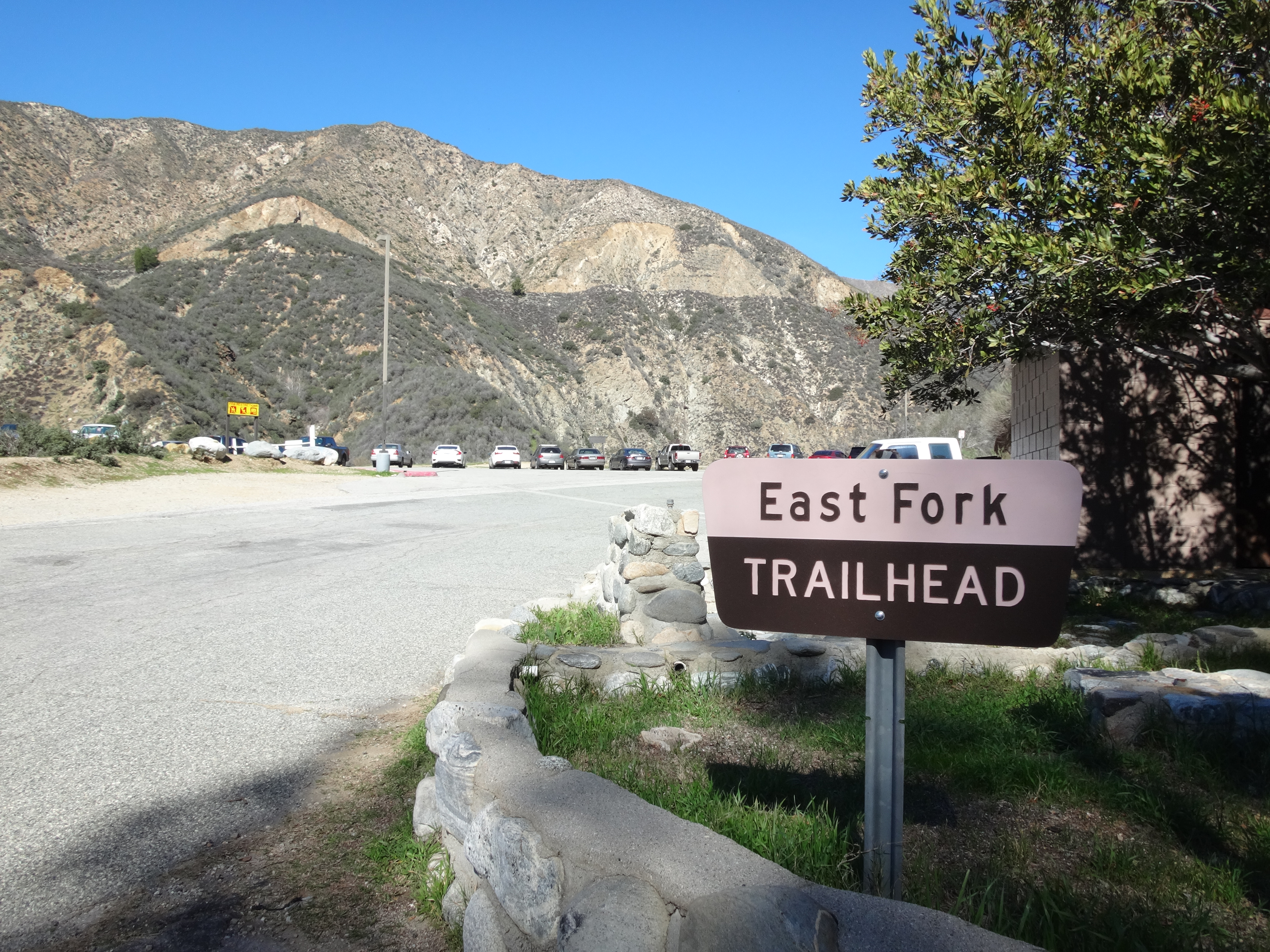
From the parking lot I ambled up the fire road. My brand-new, thick black socks felt good. I like dressing in black, even though I'm a fairly friendly guy and don't believe in Satan, despite the fact that I listen to Satanic metal. But then I also listen to some Christian music--as long as it's catchy or has a Satanic rhythm.

My hiking pole seemed like an unnecessary aid on the flat fire road, but I was sure it would serve some useful purpose later on in the journey. For example, I might run into a vicious Satanist who wanted to cut me open and eat my glands. In which case a pointy, aluminum stick would surely come in handy for self-defense.

While deep in thought, I could see and hear the strong river rushing through the canyon to the left of the road.

Image

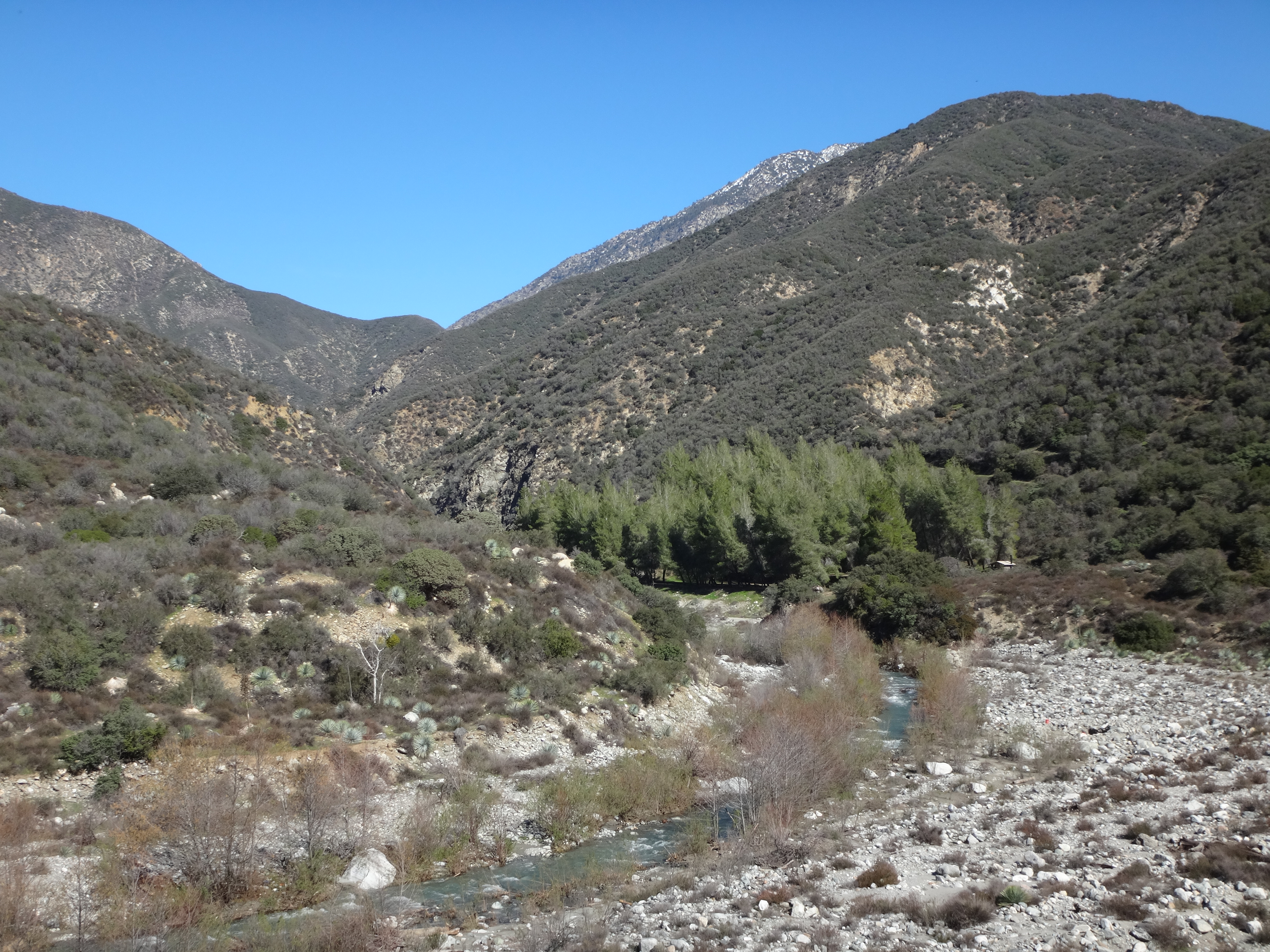
After a half-mile I reached the campground. A couple tents were set up. Turning right, I started on the Heaton Flats singletrack. It wasn't long before canyon views opened up. Shoemaker Road hugged slopes on the opposite side of the river.

Image

The trail seemed steeper than I remembered it. But then I also seemed less conditioned than the last time I hiked here. Several breaks were required to "take in the scenery" (and maybe also to forestall a respiratory meltdown). Eventually, my legs made it up the minor gully, across a minor stream, and to the first minor saddle, where I rejected another break opportunity due to lack of shade.

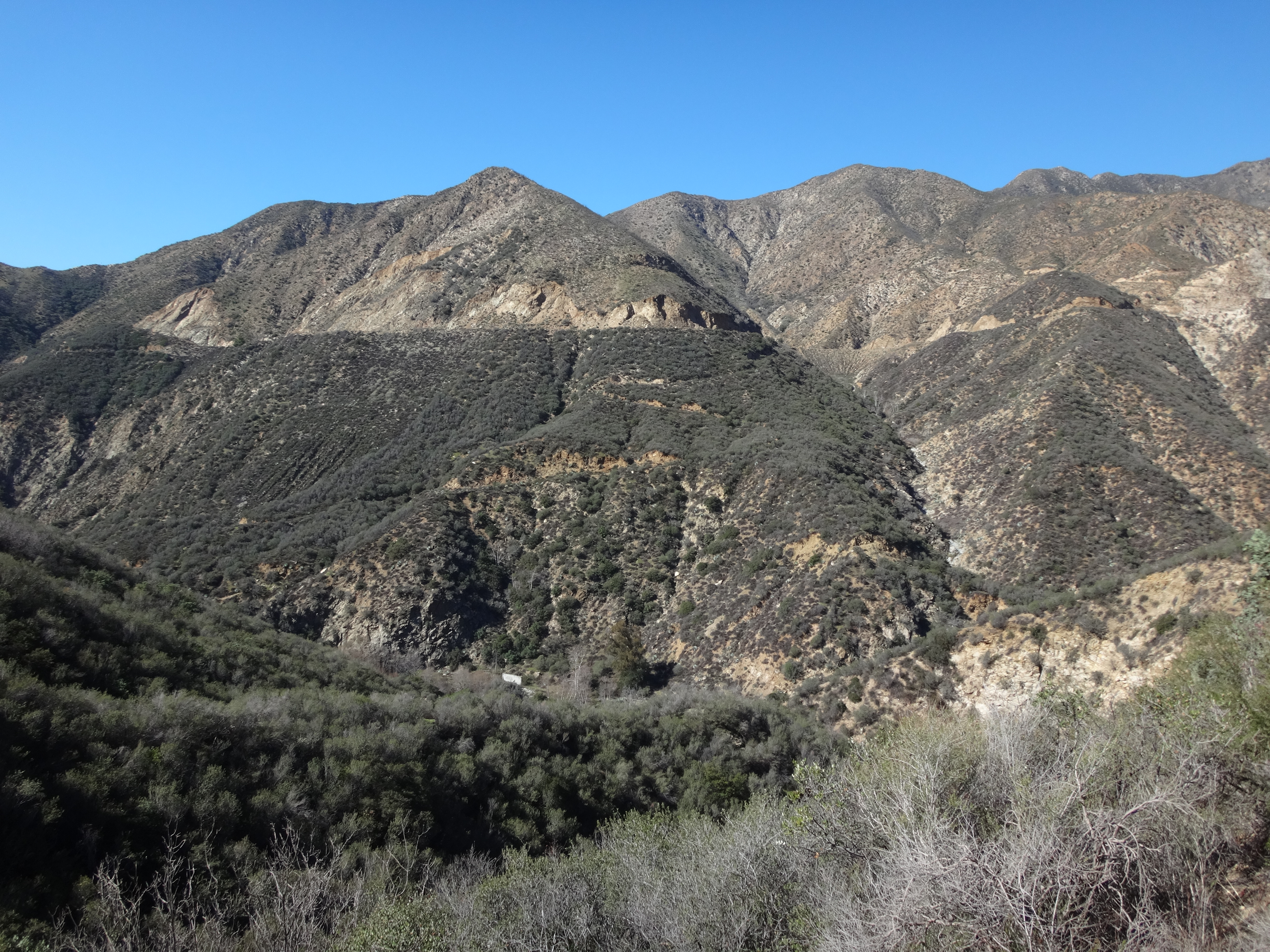
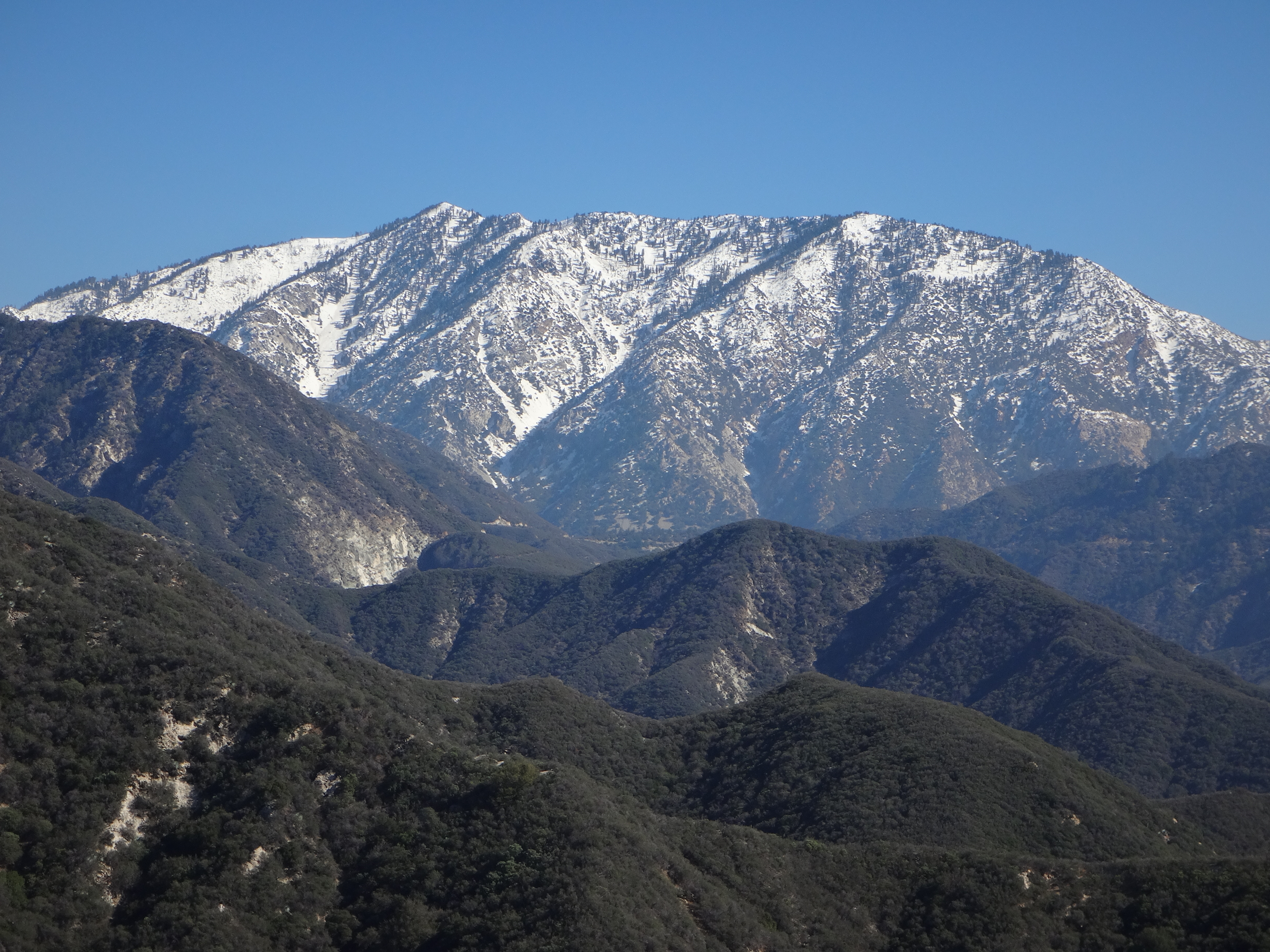
Pushing on, the trail marched up and around, now mostly following and skirting a major ridge. At the next shady section I rested and enjoyed the view of snowy Ontario Peak to the east.

Image

A switchback landed me on the top of the ridge with a view of perhaps the steepest section ahead.

Image

This stretch can be mellowed by utilizing an abandoned, deteriorated switchback, instead of following the blazed route straight up the spine of the ridge. Going up I used the direct path. But coming down I took the switchback.

Image

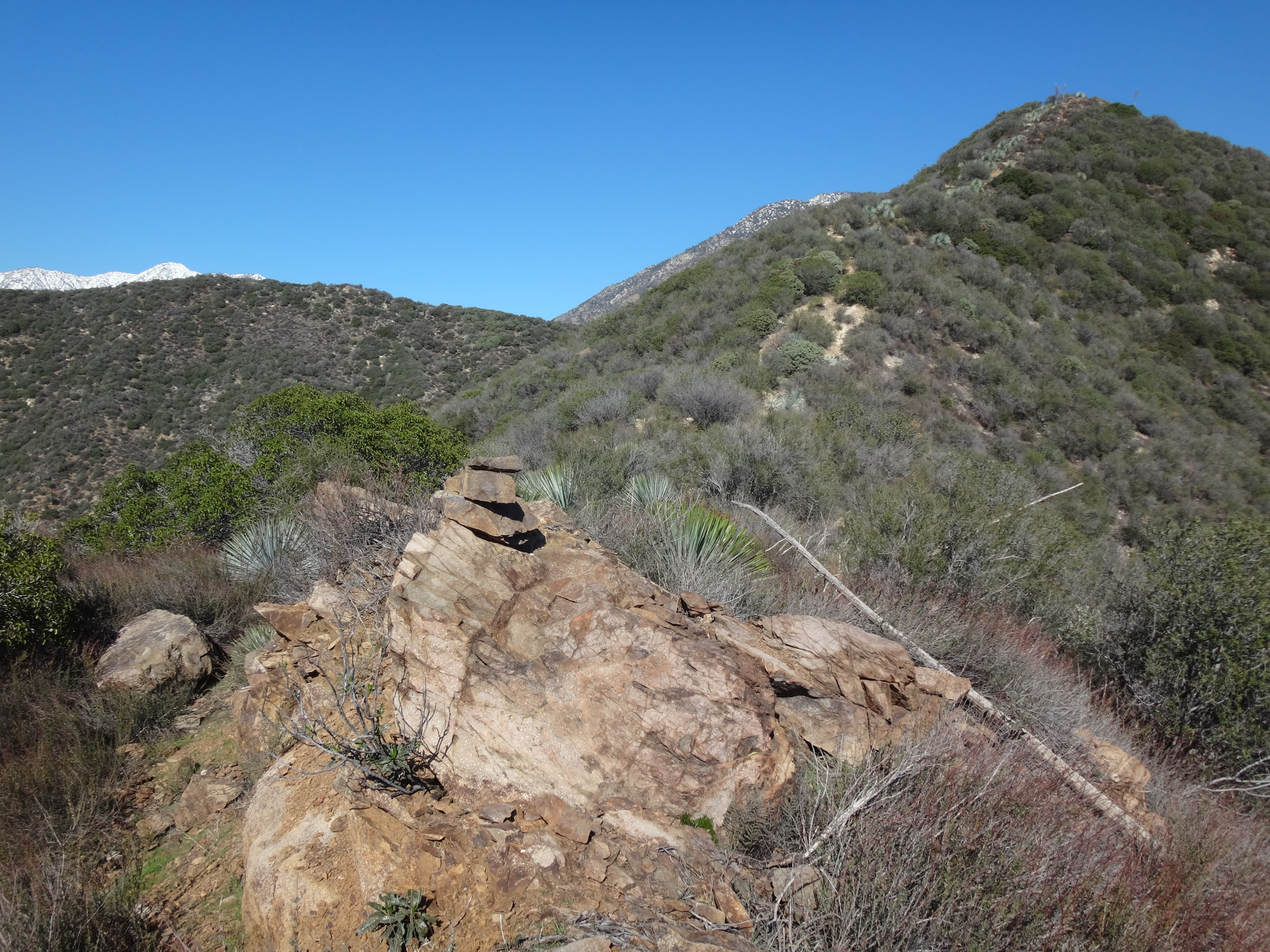
Beyond this part, the trail moved along the northwest (left) side of the ridge for three-tenths of a mile before bending onto a tiny saddle. Bonita Peak is the slight bump 400 feet south (right) from this saddle. To the northeast 500 feet is a slightly higher double-hump, which marks the corner where the trail turns to head dead eastward over a rolling stretch of the ridge.

Image
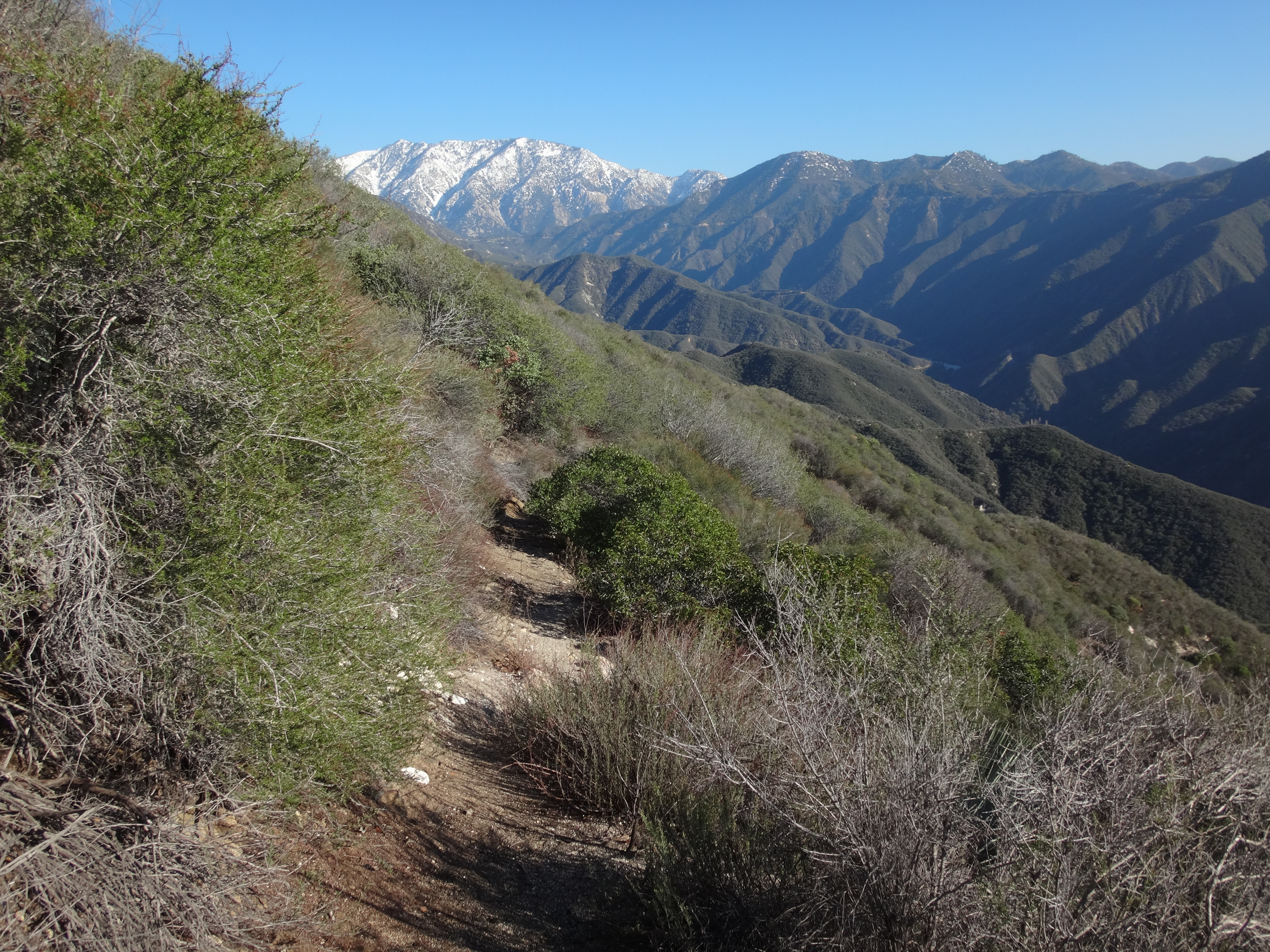
(Looking east from the double-hump toward Coldwater Saddle and West Baldy.)

Image
(Looking back from the double-hump. Bonita Peak is the middle-left bump.)

From the saddle between Bonita and the double-hump, I bushwhacked along the top of the ridge to the tiny summit, which contained a register placed by Cecelia last year.

Image

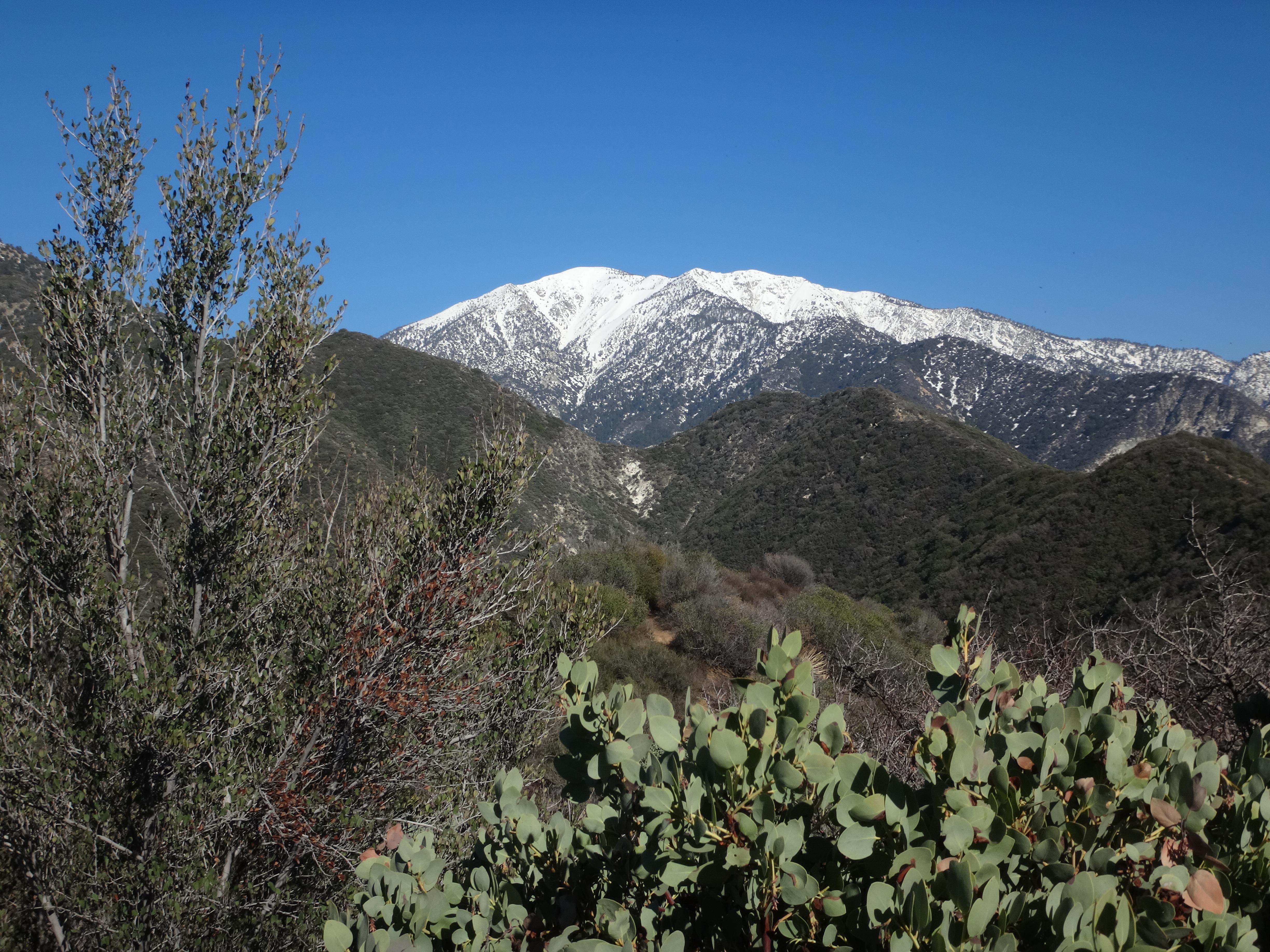
While the highpoint was shaded by vegetation, moving a few yards away offered a stunning mountain skyline of Rattlesnake Peak to Baden-Powell.

Image

I sat down and savored my sandwich in the warm winter sunshine. The clear blue sky dissolved all concerns about gland-hunting Satanists. And the natural silence infused my soul with thoughts about the mildly disappointing absence of a benchmark.

You see, before visiting the summit, I had searched for the Bonita Benchmark with no luck. The Lower Peaks guide reported at least one surviving reference mark, but either I stupidly missed it, or it's gone now.
User avatar
oldcoot
Posts: 64
Joined: Wed Jun 16, 2010 9:42 pm

Post by oldcoot »

Thanks for this...

While I greatly enjoy reading your death-march adventures (and all the reports here), it's also nice to occasionally see one where one of you superguys/gals does something I've actually done...

FWIW, I'm a benchmark freak, and I could not find one (or a reference mark) up there in four visits 2006-2012...

Thanks for all your great contributions!

oldcoot
User avatar
Sean
Posts: 3700
Joined: Wed Jul 27, 2011 12:32 pm

Post by Sean »

oldcoot wrote: FWIW, I'm a benchmark freak, and I could not find one (or a reference mark) up there in four visits 2006-2012.
The Lower Peaks guide for Bonita was written in 1986 and revised in 2004. Apparently the reference mark was still around at that time. I'm unaware if there is a later revision.
User avatar
oldcoot
Posts: 64
Joined: Wed Jun 16, 2010 9:42 pm

Post by oldcoot »

My LPC guide for Bonita was written in 1986, but is older (last revised in 2001)...it did not mention a benchmark or reference mark, but said "Continue until you see a USGS marker on the right (east) side of the trail. The marker is placed on a rock in an unusual horizontal position. Note the arrow to Bonita!"

At first I thought they were referring to a regular benchmark mounted like a coin standing on edge instead of face-up...but think they're referring to a spade marker (which I have never seen there, either)...

Have you ever found the benchmark on Devil Peak (the one near Mt. Mooney)? In keeping with your theme above, it's supposed to say DEVIL. I have not been able to find it (think someone probably swiped it)...

It all just helps to make it more interesting out there...even for those of us who can't do the "hard stuff." (I did do Big Iron, Rattlesnake and 40+ other HPS peaks in 2003 at age 57...but will soon be 71...and noticing it...)

oldcoot
User avatar
tekewin
Posts: 1179
Joined: Thu Apr 11, 2013 5:07 pm

Post by tekewin »

Nice to see you back in the mountains. The view from that first saddle is pretty sweet.
User avatar
Sean
Posts: 3700
Joined: Wed Jul 27, 2011 12:32 pm

Post by Sean »

oldcoot wrote: Have you ever found the benchmark on Devil Peak (the one near Mt. Mooney)? In keeping with your theme above, it's supposed to say DEVIL.
I did go to Devil Peak a couple years ago. It was very overgrown and messed up from the Station Fire. I didn't look for a benchmark, but I plan to go back and look for it. I hear that it's there somewhere.
User avatar
HikeUp
Posts: 3822
Joined: Thu Sep 27, 2007 9:21 pm

Post by HikeUp »

10 years ago I couldn't find a marker on Devils Peak. Also couldn't find a view of anything! Worst peak ever.
User avatar
Sean
Posts: 3700
Joined: Wed Jul 27, 2011 12:32 pm

Post by Sean »

oldcoot wrote: At first I thought they were referring to a regular benchmark mounted like a coin standing on edge instead of face-up...but think they're referring to a spade marker (which I have never seen there, either).
What is a spade marker, and do they have arrows on them? I assumed the guide was talking about a reference mark with an arrow pointing to the triangulation station mark's location. Though the guide makes it sound like the arrow was intended to point to some peak.

Another problem with the wording in the guide is that a "horizontal" benchmark position is normal, not unusual. Typically they are mounted in concrete or rock parallel to the ground (facing up), which I consider horizontal with the ground. So I think the Sierra Club means that the benchmark is placed vertically (perpendicular) to the ground, or facing sideways. I've seen that once or twice elsewhere.
User avatar
Sean
Posts: 3700
Joined: Wed Jul 27, 2011 12:32 pm

Post by Sean »

HikeUp wrote: 10 years ago I couldn't find a marker on Devils Peak. Also couldn't find a view of anything! Worst peak ever.
Tell me about it! We couldn't find a spot to sit down.
User avatar
oldcoot
Posts: 64
Joined: Wed Jun 16, 2010 9:42 pm

Post by oldcoot »

It was bad enough before the Station Fire brought out the guard dogs...who knew Cerberus was a poodle...no point in trying to look for stuff up there until the poodles are gone...maybe all the rain will encourage them to finally go back to the kennel...

My thanks for this forum for saving me from poodle dog...I'd never heard of it until the discussion here a few years back...would have blundered right through it...so thanks, all!

oldcoot
User avatar
HikeUp
Posts: 3822
Joined: Thu Sep 27, 2007 9:21 pm

Post by HikeUp »

oldcoot wrote: It was bad enough before the Station Fire brought out the guard dogs...who knew Cerberus was a poodle...no point in trying to look for stuff up there until the poodles are gone...maybe all the rain will encourage them to finally go back to the kennel...

My thanks for this forum for saving me from poodle dog...I'd never heard of it until the discussion here a few years back...would have blundered right through it...so thanks, all!

oldcoot
ditto. although i make a point of minimizing contack with unknown vegetation anyway.
User avatar
Sean
Posts: 3700
Joined: Wed Jul 27, 2011 12:32 pm

Post by Sean »

I returned to Bonita on Tuesday, this time with Keith. The register can is still there. But again I missed the alleged hidden reference mark.

Bonita is really a set of three bumps, and the register is on the lowest one. If I had endless time on my hands, I'd clear a space at the highest bump and move the register.
IMG_20240409_142417863_HDR.jpg
IMG_20240409_143831441_HDR.jpg
User avatar
Girl Hiker
Posts: 1288
Joined: Fri Apr 04, 2014 7:46 am

Post by Girl Hiker »

I'm glad the register is still there. I've been wanting to go back myself.
Post Reply