
General Conditions


Went with Tony to go check conditions in the morning the other day before heading to school...
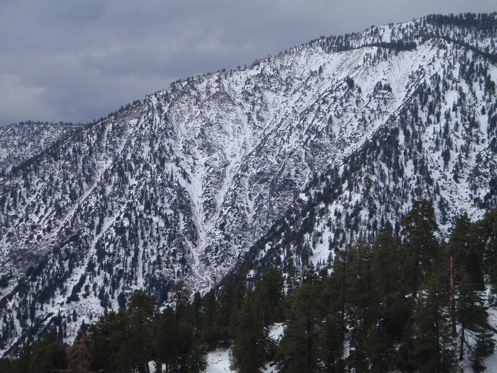
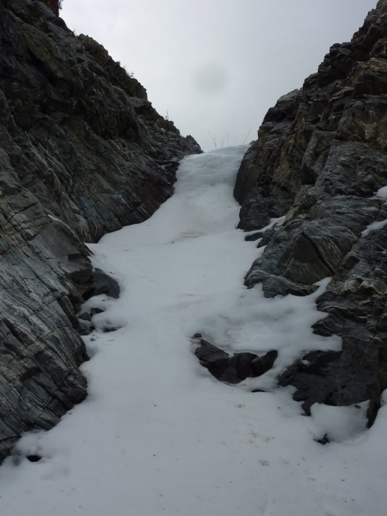
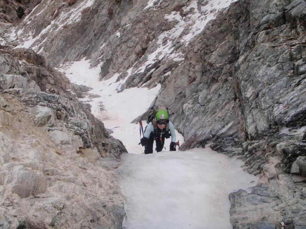
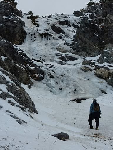
BP NEF
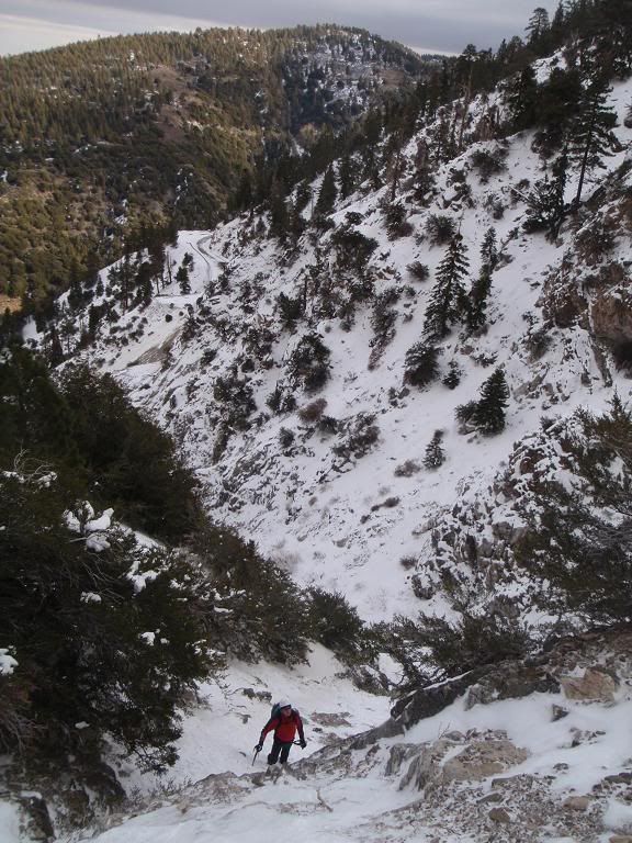
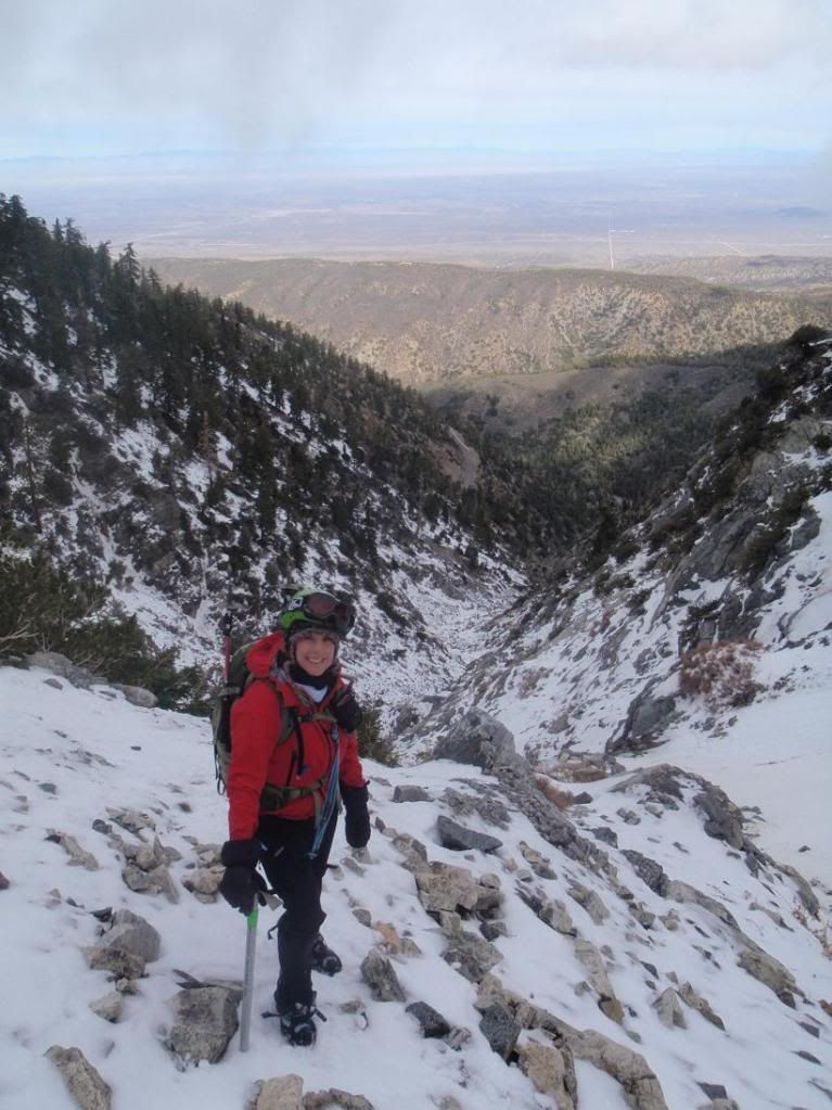
Tony going up a chute along the North Baldy Route on BP to bypass some bad rock
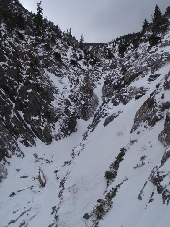
Looking for ice
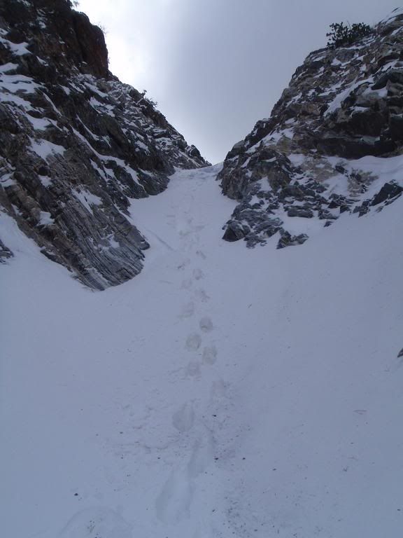
Covered in snow
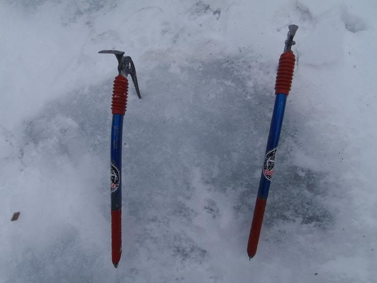
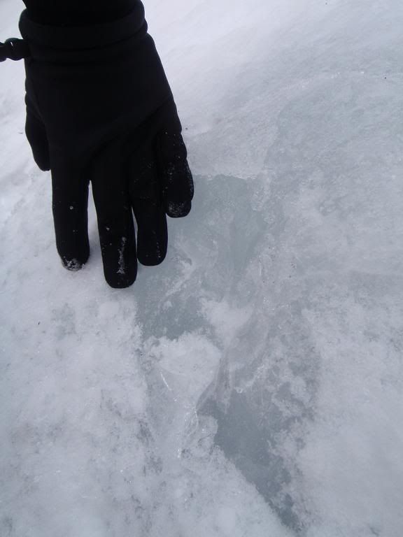
Ice was VERY thick, very good. Some bashing and cleaning required to get to the good stuff. This should all be in condition either in a week or two, or after a REALLY good dump plus some time for avalanches to plow the road and consolidation, freeze thaw etc.
BP NEF
Tony going up a chute along the North Baldy Route on BP to bypass some bad rock
Looking for ice
Covered in snow
Ice was VERY thick, very good. Some bashing and cleaning required to get to the good stuff. This should all be in condition either in a week or two, or after a REALLY good dump plus some time for avalanches to plow the road and consolidation, freeze thaw etc.
-
cougarmagic

- Posts: 1409
- Joined: Wed May 07, 2008 5:21 pm
"La Nina" in Spanish means "Mean Girl Who Keeps the Snow and Rain Away, Ruining The Fun of Mountaineers and Canyoneers and Increases Fire Danger Due To Drought Stress on Chaparral. Oh And Also Creates Ideal Conditions for Bark Beetles".
-
666-The Beast
- Posts: 124
- Joined: Wed Jun 15, 2011 8:08 pm
the view from 39 near East Fork River
I know, there must be lots of pissed off mountain snow people out there for right now, so be patient, mother nature is unpredictable, you can have a white blanket cover Baldy soon.
sorry.... Hell is not the only hot place, Baldy is expected to hit 60...... 666
LOLcougarmagic wrote: ↑"La Nina" in Spanish means "Mean Girl Who Keeps the Snow and Rain Away, Ruining The Fun of Mountaineers and Canyoneers and Increases Fire Danger Due To Drought Stress on Chaparral. Oh And Also Creates Ideal Conditions for Bark Beetles".

OK, then its the 'be grateful' response. Los Angeles 113% of normal rain fall.
San Francisco at 65% of normal....Los Angeles has had 4 inches more than San Francisco! Sierra Nevada at 10% of normal snowpack.
"This last map clearly shows the Sierra having very little snow compared to normal with below-normal snowfall from central Idaho to Utah and parts of Colorado. The one anomaly in the Southwest is that the mountains of Arizona are above normal. "
So are we going to be seeing some Arizona trip reports?
Stranded Arizona college student survives 10-day blizzard in car
http://www.blottr.com/breaking-news/str ... izzard-car
Stupid Girl.cougarmagic wrote: ↑"La Nina" in Spanish means "Mean Girl Who Keeps the Snow and Rain Away, Ruining The Fun of Mountaineers and Canyoneers and Increases Fire Danger Due To Drought Stress on Chaparral. Oh And Also Creates Ideal Conditions for Bark Beetles".
-
morgangoat
- Posts: 3
- Joined: Sun Nov 13, 2011 6:56 am
Hi all,
Myself and a friend are thinking of driving up the 2 this weekend. Can anyone tell me where snowline is on north-facing slopes? I know the Waterman ski slopes didn't open this year, but are they free of snow? We probably don't want to break out the snowshoes...
Thanks
Myself and a friend are thinking of driving up the 2 this weekend. Can anyone tell me where snowline is on north-facing slopes? I know the Waterman ski slopes didn't open this year, but are they free of snow? We probably don't want to break out the snowshoes...
Thanks
-
VermillionPearlGirl
- Posts: 239
- Joined: Wed Apr 06, 2011 9:57 am
Anyone know around what elevation the snow level is at these days? I'm actually trying to avoid it. (I hike in 5 fingers. I've hiked in them in the snow a few times this season and its surprising how cold and wet your feet can get and still be fine, but I'm not in the mood this weekend 
It looked like when it snowed last weekend it was down to like 4000 ft and it wasn't all that warm this week. I hiked Echo Mtn this morning but it was totally fogged in so I couldn't tell what it looked like above me and with the Mount Wilson Webcam out of commission I'm flying blind
I'm wondering if I could hit a San Gabriel Peak or something like that and keep my feet dry. I kind of doubt it. Anyone know?

Hi All,
A few years back (summer) I recall driving up to Cobb Estate to get in a late afternoon trail run in. There was a sign out front saying trail closed / fire danger.
Some questions
Do you think this is ahead for the trails/mountains this summer?
Have they ever closed the road to Chantry Flats due to fire danger / red flag?
I have mixed feelings about closing up these areas. Apparently wildfires are healthy for the ecosystem, but it always kills me when they are started by some ignorant person who throws a smoke out on the trail etc.
Thoughts / opinions?
Be safe / smart out there!
Shreddy


We hiked Icehouse Canyon for the first time this year today. It was dry. The creek level was low. The small spring just below the Saddle was dry. It usually has water in May. Mercifully, Columbine Spring is still flowing. Other reports say the Kellys Camp spring has very low flow.
If there are a bunch of fires, then the forest could be closed. Maybe the Monday rain will help a little.
If there are a bunch of fires, then the forest could be closed. Maybe the Monday rain will help a little.
Hello,
Planning a trip from the Devils punchbowl to Vincent Gap via the Burkhart trail via Islip saddle, to Baden Powell and ending at Vincent Gap as stated. My plan is for a three day two night trip.
Anyone know of a good campsite just beyond Burkhart saddle?
Wondering about trail conditions water availability etc.
Thanks in advance
Bill

Here is my best shot at recon...
Heading south from Burkhart Saddle there is nothing that I know of campsite wise until you reach the PCT (where the frog closure area boundary is up near cooper cyn falls). Burkhart Saddle itself is very flat and would be easy place to set up a tent - probably windy though. Within say the first 1/4 to 1/2 mile south of the saddle you might be able to find something off trail flat enough for a tent but I can't recall for sure. If you want to you could climb either Pallett or Will Thrall and camp on top - plenty of places up on either of those peaks. No water anywhere though until you reach the PCT area.
Heading south from Burkhart Saddle there is nothing that I know of campsite wise until you reach the PCT (where the frog closure area boundary is up near cooper cyn falls). Burkhart Saddle itself is very flat and would be easy place to set up a tent - probably windy though. Within say the first 1/4 to 1/2 mile south of the saddle you might be able to find something off trail flat enough for a tent but I can't recall for sure. If you want to you could climb either Pallett or Will Thrall and camp on top - plenty of places up on either of those peaks. No water anywhere though until you reach the PCT area.
Thanks Hike up. Forgot about the frog closure. My intended route hopefully is outside that boundary. I was hoping to make the 3 days more uniform in distance for my hiking buddies who tend to complain on longer days. Sounds like I would need to bring adequate water up from Burkhart trail (Cruthers creek?) Also is there a path from Burkhart saddle to Mt Williamson along Pleasant view ridge?
I am excited to do this hike, seems like a neat area.
Bill
I am excited to do this hike, seems like a neat area.
Bill

I did the Burkhart Trail last August from Buckhorn to Will Thrall and Pallett. I think going up to Pallett to camp is perhaps your best option, though I'm not really a camper. Pallett, however, is a long and flat summit with some tree cover on the north side. It's about a 700' climb from Burkhart Saddle.
If I recall correctly, there was an intermittent stream about a mile south of the Saddle, which only had stagnant puddles during my August visit. There wasn't a reliable water source until Little Rock Creek, which is 3.3 miles south.
No water on Pleasant View Ridge.
There is an obvious trail up to Pallett. Beyond that is a slightly tricky bit where you drop down to a saddle on the southeast side and climb up the other side. That's the only section of PVR that I haven't personally done. But I scouted it and it looked fairly straightforward, as long as you're coming from Burkhart. I got lost my first time coming from Williamson and ended up on the ridge to Goodykoontz.
If you take the Burkhart Trail to Buckhorn, you then have to walk some of the highway to Islip Saddle. The PCT is closed. Generally Burkhart is in decent shape, but during my visit last year a few rockslide areas were in poor but passable condition. The trail has little tree cover, but the views of rock formations are really great.
Thanks for the intel Sean. Regarding PCT closure, I plan on:
1. Either following PVR east to Mt Williamson and on to Islip saddle. (Is this a viable option?) or:
2. Following the Burkhart trail to the PCT.
Where is the PCT closure exactly?
Thanks again!
1. Either following PVR east to Mt Williamson and on to Islip saddle. (Is this a viable option?) or:
2. Following the Burkhart trail to the PCT.
Where is the PCT closure exactly?
Thanks again!
Certainly viable, especially if you camp on Pallett.
PCT is closed from Eagles Roost on the east end and where the Burkhart trail intersects it at Little Rock Creek on the west end.