
Native Son Mine
I have hiked along the road from both directions. Its very difficult to get there from Vincent gulch as the trail is unmaintained. The fire road fromedenooch wrote:i asked the mine expert about this....i think its all fire road
Blue ridge 3n39 gets you to Lupine but the road washes out in spots. Anyway, I did'nt realize there was a mine in that location at the time, or I might have looked for it.
Has the expert checked it out? Is it worth exploring?
-
moppychris

- Posts: 87
- Joined: Mon Sep 07, 2009 12:56 pm
Native Son mine is hard to find. I have been down that road twice, looking for the mine from the road, also bush whacking to the spot that it is labeled on my map. I have yet to find a trace of it. (maybe I just suck at that sort of thing) It is possible it has caved in.

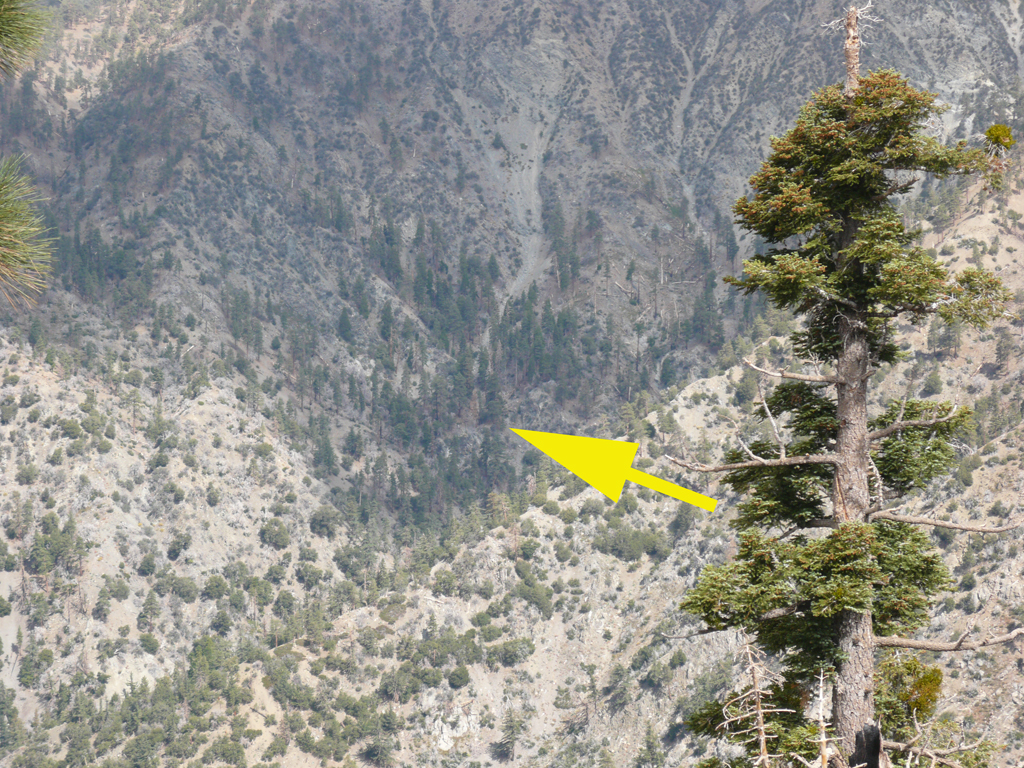
It can be seen, with difficulty from the pine mountain fire road, the one that goes up from the spring above Lupine Campground.
The 12 Megapixel original is here" http://www.electricskates.com/Pix/Other2/P1030040X1.jpg "
The 12 Megapixel original is here" http://www.electricskates.com/Pix/Other2/P1030040X1.jpg "

Thanks Elwood. I don't see the road from this photo, so I'm assuming it's far enough off the road to make it a good bushwack to get to.Elwood wrote:It can be seen, with difficulty from the pine mountain fire road, the one that goes up from the spring above Lupine Campground.
The 12 Megapixel original is here" http://www.electricskates.com/Pix/Other2/P1030040X1.jpg "
Might be fun to try though. 8)
is this the actual location, as in the photograph? looks close to the road
They don't look the same but it is difficult to tell from the photo. The location you gave is the exact location I was prepared to explore. I have the GPS coordinates so I'll give it a go. I am familiar with the road along Pine ridge where Elwood took the photo. I would be interested to know the exact location though.Zé wrote:is this the actual location, as in the photograph? looks close to the road
I'll be the first to admit some confusion as to the location of the mine. My picture is obviously up one of the drainages North of 3N34 in Prairie Fork. The USGS topographic maps show Native Son adjacent to the Prairie Fork Guard Station site. There is another unlabeled mine in grid square 23, well East of the Guard Station. I suspect that my picture and the mine itself are up the drainage, East of the unlabeled mine symbol. Caveat Explorator!
Really thats half the fun is putting boots on the ground to know for sure. 8)Elwood wrote:I'll be the first to admit some confusion as to the location of the mine. My picture is obviously up one of the drainages North of 3N34 in Prairie Fork. The USGS topographic maps show Native Son adjacent to the Prairie Fork Guard Station site. There is another unlabeled mine in grid square 23, well East of the Guard Station. I suspect that my picture and the mine itself are up the drainage, East of the unlabeled mine symbol. Caveat Explorator!
I visited the area specified by my GPS as the Native son mine yersterday.
It does appear to be a caved in mine. The area is close to 3N39. I was in a hurry and did not explore the area too well, but supposedly there are 6 tunnels among the complex.

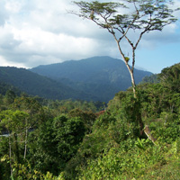
This is the view from 3N39.

Old rusty cans all over.


I think this is the area in Elwood's photo. I need to investigate this area further.
It does appear to be a caved in mine. The area is close to 3N39. I was in a hurry and did not explore the area too well, but supposedly there are 6 tunnels among the complex.

This is the view from 3N39.

Old rusty cans all over.


I think this is the area in Elwood's photo. I need to investigate this area further.
