
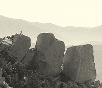
Burnt Peak

Thank you for the response!
Here's the link. It looks good but I hesitate because I don't see evidence that anyone goes there very often....
http://alltrails.com/trail/us/californi ... peak-trail
Here's the link. It looks good but I hesitate because I don't see evidence that anyone goes there very often....
http://alltrails.com/trail/us/californi ... peak-trail
acme map
sierra club description
from the satellite image, looks like the fireroad to the top is fine. but I don't know if that is the "Burnt Peak" trail...
sierra club description
from the satellite image, looks like the fireroad to the top is fine. but I don't know if that is the "Burnt Peak" trail...
burnt peak trail
ok so looks like that trail comes from the SW and wraps around the east side of burnt peak, looking at satellite I can see the trail in some spots, but hard to say that it is clear all the time. The fire break ridge route that veers off from the trail and heads north to the peak looks to have potential.
ok so looks like that trail comes from the SW and wraps around the east side of burnt peak, looking at satellite I can see the trail in some spots, but hard to say that it is clear all the time. The fire break ridge route that veers off from the trail and heads north to the peak looks to have potential.

Yep been there
It is a NHPS listed peak as is nearby Sawtooth Mountain
http://angeles.sierraclub.org/hps/guides/08b.htm
http://angeles.sierraclub.org/hps/guides/08c.htm
If you've been there you can pick it out from I-5
Cheers
Matt
It is a NHPS listed peak as is nearby Sawtooth Mountain
http://angeles.sierraclub.org/hps/guides/08b.htm
http://angeles.sierraclub.org/hps/guides/08c.htm
If you've been there you can pick it out from I-5
Cheers
Matt
Those trails are mostly unmaintained more of a line on a map than an actual trail.Zé wrote:ok so looks like that trail comes from the SW and wraps around the east side of burnt peak, looking at satellite I can see the trail in some spots, but hard to say that it is clear all the time. The fire break ridge route that veers off from the trail and heads north to the peak looks to have potential.
I know of one group who went from Atmore Meadows to Templin Hwy
The trail was overgrown down to Fish canyon where it disappeared there is no trail to speak of in the canyon. I suspect Burnt Peak "Trail" would be in a similar condition

That is a fun hike. I hiked that peak on July 2nd 2005.
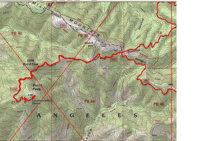
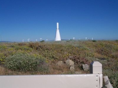
The red "Y" on the map is the parking spot. The trail is an access road to the peak top. I believe this is a VOR station for pilots, on the peak top.
The big advantage to this peak is the seldom visited nature. No big crowds to spoil your trip.
The Burnt Peak trail goes from Fish Canyon Trail to the Maxwell dirt road. A long time ago the trail went all the way to Burnt Peak. Now, when you reach Maxwell Road you follow the Burnt Peak road to the top. I have hiked the section from Fish canyon to Maxwell road a few times. Using GPS the trail follows the topo map trail exactly. The first 1-2 miles of trail from Maxwell Road is in fair condition. After that it becomes overgrown with a few wash out. Difficult at best. On Sunday, 11/25/12 I will be leading a small group from Atmore Mdw to Lions Camp using the Fish Cyn Trail. We should be passing the Burnt Peak trail parking area around 07:30. Hope to see you there.
Stop by the Burnt Peak trail head and saw two parked cars. No one around so drove to Atmore Meadow and hiked Fish Canyon Trail to Lions Camp. The hikers were good, weather was great and lots of color. Lions Camp had plenty of shade and places to enjoy your lunch. We checked out the Burnt Peak trail by Fish Canyon Trail. It needs work. Taking a average pace we start the hike at 08:30 AM and were back to the car by 3:30 pm.