Jepson Peak 4.27.11

Archived TRs for ranges in California.
User avatar
norma r
Posts: 707
Joined: Thu Nov 06, 2008 4:22 pm

Post by norma r »

Last winter as i summited San G from the north ridge i had eyed Jepson and was blown away by the beauty of the mountain and knew i would get there eventually to climb a chute. In January of this year as i viewed Jepson from Charlton Peak, i picked in my mind the north chute with the biggest cornice as the one i would like to do first.

Fast forward to April and with the snow now consolidated, Dave G and i headed up the South Fork trail last Wednesday for a chance to climb that chute. It was one of those days you hope for... perfect weather and great conditions. What we got was a great snow climb, a beautiful summit and a way fun glissade descent of Big Draw. Pretty much a perfect day in the mountains! :D

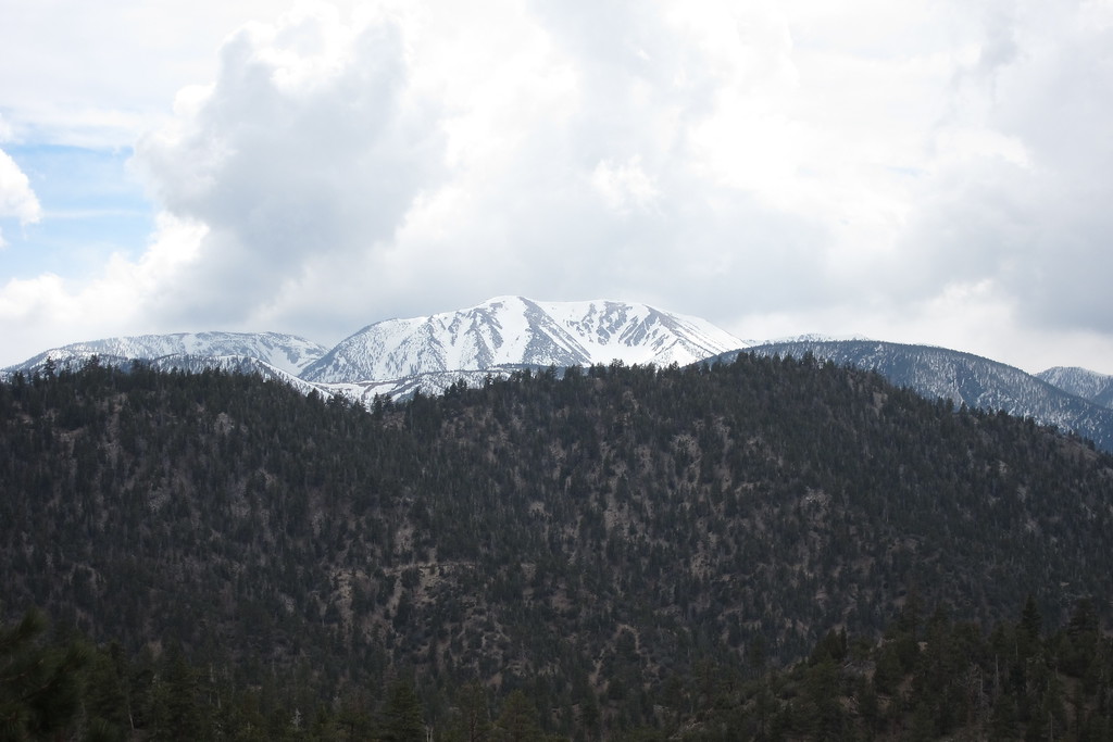
The January view that lured me
Image

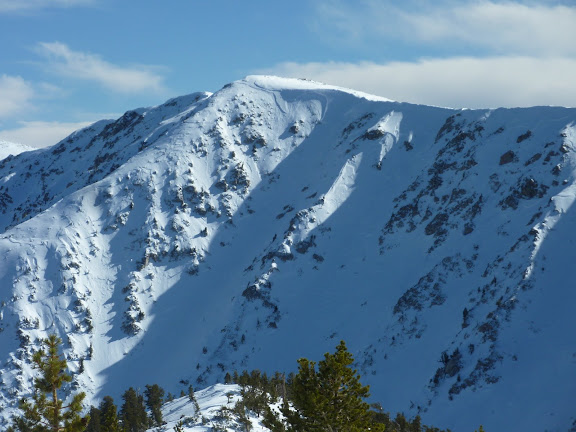
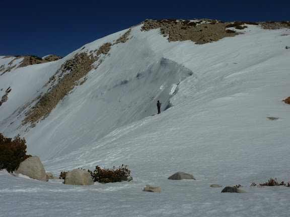
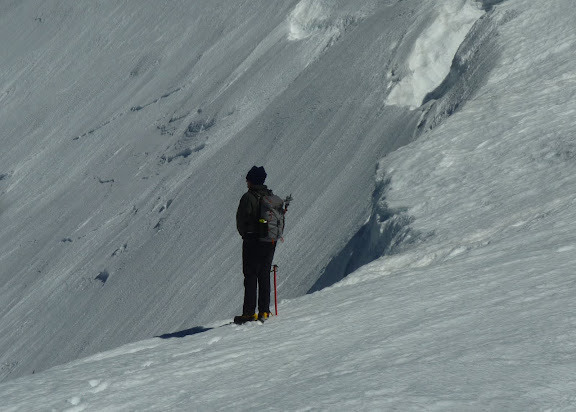
Dave heading toward the Jepson north couloir #1
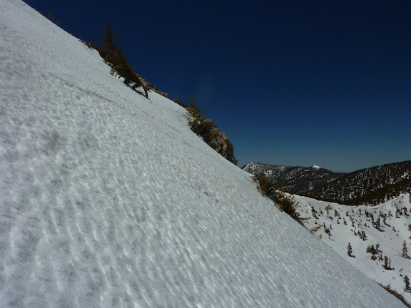
Image

Steep is good :D
Image

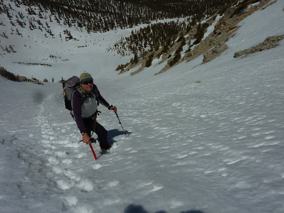
G-man is digging the climb
Image

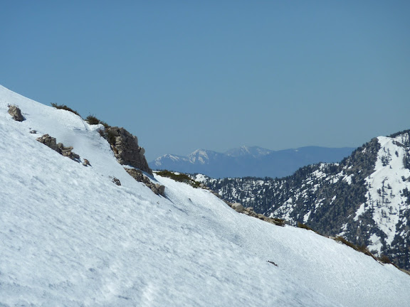
We nod Hello to Etiwanda, Cucamonga & Mt. San Antonio
Image

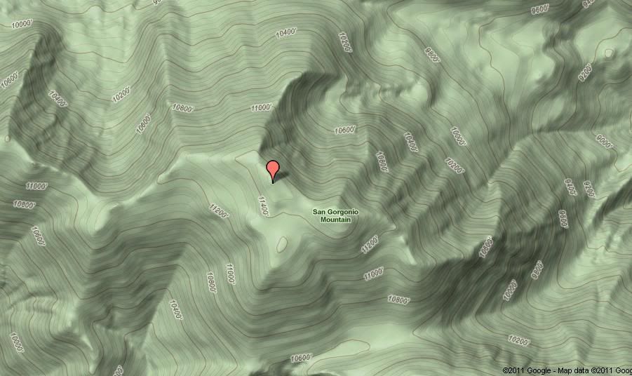
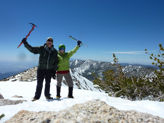
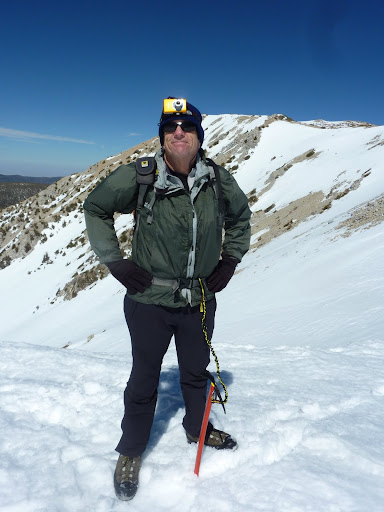
Summiteers at 11,205 feet
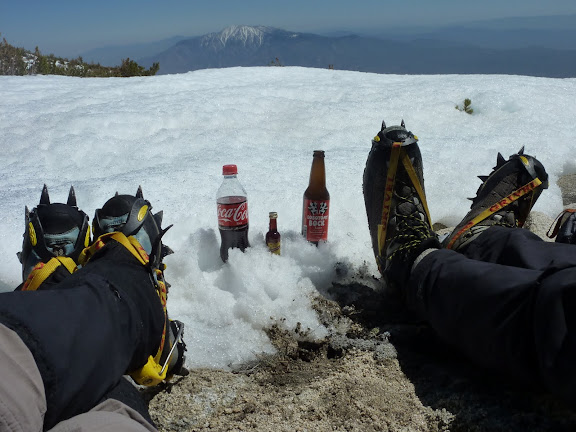
Image

Chillin'
Image

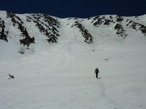
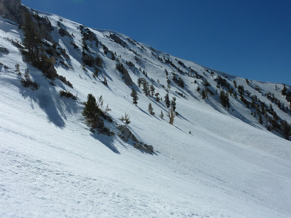
Dave checking out Big Draw.
Image

The illimitable inventor strapped a camera to his headlamp for a glissade video! :lol:
Image

Perfect snow conditions allowed us to begin our glissade right from the top of Big Draw
Image

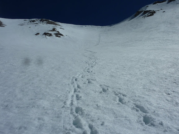
A look back at our glissade and boot track. Way FUN!
Image

Jepson's beautiful northeast face as we descend Big Draw
Image

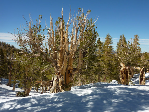
Lovely Limber Pines in the drainage below Jepson
Image

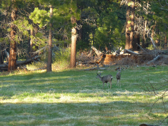
Deer at Horse Meadow
Image

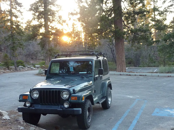
Our steed awaits in the setting sun at the quiet TH parking lot
Image

rest of my pix are here:
https://picasaweb.google.com/ryan.norma ... hFace42711#
User avatar
Burchey
Posts: 304
Joined: Tue Dec 28, 2010 11:28 am

Post by Burchey »

Looks like a blast, Norma! What time did you get started and when did you head back? I think I'll head up there this Sunday for a day attempt.
User avatar
Dave G
Posts: 321
Joined: Sun Jun 22, 2008 9:51 am

Post by Dave G »

norma r wrote: Pretty much a perfect day in the mountains! :D
Ditto on that, Ms Norma! :D

Got a few snapshots of me own: http://www.flickr.com/photos/21042415@N ... 633318840/
User avatar
norma r
Posts: 707
Joined: Thu Nov 06, 2008 4:22 pm

Post by norma r »

Burchey,
we began at 7am and finished at 7pm. no speed record as Dave and i always seem to enjoy the journey and take lots of pix. plus the summit and views were so nice that we took a 30+ min summit respite.
User avatar
tinaballina
Posts: 182
Joined: Thu Jun 18, 2009 11:28 am

Post by tinaballina »

Nice TR-great work Dave and Norma.
User avatar
lilbitmo
Posts: 1092
Joined: Tue Mar 04, 2008 9:44 pm

Post by lilbitmo »

Norma and Dave, great to see you two back out, very, very nice TR and great pictures - still some good "white" to be had.

Dave what did the "Incline-O-Meter" say the angle on that slope was near the top - looked to be very steep - niceeeeeeeee :D

And how soft was the snow on the way up?

Thanks for sharing. :D
User avatar
TracieB
Posts: 216
Joined: Mon Feb 22, 2010 8:57 am

Post by TracieB »

Nice. Great pix, glad you got that one out of your head at last 8)
User avatar
Sam Page
Posts: 267
Joined: Fri Sep 04, 2009 10:59 am

Post by Sam Page »

Nice. Miguel climbed the route a few days after you. That view from the summit of Charlton also lured me up the same couloir last spring.
User avatar
hvydrt
Posts: 494
Joined: Thu Sep 27, 2007 8:18 pm

Post by hvydrt »

Looks like a fun day! How did the helmet cam glissade video come out????
User avatar
So.BayMark
Posts: 58
Joined: Mon Dec 14, 2009 5:04 pm

Post by So.BayMark »

Nice norma and dave...like those pictures, fun time...

mark
User avatar
Dave G
Posts: 321
Joined: Sun Jun 22, 2008 9:51 am

Post by Dave G »

lilbitmo wrote: Dave what did the "Incline-O-Meter" say the angle on that slope was near the top - looked to be very steep - niceeeeeeeee :D

And how soft was the snow on the way up?

Thanks for sharing. :D
Hey Patrick, the highest angle I measured was 46 degrees. The snow condition was just about perfect. You could almost get away w/o crampons if you kicked hard.
hvydrt wrote: Looks like a fun day! How did the helmet cam glissade video come out????
Hi Mark, in the excitement of dropping in on Big Draw I neglected to turn on the "Ghetto Cam" :oops: . I did get one of Norma though while I was wearing it.
User avatar
hvydrt
Posts: 494
Joined: Thu Sep 27, 2007 8:18 pm

Post by hvydrt »

Dave G wrote:
hvydrt wrote: the "Ghetto Cam" :oops: . I did get one of Norma though while I was wearing it.
I like the name!
User avatar
KathyW
Posts: 212
Joined: Thu Sep 27, 2007 9:00 pm

Post by KathyW »

That looks like it was a lot of fun. Jepson looks like it's the best option for fun in the snow at this point. Maybe the "chute of death" over on the NE face of San G still has good snow too.
User avatar
Dave G
Posts: 321
Joined: Sun Jun 22, 2008 9:51 am

Post by Dave G »

KathyW wrote: Maybe the "chute of death" over on the NE face of San G still has good snow too.
A friend and I have been eyeballing that chute, Kathy. Ever done it?
User avatar
Burchey
Posts: 304
Joined: Tue Dec 28, 2010 11:28 am

Post by Burchey »

Dave G wrote:
KathyW wrote: Maybe the "chute of death" over on the NE face of San G still has good snow too.
A friend and I have been eyeballing that chute, Kathy. Ever done it?
I was planning to do a solo Jepson Dayhike Sunday....but if someone wants to join, I'd be down to check out this chute of death.
User avatar
KathyW
Posts: 212
Joined: Thu Sep 27, 2007 9:00 pm

Post by KathyW »

Dave G wrote:
KathyW wrote: Maybe the "chute of death" over on the NE face of San G still has good snow too.
A friend and I have been eyeballing that chute, Kathy. Ever done it?
I have gone down that way a number of times, but without snow. Anymore, that's my usual way down when I do San G via the South Fork Trail in the summer/fall. It's a 10 or 15 minute scree ski and you skip 3 miles of boring switchbacks. We were going to do it as a snow climb once in March a couple of years ago, but ended up doing the same old route up the chutes on the north side. Sometime I'll do it when there's snow. The area I'm really interested in checking out when there's good snow conditions is Glacier Valley. In December I climbed up the ridge from Poopout hill to Point 10,230 and then traversed to one of the chutes over there dropped down, but there wasn't enough snow yet; so it wasn't fun like it would be with good snow.

If you're ever over at the Mill Creek Ranger Station when their open, you can pick up one of the Defenders of the Wilderness Maps - it has the names of the areas like Glacier Valley, Christmas Tree Hill....etc. on it.
User avatar
Dave G
Posts: 321
Joined: Sun Jun 22, 2008 9:51 am

Post by Dave G »

Burchey wrote:
Dave G wrote:
KathyW wrote: Maybe the "chute of death" over on the NE face of San G still has good snow too.
A friend and I have been eyeballing that chute, Kathy. Ever done it?
I was planning to do a solo Jepson Dayhike Sunday....but if someone wants to join, I'd be down to check out this chute of death.
Hey Burch, I'd join you on Sunday if it wasn't for that Mother's Day thang.
I'd have my own personal "death chute" waiting for me at home if I went climbing. :wink:
User avatar
Taco
Posts: 5991
Joined: Thu Sep 27, 2007 4:35 pm

Post by Taco »

Wait, chute of death? In the NE Bowl?
User avatar
Burchey
Posts: 304
Joined: Tue Dec 28, 2010 11:28 am

Post by Burchey »

Dave - understood, trust me. You're cracking me up man.

Question for those more familiar with this area. Can you point this death chute out on this lil ole map?

Image
User avatar
Dave G
Posts: 321
Joined: Sun Jun 22, 2008 9:51 am

Post by Dave G »

DCIQ:

Image
User avatar
Burchey
Posts: 304
Joined: Tue Dec 28, 2010 11:28 am

Post by Burchey »

Dave G wrote: DCIQ:

Image
Awesome, thanks Dave. That's what I guessed. What are we looking at mileage-wise on this baby - 19ish round trip from South Fork? Yeah!
User avatar
Dave G
Posts: 321
Joined: Sun Jun 22, 2008 9:51 am

Post by Dave G »

Burchey wrote: Awesome, thanks Dave. That's what I guessed. What are we looking at mileage-wise on this baby - 19ish round trip from South Fork? Yeah!
That might be a bit high, but it would be a full day.
Be sure and post up on what you find.
User avatar
hvydrt
Posts: 494
Joined: Thu Sep 27, 2007 8:18 pm

Post by hvydrt »

We glissaded down part of it late June last year. It is steep near the top but looks like fun to climb up.

https://picasaweb.google.com/mrkmcormic ... FootRidge#
User avatar
Burchey
Posts: 304
Joined: Tue Dec 28, 2010 11:28 am

Post by Burchey »

Will do Dave, I need to remember those mileage estimates for the trails include a lot of useless switchbacks in spots. I'm going straight up.
User avatar
KathyW
Posts: 212
Joined: Thu Sep 27, 2007 9:00 pm

Post by KathyW »

This map shows what I always think of "The Chute of Death", but there are lots of chutes you can take to get up San G. A friend called it the Chute of Death after going up it in the summer - it's hell to go up in the summer, but heaven to come down if you like scree skiing.

http://kathywing.smugmug.com/California ... ifLMQ-O-LB
User avatar
Taco
Posts: 5991
Joined: Thu Sep 27, 2007 4:35 pm

Post by Taco »

Thanks Kathy!
User avatar
Burchey
Posts: 304
Joined: Tue Dec 28, 2010 11:28 am

Post by Burchey »

Hmmm, Kathy's chute looks a little more deadly. I wonder which is the true DEATH CHUTE?!?!?!!
User avatar
KathyW
Posts: 212
Joined: Thu Sep 27, 2007 9:00 pm

Post by KathyW »

I think any of the chutes work. Here's a view from the Onyx summit area yesterday afternoon:

Image

Not the same view, but I took some other pictures of the SGW from Butler Peak:

http://kathywing.smugmug.com/Trail-Runn ... 08_N4XFhGR

The snow looks like it might still be good in some of those chutes. I thought about heading up there today when I was on Butler yesterday, but my body is telling me it needs an easy weekend; so I'm going to go look for some flowers instead and wait until next weekend to go play in the snow somewhere.
User avatar
Hikin_Jim
Posts: 4686
Joined: Thu Sep 27, 2007 9:04 pm

Post by Hikin_Jim »

Dave G wrote: "Ghetto Cam"
:lol: :lol:

HJ
User avatar
Norris
Posts: 3
Joined: Sat Mar 14, 2009 3:35 pm

Post by Norris »

This screen grab shows the route we did on Sunday. It was 14.7 miles according to Garmin. Of course, Garmin also said the summit was in the wrong place :D
http://www.facebook.com/photo.php?fbid= ... f4&theater
Post Reply