Strawberry Peak Routes
-
BrownMtnBob

- Posts: 96
- Joined: Mon Oct 15, 2012 1:55 pm
Last I heard strawberry is still closed, but what about Lawlor? Thought I heard of some trail work being done on strawberry. Any news?
I believe the area is still technically closed. However, we were up there in October and climbed Josephine, Strawberry, and Lawlor. Started up the Josephine Peak road/trail, then followed the ridge east to Strawberry and Lawlor, then down trail 12W05.2 (as shown on the topo map) to Red Box. The ridge is brushy in some places and somewhat overgrown with poodledog, but not too bad. No one in our group had any ill effects after carefully moving through it in a few spots.
Trail 12W05.2 going down from the ridge to Red Box was in great condition and was being worked on by a large Sierra Club party on the day we were there.
Trail 12W05.2 going down from the ridge to Red Box was in great condition and was being worked on by a large Sierra Club party on the day we were there.
Any poodledog bush is too much poodledog bush for me. It does seem to be less dominant in the burn area than it was a year and a half ago, when the hillsides along the road were covered with it.
For anyone who doesn't know how to identify it, save yourself some misery and read up on it: http://en.wikipedia.org/wiki/Turricula_%28plant%29


The trail up Colby Canyon is in good shape, but watch out for Poodle Dog Bush above Josephine Saddle if you are going to do the 3rd class rock route. There really is no reason for it to have been officially closed last year.
You might have to wade through the Poodle Dog. If so you are going to want long pants, long sleeve shirt and gloves. Somehow I was not quite that smart.

Are you talking about the trail from the former Colby Canyon trailhead ?JerryN wrote: ↑The trail up Colby Canyon is in good shape, but watch out for Poodle Dog Bush above Josephine Saddle if you are going to do the 3rd class rock route. There really is no reason for it to have been officially closed last year.
You might have to wade through the Poodle Dog. If so you are going to want long pants, long sleeve shirt and gloves. Somehow I was not quite that smart.
Yes former and current Colby Canyon Trailhead. The trail is closed of course, so who would ever think to walk around the sign and ignore it? Those miscreants would probably park up the hill at Redbox and walk down to the trailhead.Augie wrote: ↑Are you talking about the trail from the former Colby Canyon trailhead ?JerryN wrote: ↑The trail up Colby Canyon is in good shape, but watch out for Poodle Dog Bush above Josephine Saddle if you are going to do the 3rd class rock route. There really is no reason for it to have been officially closed last year.
You might have to wade through the Poodle Dog. If so you are going to want long pants, long sleeve shirt and gloves. Somehow I was not quite that smart.
Yes, I wouldn't expect to find such miscreants on this site.JerryN wrote: ↑Yes former and current Colby Canyon Trailhead. The trail is closed of course, so who would ever think to walk around the sign and ignore it? Those miscreants would probably park up the hill at Redbox and walk down to the trailhead.Augie wrote: ↑Are you talking about the trail from the former Colby Canyon trailhead ?JerryN wrote: ↑ The trail up Colby Canyon is in good shape, but watch out for Poodle Dog Bush above Josephine Saddle if you are going to do the 3rd class rock route. There really is no reason for it to have been officially closed last year.
You might have to wade through the Poodle Dog. If so you are going to want long pants, long sleeve shirt and gloves. Somehow I was not quite that smart.

-
Uncle Rico

- Posts: 1386
- Joined: Thu Mar 20, 2008 7:48 pm
Sean has already done some recon on this for us. Strawberry is only closed to public use, not private use. 
https://eispiraten.com/viewtopic.php?t=5409
https://eispiraten.com/viewtopic.php?t=5409


http://www.corbamtb.com/news/2014/04/02 ... on-update/
The north side is expected to remain closed ...also with a temporay closure of a Lawlor section of the trail. I think it was those same forums that had something about a toad being found by FS biologists in the Big Tujunga Creek@Colby, so it remains to be seen how that will affect the Upper Big Tujunga.
The north side is expected to remain closed ...also with a temporay closure of a Lawlor section of the trail. I think it was those same forums that had something about a toad being found by FS biologists in the Big Tujunga Creek@Colby, so it remains to be seen how that will affect the Upper Big Tujunga.
-
BrownMtnBob
- Posts: 96
- Joined: Mon Oct 15, 2012 1:55 pm
Curious about just how tough the two steep class-3 climbs are on the W side of Strawberry. Some people claim it's very dangerous and scary (turn around territory)...while others say "not a big deal". I have no rock climbing experience, and really don't like it much to be honest. Climbing 100' straight up on decomposing granite with no ropes just doesn't fun.
Any thoughts? I'm young, strong and all that jazz; so just physically, it's no issue. Is it like straight up or just steep or....???
Any thoughts? I'm young, strong and all that jazz; so just physically, it's no issue. Is it like straight up or just steep or....???
The final climb is like vertical boulder hopping. Nothing loose, just a pile of rocks you have to climb (3rd class at worst in my opinion). Hard part was finding the route that avoids difficult 3rd class moves and exposure to some pretty dramatic drops. When I went (before station fire) there were colored dots painted on rocks that supposedly marked the easiest route, but we found it easier to follow footprints instead. The station fire probably eliminated, or possibly even exposed, the dots, dunno.
I didn't downclimb the route so can't offer opinion on that part. I don't climb anything that I don't know an easy way off of - knowing that I could walk down the east route gave me courage to climb it, knowing that if I chickened out on the downclimb I could always take the easy route down.
I didn't downclimb the route so can't offer opinion on that part. I don't climb anything that I don't know an easy way off of - knowing that I could walk down the east route gave me courage to climb it, knowing that if I chickened out on the downclimb I could always take the easy route down.
I've chickened out twice on the first (shorter, easier) class-3 part...have done Strawberry twice from the easier east side, including climbing neighboring Lawlor via the south "firebreak" along the way, in 2005...the first time I was a San Gabriels "newbie," but the second, I had done things like Rattlesnake and Big Iron, and still chickened out on that first steep pitch...
For perspective, I have done Sugarloaf up and down Falling Rock Canyon (did not like it, but made it), also in 2005...did Hoyt Mountain up and down the east side last year at age 67, and found coming down very scary...
I suspect most active members of this list would love it (and have done it), but just providing some perspective from someone who's not a "pro"...bottom line: I don't recommend it if you're uncomfortable on steep rocks with exposure...but I'm notoriously chicken on such terrain...
Also, no idea what it's like since the Station Fire (believe that area is still officially closed)...others no doubt can tell you...
Just some perspective from an
oldcoot
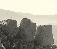
Here's a picture of the start of the second pitch, from Bob Burd:
http://www.snwburd.com/bob/trip_photos/ ... 076_w.html
oldcoot
http://www.snwburd.com/bob/trip_photos/ ... 076_w.html
oldcoot
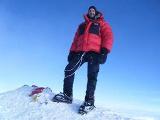
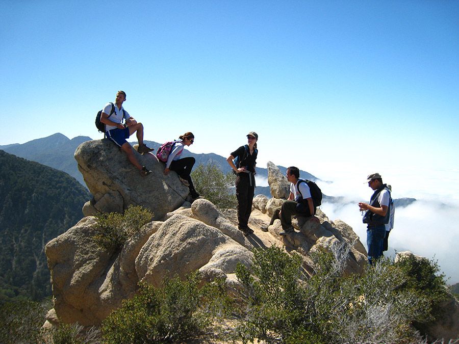
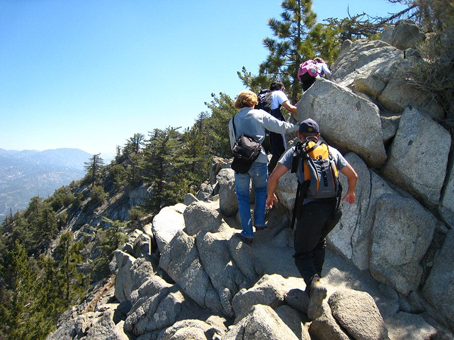
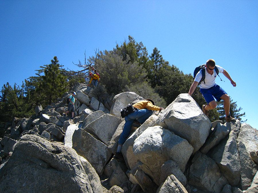
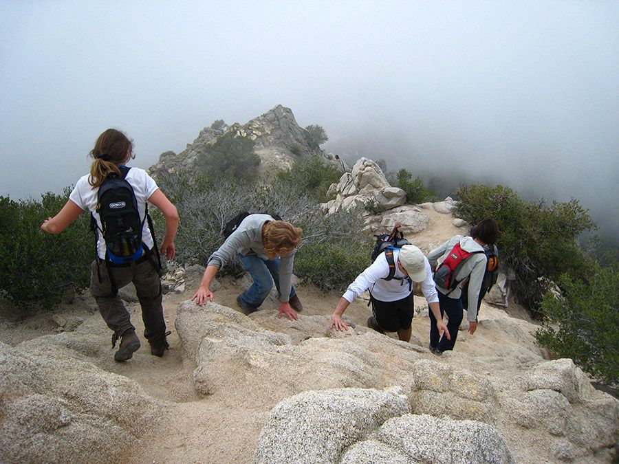
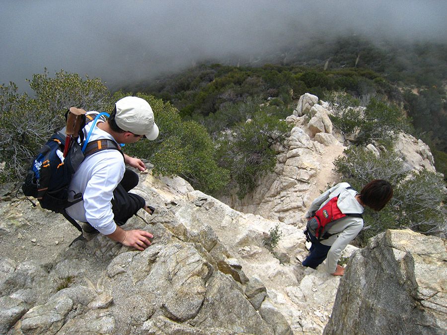
Here are some photos from 2008. If I remember right, the rock climbing isn't that bad because there are a lot of foot and hand holds and the ledges are pretty wide. However, Hikeup is correct, there is some exposure in spots that might mess with your head. Only a few stretches of climbing are close to vertical, but this only lasts for 10-12 feet and you can usually find a bypass if you prefer. The rest is mostly boulder hopping. Going back down can be more difficult--just have to be extra careful. There is a spot on the 1st pitch that has some gravel that should be taken with extra care (see second to last picture).
1st pictch:
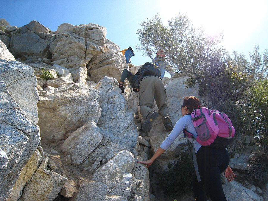
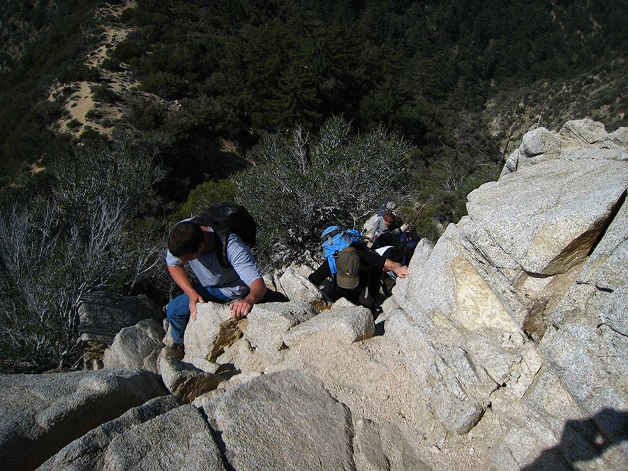
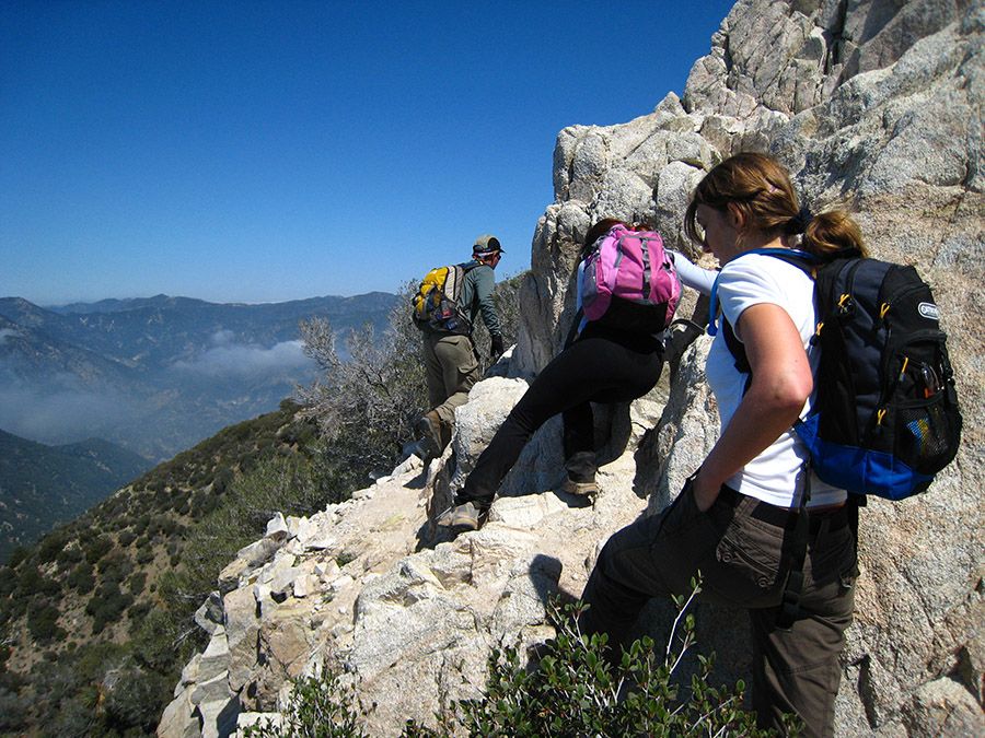
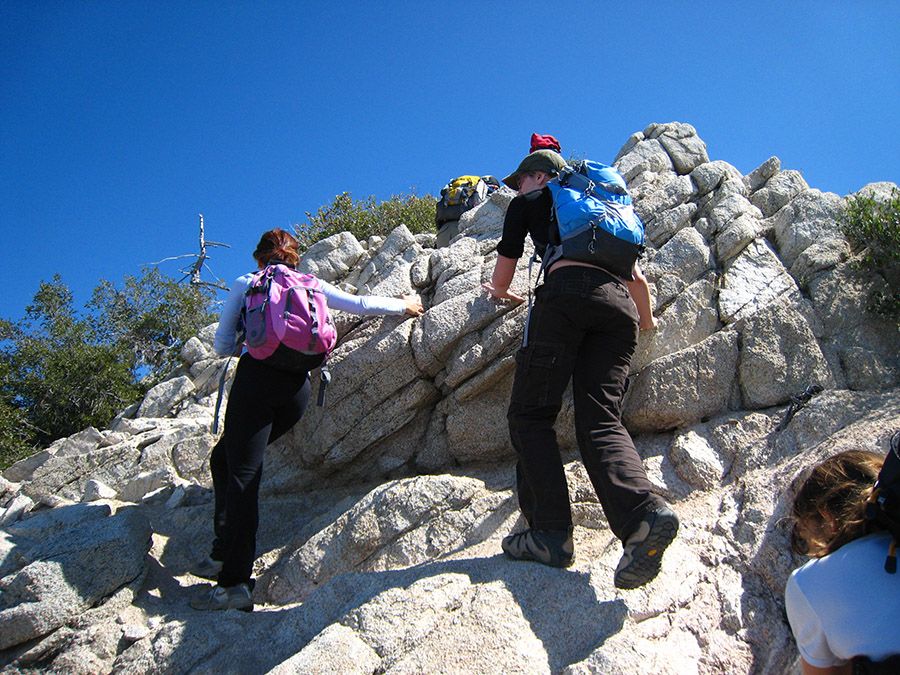
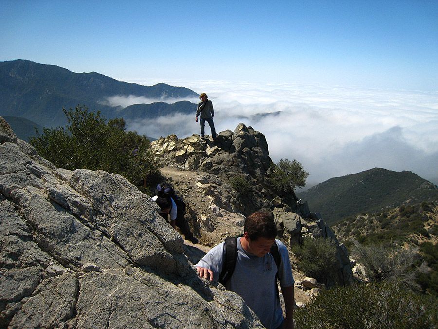
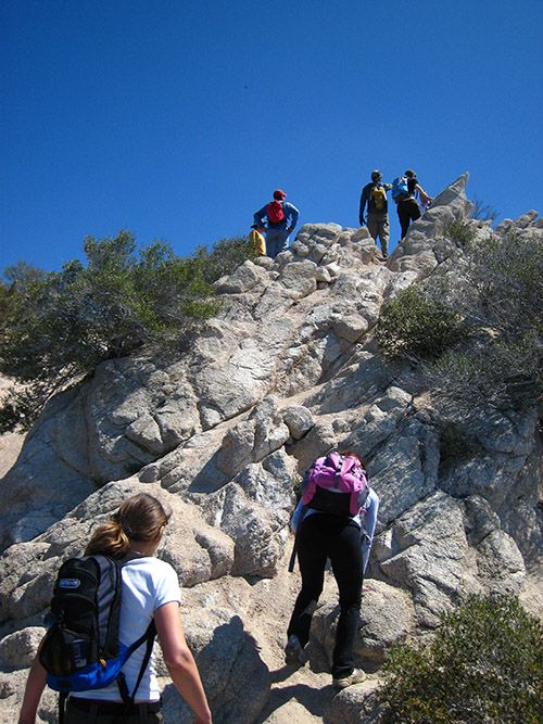
2nd pitch:
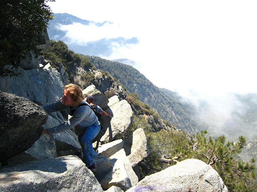
Going back down 2nd pitch:
Going back down 1st pitch:
1st pictch:
2nd pitch:
Going back down 2nd pitch:
Going back down 1st pitch:


As others have stated, the climbing is not that hard, but it's exposed. I did it once before the fire in the middle of the night. Didn't know what we were getting into, and on the way up, it didn't seem dangerous or foolhardy at all. The sun came up while we were on the peak, and the downclimb was WAY more intense. We could not believe that we went up that with just headlamps. So yeah. Go at night and it's not scary 
Has anybody gone up that west ridge since the fire? How is it?
Has anybody gone up that west ridge since the fire? How is it?
Everyone has a different style and preference, but I would usually down-climb that mostly facing out. You get better visibility on holds when facing out, so you can move faster (if you're confidence and comfortable in the terrain). I will switch to sideways or facing in if a particular spot is high angle or too risky and needs extra care.
Some additional advice from Freedom of the Hills:
Holds are harder to see when down-climbing than when climbing upward. The steeper the face, the harder the holds are to see. It is difficult to test holds without committing to them.
On low-angle rock, face outward for the best ability to see the route when down-climbing. Keep hands low and use down-pressure holds whenever possible. Keep your weight over your feet to maximize friction, especially when going down slabs. It may help to keep your center of gravity low, with knees well bent. As the rock steepens, turn sideways, leaning away from the rock for better ability to see the route. If the angle gets even steeper, face into the rock.
Post Station Fire it will be different. There was lots of reassuring hand holds. What is there now is anybody's guess.
The worst spot IMO the route appears to go one way to the left but actually goes to the right. If you are at a spot that is very exposed you may want to backup and look for a less apparent route
Once upon at there were painted route blazes
The worst spot IMO the route appears to go one way to the left but actually goes to the right. If you are at a spot that is very exposed you may want to backup and look for a less apparent route
Once upon at there were painted route blazes