

I went up Angeles Crest Highway this past Friday and was surprised to find it closed At Islip Saddle. I was headed to Little Jimmy anyway, so no loss, but I was surprised to find it closed this time of year.
Was there a wash out or slide during the weekend prior's rainstorms?
HJ
Angeles Crest Highway (CA-2)
From the Cal Trans website:
SR 2
[IN THE SOUTHERN CALIFORNIA AREA]
IS CLOSED FROM ISLIP SADDLE TO 5 MI WEST OF BIG PINES HWY (LOS ANGELES CO)
- DUE TO MUD SLIDES - MOTORISTS ARE ADVISED TO USE AN ALTERNATE ROUTE
Dunno when the slides occurred...
oldcoot
SR 2
[IN THE SOUTHERN CALIFORNIA AREA]
IS CLOSED FROM ISLIP SADDLE TO 5 MI WEST OF BIG PINES HWY (LOS ANGELES CO)
- DUE TO MUD SLIDES - MOTORISTS ARE ADVISED TO USE AN ALTERNATE ROUTE
Dunno when the slides occurred...
oldcoot

-
Uncle Rico

- Posts: 1386
- Joined: Thu Mar 20, 2008 7:48 pm
Cal-Trans does not report Highway 2 closed and the Big Pines Ranger Station FB page has a post that mentions the fact Highway 2 is open.
http://www.dot.ca.gov/hq/roadinfo/display.php?page=sr2
https://www.facebook.com/Big-Pines-Rang ... 338620103/
I know for a fact the ACH is open coming the other direction from Islip Saddle to Dawson Saddle.
http://www.dot.ca.gov/hq/roadinfo/display.php?page=sr2
https://www.facebook.com/Big-Pines-Rang ... 338620103/
I know for a fact the ACH is open coming the other direction from Islip Saddle to Dawson Saddle.
I was up at BP last weekend, started at Dawson saddle and saw plenty of cars coming from the direction of Wrightwood so it's safe to say that the road is open all the way through. We came up from La Canada and the ACH was open past Islip with no signs of closure any further on.

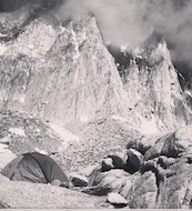
The gate at the 39 junction was open last week. I'm assuming you're parking in that spot anyway and taking the PCT to Little Jimmy. The parking area was open with restrooms and plenty of parking on a Sunday Afternoon. The campground was 3/4 full- surprising to me on a Sunday Night this early in the season.
Not sure if this weekend's snow brought anything. There were still some patches of snow last weekend, but nothing too difficult to safely navigate through to Little Jimmy.
I did run into a couple who tried the approach from Baden Powell and said they had to turn back because of treacherous snow in a select places on the trail.

I imagine they'll have the snow off the road by Friday. But you will probably see lingering snow at Little Jimmy. The Crest above Crystal Lake got a good covering. I can see it from Monterey Park.

-
Slowest_Hiker
- Posts: 245
- Joined: Sun Jul 31, 2011 12:31 pm
Heads up, 2 closed for a sinkhole
That says it's closed from Islip Saddle to Grassy Hollow, but the DOT website site sounds like it's Inspiration Point rather than Grassy Hollow, so details are slightly sketchy.
That says it's closed from Islip Saddle to Grassy Hollow, but the DOT website site sounds like it's Inspiration Point rather than Grassy Hollow, so details are slightly sketchy.
-
Slowest_Hiker
- Posts: 245
- Joined: Sun Jul 31, 2011 12:31 pm
Ugh, sounds like at least a month !
Aren't there a lot more gates now? Seems like a smaller closure area could be set up.
Aren't there a lot more gates now? Seems like a smaller closure area could be set up.
Maybe they need engineers to inspect that whole stretch of road now. I'd hate to be driving on it when another sinkhole appears. Isn't there a gate at Vincent Gap?Slowest_Hiker wrote: ↑Aren't there a lot more gates now? Seems like a smaller closure area could be set up.
-
Tom Kenney

- Posts: 351
- Joined: Sat Sep 29, 2007 7:51 pm
The gate is right next to the Vincent Gap parking lot, so folks coming from the west cannot access the Big Rock Creek road or Vincent Gap parking if it's closed. If they didn't close the Islip gate, I could see a lot of pissed off people jamming the road like penned sheep! I wonder if they've also closed the Big Rock Creek road at Fenner and the Fenner Saddle road at Jackson Lake.Sean wrote: ↑Maybe they need engineers to inspect that whole stretch of road now. I'd hate to be driving on it when another sinkhole appears. Isn't there a gate at Vincent Gap?Slowest_Hiker wrote: ↑Aren't there a lot more gates now? Seems like a smaller closure area could be set up.
-
Slowest_Hiker
- Posts: 245
- Joined: Sun Jul 31, 2011 12:31 pm
Yep!

I had seen that earlier and didn't know about the 2 closure yet.

I had seen that earlier and didn't know about the 2 closure yet.


-
Slowest_Hiker
- Posts: 245
- Joined: Sun Jul 31, 2011 12:31 pm
Has anyone visually confirmed either endpoint of the closure in the past week or so?
On Sat 6/24 we drove out from Inspiration Pt to see it for ourselves and indeed, the road was coned off immediately past the driveway into Grassy Hollow. There were also a lot of cars parked on the sides of the highway right around there, as if to confirm that was as far as one could drive. Then I got home and saw this:
NEW: Eastern closure point moved west to winter gate at Vincent Gap
which I don't understand because that's dated 6/23 and I saw the closure at Grassy Hollow on 6/24.
DOT website, which is not always up to date in my experience, appears to agree with their twitter statement at the moment. "SR 2 [IN THE SOUTHERN CALIFORNIA AREA] IS CLOSED FROM THE JCT OF SR 39 TO 5.3 MI WEST OF BIG PINES /AT VINCENT GULCH RD/ (LOS ANGELES CO)."
The Wrightwood forum also says
So everything seems to point to the closure being from Islip Saddle to Vincent Gap since 6/23, except for my eyeballs that saw a closure at Grassy Hollow on 6/24. Also, upthread on the Wrightwood forum somebody says the "sinkhole" is "Just West of Grassy Hollow (walking distance)." That is an odd description if the problem is actually between Islip Saddle and Vincent Gap.
Any eyewitness accounts appreciated.
On Sat 6/24 we drove out from Inspiration Pt to see it for ourselves and indeed, the road was coned off immediately past the driveway into Grassy Hollow. There were also a lot of cars parked on the sides of the highway right around there, as if to confirm that was as far as one could drive. Then I got home and saw this:
NEW: Eastern closure point moved west to winter gate at Vincent Gap
which I don't understand because that's dated 6/23 and I saw the closure at Grassy Hollow on 6/24.
DOT website, which is not always up to date in my experience, appears to agree with their twitter statement at the moment. "SR 2 [IN THE SOUTHERN CALIFORNIA AREA] IS CLOSED FROM THE JCT OF SR 39 TO 5.3 MI WEST OF BIG PINES /AT VINCENT GULCH RD/ (LOS ANGELES CO)."
The Wrightwood forum also says
Vincent Gap parking lot is right around mile 75, confirmed with Google street view.Jun 23, 2017 2:37pm
From Caltrans
Media Relations and Public Affairs
I just heard that the eastern closure limit has been moved west to Vincent Gulch postmile 74.7
Logged
So everything seems to point to the closure being from Islip Saddle to Vincent Gap since 6/23, except for my eyeballs that saw a closure at Grassy Hollow on 6/24. Also, upthread on the Wrightwood forum somebody says the "sinkhole" is "Just West of Grassy Hollow (walking distance)." That is an odd description if the problem is actually between Islip Saddle and Vincent Gap.
Any eyewitness accounts appreciated.
-
Tom Kenney
- Posts: 351
- Joined: Sat Sep 29, 2007 7:51 pm
RE: Closure location, my guess-timate is just past Grassy Hollow. On the 4th, we came up to Big Pines, then west on CA-2, seeing a sign saying "closed 2.5 mi ahead". It was certainly open past Inspiration Pt/Blue Ridge Rd entrance, but we didn't go further west, so not 100% sure.
-
Slowest_Hiker
- Posts: 245
- Joined: Sun Jul 31, 2011 12:31 pm
Thanks for that. I wonder is it possible they meant the west end was moved east to Vincent Gap?? There are multiple sources that say the other way around though.
Just noticed this: Aug 5th Moon Light Hike to Baden Powell has been cancelled due to Highway 2 road closure. That sounds like Vincent Gap isn't reachable by car. It's all so confusing.
I should have thought to try to call Big Pines earlier in the day, since it's staffed again. Will try in the morning.
-
Slowest_Hiker
- Posts: 245
- Joined: Sun Jul 31, 2011 12:31 pm
Never did call because we decided to go out of Islip Saddle regardless. But I can now confirm that the western end of the closure is indeed immediately past the Islip Saddle parking area. Can't edit my conjecture about that above due to the forum oddities, but I'll try again later.
-
Tom Kenney
- Posts: 351
- Joined: Sat Sep 29, 2007 7:51 pm
Eastern closure is immediately past (west of) the Grassy Hollow entrance. I saw folks walking the highway yesterday, so apparently just a vehicle closure. Fenner Saddle Rd is closed at Jackson Lake, and I'm guessing (as someone indicated in a previous thread) the Big Rock Creek Rd. is also still closed at Camp Fenner.
-
Slowest_Hiker
- Posts: 245
- Joined: Sun Jul 31, 2011 12:31 pm
Quick message.
1. I laid eyes on Grassy Hollow today. The eastern closure is definitely at Grassy Hollow. That's unlikely to change, because...
2. I laid eyes on the hole in the road. It's west of Grassy Hollow about 1/2 mile. No equipment there, nothing going on. They filled it in with gravel/dirt and placed some cones. The gate at Grassy Hollow is not signed to prohibit pedestrians or bikes. Saw several others going down there.
3. I laid eyes on Vincent Gap. The gate immediately west of the parking lot is in fact closed. However, I strongly suspect the gate at Islip Saddle is not open. There were no cars parked on the 2 at the Vincent Gap area, no motorcycles, no nothing visible west of the gate. The gate on the 2 is signed pedestrians and bicycles prohibited (sign facing so you read it when looking west).
4. The gates on 4N11 and 3N26 at Vincent Gap are closed. There was a car parked just north of the gate on 4N11 (the one that comes from Big Rock). This may be the way to access Vincent Gap by car if you need to.
5. Staggering amount of erroneous information out there. We were told by a USFS volunteer today that the western closure had moved from Islip Saddle to Vincent Gap. I know he was just repeating what he's been told by Caltrans, but ... :q52:
It's true, the gate at Islip Saddle is still closed. I saw it with my own eyes today while attempting to reach Vincent Gap. Sorry guys, I guess you can't believe everything you read on the internet (except for this forum, of courseSlowest_Hiker wrote: ↑Quick message.
1. I laid eyes on Grassy Hollow today. The eastern closure is definitely at Grassy Hollow. That's unlikely to change, because...
2. I laid eyes on the hole in the road. It's west of Grassy Hollow about 1/2 mile. No equipment there, nothing going on. They filled it in with gravel/dirt and placed some cones. The gate at Grassy Hollow is not signed to prohibit pedestrians or bikes. Saw several others going down there.
3. I laid eyes on Vincent Gap. The gate immediately west of the parking lot is in fact closed. However, I strongly suspect the gate at Islip Saddle is not open. There were no cars parked on the 2 at the Vincent Gap area, no motorcycles, no nothing visible west of the gate. The gate on the 2 is signed pedestrians and bicycles prohibited (sign facing so you read it when looking west).
4. The gates on 4N11 and 3N26 at Vincent Gap are closed. There was a car parked just north of the gate on 4N11 (the one that comes from Big Rock). This may be the way to access Vincent Gap by car if you need to.
5. Staggering amount of erroneous information out there. We were told by a USFS volunteer today that the western closure had moved from Islip Saddle to Vincent Gap. I know he was just repeating what he's been told by Caltrans, but ... :q52:
There were "at least five injury motorcycle crashes reported along Angeles Crest Highway on Saturday."
I drove by two of them, including this one: http://www.pasadenastarnews.com/g...-na ... ycle-crash
It seems like motorcyclists own the 2 these days. Something must be done to improve safety.
I drove by two of them, including this one: http://www.pasadenastarnews.com/g...-na ... ycle-crash
It seems like motorcyclists own the 2 these days. Something must be done to improve safety.