(Edit - pictures should have been restored, I only had to slap him twice
James Ledbetter had wanted to do a backpacking trip for some time that involved going from Onion Valley to Whitney Portal, so he convinced me to join him and after getting some great assistance from Deb Castro on a car shuttle we were off. After seeing Jeff H’s pictures and trip report I knew that we were going to have fun – see his TR here
Wednesday Aug 14th at 5:15 PM she dropped us off at the Onion Valley Trail head by 5:30 PM we were headed up the trail, she was super gracious by meeting us at the Whitney Portal an hour earlier to leave the other car for our exit.
Right at sunset we reached the Kearsarge Pass at 11,760 Feet and kept moving to our first campsite of the trip about ½ mile past Bullfrog Lake (As Bullfrog is closed to camping). We made camp right around 9 PM and were soon asleep.
The next morning we dropped down into Vidette Meadows and the Bubbs Creek Drainage heading south on the JMT, the meadows and views were outstanding. We ran into JMT’ers all over the place, some going south, some going north, some that came in from Cedar Springs on the Kings Canyon side, all having a blast. By 11:15 AM we had traveled 7.6 miles from our first camp and came to the last of the trees before Forester Pass, we decided to make camp here because we wanted to climb Mount Stanford from the North side today and then go after Junction Peak the next day from the south side of the pass. After a quick set up and some grub we headed up the headwall to the northeast slightly then traversed over the “endless moraine fields” that make up the approach to main chute that leads to the summit ridge and thus up to the summit of Mount Stanford (you can also reach Gregory’s Monument from here but we did not have time to do both and make it back before dark). Three hours into the climb we found ourselves sitting on the summit, we had allotted 4 hours up so we spent from 3:30 until 4 just taking in the views. By 6:30 we returned to our campsite in the trees only to find 15 or so other JMT’ers all camped around us, glad we grab some good spots. If you plan to do Stanford be prepared for a mindless number of up’s and down’s in the moraine fields, it reminds me of Mount Lyell in Yosemite, they go on forever and it’s like a “Yo-Yo”, up down, up down, up down, you get the idea.
Knowing that Forester Pass was going to be hot with no tree cover we headed out early and made the pass by 8 in the morning the next day, once there we realized that making the approach on Junction Peak would be easier if we headed down the other side of the pass instead of (as some write-ups indicate) going over the top of the 500 foot sub peak that was just east of us at the pass blocking our way to the main approach to Junction. Once we were far enough down the south side of Forester Pass we found a spot to hide our big packs and take a “day pack” from there we made a line up to the saddle between Junction and the sub peak, from there we crossed over to the first “arête” that we needed to get past in order to make our way up and climbers right, there are at least 5 different chutes that all have some form of arête’s that block your way, but you keep moving up and right as you go over each of these until you get to the main chute, once there you see your final 300 foot approach to the class 4 move at the top, this chute has a “cliffed out section” near the halfway point otherwise you could take it all the way up or down but it’s very sketchy and I wouldn’t recommend it.
After returning to the saddle we were able to race down the sandy scree field that makes up the wide open chute between the sub peak and the main mountain that is Junction Peak, this took all of three minutes. Back at our packs we rambled all the way down to the first water source and filled up before heading south again.
It was only noon but we were starting to feel the effects of having climbed two 13,800+ peaks but we kept pushing all the way to Wright Creek another 8.9 miles down the trail which we made by 4 PM and called it quits for the day. We soaked our feet in Wright Creek, what a treat that was, made some lunch, visited with our camp neighbors and had dinner by 7 and were in bed before 8, fast asleep.
Day 3 was a big day, we got going early at 5:50 AM, crossed over Wallace Creek and rolled with the small hills leading up to Crabtree Meadows, then continued on past Timberline Lake, Guitar Lake, past the first of the Hitchcock Lakes and then started up the relentless switchbacks that lead up to Trail Junction. It was hot so the going was slow; we were feeling all the tiredness of pushing hard for the third day in a row. By 11:30 AM we reached the ridgeline at which point we both looked at each other and said, I’ve done Whitney twice this year I don’t care about taking it a third time, so we stopped for some chow, had fun talks with a nice Canadian Father and his two sons that had been playing “lead frog” with us all the way up from Timberline Lake, let them use my knife to open a can of salmon, then headed for the summit, we headed for the Portal. We walked up the Portal and Doug’s smiling face at 3:30 PM just three hours after leaving Trial Junction some 9 miles back and some 5,168 feet above, we were tired and sat down and split a chicken sandwich with fries.
To the best of my ability to put the numbers together we did 53.8 miles, 14,085” of ascent, 14,410” of descent in 70 hours flat, that includes the two peaks we bagged in under 24 hours, with a Wednesday night start at 5:30 PM and a Saturday afternoon finish at 3:30 PM – I’m still paying the price for carrying a 50lbs pound pack, part of the reason for going that speed was that we were concerned with the weather moving in Sat night, word had it that it was going to be raining and we did bivy’s and tarps so no tents. As it turned out we beat the rain and it’s a good thing, word has it that it came down hard.
Pictures have been restored
All Pictures here
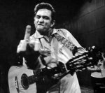
The two clowns at the Onion Vally Trail Head

There's a test here, which of these is older? You pick

Sunset at Kearsarge Pass 11,760 Feet

JMT trail junction just before Charlotte Lake

A loving message to a close friend

Vidette Meadows and the way south

South of us is Deerhorn Mountain on the left and "The Minster" on the right

East Vidette Peak

Bubbs Creek #1

Bubbs Creek #2

Further south along the creek into the open area

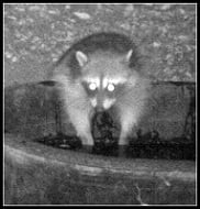
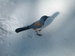
One of our neighbor's decided to stop by

Junction Peak in the distance, with Forester Pass just to the right of it

If only this was the view out my front window at home, I'd never have to have a bad day

Looking back the way we came

Approaching campsite #2 with Mount Stanford on the right

We made camp for the second night in the trees just to the left of this shot with Mnt Stanford on the right, big head wall in front can be accessed by going up to your left then swinging around all the moraine fields across the whole shot

Out goal for the rest of the day Mount Stanford

Forester Pass is on the other side of this head wall, this is the start of "Adam's Footpath" go up this and move right

The view looking north from the first head wall

Forester Pass is hidden behind this cylindrical looking peaklett with Mount Stanford off to the right by about two frames

400 foot head wall is just to my right it's bigger than it looks from below

One of 2 tarns that are on the way up to Mnt Stanford

The main chute on Mnt Stanford, the moraine fields are much bigger than they appear, there's over a mile of them just in this frame alone

Adam's Footpath leads up through the opening in the top right which then leads to Harrison's Pass, one of the ways winter skiiers make there way through from Yosemite

Main chute of Mnt Stanford, it look like any other slope but it's much steeper than the picture gives it credit, there's three or four spots near the top that are class four or more depending on the approach you take, we went from lower right to upper left

Looking back at the endless rock piles we just crossed to get to the main chute

Me scratching my head saying "does this crap ever end"?

The slope is 50% or more in some spots this shot shows that

Nearing the top of the ridge, class four sections on both sides, you have to work back and fourth to avoid them, just pay attention

Head wall that is the north flank of Gregory's Monument

Second choice to climb up this chute, it faces more south east (we did not come or go this way and it looks extremely loose) our campsite is in the distance where the trees thin out on the upper right

James Ledbetter showing those Nor Cal boys from Stanford how to surf

Me doing my usual jump in the air, only this time it was not going to be on the summit block, it was teetering on another that was loose so I didn't trust it

The view East from Stanford

The view West (that's Gregory's Monument just across the way) from Stanford

The view directly down to the north east with camp just above the water

The view south, our destination for tomorrow after bagging Junction Peak

The view North west into Yosemite and all points in that direction

The zoomed in shot of our exit point, do I really have to name that peak?

Alpine Glow on the east face of Mount Stanford as we returned to camp

Junction Peak in dead center with Forester Pass in the far right on the shoulder of that other peaklett, as we got over the pass we came up from the other side to avoid going over that peaklett and coming up to the saddle between the two from the north it worked out great

The pass is in the dead center notch just above

Our first view of the north side of Forester Pass

The high point on the JMT Forester Pass at 13,200

We dropped our packs way down on the left to turn back up and left to get into the saddle to head up to Junction Peak

A little tarn as we look back down from where we hid the packs heading up to the saddle between Junction and sub peaklett

There was no summit register or summit marker that we could find on Stanford but here on Junction we found both

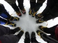
Officially signed in, only four others this season

The formation you see in this picture is called the "Diamond Plateau" which separates Forester Pass, it's drainage's and Sheppard's Pass drainage's.

View to the north from Junction Peak

If ever there were two clowns on a mountain top it would be these two characters

A view west as you can see there's plenty of "sub peaks" that make hitting the actual summit confusing, keep moving up and left

This is the top of the saddle between Junction and the sub peak that hides Forester Pass, it's so sandy we were able to run down at top speed in less than three minutes to where our packs were

Looking back up at the summit before doing our "run scree-sade"

The saddle between the two peaks plus all the "arete's" that make up the south face of Junction Peak, start in the lower left (where the saddle hits the wall) and move up to your left always looking for safe places to go up

Getting water at the south base of Forester Pass

Grandaddy in the background, we'll see you tomorrow mister

Time to cross Tyndall Creek

This is where the JMT and Sheppard's Pass trail cross

Heading up to Big Horn Plateau

The views from the plateau are very interesting

The eastern escarpment or high country coming into view

Big Horn Plateau was a pleasant surprise

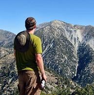
James was quite happy to final be approaching Whitney and the high/high country

The clouds gave the views more depth

The forest looks healthy back here, always could see it from Trail Crest and the top of Mount Whitney now I can see it up close

Dude, why are you carrying that 50+ lbs suit case

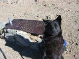
Another friend stopped by to say hello

Good morning gentlemen it's time to do 9.8 miles and climb 3,195 feet just to get to Trail Junction/Trail Crest, better eat some breakfast

The sun has risen on our final day in the dem dare hills

Approaching Timberline Lake

Timberline Lake

Passing Guitar Lake, it's a getting warm out here fella let's keep moving

The ridge is just up here a little ways

Hitchcock Lakes are coming into view

Some nice easy switchbacks to make your day complete, big daddy is just up at the top there

The view that always brings joy to my heart, the first time I saw this all I could say was just "wow"

My hammock at the Trail Junction with Guitar Lake in the background

At this point we checked our guns in and called "Hugh Hefner" to come get the "Pets" but he was busy so we kept going

Waving goodbye to the grandaddy

The sun filtering through the clouds gave Consultation Lake a unique look, that's my story and I'm sticking it to you, no need to show the portal or the food you already had enough of my BS, hope you enjoyed the show

In case anyone wants to know where we camped see this map