

Government road contractors need to make a living too, ya know.
Misc. News (Archive)
Nunc est bibendum

purportedly 1929 photo "Angeles National Forest Browns Flat ??M, Fern Canyon 1M, San Dimas/San Antonio Trail ??M"

A year after Station Fire, botanist, volunteers protect changing forest ecology
http://www.scpr.org/news/2010/08/25/a-y ... d-volunte/
"A year ago today, near a ranger station on the Angeles Crest Highway, the Station Fire began burning and didn't stop for months. The recovery of native plants within the Angeles National Forest has depended on scientific surveys and on volunteers pulling weeds in recent months....In a way, they are. In chaparral the five years after the fire are pivotal. Here the native chemise and manzanita bushes are sprouting again. Fire following wildflowers are thriving. Vinzant says Spanish broom plants can get in the way."I think a plant can produce 150,000 seeds at a time, so you can see how it just propagates, it explodes, it propagates," she says, her hands waving an imaginary explosion in the air.......This work grew out of surveys done last fall by a team of federal scientists known as the Burned Area Emergency Response team. They've also funded a small crew this year to survey and remove plants in the Angeles forest's burned area. Vinzant says that's unusual, but insufficient....Enthusiasm for volunteering has dropped off. Trouble is, the need hasn't..."
Anger, frustration still flaring over Station fire
http://articles.lacanadaonline.com/2010 ... ogel-flats
"But while the San Gabriel Mountains are showing preliminary signs of recovery — baby greens can be seen on many of the previously ash-gray slopes — the furor surrounding how the firefight was managed by the U.S. Forest Service shows no sign of abating.
For some residents who lost their homes and face a long and complicated rebuilding process, there is a deep sense of betrayal. And among county, state and federal representatives, there is frustration and concern about a lack of transparency and reform....."
National Park Service Sets Meetings For "Rim of Valley Corridor" Special Resource Study
http://www.nationalparkstraveler.com/20 ... -study6455
"A series of meetings to discuss whether an area of southern California that generally includes the mountains encircling San Fernando, La Crescenta, Santa Clarita, Simi and Conejo Valleys of Los Angeles and Ventura counties should be added to the National Park System will be held from mid-September into October"

The Meaning of Quail
http://arroyolover.blogspot.com/2010/08 ... quail.html
"The recent sighting of a quail in Debs Park along the Arroyo Seco is exciting news for those who understand the process, both natural and human-assisted, of ecosystem restoration.Quail are terrestrial birds, which means they live and forage at ground level. Members of the pheasant family, quail are an indicator species for the Arroyo Seco habitat corridor, because they are a sensitive species whose presence or absence 'indicates' the environmental health of the region...Quail are common in the Upper Arroyo Seco Watershed, including headwaters in Angeles National Forest, although last year's Station Fire has devastated all natural habitats and has resulted in animal migration southward. ..."
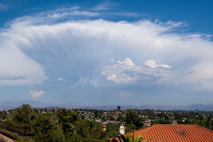
Official Monsoon 2010 thread(currently 54 pages long)-link is to photos from Wrightwood
http://forums.mammothmountain.com/viewt ... &start=675
REMEDIATION SERVICES CRYSTAL LAKE
https://www.fbo.gov/download/c3b/c3b4cd ... ke_SOW.pdf
"Requirement is to procure REMEDIATION SERVICES, to include complete demolition of buildings, debris removal, hazardous material characterization and delineation, and the clean up and disposal of contaminated soils at the Crystal Lake and East Fork Station areas located in the Angeles National Forest in accordance to the attached Statement of Work.....

Bear Signs

http://eastofallen.blogspot.com/2010/08/bear-signs.html
Current conditions Liebre Mtn
http://mtngal.zenfolio.com/img/s6/v6/p522004566.jpg
A year after Station Fire, botanist, volunteers protect changing forest ecology
http://www.scpr.org/news/2010/08/25/a-y ... d-volunte/
"A year ago today, near a ranger station on the Angeles Crest Highway, the Station Fire began burning and didn't stop for months. The recovery of native plants within the Angeles National Forest has depended on scientific surveys and on volunteers pulling weeds in recent months....In a way, they are. In chaparral the five years after the fire are pivotal. Here the native chemise and manzanita bushes are sprouting again. Fire following wildflowers are thriving. Vinzant says Spanish broom plants can get in the way."I think a plant can produce 150,000 seeds at a time, so you can see how it just propagates, it explodes, it propagates," she says, her hands waving an imaginary explosion in the air.......This work grew out of surveys done last fall by a team of federal scientists known as the Burned Area Emergency Response team. They've also funded a small crew this year to survey and remove plants in the Angeles forest's burned area. Vinzant says that's unusual, but insufficient....Enthusiasm for volunteering has dropped off. Trouble is, the need hasn't..."
Anger, frustration still flaring over Station fire
http://articles.lacanadaonline.com/2010 ... ogel-flats
"But while the San Gabriel Mountains are showing preliminary signs of recovery — baby greens can be seen on many of the previously ash-gray slopes — the furor surrounding how the firefight was managed by the U.S. Forest Service shows no sign of abating.
For some residents who lost their homes and face a long and complicated rebuilding process, there is a deep sense of betrayal. And among county, state and federal representatives, there is frustration and concern about a lack of transparency and reform....."
National Park Service Sets Meetings For "Rim of Valley Corridor" Special Resource Study
http://www.nationalparkstraveler.com/20 ... -study6455
"A series of meetings to discuss whether an area of southern California that generally includes the mountains encircling San Fernando, La Crescenta, Santa Clarita, Simi and Conejo Valleys of Los Angeles and Ventura counties should be added to the National Park System will be held from mid-September into October"
The Meaning of Quail
http://arroyolover.blogspot.com/2010/08 ... quail.html
"The recent sighting of a quail in Debs Park along the Arroyo Seco is exciting news for those who understand the process, both natural and human-assisted, of ecosystem restoration.Quail are terrestrial birds, which means they live and forage at ground level. Members of the pheasant family, quail are an indicator species for the Arroyo Seco habitat corridor, because they are a sensitive species whose presence or absence 'indicates' the environmental health of the region...Quail are common in the Upper Arroyo Seco Watershed, including headwaters in Angeles National Forest, although last year's Station Fire has devastated all natural habitats and has resulted in animal migration southward. ..."
Official Monsoon 2010 thread(currently 54 pages long)-link is to photos from Wrightwood
http://forums.mammothmountain.com/viewt ... &start=675
REMEDIATION SERVICES CRYSTAL LAKE
https://www.fbo.gov/download/c3b/c3b4cd ... ke_SOW.pdf
"Requirement is to procure REMEDIATION SERVICES, to include complete demolition of buildings, debris removal, hazardous material characterization and delineation, and the clean up and disposal of contaminated soils at the Crystal Lake and East Fork Station areas located in the Angeles National Forest in accordance to the attached Statement of Work.....
Bear Signs
http://eastofallen.blogspot.com/2010/08/bear-signs.html
Current conditions Liebre Mtn
http://mtngal.zenfolio.com/img/s6/v6/p522004566.jpg

Exactly....Rumpled wrote:What's with Crystal Lake? 39's been closed for forever and they've been working up there and still more to go.
Our Next National Park?
http://wyeastblog.wordpress.com/2010/08/31/201-odds/
"As part of the cover story, Sunset gave odds on “Our Next National Park?” Here’s what they had to say:
3:2 – Valles Caldera National Preserve, New Mexico – in a bill for full park status
4:1 – San Gabriel Mountains, California – under study by the National Park Service
7:1 – Pinnacles National Monument, California – another monument proposed for promotion to full park status
8:1 – Mount St. Helens National Volcanic Monument, Washington – also under study, in this case by a citizens committee that may recommend bumping it from failed USFS management to National Park Service protection
20:1 – Mount Hood National Forest, Oregon – “A labor of love by a Portland city planner, this campaign faces a couple of roadblocks, the main one being it’s similar to what’s already in the NPS portfolio (hello, Mt. Rainier!)
100:1 – “Ancient Forest”, Northern California/Southern Oregon – “Another quixotic cause from a lone visionary, this 3.8 million-acres swatch would link ecosystems to help preserve species… but it’s a long shot"
Author to speak in Mt. Baldy Saturday
http://www.insidesocal.com/uplandnow/20 ... dy-sa.html
Mt. Wilson Observatory awarded National Science Foundation grantJohn Robinson, author of "Trails of the Angeles" and "The San Gabriel Mountains," will speaking at the Mt. Baldy Visitor Center at 9 a.m. Saturday.
Robinson will discuss a variety topics related to the history of the San Gabriel Mountains as well as native plants and wildlife.
He will be available for a book signing.
Cost is $5.
The last Saturday of every month is devoted to the Mt. Baldy Visitor Center Speaker Series. The series is meant to teach the community about the Angeles National Forest.
The Mt. Baldy Visitor Center is in the middle of the Mt. Baldy Village on the west side of the street, just past the Mt. Baldy Lodge.
For more information and to make reservations call the center at 909-982-2879.
http://www.pasadenastarnews.com/news/ci ... z0yPIr2W39
".....The Observatory is launching a "Second Century Campaign" to build a major new visitor center on the Observatory grounds. As a prelude, a new food venue, The Cosmic Café, was opened on the mountain this summer. The café is open weekends, including the upcoming Labor Day holiday, from 10 a.m. to 4 p.m"
Backyard Bobcat
http://www.nbclosangeles.com/station/as ... geles.html
news video about:
"A bobcat made himself right at home in a Rancho Cucamonga back yard, one of several sightings in the neighborhood over the past few weeks."
Monday Ride
http://glendoramtnroad.blogspot.com/201 ... de_23.html
"....Little did we know that as we passed the bottom of Monroe the news of the night was resting in the shade.Matt and Ron left much later and happened upon this forest family foraging for fragments of foresaken foodstuffs from folks futily flinging fodder into garbage cans."
Also has another blog post with video of the bears(requires quicktime)
Hazards
If you ever wanted to know what driving the forest feels like at night
Short film of Big Tujunga canyon road and pre-forest area.
Hiker Rescued in Angeles National Forest
http://www.nbclosangeles.com/news/local ... 13174.html
"....The 20-year-old woman was at the goofing around near Chantry Flats and was jumping off the top of a waterfall about 40 feet above a pool of water. She missed her target.
Lucky for her the Sierra Madre Search and Rescue team was in the area checking into a bogus report of a missing hiker. It turned out the “missing” hiker had a hissy fit and stormed off into the forest. His buddies summoned rescuers but it was all for not when the agitated hiker emerged unscathed a nearby trailhead.
That was good new for the female hiker who was hurt and really need help. Rescuers arrived within minutes of her pals calling for help....."
Woman drives over edge in Angeles National Forest
http://www.pasadenastarnews.com/news/ci ... z0z05Ny8eT
Inncludes video
http://abclocal.go.com/kabc/story?secti ... id=7653392
"....There's a lot of cups, food, a lot of trash next to the river. We swim on it," said Gus Lopez, who came from Riverside to enjoy the park...One simple solution Rossman suggested was to restart a program instructing visitors to carry out whatever they carry in to the park - especially trash.
However, funding for such a basic campaign is just not available at this time, proving that keeping our parklands clean is no walk in the park these days"
More video of the San Gabriel river
http://www.kvue.com/news/Rescuers-neede ... 75189.html
OK. thats the San Gabriel river in Texas affected by Hermine 8) as rescuers get rescued.
Fire Danger Remains High after a Small Brush Fire in Monrovia Monday(8/26/10)
http://sierramadreweekly.com/featured/f ... ia-monday/
"A major Fire Department response put dozens of firefighters, three helicopters and 40 pieces of equipment at the foot of Canyon Park in Monrovia Monday, with assistance from Los Angeles County, Arcadia, Pasadena, Glendale, Monterey Park and the US Forest Service.
Canyon Park was evacuated as the fire began.......In the confusion of the road closures, one driver was arrested at gunpoint by Monrovia police officers when he continually refused to stop his vehicle despite repeated requests. At one point an Edison worker attempted to stop the vehicle by standing in front of the car. The driver proceeded to put his foot on the gas and the Edison employee was literally holding on to the hood as the driver attempted to continue. Monrovia police officers ran to the window of the car and order him out at gunpoint.
Donald Skelton was arrested and transported to Monrovia PD for booking on numerous charges. Skelton, who is in his 70′s is charged with two counts of ADW (Assault with a Deadly Weapon) as he hit two people with his car. His bail was set at $80,000..."
Angeles Crest 100 Mile Endurance Run - Part 3
http://j-tris.blogspot.com/2010/09/ange ... un_08.html
""....From the Mt. Hillyer aid station, I hadn't seen a single trail marker. The trail was straightforward enough. Or so I thought. But then it turned nasty. Lots of boulders, no clear trail, a dead-end, a small path between bushes that could be a trail, another dead-end. But I kept moving down the hill, following false trails. Kept moving, that is until I realized I'd gone way too far. And what was I supposed to do then? I didn't know where the trail was, didn't know where I'd gone wrong and didn't even know how to get back to where I'd started. I thrashed through bushes, mostly ones with thorns. I climbed to the top of the biggest rocks I could find and shouted for help. ....Just" 25 miles to go. Two big climbs, two long descents. I couldn't visualize the finish yet, but I knew it was coming"
The Sandburg Ranch(close to Lake Castaic)

"...First, please toss out any image of what one may perceive as organized ranching, think a homestead near the Castaic Lakes, just outside the boundaries of Angeles National Forest, instead. Much of this land used to be an apple orchard. Once upon a time, a unique apple variety literally called the “Sandberg”, now “heirloom”, produced tons of apples from 2000 trees. Now, horses roam, and scout troops come for camp outs and bonding time. Near the house, prolific century old oak trees can be found. And with oaks, come acorns. With acorns, come fatty fat fat piggies..."
Twitter: "Almost 27,000 trees planted so far this year in the Angeles National Forest burn area! Go TreePeople!!: "
http://twitter.com/extremegreenbob
Note: http://twitter.com/AngelesNF "Sorry, that page doesn’t exist!"
http://www.nbclosangeles.com/news/local ... 13174.html
"....The 20-year-old woman was at the goofing around near Chantry Flats and was jumping off the top of a waterfall about 40 feet above a pool of water. She missed her target.
Lucky for her the Sierra Madre Search and Rescue team was in the area checking into a bogus report of a missing hiker. It turned out the “missing” hiker had a hissy fit and stormed off into the forest. His buddies summoned rescuers but it was all for not when the agitated hiker emerged unscathed a nearby trailhead.
That was good new for the female hiker who was hurt and really need help. Rescuers arrived within minutes of her pals calling for help....."
Woman drives over edge in Angeles National Forest
http://www.pasadenastarnews.com/news/ci ... z0z05Ny8eT
Angeles Forest plagued by big city problems(concentrating on the West Fork SG river)ANGELES NATIONAL FOREST - A woman is in stable condition after she drove over an edge and fell 75 feet Friday, police said.
A woman on a motorcycle drove off a cliff on Angeles Crest Highway at the 50-mile marker at 7:30 p.m., Lt. Larry Landreth with the sheriff's Crescenta Valley station said.
The 34-year-old woman suffered major injuries to her back, pelvis and neck, Landreth said.
She was airlifted by Los Angeles County fire officials and taken to Huntington Hospital, Landreth said
Inncludes video
http://abclocal.go.com/kabc/story?secti ... id=7653392
"....There's a lot of cups, food, a lot of trash next to the river. We swim on it," said Gus Lopez, who came from Riverside to enjoy the park...One simple solution Rossman suggested was to restart a program instructing visitors to carry out whatever they carry in to the park - especially trash.
However, funding for such a basic campaign is just not available at this time, proving that keeping our parklands clean is no walk in the park these days"
More video of the San Gabriel river
http://www.kvue.com/news/Rescuers-neede ... 75189.html
OK. thats the San Gabriel river in Texas affected by Hermine 8) as rescuers get rescued.
Fire Danger Remains High after a Small Brush Fire in Monrovia Monday(8/26/10)
http://sierramadreweekly.com/featured/f ... ia-monday/
"A major Fire Department response put dozens of firefighters, three helicopters and 40 pieces of equipment at the foot of Canyon Park in Monrovia Monday, with assistance from Los Angeles County, Arcadia, Pasadena, Glendale, Monterey Park and the US Forest Service.
Canyon Park was evacuated as the fire began.......In the confusion of the road closures, one driver was arrested at gunpoint by Monrovia police officers when he continually refused to stop his vehicle despite repeated requests. At one point an Edison worker attempted to stop the vehicle by standing in front of the car. The driver proceeded to put his foot on the gas and the Edison employee was literally holding on to the hood as the driver attempted to continue. Monrovia police officers ran to the window of the car and order him out at gunpoint.
Donald Skelton was arrested and transported to Monrovia PD for booking on numerous charges. Skelton, who is in his 70′s is charged with two counts of ADW (Assault with a Deadly Weapon) as he hit two people with his car. His bail was set at $80,000..."
Angeles Crest 100 Mile Endurance Run - Part 3
http://j-tris.blogspot.com/2010/09/ange ... un_08.html
""....From the Mt. Hillyer aid station, I hadn't seen a single trail marker. The trail was straightforward enough. Or so I thought. But then it turned nasty. Lots of boulders, no clear trail, a dead-end, a small path between bushes that could be a trail, another dead-end. But I kept moving down the hill, following false trails. Kept moving, that is until I realized I'd gone way too far. And what was I supposed to do then? I didn't know where the trail was, didn't know where I'd gone wrong and didn't even know how to get back to where I'd started. I thrashed through bushes, mostly ones with thorns. I climbed to the top of the biggest rocks I could find and shouted for help. ....Just" 25 miles to go. Two big climbs, two long descents. I couldn't visualize the finish yet, but I knew it was coming"
The Sandburg Ranch(close to Lake Castaic)
"...First, please toss out any image of what one may perceive as organized ranching, think a homestead near the Castaic Lakes, just outside the boundaries of Angeles National Forest, instead. Much of this land used to be an apple orchard. Once upon a time, a unique apple variety literally called the “Sandberg”, now “heirloom”, produced tons of apples from 2000 trees. Now, horses roam, and scout troops come for camp outs and bonding time. Near the house, prolific century old oak trees can be found. And with oaks, come acorns. With acorns, come fatty fat fat piggies..."
Twitter: "Almost 27,000 trees planted so far this year in the Angeles National Forest burn area! Go TreePeople!!: "
http://twitter.com/extremegreenbob
Note: http://twitter.com/AngelesNF "Sorry, that page doesn’t exist!"
-
PackerGreg
- Posts: 623
- Joined: Sat Sep 12, 2009 9:31 pm
That's MY story!! - not proud of it, by the way... drove over an edge and fell 75 feet... suffered major injuries to back, pelvis and neck... was airlifted by Los Angeles County fire officials and taken to Huntington Hospital
Little Tujunga/Riverwood area re-opens from Station fire closure
http://www.sgvtribune.com/news/ci_16117897
Pasadena Sierra Club will explore proposed recreation area
http://www.pasadenastarnews.com/news/ci ... z106gFx1Oj
"The Sierra Club will present "A New Vision for the San Gabriel Mountains" at 7:30 p.m. Wednesday at Eaton Canyon Nature Center, 1750 N. Altadena Drive. "
CA: Mounted SAR prepares to search 13 people
http://jocosarblog.typepad.com/jocosarb ... 010-0.html
"PALMDALE - A woman who sparked a massive search throughout the Antelope Valley when she and a religious group she led were reported missing, is under mental evaluation after she and the others were discovered Sunday praying in a Palmdale-area park.....The notes prompted the Los Angeles County Sheriff's Department and the California Highway Patrol to launch an all-out search Saturday and Sunday morning on highways and through deserts and canyons by horseback and with the use of a helicopter."
Motorcycle noise
http://www.scpr.org/programs/airtalk/20 ... cle-noise/
"State Senator Fran Pavley (D-Agoura Hills) has sponsored a bill that will subject bikers to fines if they don’t have EPA stickers showing their motorcycles comply with noise laws...."
O/T:Emergency boxes installed to aid lost hikers on Mt. San Jacinto
http://www.pe.com/localnews/stories/PE_ ... 3c8bf.html
".....Now, Skyline Trail hikers who find themselves in trouble will see a little help along the way.
The Palm Springs Mounted Police Search and Rescue Team installed hiking rescue boxes last week at two elevations -- 2,500 and 5,000 feet -- along the trail...."
edit: also in light of the Station Fire panel recovening,
photos: Station Fire - A Year After
http://www.mikegeephotos.com/Wildfires/ ... 7597_q4686
Stalled Highway 39 project frustrates Crystal Lake Campground business ownerAngeles National Forest officials on Monday will reopen a five mile by two mile stretch of land northwest of Sunland, according to an announcement released today.
The Little Tujunga-Riverwood area has been closed since the Station fire scorched the area last year. The recreation area offers facilities for hiking, biking and picnics. Forest Service officials signed off on the opening after crews completed trail improvements and removed storm debris.
Despite the reopening, the vast bulk of the Station fire burn area remains closed due the significant damaged caused by the winter storms proceeding the fire
http://www.sgvtribune.com/news/ci_16117897
No mention of the Angeles Crest highway other than "Road repairs continue to move forward and the crest is expected to re-open some time this fall"-mtwaterman.orgANGELES NATIONAL FOREST - Eight years ago, Adam Samrah survived a forest fire by sitting in a 2-foot-deep pond for nearly seven hours as walls of flames surrounded him.
And in 2008, he reinvented himself when the bank where he worked for 14 years was declared insolvent by the FDIC and he lost his job and $165,000 in stock.
But, despite his previous survival feats, it could be the California Department of Transportation (Caltrans) that finally does in Samrah.
Samrah is the owner of the small store and restaurant at Crystal Lake Campground. His livelihood depends on selling wood and ice and s'mores fixings to campground visitors. The problem is, the campground is closed. And, for all but a few months, it has been since 2002, when Samrah bought the store and when the same fire he survived scorched the surrounding land.
Samrah does not blame the Curve Fire for his woes. And, he has nothing but praise for the National Forest Service, which has invested more than $6 million to rebuild the campground, including building all new bathrooms Samrah says are so nice he could sleep in them.
Samrah's problems lie with State Route 39.
Several miles of the highway above West Fork have been closed for five years, blocking access to the campground and his store.
In 2005, record rainfall pounded the Curve Fire-scorched hills and the resulting flooding damaged parts of the road that twists into the upper reaches of the San Gabriel mountains.
Since then, Samrah has been waiting.
In 2006, he was told the road would reopen in the summer of 2007.
In 2008, he was told it would reopen in fall 2009.
Last month, he was told it would reopen next spring.
"This is my only hope," Samrah said.
"I know I have a business, I have a personal interest. But I feel sorry for the people. This is their land. They have an interest too."
Azusa Chamber of Commerce member Barry Wetherby agrees. And he is sympathetic to Samrah's plight. Wetherby has been leading the Azusa drive to reopen the road on behalf of the chamber because he says it is not only important to residents, but it could be a boon to area businesses that serve campers and picnickers heading to Crystal Lake.
But, despite the chamber's advocacy, Wetherby is not optimistic that the latest timetable will hold true.
"I couldn't believe it any more than I believe it is going to rain tomorrow," Wetherby said. "We are at wits end how to get that road open again."
Caltrans project manager John Lee says the delays are normal, especially for a large project that has cost more than $10 million. When officials began emergency repairs on the road following the 2005 flooding, they discovered two areas were seriously damaged and needed more significant repair, including the construction of retaining walls.
But even after that additional work was discovered and planned for, Lee wrote to Samrah that work would be complete by September 2009.
So what happened between then and now?
Two issues: bad weather and funding delays, Lee said Friday, despite saying two weeks ago that he didn't recall any funding delays on the project.
Though the funds were earmarked, Caltrans did not have the cash in hand to actually begin repairs under the original schedule, Lee said.
Those pushing for the road's reopening say the funding delays are proof the project is not a priority for Caltrans.
"If they wanted to do it, they could. If it was their business at the top, or their parents' business, they would get it done like that," Samrah said with a snap of his fingers.
"This is ridiculous. Every mountain road, in Big Bear, Arrowhead, they fix them all. But our canyon has been on the backburner forever. It has always been the forgotten road," Wetherby said.
Lee disagreed.
"If you really think about it, we have limited funds for our transportation programs and to program this much money into a special road that has very little volume of traffic is a lot," Lee said.
While the majority of work on the highway is complete, several newly discovered smaller repairs are still needed, amounting to some $200,000 in repairs.
"If we don't get that funding, it could drag on longer, but we anticipate we will get it," Lee said, adding that he is confident in a spring completion.
Samrah is getting desperate.
"I'll fix the pavement. I'll stripe it by hand. I'm not doing anything in this economy," he said.
Samrah has been unemployed since losing his job at PFF Bank and Trust in Pomona. The camp store was supposed to be his retirement project, buffered by his now-lost stock investments.
He began thinking about buying the camp store shortly before the Curve Fire. That fire destroyed dozens of cabins in the forest, including eight surrounding a cabin formerly owned by Samrah several miles below Crystal Lake.
Samrah was at his cabin when the fire broke out. He and neighbor Clyde Stelling couldn't escape in time and so they found refuge in a nearby spring-fed pond. For seven hours they dodged flames.
Despite the terrifying experience, Samrah wasn't scared away from his camp store plan.
"I didn't back out because this is the American dream. This is my American dream. This is where I will die," he said, pointing to his small freshly painted red and stone store. Like many structures on the campground, the store occupies the original building constructed in the 1930s. Crystal Lake has been a popular destination since then.
"I'm not looking to be rich. I just want to work... I just need a little to support my family," added Samrah, who lives in a house next to the store with his wife and two-year-old son.
And he said he wants to see the empty campground filled with people.
"This is public land. People should be allowed to enjoy it," he said.
The campground will reopen once the road is open, according to Marty Dumpis, deputy supervisor for the forest.
The National Forest Service spent more than $6 million completely renovating and rebuilding the 250-site campground after the Curve fire.
Roads through the entire campground were repaved, 23 new bathrooms were built, and each campsite was rehabilitated with a new picnic table and fire ring. In addition, some campsites were made more handicap accessible and the area's amphitheater, with views of the Valley, was made handicap accessible.
Caltrans is also working to open Highway 39 all the way to the Angeles Crest (2) Highway, parts of which have been closed for decades. Lee estimates the $32 million project could begin in the early spring of 2013 and take 2 1/2 years to complete, though he acknowledges that project could face delays as well.
In particular, Lee said Caltrans needs to determine how it will mitigate the impact reopening the road will have on the bighorn sheep population.
"That issue has not been completely addressed yet. And those issues can delay the project," Lee said. "But we are committed to opening all the roads we have."
Pasadena Sierra Club will explore proposed recreation area
http://www.pasadenastarnews.com/news/ci ... z106gFx1Oj
"The Sierra Club will present "A New Vision for the San Gabriel Mountains" at 7:30 p.m. Wednesday at Eaton Canyon Nature Center, 1750 N. Altadena Drive. "
CA: Mounted SAR prepares to search 13 people
http://jocosarblog.typepad.com/jocosarb ... 010-0.html
"PALMDALE - A woman who sparked a massive search throughout the Antelope Valley when she and a religious group she led were reported missing, is under mental evaluation after she and the others were discovered Sunday praying in a Palmdale-area park.....The notes prompted the Los Angeles County Sheriff's Department and the California Highway Patrol to launch an all-out search Saturday and Sunday morning on highways and through deserts and canyons by horseback and with the use of a helicopter."
Motorcycle noise
http://www.scpr.org/programs/airtalk/20 ... cle-noise/
"State Senator Fran Pavley (D-Agoura Hills) has sponsored a bill that will subject bikers to fines if they don’t have EPA stickers showing their motorcycles comply with noise laws...."
O/T:Emergency boxes installed to aid lost hikers on Mt. San Jacinto
http://www.pe.com/localnews/stories/PE_ ... 3c8bf.html
".....Now, Skyline Trail hikers who find themselves in trouble will see a little help along the way.
The Palm Springs Mounted Police Search and Rescue Team installed hiking rescue boxes last week at two elevations -- 2,500 and 5,000 feet -- along the trail...."
edit: also in light of the Station Fire panel recovening,
photos: Station Fire - A Year After
http://www.mikegeephotos.com/Wildfires/ ... 7597_q4686
No dogs, no bikes and more fees!AW wrote: Pasadena Sierra Club will explore proposed recreation area
http://www.pasadenastarnews.com/news/ci ... z106gFx1Oj
"The Sierra Club will present "A New Vision for the San Gabriel Mountains"

Nunc est bibendum
Mourning for teacher found dead in forest(Big Tujunga mm 6.6 near BT dam)
http://latimesblogs.latimes.com/lanow/2 ... death.html
"The body of Rigoberto Ruelas was found Sunday morning around the Big Tujunga Canyon area in the Angeles National Forest, according to the Los Angeles County Sheriff's Department. Members of a search-and-rescue team that were training nearby came across Ruelas' vehicle, officials said. They searched a ravine about 100 feet below a nearby bridge and found Ruelas' body"
Body of missing camper found in forest north of Azusa
http://www.pasadenastarnews.com/news/ci ... z10sPODThj
"ANGELES NATIONAL FOREST - A search for a missing camper Sunday ended with the discovery of the young man's body beneath the Bridge to Nowhere in the Angeles National Forest north of Azusa, authorities said.
...He appeared to be in his mid-20s.
Sheriff's officials received a call from campers about 5 a.m. reporting a fellow camper had left the campsite to use the restroom and had not returned, Los Angeles County sheriff's Sgt. Melinda Berry....
The man appeared to have fallen from the bridge, authorities added...."
Motorcyclist plunges off Angeles Crest 9/28/10
http://www.pasadenastarnews.com/news/ci_16197360
"A motorcyclist fell 40 feet off Angeles Crest Highway this afternoon but was conscious and breathing, officials said.
The incident happened about 2:40 p.m. about 6 miles north of Newcomb Ranch, Lt. Angela Shepherd of the Los Angeles County Sheriff's Department's Altadena Station.
A rescue helicopter was flying to the scene, she said."
Tarantino film editor dies on hike in LA hills
http://www.google.com/hostednews/ap/art ... =D9IH840G0
"...The body of Sally JoAnne Menke, 56, was discovered at 2:15 a.m. Tuesday in rugged Beachwood Canyon on the west side of Griffith Park, assistant coroner Ed Winter said. Her black Labrador retriever was standing near the body.
Investigators suspect she died of hyperthermia Monday in Griffith Park, when downtown Los Angeles was on its way to a record high of 113..."
CHP paying attention to choppers & hogs Sept. 26
http://www.altadenablog.com/2010/09/chp ... pt-26.html
"On Sept. 26, the Altadena Area office of the CHP will conduct a special enforcement campaign on State Route 2 – Angeles Crest Highway. “We are experiencing a slight increase in the number of traffic collisions on the Angeles Forest roadways and the purpose of this enforcement is to combat the causes of those collisions,” said Captain Bill Dance, Altadena Area Commander. “We would like to remind all motorists to adhere to the speed limit and solid double yellow lines. Too often we respond to collisions involving motorists who have lost control of their vehicle due to unsafe speed or who collide into an oncoming vehicle as they drift over the double yellow lines.”
So dont drive like this in other words..."Black Devil - Moscow Ride on R1 " - video of Moscow motorcylce commuter..really gets going approx 4 mins into the video.
Water fight comes to boil
http://www.dailybulletin.com/ci_16176319
"Paul Ridgeway and another resident, Blake Slater, were given more than a month to sign a license agreement with San Antonio Water or face litigation......San Antonio Water is claiming water rights to a spring where the residents get their water."
Antonio Margarito Prepares for Manny Pacquiao
http://www.doghouseboxing.com/DHB/Kim092510.htm
"That's what we're doing(team of A.Margarito)," said Garcia. "To do the mountain running at Mt. Baldy, we're doing it every day"
Fish Canyon Falls Hike - September 25, 2010
http://danshikingblog.blogspot.com/2010 ... er-25.html
"....Arrive at Fish Canon Falls, 2.0 miles from the start. No water falling today. There is water in the lower pool but the main pool is virtually dry except for a little puddle at the rock face...Back at the Vulcan office I sign out at 9:51. There are 74 hikers who have signed in at this point"
From glendoramtnroad.blogspot.com
Historical: Charles and Olive
http://larryorcutt.wordpress.com/2010/0 ... and-olive/
"....In November 1891, Charles took a room at the Lindley House in Pasadena, where he met with a number of gentlemen to organize ”a Scientific Association” on the 6th. The next day he went to Lamanda Park in Pasadena, largely devoted to vineyards and ranch-land at the time (Lamanda Park consisted of eastern Pasadena and today’s Arcadia, Duarte, Baldwin Park, and Temple City). He met with Abbot Kinney (1850-1920), a developer, conservationist, and friend of naturalist John Muir with whom Kinney would establish the San Gabriel Timberland Reserve in December 1892 (the forerunner to the Angeles National Forest). In 1883, Kinney and Helen Hunt Jackson had written a report for the U.S. Department of the Interior on the condition of California Mission Indians...."
Man sentenced in pot cultivating operation(not in Angeles Forest)
http://www.vcstar.com/news/2010/sep/24/ ... rijuana25/
"A man who was described as a minor player in a marijuana cultivating operation off Tule Creek Trail in Los Padres National Forest was sentenced to six months in jail and 36 months probation....
Arturo Hernandez told police he got involved in the operation when someone whose name he does not know came to where he was staying in Camarillo and asked if he wanted to work, according to probation report.
Arturo Hernandez’s job had ended in Washington state, and friends said he could find work in Ventura County. He was unable to find work and was offered a job delivering bags.
“He was suppose to be paid $100 a day but he never received any type of payment,” according to the report.
Jose Hernandez told authorities that he was given the handgun(.22 caliber rifle) by his “employer” in case he encountered any animals.
2 Ventura County companies to pay millions in connection with 2003 Piru fire
http://latimesblogs.latimes.com/lanow/2 ... ounty.html
"Two Ventura County companies have agreed to pay the federal government more than $5.4 million in compensation after they allegedly started a wildfire that burned more than 63,000 acres, about half of it in the Los Padres National Forest, according to court papers filed Friday.
In a civil lawsuit filed last year, federal prosecutors alleged that the two companies started the 2003 Piru fire when they were doing construction work on a boat launch in the Lake Piru Recreation Area. Company employees ignited the fire when sparks from a cutting tool ignited dry brush nearby. They did not have a fire extinguisher on hand as they should have, prosecutors alleged.
In the settlement agreement, Berry Engineering General Contractors Inc. agreed to pay $5 million to compensate the U.S. Forest Service, which suppressed the fire and provided emergency rehabilitation in the burn area.
Mendez Concrete, a Santa Paula subcontractor on the project for the United Water Conservation District, agreed to pay $447,423.
Both companies agreed to pay the settlement without admitting wrongdoing....."
Hansen Dam starts with ranger station, will add skate park, horse trails
http://www.dailynews.com/news/ci_15979409
"A groundbreaking ceremony was held Thursday for a ranger station at Hansen Dam Recreation Area, the first of many planned at the rustic park in Lake View Terrace.
Construction of the 4,000-square-foot station and visitors center will be followed by the development of a campground, where inner-city youths will be able to enjoy a night in the outdoors.
The city Department of Recreation and Parks also plans a 6,000-square-foot skate park, improved parking and equestrian trails and a wetlands restoration, which will capture and treat water from three parking lots.
The Hansen Dam Recreation Area in Big Tujunga Wash includes more than 1,400 acres of wildlife preserve, 12 miles of equestrian and foot trails and a 40-acre water recreation facility with a 9-acre fishing lake and 1.5-acre swimming lake, two large water slides and a sand volleyball court....."
-
blueshammer
- Posts: 105
- Joined: Wed Nov 25, 2009 1:03 pm
Good old Dan Simpson. I should ask him to autograph my hiking boots one day.AW wrote: Fish Canyon Falls Hike - September 25, 2010
http://danshikingblog.blogspot.com/2010 ... er-25.html
"....Arrive at Fish Canon Falls, 2.0 miles from the start. No water falling today. There is water in the lower pool but the main pool is virtually dry except for a little puddle at the rock face...Back at the Vulcan office I sign out at 9:51. There are 74 hikers who have signed in at this point"
Nope, but I know it has been directly scrambled and rappelled. Ive had it in my plans as the latter half of a day after another route, but the first route always took the energy out of me.TacoDelRio wrote:Fish Canyon Falls looks awesome. Have you canyoneered that yet, AW?
-
davantalus
- Posts: 203
- Joined: Mon Jun 08, 2009 9:09 am
Apparently this was a gent named Mykel who was one of the bungee guys on the Bridge to Nowhere.AW wrote:Body of missing camper found in forest north of Azusa
http://www.pasadenastarnews.com/news/ci ... z10sPODThj
Photo - http://www.myspace.com/31553217/photos/38406250
I'm kinda bummed I'll never see his smiling face up there as I pass through. He'd joke with us about our lunch of beer and burritos.
No hikers found trapped by mudslide in Angeles National Forest
http://latimesblogs.latimes.com/lanow/2 ... orest.html
http://www.pasadenastarnews.com/news/ci ... z11RTKc8vb
"Hikers in Altadena on Friday literally got a breathtaking view. Caught in a violent thunderstorm, they had a close encounter with lightning that flashed close enough to them badly shaken but not hurt.
Don't write off the trail near Loma Alta Drive, though - lightning rarely strikes twice.
And hiking elsewhere could present its own excitement.
A mountain lion has been "sighted during the evening hours in the mountainous area from Gold Hills to Norumbega Avenue." Local police called to warn homeowners in the area, and the city says California Fish and Game is monitoring the situation.."
Mtn. Lion Encounter(perhaps) in California(also 3Ts + Baldy)
http://14ers.com/php14ers/tripreport.php?trip=9274
"....After enjoying the sunset, I made my way down the Baldy Bowl route. This thing is STEEP. I lost the trail a few times, but luckily my map reading skills are much improved and I managed to find it again when I needed it. After clearing through the difficult portions I thought I was home free so I started to jog the lower portions - that's when things got very interesting. First, my headlamp just caught a little glimpse of a spider web before I walked through it. One more step and I would have had this guy in my face. Then, I sped around a corner to startle some large object about 10 yards off the low side of the trail. I turned my headlamp just in time to catch a glimpse of a very large cat hopping some boulders. He was close enough that my light showed size/color. I'm guessing his body was between 4-5 feet long and probably ~150 pounds. He came to a stop on a rock about 15-20 yards behind me. At this point all I could see was the reflection of his green eyes. (I haven't slept well since as those eyes still haunt me.) It was now a standoff - and since I didn't check my luggage for the trip, I didn't even have my hiking poles to protect me, let alone my knife. I was - shall I say - up a creek... alone, pitch black, essentially defenseless, on a trail I've never been on, and face-to-face with a huge cat (sorry, I was too busy soiling myself to take out my camera). After what felt like 10 minutes (reality, maybe 10 seconds), I figured I would make the first move rather than wait for his. I let out some deep barks, but he didn't seem to care much - he just sat there, with that slow cat blink. Now, I was out of ideas so I reached down, grabbed a rock and he didn't seem to want to mess with any flying objects as he turned and walked away after one warning shot across his bow. I picked up a larger rock (small volleyball) and threw it in that general direction to keep him moving that way and I couldn't get out of there fast enough.
I've never liked hiking alone in the dark and now I was absolutely spooked. I kept hearing rocks being kicked around above me - like I was being followed. I picked up the 2 sharpest rocks I could find and moved as fast as I could with a firm grasp on them. I made the road about 15 minutes later and now all I had was a 4-mile hike on pavement back to the Icehouse TH. I caught the eyes of an big owl in a tree just off the trail which was pretty cool and I would have watched him some more under different circumstances. I then saw another critter walking the other side of the road at Manker Flats. This time, I was pretty sure he was a coyote. Not terribly concerned, I just kept my eye on him, but then he turned and started trotting towards me! At this point, I had enough of the local wildlife. There are some cabins/camping in the area so I didn't let a rock fly just in case it was someone's dog but I was pretty sure this was a coyote. He finally stopped about 25 yards away from me and I just walked backwards with my light on him until he was out of sight.
I finally made it back to the car at 9:45, totally exhausted, and I finally dropped my rocks......"
Bear Climbs Tree in Monrovia Neighborhood
http://www.nbclosangeles.com/news/weird ... 82789.html
http://jocosarblog.typepad.com/jocosarb ... anyon.html
" Four teenage hikers were escorted from Eaton Canyon by rescuers Saturday after they are believed to have become too drunk to get themselves out, authorities said...."
Thundershowers, lightning strikes leave San Gabriel Valley reeling
http://www.pasadenastarnews.com/weather/ci_16230455
"...Moments after his too-close encounter with Friday's surprise thunderstorms over the West San Gabriel Valley's foothills, Bobby D'Amico was considering playing SupperLotto this weekend.
Caught in the center of a storm cell while mountain biking in the Echo Canyon area above Altadena, the 36-year-old local resident said he saw a blinding flash, then felt a jolt shoot through the handlebars and up both his arms.
"It was just a weird feeling. I got off my bike and I felt wobbly, like I was doing the chicken dance or something," said D'Amico, who had just reached the top of the trail when a bolt struck very near him........
Friday morning's wild weather caught folks by surprise - especially D'Amico, who set out in bike shorts intent on making it to the top of the San Merrill Trail in Echo Canyon. He and a group of young women who happened to be hiking the trail had just reached the summit when lightning struck near them.
"All of a sudden it was right over us. After the flash, I couldn't move for a few minutes. It was kind of like a buzzing feeling. When it didn't go away, I called 9-1-1." A county fire rescue unit medically evaluated the three young women caught in the storm with D'Amico, but all three were fine. D'Amico declined to be looked at, saying he'd see his own doctor later if he felt ill..."
http://latimesblogs.latimes.com/lanow/2 ... orest.html
Citybeats: Evidence points to another run for Mayor BogaardLos Angeles County fire officials said they could not find any victims reportedly trapped Monday afternoon in mud in the Angeles National Forest.
Crews rushed to the scene near the Chantry Flats Campground about 2 p.m. after receiving reports of several hikers trapped by a mudslide.
The location where the hikers were reportedly trapped was about a 25-minute hike up the trail from the campground, said Fire Inspector Matt Levesque.
Officials said they would continue to search, but some rescue units had been released from the scene
http://www.pasadenastarnews.com/news/ci ... z11RTKc8vb
"Hikers in Altadena on Friday literally got a breathtaking view. Caught in a violent thunderstorm, they had a close encounter with lightning that flashed close enough to them badly shaken but not hurt.
Don't write off the trail near Loma Alta Drive, though - lightning rarely strikes twice.
And hiking elsewhere could present its own excitement.
A mountain lion has been "sighted during the evening hours in the mountainous area from Gold Hills to Norumbega Avenue." Local police called to warn homeowners in the area, and the city says California Fish and Game is monitoring the situation.."
Mtn. Lion Encounter(perhaps) in California(also 3Ts + Baldy)
http://14ers.com/php14ers/tripreport.php?trip=9274
"....After enjoying the sunset, I made my way down the Baldy Bowl route. This thing is STEEP. I lost the trail a few times, but luckily my map reading skills are much improved and I managed to find it again when I needed it. After clearing through the difficult portions I thought I was home free so I started to jog the lower portions - that's when things got very interesting. First, my headlamp just caught a little glimpse of a spider web before I walked through it. One more step and I would have had this guy in my face. Then, I sped around a corner to startle some large object about 10 yards off the low side of the trail. I turned my headlamp just in time to catch a glimpse of a very large cat hopping some boulders. He was close enough that my light showed size/color. I'm guessing his body was between 4-5 feet long and probably ~150 pounds. He came to a stop on a rock about 15-20 yards behind me. At this point all I could see was the reflection of his green eyes. (I haven't slept well since as those eyes still haunt me.) It was now a standoff - and since I didn't check my luggage for the trip, I didn't even have my hiking poles to protect me, let alone my knife. I was - shall I say - up a creek... alone, pitch black, essentially defenseless, on a trail I've never been on, and face-to-face with a huge cat (sorry, I was too busy soiling myself to take out my camera). After what felt like 10 minutes (reality, maybe 10 seconds), I figured I would make the first move rather than wait for his. I let out some deep barks, but he didn't seem to care much - he just sat there, with that slow cat blink. Now, I was out of ideas so I reached down, grabbed a rock and he didn't seem to want to mess with any flying objects as he turned and walked away after one warning shot across his bow. I picked up a larger rock (small volleyball) and threw it in that general direction to keep him moving that way and I couldn't get out of there fast enough.
I've never liked hiking alone in the dark and now I was absolutely spooked. I kept hearing rocks being kicked around above me - like I was being followed. I picked up the 2 sharpest rocks I could find and moved as fast as I could with a firm grasp on them. I made the road about 15 minutes later and now all I had was a 4-mile hike on pavement back to the Icehouse TH. I caught the eyes of an big owl in a tree just off the trail which was pretty cool and I would have watched him some more under different circumstances. I then saw another critter walking the other side of the road at Manker Flats. This time, I was pretty sure he was a coyote. Not terribly concerned, I just kept my eye on him, but then he turned and started trotting towards me! At this point, I had enough of the local wildlife. There are some cabins/camping in the area so I didn't let a rock fly just in case it was someone's dog but I was pretty sure this was a coyote. He finally stopped about 25 yards away from me and I just walked backwards with my light on him until he was out of sight.
I finally made it back to the car at 9:45, totally exhausted, and I finally dropped my rocks......"
Bear Climbs Tree in Monrovia Neighborhood
http://www.nbclosangeles.com/news/weird ... 82789.html
CA: Apparently drunken teen hikers escorted out of canyonA bear was spotted in a tree near Monrovia this past weekend. Residents near 218 W. Greystone Ave reported that the bear was climbing in multiple trees around 10:30 a.m.
Animal control was called, however they were not able to do much as the bear was too high up in the tree. Officials advised residents to stay away until the bear left.
According to residents of the neighborhood, this particular bear has been around a couple times before, and is recognizable because of certain markings on the animal.
Video of the bear was recorded on an iPhone by Kari Nicholas, an amateur photographer
http://jocosarblog.typepad.com/jocosarb ... anyon.html
" Four teenage hikers were escorted from Eaton Canyon by rescuers Saturday after they are believed to have become too drunk to get themselves out, authorities said...."
Thundershowers, lightning strikes leave San Gabriel Valley reeling
http://www.pasadenastarnews.com/weather/ci_16230455
"...Moments after his too-close encounter with Friday's surprise thunderstorms over the West San Gabriel Valley's foothills, Bobby D'Amico was considering playing SupperLotto this weekend.
Caught in the center of a storm cell while mountain biking in the Echo Canyon area above Altadena, the 36-year-old local resident said he saw a blinding flash, then felt a jolt shoot through the handlebars and up both his arms.
"It was just a weird feeling. I got off my bike and I felt wobbly, like I was doing the chicken dance or something," said D'Amico, who had just reached the top of the trail when a bolt struck very near him........
Friday morning's wild weather caught folks by surprise - especially D'Amico, who set out in bike shorts intent on making it to the top of the San Merrill Trail in Echo Canyon. He and a group of young women who happened to be hiking the trail had just reached the summit when lightning struck near them.
"All of a sudden it was right over us. After the flash, I couldn't move for a few minutes. It was kind of like a buzzing feeling. When it didn't go away, I called 9-1-1." A county fire rescue unit medically evaluated the three young women caught in the storm with D'Amico, but all three were fine. D'Amico declined to be looked at, saying he'd see his own doctor later if he felt ill..."
Slippery odds for a mountain road
http://www.glendalenewspress.com/news/l ... ?track=rss
"After the Station fire, debris flows severely damaged Angeles Crest Highway. Caltrans hopes to reopen an 11-mile stretch of the route in December — but the unpredictable San Gabriel range might have other ideas....Those repairs — and work on the storm-damaged roadbed and drainage systems — total $16.5 million.....Construction started in October 1929.
Engineers plotted curves and grades on 100-key desk calculators, and surveyors in hip boots and pith helmets headed into the field. Hard labor was provided by the homeless and the convicted, enlisted from unemployment queues and state prisons. With mules, wagons, picks, steam shovels and dynamite, they pushed their way forward.
The results were deemed "a miracle of modern engineering," as a reporter for The Times wrote in 1932. "In a few short years, any Angeleno with even a brief half day for escape can head into the mountain wind and in one ecstatic hour, find peace in a play-land that will forever prove panacea for all the hurts of his city-worn body and soul."
The final stretch of road into Wrightwood opened on Nov. 8, 1956, but by then, this play-land had become a little less idyllic. "Angeles Crest Traffic Stirs Resident Lament," read one headline. Others followed: "3 Killed, 3 Injured in 500-Ft. Auto Plunge," "Model Found Stabbed to Death Beside Road," "Confession Reported in Big Angeles Fire."...."
Smoke Spotters Guard SoCal Mountaintops
http://www.nbclosangeles.com/news/local ... 64679.html
A photo gallery with captions of Vetter Mtn lookout..."Their only structure that survived the Station Fire is this unlikely wooden picnic area"
Congressional Hearing Documents & Links(Station fire)
http://www.angelesrising.org/index.php/ ... nts-links/
"...The two panels addressed slightly different, but related, issues. The first panel addressed the Station Fire specifically, while the second panel focused more on ways to improve fire response policies and procedures within the Forest Service. Copies of the written statements presented to Congressional panel are available for download and review. (Thanks, Bert and Ben!) ..."
Fire Chief: Wildfire in Overgrown Hillsides Is Overdue, 'Inevitable'
http://monrovia.patch.com/articles/fire ... inevitable
"It didn't take much to start the August wildfire in Canyon Park, where a stray Mylar balloon last caused the hillsides to erupt in flames.
The balloon drifted into a power line, triggering an explosion that ignited the thick brush in the park, only part of the thousands of acres above Monrovia that haven't gone up in flames in decades....But the two-acre brush fire highlighted the heightened danger of wildfires in Monrovia's hillsides, where a major fire hasn't burned since 1958. Now, city officials are taking additional steps to prepare for a wildfire they deem inevitable....Edison spokesman Steve Conroy said the utility is open to discussion about placing hillside power lines underground but he noted the cost to do that is especially high in mountainous terrain.
Normally, burying power lines costs about $1 million to $1.5 million per mile, but that figure multiplies in foothill communities, Conroy said.
"When you go into a mountain community, it can be 10 times as much," he said....."
State investigating discovery of bear paws in Riverside - The Press-Enterprise
http://campbell.house.gov/index.php?opt ... le&id=1299
"....Glenn Stewart, a Cal Poly Pomona biology professor who has studied bears in the Southern California, said there are 600 to 800 bears in the San Bernardino Mountains and about 400 in the San Gabriel Mountains.
He believes illegal hunting of bears has increased in Southern California because there are more bears in the local mountains and fewer in Asia.
"Wherever the bears are available, they're going to be going after them," Stewart said...."
speaking of bears, "Bear Warnings"
http://glendoramtnroad.blogspot.com/201 ... nings.html
Editorial: Coconino decision on Red Rock Pass raises new questions(re:adventure pass fee/ fee for public use of NFS areas as judge strikes down Coconino's pass fee)
http://campverdebugleonline.com/main.as ... leID=28344
"...Last week, Coconino National Forest opted not to appeal a judge's ruling on the matter that has made a local hero out of Jim Smith. So the question becomes, what now?
Obviously, the Red Rock area of Sedona is a high-traffic area, requiring more maintenance and vigilance than your average U.S. Forest Service land. Folks from all over the United States and the rest of the world have come to Sedona to enjoy the natural scenery, put the numerous hiking trails to use and, occasionally, fall off a cliff. It was understandable that the USFS would want more money for taking care of this neck of the woods.....Putting the 33-page ruling into practice, something the Coconino has been eyeing for a month, is a daunting prospect for a Forest that is accustomed to the fees accumulated through the Red Rock Pass..."
Aerial overview of the SG front range Glendora-Claremont with captions
http://drmrenfrew.files.wordpress.com/2 ... lb-edu.gif
Lastly...could not find any backup source for this but of all things there was a celebrity blog purporting that Paris Hilton got lost in the Angeles National Forest traveling alone
http://www.glendalenewspress.com/news/l ... ?track=rss
"After the Station fire, debris flows severely damaged Angeles Crest Highway. Caltrans hopes to reopen an 11-mile stretch of the route in December — but the unpredictable San Gabriel range might have other ideas....Those repairs — and work on the storm-damaged roadbed and drainage systems — total $16.5 million.....Construction started in October 1929.
Engineers plotted curves and grades on 100-key desk calculators, and surveyors in hip boots and pith helmets headed into the field. Hard labor was provided by the homeless and the convicted, enlisted from unemployment queues and state prisons. With mules, wagons, picks, steam shovels and dynamite, they pushed their way forward.
The results were deemed "a miracle of modern engineering," as a reporter for The Times wrote in 1932. "In a few short years, any Angeleno with even a brief half day for escape can head into the mountain wind and in one ecstatic hour, find peace in a play-land that will forever prove panacea for all the hurts of his city-worn body and soul."
The final stretch of road into Wrightwood opened on Nov. 8, 1956, but by then, this play-land had become a little less idyllic. "Angeles Crest Traffic Stirs Resident Lament," read one headline. Others followed: "3 Killed, 3 Injured in 500-Ft. Auto Plunge," "Model Found Stabbed to Death Beside Road," "Confession Reported in Big Angeles Fire."...."
Smoke Spotters Guard SoCal Mountaintops
http://www.nbclosangeles.com/news/local ... 64679.html
A photo gallery with captions of Vetter Mtn lookout..."Their only structure that survived the Station Fire is this unlikely wooden picnic area"
Congressional Hearing Documents & Links(Station fire)
http://www.angelesrising.org/index.php/ ... nts-links/
"...The two panels addressed slightly different, but related, issues. The first panel addressed the Station Fire specifically, while the second panel focused more on ways to improve fire response policies and procedures within the Forest Service. Copies of the written statements presented to Congressional panel are available for download and review. (Thanks, Bert and Ben!) ..."
Fire Chief: Wildfire in Overgrown Hillsides Is Overdue, 'Inevitable'
http://monrovia.patch.com/articles/fire ... inevitable
"It didn't take much to start the August wildfire in Canyon Park, where a stray Mylar balloon last caused the hillsides to erupt in flames.
The balloon drifted into a power line, triggering an explosion that ignited the thick brush in the park, only part of the thousands of acres above Monrovia that haven't gone up in flames in decades....But the two-acre brush fire highlighted the heightened danger of wildfires in Monrovia's hillsides, where a major fire hasn't burned since 1958. Now, city officials are taking additional steps to prepare for a wildfire they deem inevitable....Edison spokesman Steve Conroy said the utility is open to discussion about placing hillside power lines underground but he noted the cost to do that is especially high in mountainous terrain.
Normally, burying power lines costs about $1 million to $1.5 million per mile, but that figure multiplies in foothill communities, Conroy said.
"When you go into a mountain community, it can be 10 times as much," he said....."
State investigating discovery of bear paws in Riverside - The Press-Enterprise
http://campbell.house.gov/index.php?opt ... le&id=1299
"....Glenn Stewart, a Cal Poly Pomona biology professor who has studied bears in the Southern California, said there are 600 to 800 bears in the San Bernardino Mountains and about 400 in the San Gabriel Mountains.
He believes illegal hunting of bears has increased in Southern California because there are more bears in the local mountains and fewer in Asia.
"Wherever the bears are available, they're going to be going after them," Stewart said...."
speaking of bears, "Bear Warnings"
http://glendoramtnroad.blogspot.com/201 ... nings.html
Glendora has posted new signage warning folks to be cautious around bears along Glendora Mountain Road and Big Dalton Road. They are wild animals and should be avoided
Editorial: Coconino decision on Red Rock Pass raises new questions(re:adventure pass fee/ fee for public use of NFS areas as judge strikes down Coconino's pass fee)
http://campverdebugleonline.com/main.as ... leID=28344
"...Last week, Coconino National Forest opted not to appeal a judge's ruling on the matter that has made a local hero out of Jim Smith. So the question becomes, what now?
Obviously, the Red Rock area of Sedona is a high-traffic area, requiring more maintenance and vigilance than your average U.S. Forest Service land. Folks from all over the United States and the rest of the world have come to Sedona to enjoy the natural scenery, put the numerous hiking trails to use and, occasionally, fall off a cliff. It was understandable that the USFS would want more money for taking care of this neck of the woods.....Putting the 33-page ruling into practice, something the Coconino has been eyeing for a month, is a daunting prospect for a Forest that is accustomed to the fees accumulated through the Red Rock Pass..."
Aerial overview of the SG front range Glendora-Claremont with captions
http://drmrenfrew.files.wordpress.com/2 ... lb-edu.gif
Lastly...could not find any backup source for this but of all things there was a celebrity blog purporting that Paris Hilton got lost in the Angeles National Forest traveling alone
not much going on...?
Rim of the Valley (National Park?)
http://www.shga.com/forum/phpBB2/viewto ... 3c48f07c26
Decent map overview of the proposal...which wont be resolved until 2014 or later. It seems the proposal would make anything west of Santa Anita canyon part of this NPS area, including Eaton Canyon,MtWilson, Little & Big Tujunga.
Supporters Push Dreier for Legislation Protecting San Gabriel Mountains
http://pasadenaindependent.com/latest_n ... mountains/
"....To date, more than 1,500 letters and postcards have been sent to Rep. Dreier asking him to introduce a bill to help preserve the San Gabriel Mountains with proposed Wilderness and Wild and Scenic River protections....San Gabriel Mountains Forever is working to add about 30,000 acres to three existing federal Wilderness areas: Sheep Mountain, Cucamonga and San Gabriel. It is also seeking Wild and Scenic River protections for portions of the San Gabriel River (east, west and north forks), San Antonio Creek and Middle Fork Lytle Creek..."
californiaherps.com
general extensive and growing resource of socal reptiles...
For example, snakes....
http://www.californiaherps.com/info/moviessnakes.html
O/T:Robot Lifeguard Ready to Rescue Swimmers
http://www.nbclosangeles.com/news/local ... 82583.html
"The device, called Emily, can travel up to 24 miles per hour and carry five people....Some of the technology planned for future models is incredible. Next year's model houses a sonar device that maps out water currents in 3D and uses built-in sensors to listen for noises above and below water that might identify distressed swimmers.
In the slightly more distant future, Emily will contain technology that will enable it to scan the ocean for human bodies or shipwrecks using hyper spectral imaging technology....."
O/T: 10-10-2010 Matilija
http://vccanyoneering.blogspot.com/2010 ... ilija.html
"....The second factor was a co-worker of mines younger brother got bitten (twice) by a rattlesnake near the Gridly Trail. He spent a week in the hospital, and is looking at another month in a wheelchair. It was a close call, but it looks like he'll pull through okay. So I instead decided to hit a trail that I knew would have some people on it, in case something happened. I went up to Matilija, there's always people up there. I was saddened to find the new Forest Service signs up.It makes it pretty clear, you're trespassing if you use the trail up the main fork past Blue Heron Ranch. You can't play dumb anymore. There's a sign at the trailhead for the Upper North Fork, and another at the entrance to the Blue Heron Ranch...."
O/T: Bear River(california) canyoneering
http://forums.boof.com/showthread.php?p=28871#post28871
Wow, some real tinfoilhattery in that thread.AW wrote:Rim of the Valley (National Park?)
http://www.shga.com/forum/phpBB2/viewto ... 3c48f07c26
Decent map overview of the proposal...which wont be resolved until 2014 or later. It seems the proposal would make anything west of Santa Anita canyon part of this NPS area, including Eaton Canyon,MtWilson, Little & Big Tujunga.
I guess that will be the end of casual placer mining in the East Fork.AW wrote:It is also seeking Wild and Scenic River protections for portions of the San Gabriel River (east, west and north forks), San Antonio Creek and Middle Fork Lytle Creek..."
Nunc est bibendum
Southern California Society of American Foresters
http://socalsaf.blogspot.com/2010/11/sa ... inner.html
".....The Society of American Foresters is also paying close attention to this matter(Station Fire). If you've been reading our announcements, you would know that two of our last three Chapter meetings have focused on the fire; first the suppression efforts as told by Incident Commander Mike Dietrich and secondly viewing the artwork generated from the fire by "ART from the ashes".....Our interest in this significant fire event continues as we invite Ms. Corina Roberts to share her photographic documentation of the Station Fire recovery processes. Corina Roberts is a writer, photographer and the founder of Redbird, a Native American and environmental non profit association. Roberts has spent the last year documenting the recovery of the Angeles National Forest from the Station Fire, the largest wildland fire in the history of Los Angeles County. The Forest Recovery Project examines the role of fire in healthy ecosystems as well as the human relationship to fire management, past and present. Roberts has amassed a collection in excess of 20,000 images from the forest’s three primary biomes; chaparral, riparian and hardwood/conifer forests....."
Costa to go it alone
http://articles.lacanadaonline.com/2010 ... bosa-costa
"Driver in last year's fatal Angeles Crest Highway truck accident will act as own attorney.....{doesnt want}plea agreement that would have dropped the murder charges in exchange for pleading guilty to manslaughter and reckless driving...."
Search and rescue finds lost hiker(Triplet Rocks) Monday
http://www.altadenablog.com/2010/11/sea ... onday.html
"...According to a sheriff's department press release, after being unable to find him by helicopter alone, Air 5 dropped two rescue team members down on a line from the helicopter into the difficult terrain. The team members spotted Gossard and began verbal communication with him, and Gossard and the rescue team members were extracted by helicopter.
.....So how did they track him?
"The deputies knew what the soles of his climber’s boots looked like, because his family had emailed photos of the boots to the Sheriff’s Department (pictured). They had retained the pictures of the boots because he is a frequent hiker and they were concerned that one day he might be missing during a hike.".."
Human remains found by hunters near Lytle Creek
http://www.sbsun.com/breakingnews/ci_16 ... z14SJ4xsbB
"San Bernardino County sheriff's homicide detectives are investigating the death of a man, whose remains were found by hunters Thursday in a ravine near Lytle Creek. Deputies received a call around noon about the discovery. Sheriff's officials said the body was badly decomposed and had been scavenged by animals.The body has not been identified but officials say the person may have been a black man."
Mountain High Resort Gets App-tastic
http://business.transworld.net/51153/ne ... pp-tastic/
"This app will allow users to follow on-mountain conditions with the latest photos, videos, and live cam images. Aside from conditions, users can access information such as a Terrain Park feed that keeps park rats aware of daily changes, lodging, lessons, ticket deals, and custom weather forecasting. The best part is that when it snows, a red exclamation point will appear over the Mountain High button notifying guests every time there is more than six inches. The application is just $1.99 and can be purchased through Mountain High’s website at mthigh.com......"
Misc postings...
Don’t Drink in the Dark
http://bodyinmind.com.au/dont-drink-in-the-dark/
"Well – be careful from hereon in because you have been warned – drinking beer attracts mosquitoes – at least it attracts mosquitoes that carry malaria. Check out this very cool study and think of a better experiment to volunteer for. Rather than ramble on about it here, the paper is well written for punters so take a look. If you can’t be bothered, here is the jist of it: the researchers took body odours and exposed them to mosquitoes and measured how keen the mosquitoes were on the odour. Drinking water made no difference but drinking beer did..."
Saline valley(canyons)exploration over Thanksgiving 2009
http://www.death-valley.net/forum/viewt ... 413991eba4
Not bad for canyoneering, not bad at all....
B.C.: Call-out frustrates searchers
http://jocosarblog.typepad.com/jocosarb ... hers-.html
"Frustrated emergency responders are asking for just an ounce of respect -- if not for them, then for the people they serve.
North Cowichan/ Duncan RCMP and Cowichan Search and Rescue wasted significant time and resources Friday afternoon looking for a young woman on the Trans Canada Trail along the Cowichan River.
Eventually they found her. She was safe at home.
But it wasn't before they pulled out all the stops trying to find her...."
NZ: Needless 21 hour search because locator beacon was dumped
http://jocosarblog.typepad.com/jocosarb ... umped.html
"The dumping of an obsolete locator beacon in a recycling bin has led to a needless 21-hour search and wasted thousand of dollars, says the Rescue Co-ordination Centre.Police, Search and Rescue and a helicopter crew from Rotorua responded when a former distress signal frequency was detected by aircraft over Tauranga on Monday.Two old frequencies no longer tracked by satellite are now used for emergency communications with aircraft control towers. It's the second time this year an Emergency Positioning Indicating Radio Beacon, or EPIRB, has been disposed of carelessly and been traced to a waste transfer station in Mt Maunganui.Another beacon was dumped in May without having its battery disconnected first..."
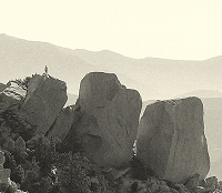
Bailey canyon 10/16/10
edit:
Morris Dam

http://www.reverencemedia.com/2010/11/1 ... -at-night/
Two lost hikers rescued
http://altadena.patch.com/articles/two- ... rs-rescued
"...two hikers were found by Search and Rescue around 7 p.m. last night near Chaney Trail. The adult male and female hikers, who live in Upland, got disoriented once it started getting dark and couldn't find their way back to the main trail.
"They are believed to be uninjured and in good health," said Shepherd. "Search and Rescue was able to locate them once the adult female found cell phone reception and called us."
Los Angeles Sheriff's Department Air Rescue V-20
video of Triplets Peaks rescue...should be noted that rescue video's containing more and more info..potentially including 911 calls and face of rescuee.
Other videos:
Trail Canyon Falls (9-12-2010)
The closed area is captured on video
Wind, Smoke, & Flaming Sunset
Hangliding north of upland
note regarding hawk:"There was a 3-month old Harris Hawk visiting from Torrey Pines w/ her trainers and a spectacular sunset that I also and edited in. "
More gates/closures/etc
Hike 98: Sawpit Wash
http://myown100hikes.blogspot.com/2010/ ... -wash.html
"Heading north, I found the walk about as scenic as you would expect a walk along a concrete drainage ditch. Interestingly, however, on the other side of the chain link fence, I saw a deer, munching on some grass and leaves. Yep, no doubt: The deer in Monrovia are tame. ....
The path north from Fooothill crosses above Greystone Avenue, and under Norembega Road. The wash slowly bends to the north. As you approach the Sawpit Canyon Debris Basin, the trail crosses through a fence (one of those with a step-through hole that I suppose is supposed to keep motorcycles and minibikes out but allow people, horses, or mountain bikes to pass through), then heads up to Canyon Blvd. From there, you've got about 2,000 feet until you reach the main entrance for Monrovia Canyon Park.
I was planning to catch the short, 1.5 mile trail from there to the falls. However, the trail was closed, so I had to turn around."
Pinecrest Gate to the Mt. Wilson Toll Road
http://corbamtb.com/news/2010/10/29/pin ... toll-road/
"....The Altadena Crest Trail Restoration Working Group has recently made their feelings on this foreboding gate known to the Mayor of Pasadena and other key government officials. CORBA fully supports their position, demanding that the gate be removed or replaced. .....Prior to the full-time closures in 2005, local neighbors and residents in the vicinity of the trailhead were given their own personal keys to the gate. The public at large were locked out from access to these public lands, while a privileged few were able to use the trail system as their own private playground any time they wished. This is still the situation today.
Being trapped behind the Pinecrest gate, especially after dark, is a continuing hazard for all trail users. A local resident has taken on the volunteer service of opening the gate in the mornings, and closing it again in the evenings around dusk. While we appreciate the generous actions of this local resident, we believe that he or she has no official authority to open or close the gate. That local resident just understands the dilemma and the need. At the same time, they are unable to provide consistent service (opening and closing at the same time each and every day), exacerbating the problem of having a closed gate. One can never be completely sure whether the gate will be open or closed....."
Do We Have to Exclude People to Save Frogs?
http://anuranblog.blogspot.com/2010/11/ ... -save.html
"....The Angeles National Forest recently released a draft Environmental Assessment of the closure that proposes to keep the area closed for at least three more years while the response of the Little Rock Creek frog population to the 2009 Station fire is monitored.This potentially open-ended closure of the area has upset several user groups, in particular the climbing community (e.g., Friends of Williamson Rock).....The Williamson Rock issue seems to have all the hallmarks of a situation where a suitable compromise is attainable"
Misc-
BI-MONTHLY FUELS DISCUSSION
http://gacc.nifc.gov/oscc/predictive/fu ... ussion.pdf
Maintained website of moisture content of brush in the mountains
Current conditions: 60-80% is moisture
AQMD
http://www.aqmd.gov/hb/2010/November/111026a.htm
"....Reforestation Project
Dr. Katzenstein provided a briefing on the reforestation project within the Station Fire area in the Angeles National Forest. This project was funded by AQMD using $1.5 million that Chevron paid as a mitigation fund for a refinery project at their El Segundo facility. The U.S. Forest service, through the National Forest Foundation, will replant 2,500 to 4,000 acres under this project. 470,000 seedlings are being grown to support this effort. Planting will occur in Spring 2011 and GHG reductions will be monitored and verified to ensure accurate quantification."
As the rainy season begins, Rubio Canyon wall still stands
http://www.altadenablog.com/2010/10/as- ... tands.html
-sparks fly over ? ....residents constructed wall south of Rubio canyon
snipet..."Mark Goldschmidt, president of Altadena Heritage, has called the construction of the wall a "desecration" of Rubio Canyon"
edit:
Morris Dam
http://www.reverencemedia.com/2010/11/1 ... -at-night/
Two lost hikers rescued
http://altadena.patch.com/articles/two- ... rs-rescued
"...two hikers were found by Search and Rescue around 7 p.m. last night near Chaney Trail. The adult male and female hikers, who live in Upland, got disoriented once it started getting dark and couldn't find their way back to the main trail.
"They are believed to be uninjured and in good health," said Shepherd. "Search and Rescue was able to locate them once the adult female found cell phone reception and called us."
Los Angeles Sheriff's Department Air Rescue V-20
video of Triplets Peaks rescue...should be noted that rescue video's containing more and more info..potentially including 911 calls and face of rescuee.
Other videos:
Trail Canyon Falls (9-12-2010)
The closed area is captured on video
Wind, Smoke, & Flaming Sunset
Hangliding north of upland
note regarding hawk:"There was a 3-month old Harris Hawk visiting from Torrey Pines w/ her trainers and a spectacular sunset that I also and edited in. "
More gates/closures/etc
Hike 98: Sawpit Wash
http://myown100hikes.blogspot.com/2010/ ... -wash.html
"Heading north, I found the walk about as scenic as you would expect a walk along a concrete drainage ditch. Interestingly, however, on the other side of the chain link fence, I saw a deer, munching on some grass and leaves. Yep, no doubt: The deer in Monrovia are tame. ....
The path north from Fooothill crosses above Greystone Avenue, and under Norembega Road. The wash slowly bends to the north. As you approach the Sawpit Canyon Debris Basin, the trail crosses through a fence (one of those with a step-through hole that I suppose is supposed to keep motorcycles and minibikes out but allow people, horses, or mountain bikes to pass through), then heads up to Canyon Blvd. From there, you've got about 2,000 feet until you reach the main entrance for Monrovia Canyon Park.
I was planning to catch the short, 1.5 mile trail from there to the falls. However, the trail was closed, so I had to turn around."
Pinecrest Gate to the Mt. Wilson Toll Road
http://corbamtb.com/news/2010/10/29/pin ... toll-road/
"....The Altadena Crest Trail Restoration Working Group has recently made their feelings on this foreboding gate known to the Mayor of Pasadena and other key government officials. CORBA fully supports their position, demanding that the gate be removed or replaced. .....Prior to the full-time closures in 2005, local neighbors and residents in the vicinity of the trailhead were given their own personal keys to the gate. The public at large were locked out from access to these public lands, while a privileged few were able to use the trail system as their own private playground any time they wished. This is still the situation today.
Being trapped behind the Pinecrest gate, especially after dark, is a continuing hazard for all trail users. A local resident has taken on the volunteer service of opening the gate in the mornings, and closing it again in the evenings around dusk. While we appreciate the generous actions of this local resident, we believe that he or she has no official authority to open or close the gate. That local resident just understands the dilemma and the need. At the same time, they are unable to provide consistent service (opening and closing at the same time each and every day), exacerbating the problem of having a closed gate. One can never be completely sure whether the gate will be open or closed....."
Do We Have to Exclude People to Save Frogs?
http://anuranblog.blogspot.com/2010/11/ ... -save.html
"....The Angeles National Forest recently released a draft Environmental Assessment of the closure that proposes to keep the area closed for at least three more years while the response of the Little Rock Creek frog population to the 2009 Station fire is monitored.This potentially open-ended closure of the area has upset several user groups, in particular the climbing community (e.g., Friends of Williamson Rock).....The Williamson Rock issue seems to have all the hallmarks of a situation where a suitable compromise is attainable"
Misc-
BI-MONTHLY FUELS DISCUSSION
http://gacc.nifc.gov/oscc/predictive/fu ... ussion.pdf
Maintained website of moisture content of brush in the mountains
Current conditions: 60-80% is moisture
AQMD
http://www.aqmd.gov/hb/2010/November/111026a.htm
"....Reforestation Project
Dr. Katzenstein provided a briefing on the reforestation project within the Station Fire area in the Angeles National Forest. This project was funded by AQMD using $1.5 million that Chevron paid as a mitigation fund for a refinery project at their El Segundo facility. The U.S. Forest service, through the National Forest Foundation, will replant 2,500 to 4,000 acres under this project. 470,000 seedlings are being grown to support this effort. Planting will occur in Spring 2011 and GHG reductions will be monitored and verified to ensure accurate quantification."
As the rainy season begins, Rubio Canyon wall still stands
http://www.altadenablog.com/2010/10/as- ... tands.html
-sparks fly over ? ....residents constructed wall south of Rubio canyon
snipet..."Mark Goldschmidt, president of Altadena Heritage, has called the construction of the wall a "desecration" of Rubio Canyon"

FYI...dirt doesn't burn.AW wrote:BI-MONTHLY FUELS DISCUSSION
http://gacc.nifc.gov/oscc/predictive/fu ... ussion.pdf
Maintained website of moisture content of brush in the mountains
Current conditions: 60-80% is moisture
11/21/2010 16:22 7 Vehicles In Closure/Snowplay Mill Creek Summit
11/21/2010 14:31 Filming ''Blind Drive''Little Tujunga Canyon mm 8.3
wrightwood forum:"Just received from Caltrans and it appears SR 2 is still open but requires chains:
SR-2 from Big Pine to Islip Saddle R-2 Snow Until further notice"
& "NWS prediction for Wed night looks mighty cold for this time of the year:
Wednesday Night
Mostly Clear
Lo 19 °F"
Had a post last week, but got stuck in internet ice and lost the post.
The AFH between Palmdale and Big Tujunga canyon got renamed for the fire-fighters but I didnt see anything about new signage or a new acroynm for it...."a segment of the Angeles Forest Highway will be renamed as the “Capt. Ted Hall and Engineer Arnie Quinones Memorial Highway.” ..my guess is HQMH for short.
Angeles Crest Highway to reopen as soon as December
http://the818now.com/2010/11/22/angeles ... -december/
"Angeles Crest Highway between La Cañada Flintridge and Mt. Wilson road will remain closed into December, state transportation officials said Monday......Recent rain has not caused any additional erosion, she added."
Streetcar to the Sky: 1913
http://www.shorpy.com/node/9389
-Mount Lowe, California, circa 1913. "Electric car at Ye Alpine Tavern, Mount Lowe Railway."
-also in comments section has video Cougarmagic posted.
Haunted Forest / Cobb Estate
http://laghostpatrol.com/2010/11/haunte ... bb-estate/
"...Reports of hauntings at the Cobb Estate are wide-spread yet, for the most part, non-specific in nature. People report negative feelings, being “watched” or even touched, strange lights, laughter, screams, along with tales of Satanic rituals and KKK gatherings...It became apparent that we were not alone: there were some kids with a stereo and a tambourine and the sound was audible throughout the estate....High up above us and to our right on the lower Sam Merrill trail, we could see the lights of hikers in the forest. This could explain the often reported lights – nothing paranormal about them. On the far curve of the paved road, we started to get random hits on the KII even though our phones were turned off and we were in an electricity-free area. We decided to try a EVP session here despite the faint radio noise. About 10 cold minutes into the session, we began to experience what can only be described as pebbles being thrown..."
City's trail loop almost finished
http://articles.lacanadaonline.com/2010 ... rail-users
"A new wilderness path now under construction between Verdugo Boulevard and Descanso Drive will, along with crossings planned for those streets, close the circle of a loop-trail system that extends for than 12 miles around Descanso Gardens, through Cherry Canyon, along Oak Grove Park and up toward the Angeles National Forest and back through town. Completion is set for early next year.....The push to complete a looped trail system "was envisioned by the city's residents even before its incorporation and appears in the city's first general plan in 1980..."
http://watershednews.blogspot.com/
scroll down past the tarantula to Nov14th, 2010 -'gale-force baldy'
"...At 10 a.m. on the 10,064-foot summit, the high point in Los Angeles County, walking and standing were challenging tasks. Wind-speed estimates among those on the mountain top ranged from 50 miles per hour sustained to 70 mph gusting.National Weather Service meteorologist Todd Hall, based in Oxnard, defined gale-force winds this evening as 39 to 46 mph.
"Forty-seven to 54 miles per hour is what we call a 'strong gale,' " Hall said in a telephone interview.
Further west in the San Gabriels earlier today, instruments at Chilao measured 30 mph sustained winds with 42 mph gusts, which also qualified as gale-force, Hall said.
Conversation below full-on shouting on Baldy's summit today was difficult, but descriptions of conditions up there later included the words "scary," "intense," and "freezing."...."
videos:
Stanley Miller Mine high trail
walk a short distance above the east fork narrows along Iron Mtn
San Gabriel Dam Pelton Closing
the closing of 4500CFS by closing the 'pelton' on the San Gabriel Dam
photo from postcard:Lytle Creek Canyon 1911

-
PackerGreg
- Posts: 623
- Joined: Sat Sep 12, 2009 9:31 pm
I was at the control room of Santa Anita Dam on the night of the big storm on December 9/10 2005 and Darryl the Dam Man was monitoring what other dams were doing as well as his. When I left, at around 2am, before the peak of rainfall, San Gabriel Dam was getting a 25,000 CFS inflow!AW wrote:the closing of 4500CFS by closing the 'pelton' on the San Gabriel Dam
-
cougarmagic

- Posts: 1409
- Joined: Wed May 07, 2008 5:21 pm
The photo postcard - looks like Bonita Falls, doesn't it?
Still checking the other links - as always, thanks for these posts!
An addition: http://www.altadenablog.com/2010/11/spe ... osium.html
The comment on this post is priceless:
Still checking the other links - as always, thanks for these posts!
An addition: http://www.altadenablog.com/2010/11/spe ... osium.html
The comment on this post is priceless:
Robby said...
I have news for anyone who expects me to pay to listen to the Forest Service talk about the Station Fire. I think the top of my head just blew off my skull.
-
realshafer

- Posts: 10
- Joined: Sun Aug 24, 2008 6:04 pm
I liked that video of the Stanley Miller High Trail. Does anyone know how to access that?
my guess is this: http://tinyurl.com/3xwr2q9