OC Hike #1

Discuss SoCal ranges other than the San Gabriels.
Post Reply
User avatar
Hikin_Jim
Posts: 4686
Joined: Thu Sep 27, 2007 9:04 pm

Post by Hikin_Jim »

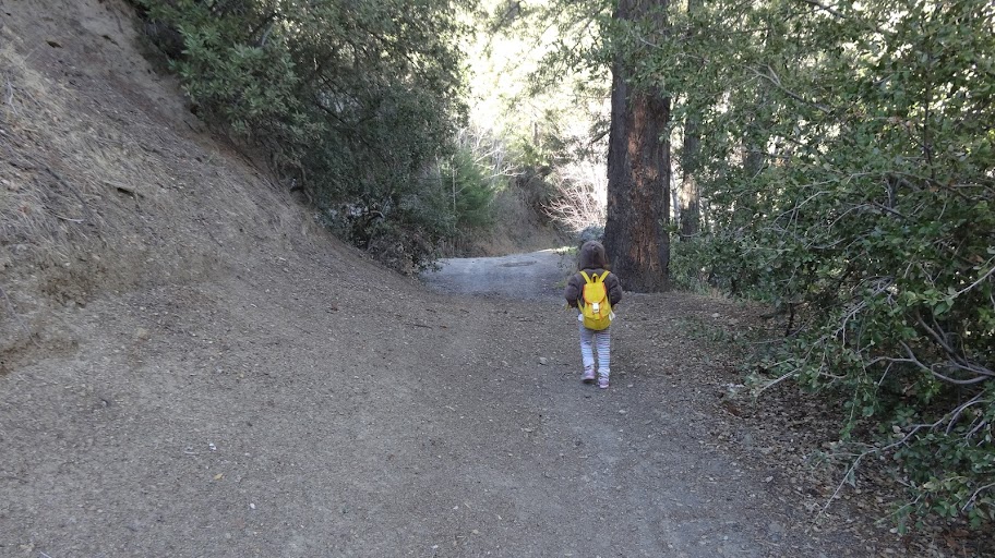
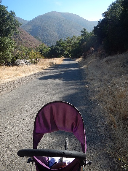
Took my first semi-real hike since moving to the OC two weeks ago. Went to Silverado Canyon. There's a visitor center there (pretty small but nice volunteer) and a fire road that goes up the canyon. Didn't know it, but the fire road is open to the public. So, we played "dodge car" through out the hike. Uh, this route not recommended. But there was some cool stuff. And I had a really rad hiking partner.
Image

I was actually fairly impressed with the number of Douglas Firs down in the canyon.
Image

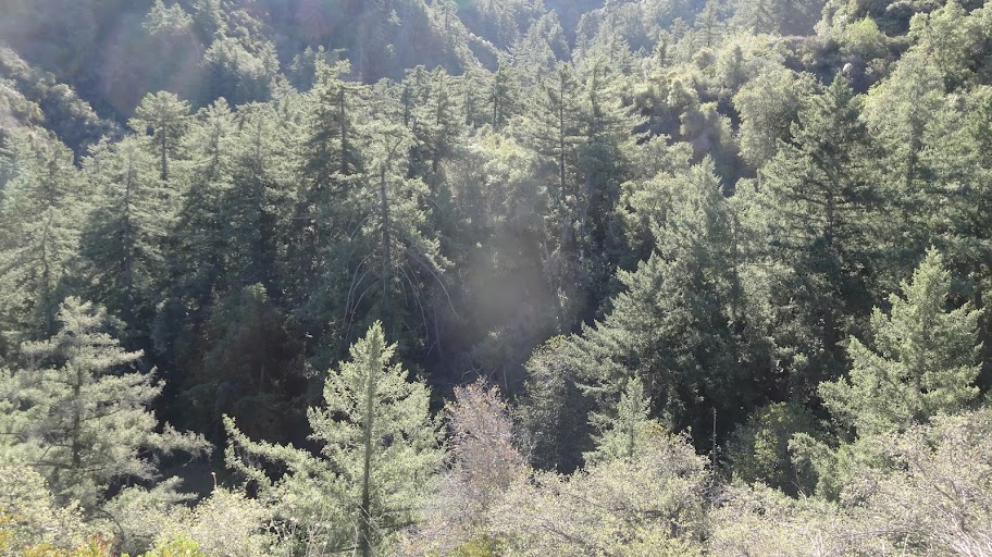
The vegetation and terrain reminded me of some kind of a cross between the Sta Monica Mountains and the front range of the San Gabriels.
Image

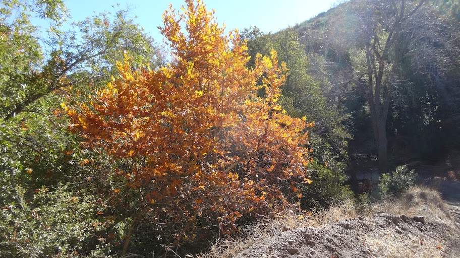
There was even some fall color.
Image

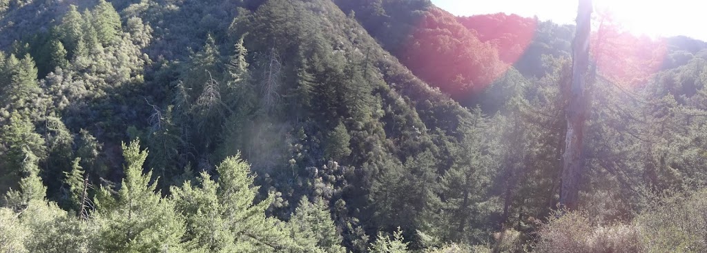
There were some good views off to the north once we got up higher.
Image

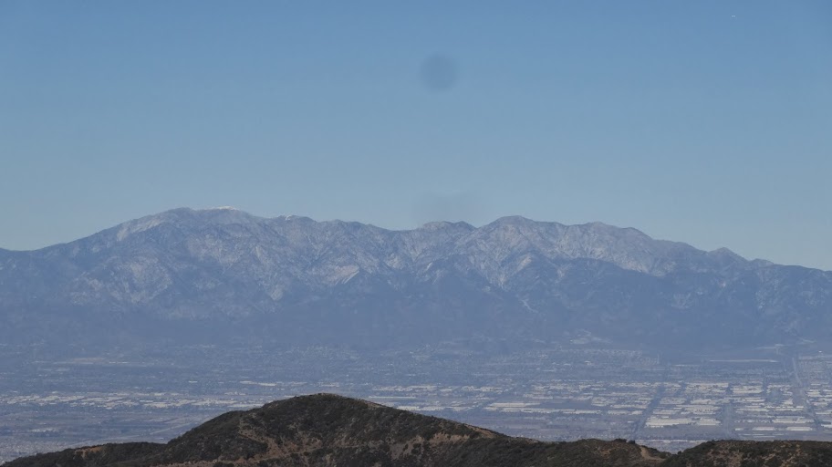
More on those views under separate cover.

HJ
User avatar
scottawr
Posts: 115
Joined: Tue Nov 12, 2013 12:41 pm

Post by scottawr »

http://mapper.acme.com/?ll=33.74728,-11 ... tains%20CA

Silverado motorway goes up the hill and meets the main divide road near bedford peak. maple springs road is the partially paved road in the canyon bottom.

cant quite figure out where you went.
User avatar
Hikin_Jim
Posts: 4686
Joined: Thu Sep 27, 2007 9:04 pm

Post by Hikin_Jim »

We went up Silverado Canyon on Maple Springs Road. The road follows the canyon at first, then climbs out of the canyon. We drove up the road a ways, but it was a bit too rough for my Honda Accord, so I pulled over in a large turn out, and we walked from there.

Interesting hiking, but I wouldn't recommend it on weekends where the road is open to motor vehicles. Some guys were getting pretty crazy back in there. A little uncomfortable a couple of times.

We only hiked about 4 miles round trip, but Joyce did it entirely under her own steam, which daddy appreciates very much.
Image

HJ
User avatar
scottawr
Posts: 115
Joined: Tue Nov 12, 2013 12:41 pm

Post by scottawr »

I run on the maple spring road on weekdays from time to time.

Image
User avatar
RichardK
Posts: 727
Joined: Sun Sep 30, 2007 12:33 pm

Post by RichardK »

Next time, turn up the old Silverado Motorway. There will be no vehicular traffic. The remains of the road are much too rough for that. Just watch out for mountain bikes on the blind curves. Welcome to the O.C. :D
User avatar
tekewin
Posts: 1189
Joined: Thu Apr 11, 2013 5:07 pm

Post by tekewin »

Nice photos, HJ.

Shortly after Maple Springs turns to dirt, maybe half a mile up, there is a use trail on the right that leads to Modjeska. It crosses the road a few more times and turns into a fire break just before the junction with Main Divide.

Nice to see your daughter is self powered. I can't believe some of the places you carried her. :o
User avatar
Hikin_Jim
Posts: 4686
Joined: Thu Sep 27, 2007 9:04 pm

Post by Hikin_Jim »

Yeah, I saw that firebreak/trail on a satellite photo -- after the hike. Maybe next time.

I've carried Joycie above 10,000' in the Sierra in the snow. That was interesting. :)

HJ
User avatar
Mike P
Posts: 1005
Joined: Tue Oct 02, 2007 10:48 pm

Post by Mike P »

Very nice, HJ. Joyce gets taller every time you show a picture of her!
User avatar
Hikin_Jim
Posts: 4686
Joined: Thu Sep 27, 2007 9:04 pm

Post by Hikin_Jim »

She's getting big all right. She pooped out on a recent hike, and I carried her up hill for three miles. Ouch.

Of course now that she's older, she can prepare my favorite (ahem) "gourmet" lunch. :)

Image

HJ
User avatar
Mike P
Posts: 1005
Joined: Tue Oct 02, 2007 10:48 pm

Post by Mike P »

Very nice! Has she mastered white gas stoves yet?
User avatar
Hikin_Jim
Posts: 4686
Joined: Thu Sep 27, 2007 9:04 pm

Post by Hikin_Jim »

Why do you think I call her "my little Svea?" ;)

HJ
Post Reply