

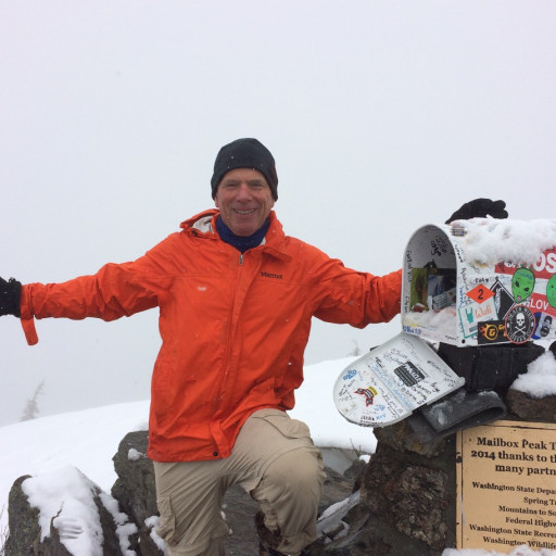
I lost my "wallet" (plastic zip lock bag) on Sunday somewhere near Sitton Peak (off of Ortega Hwy in the Cleveland National Forest). No doubt some noble hiker is trying even now to return it to me. Well, hope springs eternal anyway.
Pass the word if you know anyone who hikes near Ortega Highway. Can't hurt, right?
HJ
Lost Wallet, Sitton Peak
Thank you, Jerry.
Here's a sketch of my approximate route. I may have lost the wallet on top of the peak when I took a pen out of my pocket to write in the summit register.
-- or --
I may not have put things back in my pocket securely after getting my pen out and my "wallet" (plastic zip lock baggie) fell out in the area marked "heavy brush". Uh, and when I say "heavy", I mean heavy. I wouldn't expect you to go in there. I was looking for a better way down than the really steep trail. This wasn't it.
HJ
That's my thought, that it's in the brush. I'll send you my GPS track if you like. GPS is only about +/- 20 feet, but I'd have followed the path of least resistance through the brush, so it may be possible to approximate my track fairly closely.
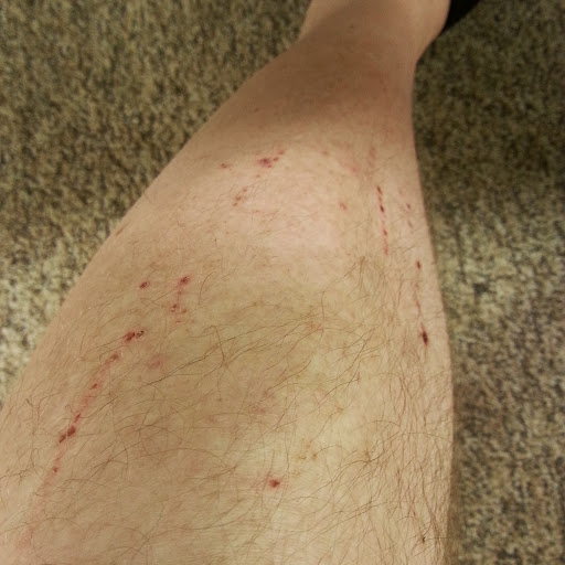
NOTE HOWEVER that the brush is pretty darned thick over there. The worst of it might be only 0.1 miles, but it's pretty bad. It was over my head, and I'm a six footer. For the last 10 feet before re-joining the road, I had to crawl on my hands and knees. I would not expect anyone to go through that brush on my behalf. If however you did find it there's a steak dinner and a beer (at least!) in it for you.
HJ
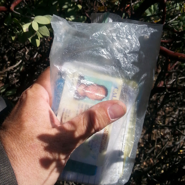
The wallet was along my XC bushwhacking route in heavy brush. I found the wallet at waypoint 19.
The way I found it was:
1. Prayed a lot
2. Follow my GPS track (which is accurate +/- 20')
3. Prayed some more
4. Track myself -- look for broken branches and logical routes.
5. Kept on praying.
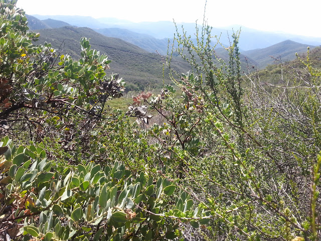
Here's a photo I took as I descended from Sitton Peak via my XC route that shows some of the brush. It was pretty darned thick once I got off the ridge top.
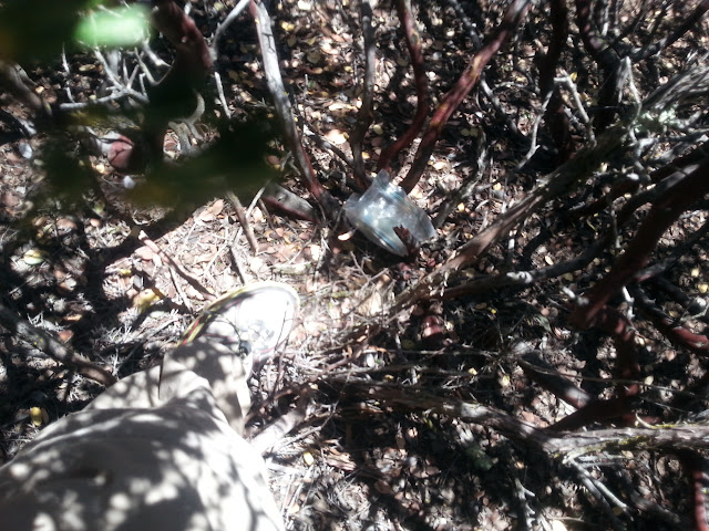
And here's my "wallet" as I looked down and saw it.
And here's the big grin after I found it. Notice how the brush is higher than my head. I had to get down at one point and butt scootch along the ground below the level of the foliage in order to make forward progress. Yeesh.

Bottom line? God smiled on me.
HJ
The way I found it was:
1. Prayed a lot
2. Follow my GPS track (which is accurate +/- 20')
3. Prayed some more
4. Track myself -- look for broken branches and logical routes.
5. Kept on praying.
Here's a photo I took as I descended from Sitton Peak via my XC route that shows some of the brush. It was pretty darned thick once I got off the ridge top.
And here's my "wallet" as I looked down and saw it.
And here's the big grin after I found it. Notice how the brush is higher than my head. I had to get down at one point and butt scootch along the ground below the level of the foliage in order to make forward progress. Yeesh.
Bottom line? God smiled on me.
HJ

Fess up Hikin' Jim.... you were determined to find your wallet because you had some soon-to-expire Arby's coupons in there... ?
Hey, don't be embarrassed --- I'd risk my life on Eaton Canyon's Razorback if I knew there was a stash of coupons for Arby's Curly Fries up there somewhere... ?
Hey, don't be embarrassed --- I'd risk my life on Eaton Canyon's Razorback if I knew there was a stash of coupons for Arby's Curly Fries up there somewhere... ?
A "Road ID" isn't a bad idea. With trail head break ins an unfortunate reality in Southern California, I think I'll continue to carry a "hiker's wallet" (Ziploc with ID, insurance, cred card, and cash), but I'll put it in my pack not my pocket.
HJ

We were in Icehouse Canyon for the first time this year on Wednesday. There were signs posted warning about car break-in's.With trail head break ins an unfortunate reality in Southern California, I think I'll continue to carry a "hiker's wallet"
Yeah, "interesting" (lol) is right. It took me an hour and a half to go maybe a quarter mile from the peak back to the road. I was looking for an easier way down.
There is something of an old trail along the ridge top, but it's harder and harder to follow as one descends. I finally said "screw it" and tried to plunge through the brush down to the old road below. Maybe it's 0.15 miles or so. But it's THICK. And slow. Really slow.
I'm now a GPS believer, although I won't discount the power of prayer either. I had the GPS in my hand and could tell if I was getting off track. The GPS enabled me to get into the right drainage, and then I just followed the drainage down to the road. Very close to the road was... my wallet.
HJ
Arby's is all right, but that doesn't justify Razorback. Now 31 Flavors coupons...outwhere wrote: ↑Fess up Hikin' Jim.... you were determined to find your wallet because you had some soon-to-expire Arby's coupons in there... ?
Hey, don't be embarrassed --- I'd risk my life on Eaton Canyon's Razorback if I knew there was a stash of coupons for Arby's Curly Fries up there somewhere... ?
HJ
I've been lucky so far, but friends of mine have been hit. It really sucks.
Don't leave anything of value in the car, and certainly don't leave anything showing. If you have a lockable trunk (i.e. you can disable the trunk release inside the car), lock it so that the trunk can't be opened even if they get in the car.
Too bad that tar and feathers have gone out of style...
HJ