

Mountain fire road to be cleared
By Dan Abendschein, Staff Writer
PASADENA - Too late for this summer, but a fire road closed by landslides 3 1/2 years ago could be ready for use by hikers, bikers and horse-back riders by August of next year.
The Mount Wilson Toll Road will receive $1.48million in improvements through a grant from the Federal Emergency Management Agency approved this week by the Pasadena City Council.
Work to clear the storm-caused landslides is scheduled to begin in October and continue through April.
The road likely will open in August 2009, after Los Angeles County officials complete work on a section owned by the county, said Chief John Todd of the county Fire Department's Forestry Division.
"Once (Pasadena) has done the work on the bottom of the road it will be easier for us to get our work vehicles in there," he said.
The city owns and maintains the bottom part of the road while the county Fire Department maintains the upper part. It also has a facility at Henninger Flats, an area about 1,400 feet above Eaton Canyon.
Todd said the county plans to use its own equipment and labor to do the work. No cost estimate has been made at this time, he added.
Bernard Melekian, the interim city manager of Pasadena, said the city's main concern with opening the fire road is to ensure
Advertisement
firefighters can get up into the hills in case of a blaze.
"If it were just about getting the trail back to hikers we probably wouldn't be acting, because I think they can still get up there without any problems," Melekian said.
Hikers still can access the road above the major landslide by taking a steep equestrian trail near the Eaton Canyon Nature Center, according to Mickey Long, a county parks and recreation administrator who is based at Eaton Canyon.
Once they reach the toll road they technically are not allowed to go any farther, although no signs that say it is closed appear until higher up the road. Hikers frequently go up to Henninger Flats, according to Long.
"We hear they are going up there all the time," said Long. "The county has told us it really isn't safe for hiking."
About five or six hikers were spotted on the trail within an hour period .
Dolores Bravo, 52, a teacher from Alhambra, said she was hiking the trail for the first time and had no idea it was supposed to be closed.
"It was a nice, wide road, and then it suddenly became more like a goat trail," Bravo said after hiking through a section of the trail that was washed out.
A sign warning of the trail's danger was posted on the other side of the washed-out area.
At this week's council meeting, city officials also considered a $732,107 contract to rebuild a collapsed bridge along the Arroyo Seco in the recreation area behind the Jet Propulsion Laboratory in La Ca ada Flintridge.
The bridge collapsed during the same stormy winter of 2005, about a month after the toll road was washed out. It is used by hikers and maintenance vehicles to access National Forest areas.
The council delayed action on the item, however, after several council members on the Finance Committee asked for more detailed financial information on the contract, according to Melekian. It likely will be considered at Monday's meeting, he said.
on a recent morning dan.abendschein@sgvn.com
Mt. Wilson Toll Road (2N45)
From the San Gabriel Valley Daily Tribune

-
FIGHT ON
That will be cool but.
They don't open the gate at Pinecrest Dr. early enough. Most of the time it's not open when it's supposed to be anyways so what's the diff?
They don't open the gate at Pinecrest Dr. early enough. Most of the time it's not open when it's supposed to be anyways so what's the diff?
Dan Simpson has posted this note on his website...
On August 12, 2008, the Board of Supervisors approved the repairs and restoration of the Mt. Wilson Toll Road. Work is scheduled to begin in October 2008 and be completed by April 2009. We'll see.


You are absolutely correct. This whole side of Harvard looks very dangerous, lots of loose rocks ready to come down. Not a place to be when it rains.HikeUp wrote:Yeah, that'd leave a mark. Looks like it is near where the road traverses around Mt. Harvard?
-
Terry Morse
- Posts: 126
- Joined: Mon Mar 03, 2008 8:55 pm
I've heard that the Pincrest gate is closed until further notice and that the toll road is closed to hiking. Has anyone been there in the last few days and is this report true?
-
Terry Morse
- Posts: 126
- Joined: Mon Mar 03, 2008 8:55 pm
Thanks, Matt. I'll check it out this weekend then.
Can you get to the toll road from Pinecrest or do you need to goto Eaton canyon or the little spot off Altadena drive? Also where does the trail go that is at the end of Glenallen Ln? I saw it when we were doing a job right there and could see that it went north and south and had a trail sign but I couldnt leave the job to go look at it. I havent been up that way since boy scouts in the 80's and thinking of going up there after work tomorrow.
Thanks!
Thanks!

Unless something has changed recently, you can enter the Mt. Wilson Toll Road from Pinecrest. That's how I typically do it. They do lock the gate at sunset, and I have gotten locked in before.yobtaf wrote: ↑Can you get to the toll road from Pinecrest or do you need to goto Eaton canyon or the little spot off Altadena drive? Also where does the trail go that is at the end of Glenallen Ln? I saw it when we were doing a job right there and could see that it went north and south and had a trail sign but I couldnt leave the job to go look at it. I havent been up that way since boy scouts in the 80's and thinking of going up there after work tomorrow.
Thanks!
You can go in via Glenallen Ln, but it's a looong way out of your way. Glenallen is my "plan B" if I ever get locked in. You can also exit down by the nature center if you get locked in. I'm not sure if the little spot off Altadena gets locked at night or not.
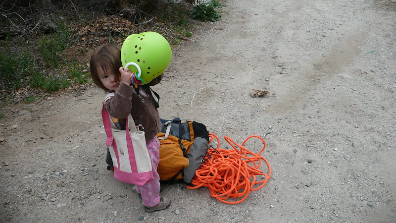
I might be out on the trail in the area tomorrow. Look for a guy with a little 2 year old girl. Of course I'll probably recognize you first based on your avatar.
HJ
-
PackerGreg
- Posts: 623
- Joined: Sat Sep 12, 2009 9:31 pm
What part of "public land" don't they understand?
Yeah, Joyce is pretty majorly into canyoneering, so we just dropped straight down the creek.
Maybe that's why you missed us.
HJ


The Mt. Wilson Toll Road suffered a lot of damage between Pinecrest and Henninger. Many big landslides cover the road and some sections have deep ruts. Last week it was still passable by foot and bike, but not by car. I'm guessing that County will clear the road after these storms, so that fire department vehicles can reach Henninger.