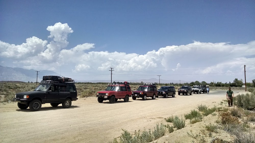
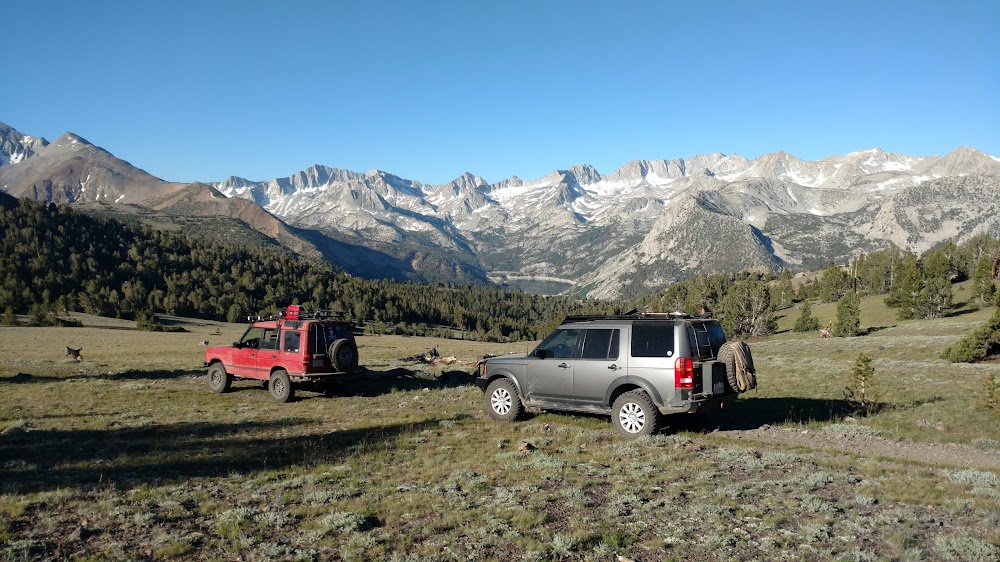
I'm taking a group of friends up to this area to dispersed camp and explore the roads, old mines and lakes over the 4th of July weekend. Having never been up to the Flat before I thought it best to do a recon run to scope out the best campsites and get some boots on the ground info about trail conditions. I met up with a fellow Land Rover owner in Bishop on Saturday and proceeded to escape the heat and head up Coyote Valley Road to the Flat. We started up the hill around 13:00, eager to leave the heat of the Owens Valley below.
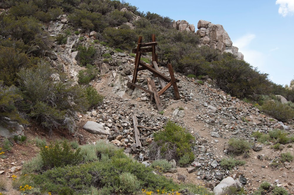
On Saturday we concentrated on the north western part of the area, first driving up past the remains of the Salty Peterson Tungsten Mine and then checking out the area around Coyote Lake. From the ridgeline due south of the Dry Coyote Lake bed you can look down onto the basin where Rocky Bottom Lake is located and lived up to its name with no water present. You can also see the area near Funnel Lake from this vantage point, but due to the headwall on the north west shore of Funnel Lake you cant see the lake itself from this point. With that done we backtracked to the main road and headed north towards Lookout Mountain initially, driving on the established tracks through meadows and stands of pine trees then contouring around the north end of Coyote Ridge and heading south to where we explored Schober Mill and & Mine sites which are due east up the hill side from South Lake Road. All that remains at the mill site is an old tin cabin and the mine site itself had a bit of mining errata spread here and there. With that leg of the open trail checked out we proceeded back the way we came and at the next main junction in the track we proceeded to switchback up the west side of Coyote Ridge and then followed the meandering track south as it undulated over the tops of the ridglines and plunged down to the valleys below. Finally after a little bit more of a climb and pushing through some small patches of snow that remained in the shadows we finally crested the hill and came to where the road ends, due north of Green Lake. A few of us are planning on day hiking Vagabond and Cloudripper on Sunday the 3rd so I wanted to make sure the track was clear all the way to the end where we plan on parking and heading up and catching the trail that comes up from Green Lake across the plateau. We stopped here and let my friends dog out to run around for a bit, and braced ourselves against the stiff winds that were blowing. At this point it was now 18:00 and we needed to retrace the track back the way we came to make it to Funnel Lake where we planned to camp for the evening. It's funny how the first time you go somewhere new it seems to take forever, but on the way back it seems much shorter even though it's taken the same amount of time. I find this to be true whether i'm driving or hiking and such was the case here as the drive back down Coyote Ridge, past Coyote Lake, Salty Peterson's mine and the track next to Coyote Creek seemed to fly by. Now we were heading south on the main track onto the Flat proper. We got about midway down and then reached the northern track that leads to Funnel Lake. The track started fine, then slowly deteriorated to the point while still an obvious track it was littered with rocks the size of volley balls which made the final 2 miles into Funnel Lake very slow going. We finally arrived at Funnel lake to find we had the entire area all to ourselves right before Sunset. The high clouds which had lingered all day and promised to make an impressive sunset to photograph blew out within the last hour of daylight and left us with a clear sky as it got dark. We setup camp, ate dinner, and had some scotch and cigars around a small campfire in one of the established fire rings. My compatriot David was feeling the altitude and decided to call it a night at about 10:00 just as the moon was rising over the ridgline. I stayed up and started t read a book I picked up at the Visitor Center in Lone Pine and tended the fire until it burned down to a point it could be easily extinguished around midnight. When I finally retired to my tent I checked the temp and at that point it was 38 degrees.
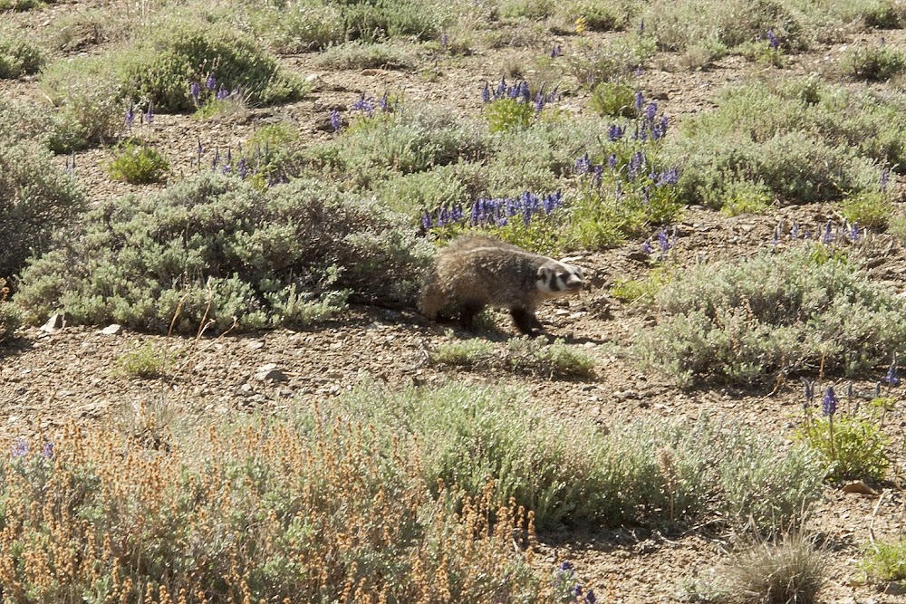
We awoke at 6:00 to bluebird skies, a little wind and the temp already up to 50 degrees. We ate breakfast, packed up camp and gave the trucks a once over before heading out. My compatriot needed to replace the bolts that held his drive shaft to his rear diff so he sorted that and we were underway at by 8:30. We proceeded to exit Funnel Lake via the southern track which while rough, was a much easier drive out than the route we took in. Finally back onto the main flat and crossing the end of the old air strip I saw some movement in the scrub brush to my right. I stopped and spotted a Badger out and about. Was neat to see one in the wild. We continued south down the flat towards Baker Creek to check out possible campsites near there. My friend was still feeling a bit off due to the altitude so he stayed near where the track crosses a creek on a bridge and I went ahead by myself to scope out the campsites. The views at this point were stunning with Middle Pal and Norman Clyde Peak and the associated Glaciers peaking out from the south side of Mt. Alice and Mt. Sill popping up above the ridgeline of Sky Haven with Cloudripper and Vagabond Peak looming over the valley where Baker Creek ran. With the campsites checked out I headed back the way I came to meet back up with my friend and head north up the flat towards the exit down the hill back to Bishop. Near the north end of the flat there was one more possible campsite that I went and checked out which ended up being the perfect place, flat with plenty of room, surrounded by foxtail and lodgepole pines which ringed which at one time was a small pond, but now has turned into a meadow. With the last place checked off of our list we went back down the rough track of Coyote Valley Road switchbacking our way down the hill until we were back down to Bishop. We fueled up at Vons, grabbed a bite to eat and then headed back down the 395 and 14 home to the LA area.
All in all a great trip and a wonderful area to explore. Cant wait to get back up there to see some of the other areas that had to be bypassed due to time constraints.
A few pics:
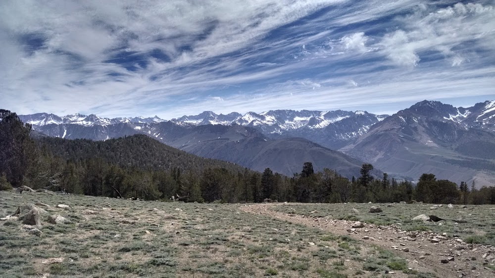
Looking across the valleys where South Lake and Sabrina Lake are located, with the Sierra crest spreading as far as the eye can see..
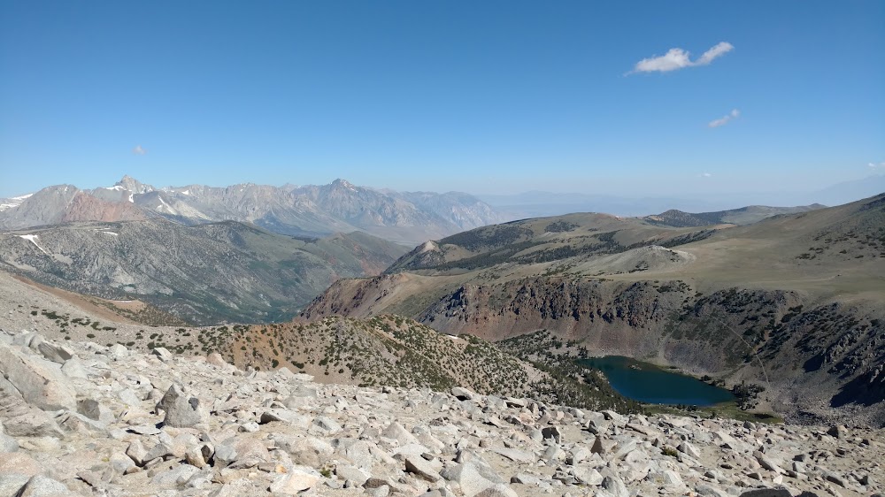
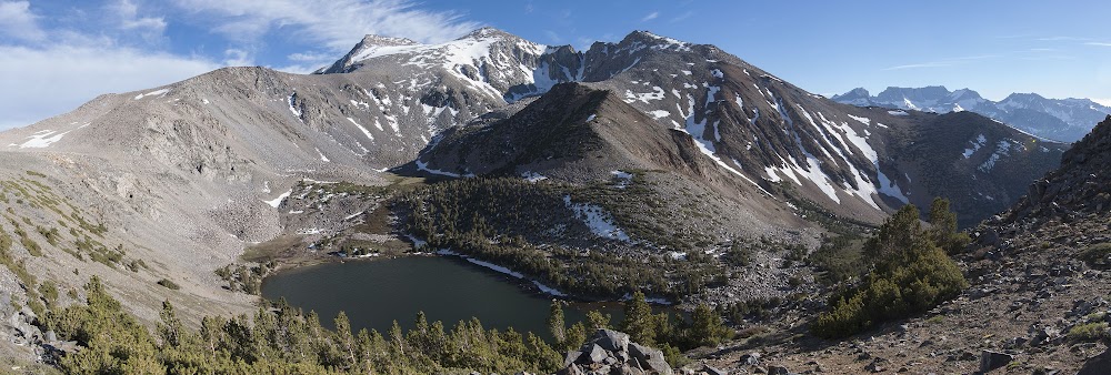
Green lake with Vagabond peak being the highest peak to the left.
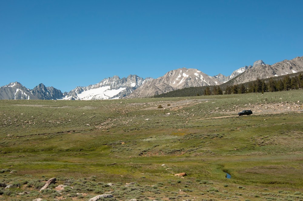
Looking south along Coyote Ridge
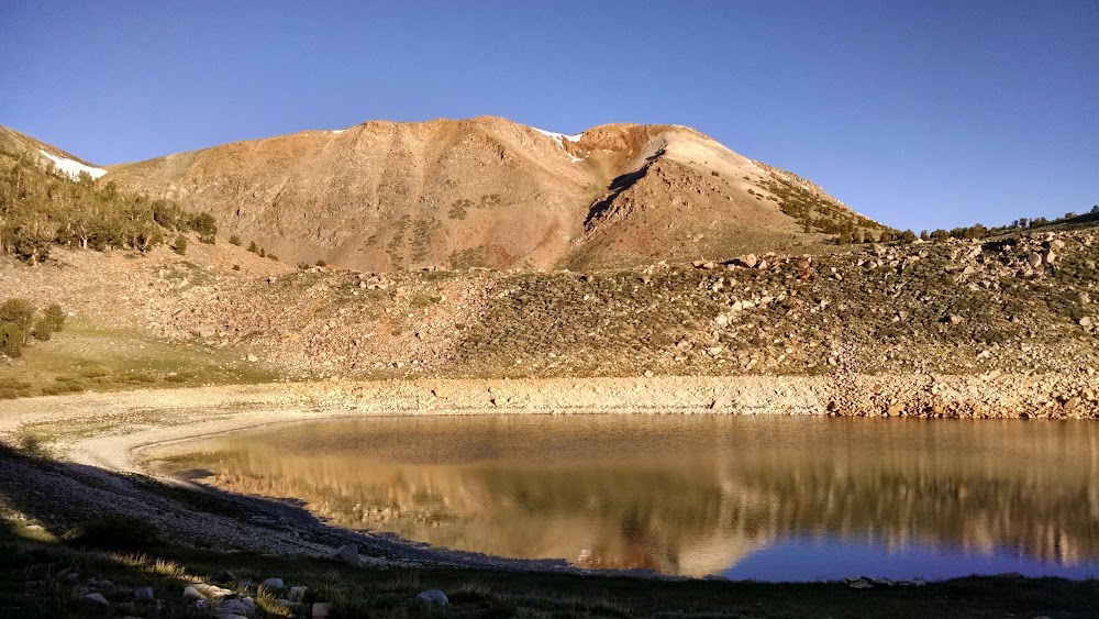
Funnel Lake
There be Badgers!!!
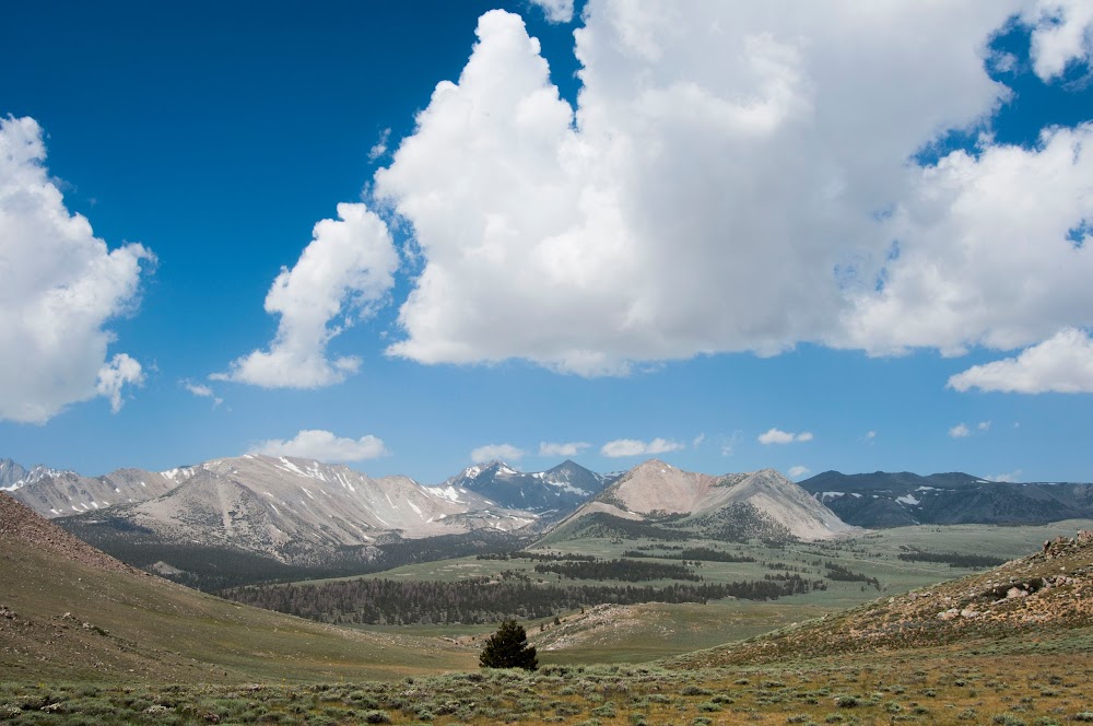
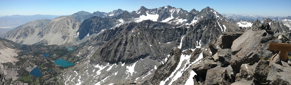
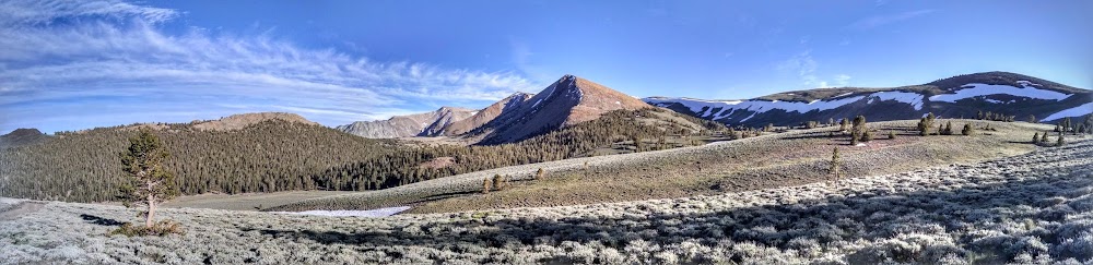
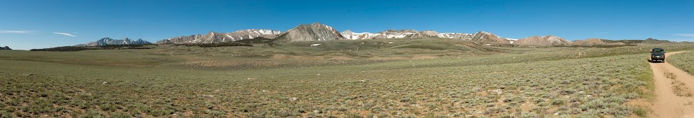
Long pano going from south to north with the Palisades, Inconsolable Range and Coyote Ridge visible.
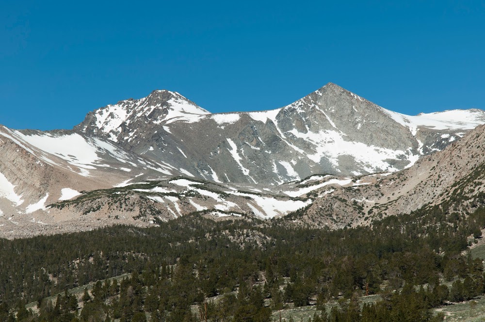
Cloudripper on the Left and Vagabond Peak on the right.
View across the south end of the meadow to the Palisades and the Middle Pal & Norman Clyde Glaciers to the left and Mt. Sill sticking up from behind the ridgeline of Sky Haven.
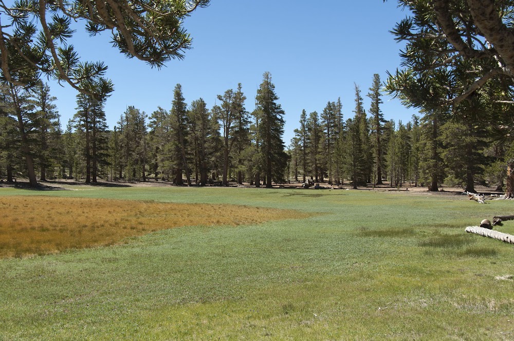
Looking south across the meadow towards a nice campsite area nestled within the foxtail and lodgepole pines: