Telescope Peak: a feat of strength

Archived TRs for desert ranges.
Post Reply
User avatar
dima
Posts: 1303
Joined: Wed Feb 12, 2014 1:35 am

Post by dima »

This has been mostly covered elsewhere, but I'll cover it again; with pictures!

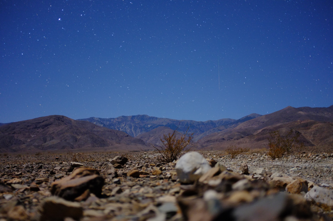
We started well before dawn from Shorty's Well (Death Valley floor, -262ft elevation). The moon was bright enough to make headlamps unnecessary, and you could see around you, but not so much the mountains themselves. Apparently if it was daytime, the top of Telescope Peak itself and the main approach ridge would be visible early on:

Image

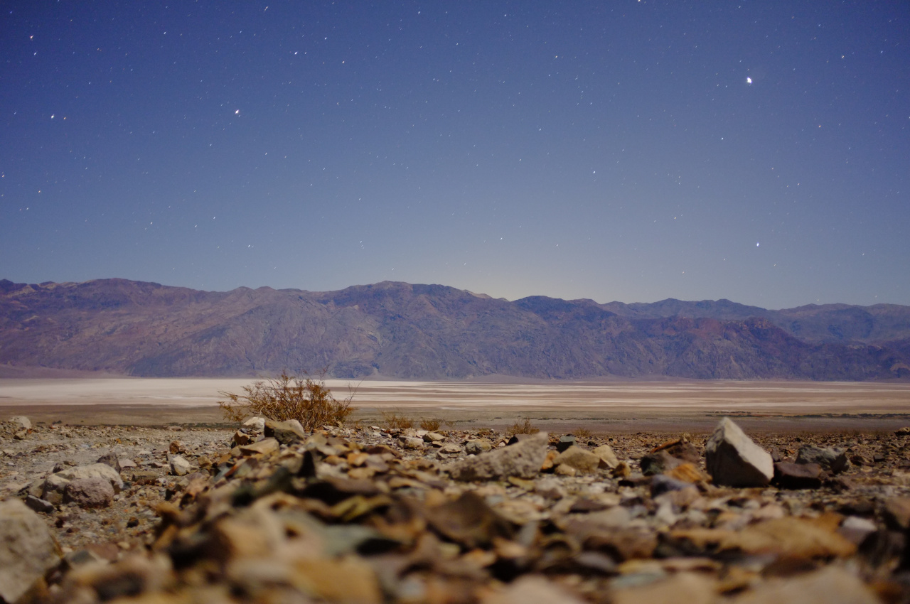
The beginning of the route climbs the gently-sloping valley floor to the mouth of Hanaupah canyon, and Badwater lake becomes defined early:

Image

The sun came up when we were following the old mining road in the canyon:

Image

Eventually you get to the end of the road (signed), and soon after that to Hanaupah spring and Shorty's mine. The spring is flowing well, and the mine is cool:

Image

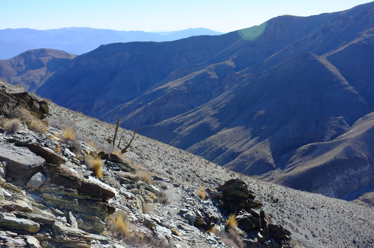
There are numerous passages inside, but nothing especially exciting. At the spring you take a right turn, and scramble straight up a loose side ridge to the top of an East-West ridge that (eventually) leads to the main ridge the peak is on. This is steep and full of scree. We're still in the desert, so brush isn't much of a problem:

Image

Image

The rest of the route becomes visible at the top:

Image

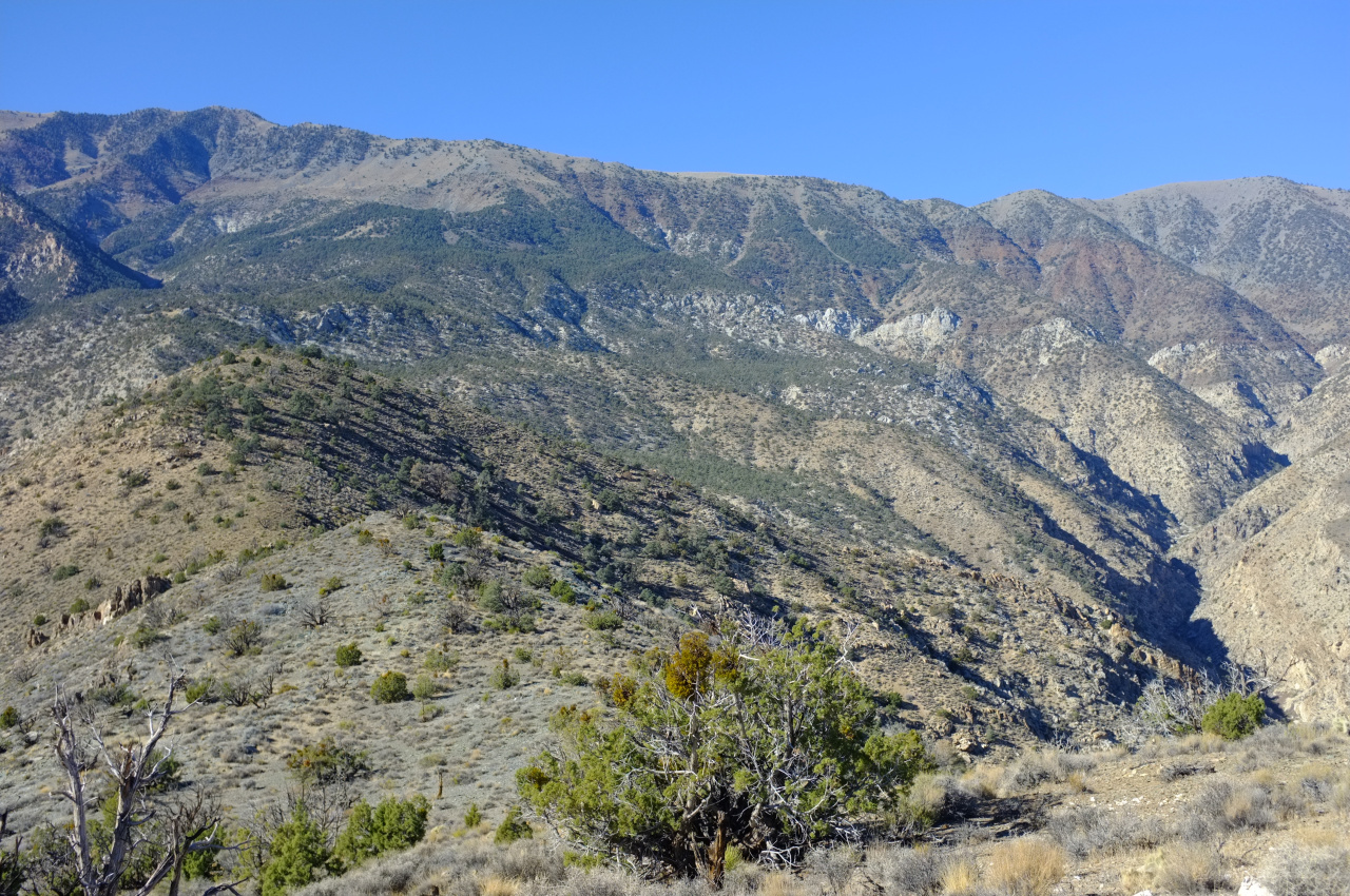
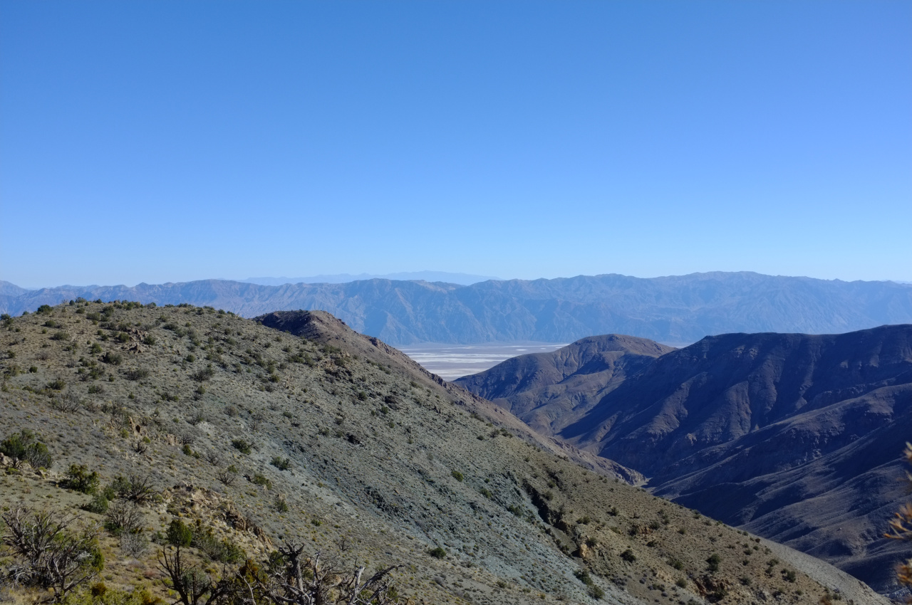
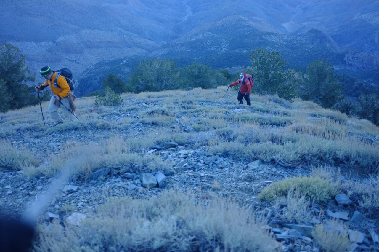
You follow the rolling ridgeline (left of the photo), then turn right in the wooded area, then ascend to a bump on the main ridge about 1/3rd of the way from the left. As you climb, Badwater lake becomes more and more visible:

Image

Image

Image

Image

The final climb to the main ridge begins abruptly at the end of the wooded section. This is all made of loose scree and is very very steep. The photos don't tell this story at all:

Image

Image

There isn't much animal life up there, but some deer hung out long enough to lose an antler:

Image

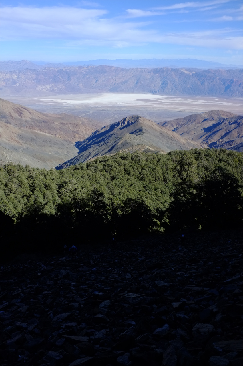
At the main ridge you hit the main trail, and switchback the final 1000' of gain to the peak. There are some cool pines here

Image

The views are amazing, and during sunset everything has an extra-special glow (or maybe it was just the fatigue, the thin air and the totally unreasonable cold and wind):

Image

Image

Image

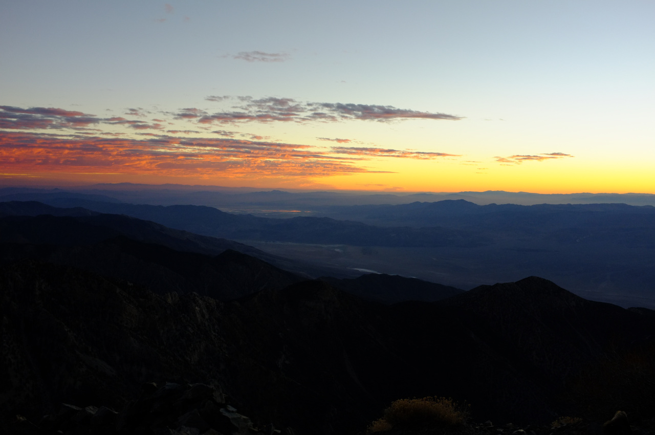
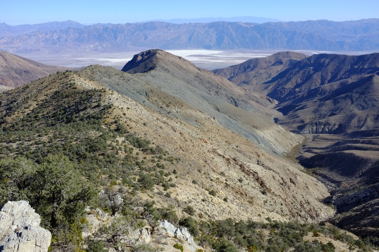
And finally from top you can see much of Death Valley sprawled out in front of you. Hard to believe this started all the way down at the bottom:

Image

It was cold, but snow-free. This would change soon; the following morning this was the scene looking up Hanaupah canyon from Shorty's well:

Image

So yeah. This route is kinda like C2C, except longer, with more elevation gain, steeper, off-trail, more remote and with better views from the top. Maybe it's not like C2C at all.
User avatar
RichardK
Posts: 727
Joined: Sun Sep 30, 2007 12:33 pm

Post by RichardK »

That is one tough hike. Congratulations! The starry sky pictures are great, the first one even captured a meteor.
User avatar
Uncle Rico
Posts: 1386
Joined: Thu Mar 20, 2008 7:48 pm

Post by Uncle Rico »

Wow. Long day. Beautiful pics.

It was very cold when I was on that peak as well. But I cheated and came up from Mahogany Flat. :P
User avatar
scottawr
Posts: 115
Joined: Tue Nov 12, 2013 12:41 pm

Post by scottawr »

nice trip! im sure sunrise on that route was breathtaking.
User avatar
tekewin
Posts: 1188
Joined: Thu Apr 11, 2013 5:07 pm

Post by tekewin »

Really great photos, Dima. That first one looks like a postcard.

Awesome hike!!
User avatar
JerryN
Posts: 200
Joined: Sun Nov 11, 2012 4:01 pm

Post by JerryN »

this was really epic Dima...nice hike
User avatar
Girl Hiker
Posts: 1297
Joined: Fri Apr 04, 2014 7:46 am

Post by Girl Hiker »

Very nice Pics. My favs are the steep slope with the scree, the Rolling ridgeline and not to mention the orange glow from the sun.
I've been wanting to do Telescope Peak for a long time now, with or without Sean :)
User avatar
Edward
Posts: 42
Joined: Sat Oct 11, 2014 11:02 am

Post by Edward »

Can't tell you how impressed I am by people who descend the same way. When I did it in 1977, we set up a car shuttle and descended to Mahogany Flats. I admit, it is a lot of extra driving. I am puzzled by the references to the scree slope found in everybody's route descriptions today. The final ascent to the ridge was steep, but I don't recall it as difficult scree. And although my memory could be wrong, I thought we hit the ridge south of the summit, not on the trail side.
User avatar
Edward
Posts: 42
Joined: Sat Oct 11, 2014 11:02 am

Post by Edward »

Ed wrote: I am puzzled by the references to the scree slope found in everybody's route descriptions today. The final ascent to the ridge was steep, but I don't recall it as difficult scree. And although my memory could be wrong, I thought we hit the ridge south of the summit, not on the trail side.
The link below explains it. The route has not changed, but people are tending to take a different route. Why people tend to take the scree slope today puzzles me, as it seems to puzzle Piero Scaruffi below, who describes both routes.

http://www.scaruffi.com/travel/shortys.html
User avatar
Edward
Posts: 42
Joined: Sat Oct 11, 2014 11:02 am

Post by Edward »

I reread Scaruffi's route description. Like Scaruffi, we followed a road leading up from Hanaupah Springs. But after that our route differed from Scaruffi's. My recollection is that the road petered out on a ridge, after that we followed the ridgeline, which had a few dips in it. We gave up on the ridge after it turned into a pine forest, which had laid a thick bed of slippery pine needles on the ground, making for poor footing walking uphill. Traversed right (northwest), until we came to a long slope leading up to the summit ridge. Seemed like a very long slope, but that may be because we were fairly played out by then. I'm sure we hit the ridgeline south of the summit, not north on the trail side, and followed it cross-country to the summit. I checked the topo, it seems consistent with my memory.
Post Reply