Spectre

Archived TRs for desert ranges.
Post Reply
User avatar
dima
Posts: 1304
Joined: Wed Feb 12, 2014 1:35 am

Post by dima »

Like (I suspect) most people here, I've never heard of the Coxcomb Mountains. Until this Saturday, that is.

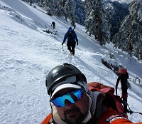
We set off just after dawn from a nondescript patch of sand in the middle of nowhere:

Image

Image

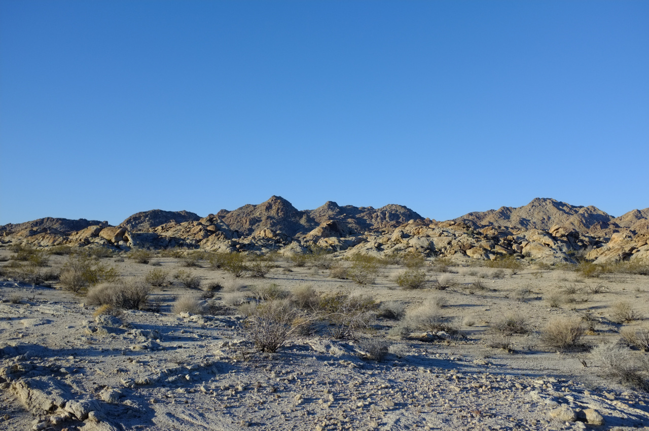
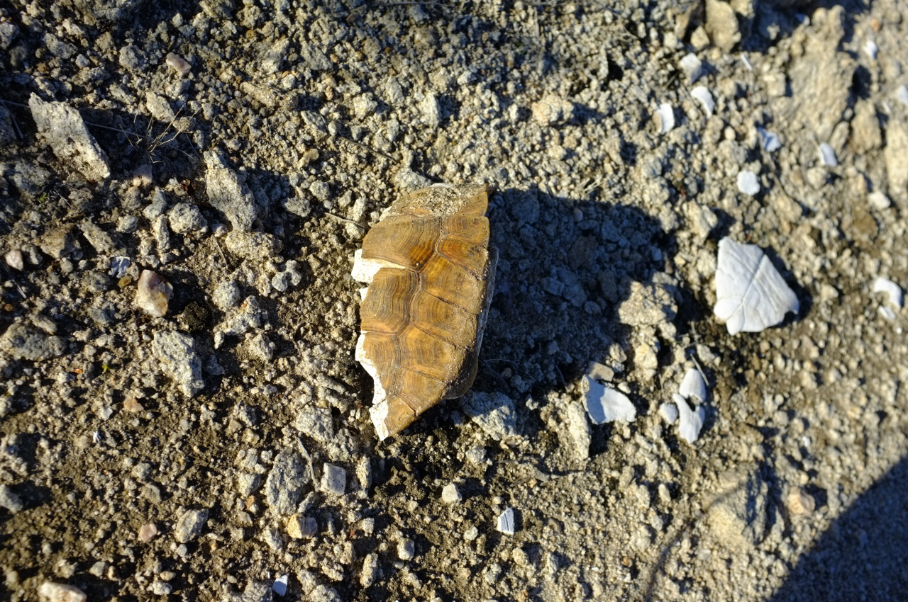
This area looks to be very dry throughout the year. Here not even the yuccas survive. There's abundant cat's claw however, and at least one desert tortoise hung out here at some point

Image

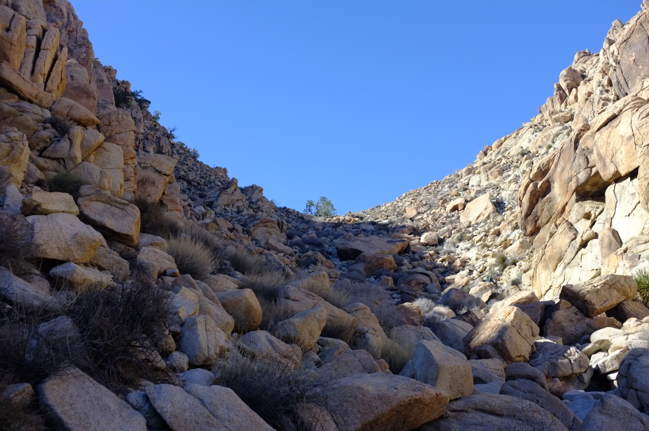
We followed a dry wash towards the rugged boulder fields in the distance. The terrain got more and more bouldery as we entered the Coxcombs.

Image

Image

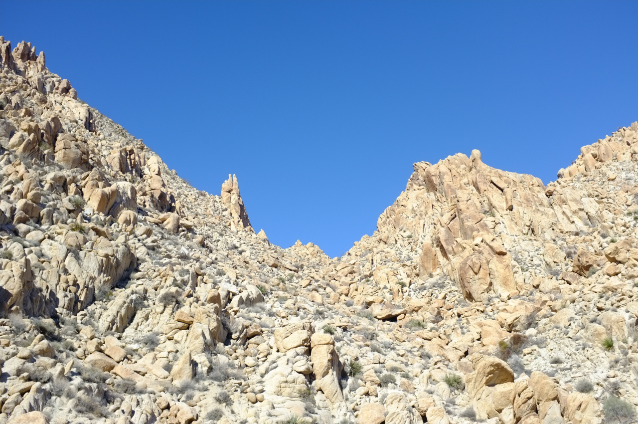
We walked up this drainage until it ended at a low pass. More boulder fields made themselves seen on the other side. After dropping a bit down the gully on the other side, a long, steep and bouldery canyon came into view

Image

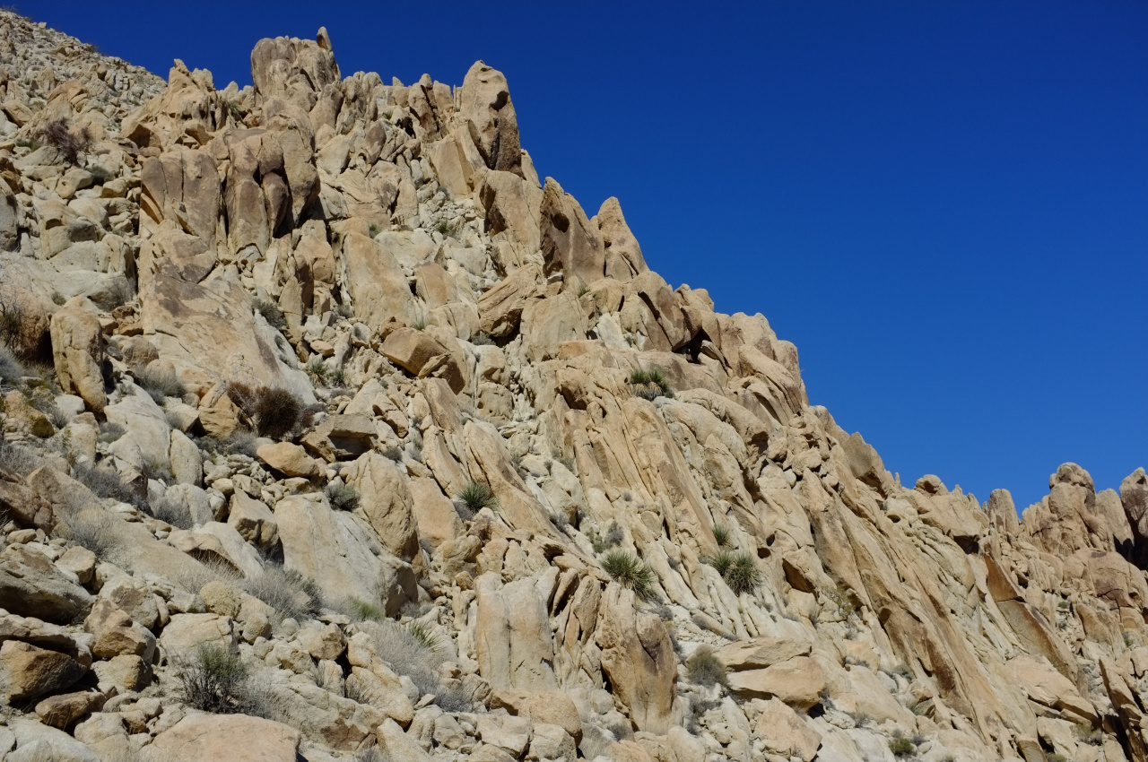
This is clearly an excellent feature to ascend, so up we went. I should say that this whole mountain range is extremely disorienting. Everything is made up of various-sized boulders. There's no sense of scale or distance on anything. After an uncertain amount of climbing we passed peace-sign rock

Image

handset rock

Image

and pigeonhole rock

Image

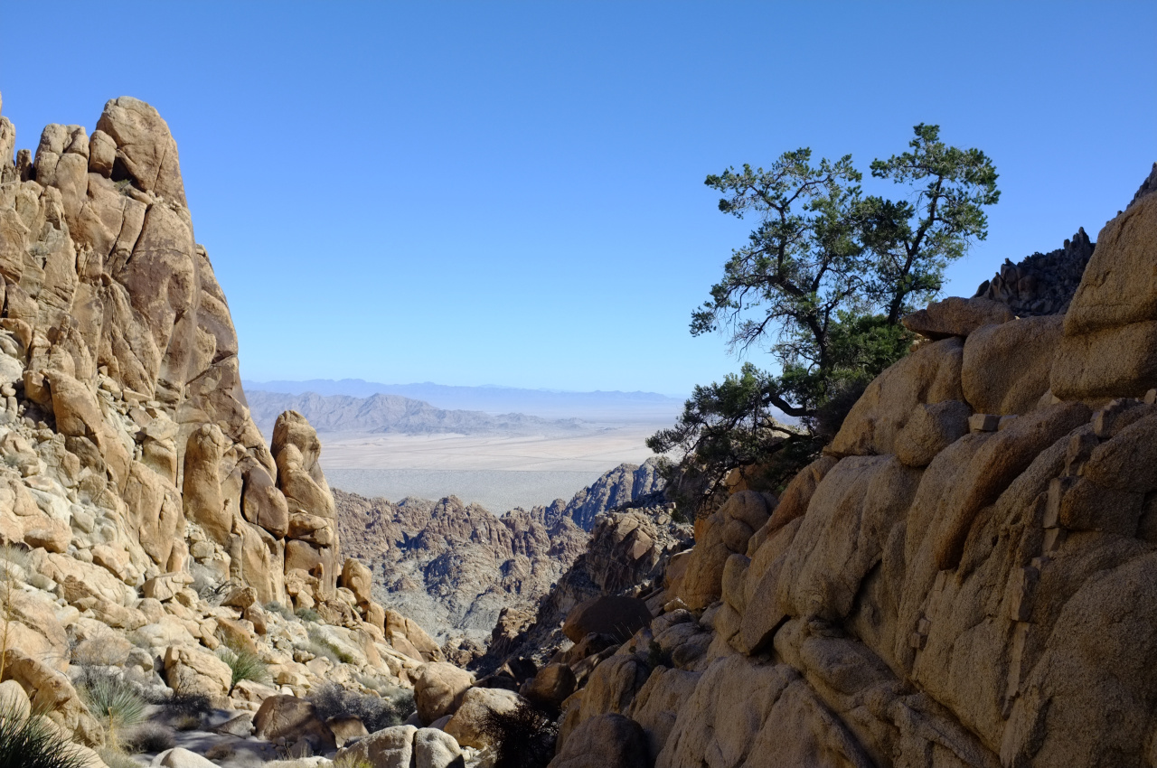
There were some recent storms, so a bit of water (and even ice!) could be found in places. Going up, yuccas appeared, and even an occasional tree. We could eventually see the top of the drainage:

Image

Looking back, this place doesn't quite look like Mars, but it's not Earthly either:

Image

Image

Image

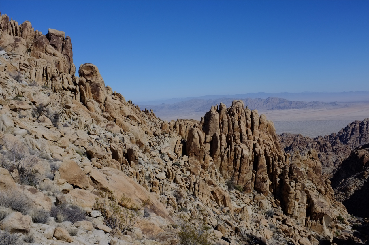
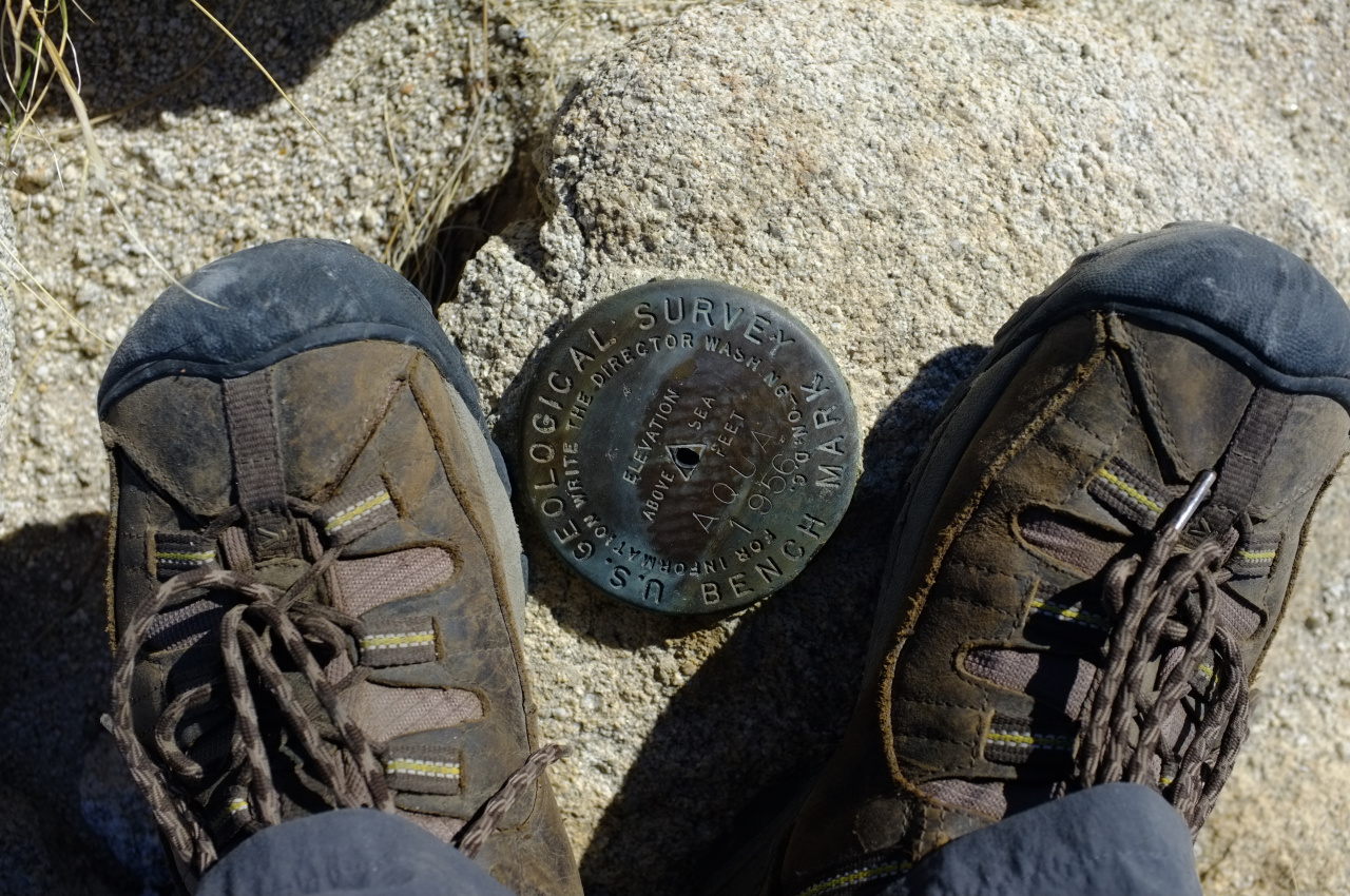
At the top of the drainage, we went right, climbed an area the map claimed to be a high point, and ended up on top, at the Aqua benchmark (Tensor point).

Image

We signed the register, which contains entries going back to 1969! If you want to see them, you'll have to visit. The view are grand:

Image

The San Bernardino and San Jacinto mountains are full of snow! Despite all that, Tensor is not the high-point of the range. THAT is Spectre peak, at the right of the center cluster in the pano. The (barely) second-highest is Dyadic point at the left of the center cluster. Dyadic looks to require a technical ascent, so we left that for next time, descended to the saddle, and started up Spectre. That ascent is a bit more technical than Tensor, but we eventually topped out. This is a much more pointy summit than Tensor, but the views are largely the same. We took some photos, ate some food, and scrambled back to the cars, finishing in the dark. I found 2 birthday baloons, so even THIS place isn't sufficiently remote apparently.

The roundtrip is around 15-16 miles, with most of this distance covered by walking in the wash (or a very old road at the start). The net elevation gain is about 2700ft from start to high-point, with a bit of lost elevation to cross drainages and peaks. Most of this gain is covered by scrambling up boulder fields. We didn't end up doing anything harder than class 3, MAYBE some low class 4, but most any kind of climbing is available. It goes without saying that there's no trail. In conclusion, this place is pretty cool.
User avatar
Sean
Posts: 3716
Joined: Wed Jul 27, 2011 12:32 pm

Post by Sean »

Did you just post the widest panorama in forum history?

Nice!
User avatar
dima
Posts: 1304
Joined: Wed Feb 12, 2014 1:35 am

Post by dima »

Sean wrote: Did you just post the widest panorama in forum history?
Heh. I do wish the forum handled those better. It doesn't piss me off enough yet to do something about it. Now if OTHER people regularly posted wide panos, then maybe something would need to be done.
User avatar
scottawr
Posts: 115
Joined: Tue Nov 12, 2013 12:41 pm

Post by scottawr »

This is a hike that's always interested me, seems like such a wild place.

The mine I posted a couple months back was in the SE coxcombs. Nobody goes out there.
User avatar
RichardK
Posts: 727
Joined: Sun Sep 30, 2007 12:33 pm

Post by RichardK »

Nice report on a seldom visited area. Thank you!
User avatar
Girl Hiker
Posts: 1297
Joined: Fri Apr 04, 2014 7:46 am

Post by Girl Hiker »

Wow my kind of rocks to climb! I love the claw picture! very nice report and another benchmark for me to find!
User avatar
tekewin
Posts: 1189
Joined: Thu Apr 11, 2013 5:07 pm

Post by tekewin »

Nice Dima! I've heard of the Coxcombs, but it's so far out there I haven't planned any runs there. One of these days, maybe. Can't get enough desert.
User avatar
dima
Posts: 1304
Joined: Wed Feb 12, 2014 1:35 am

Post by dima »

scottawr wrote: The mine I posted a couple months back was in the SE coxcombs. Nobody goes out there.
Interesting. Was it the at the cluster of prospects on the usgs topo?
User avatar
AW~
Posts: 2035
Joined: Mon Oct 01, 2007 12:00 pm

Post by AW~ »

Never heard of the place....cool deal....really like handset rock.
User avatar
David R
Posts: 522
Joined: Sun Jun 12, 2011 10:28 pm

Post by David R »

To clarify there is Tensor which is the spot you summitted which has the AQUA benchmark and Spectre Point to the SW. There is also the most difficult peak Dyadic directly south of Tensor. Spectre is the one that is on the DPS list.
User avatar
orbitor
Posts: 5
Joined: Thu Apr 05, 2012 12:32 pm

Post by orbitor »

To clarify, the three highest summits in the Coxcomb Mountains are:
1. Spectre Peak 4482 ft
2. Dyadic Point 4460 ft
3. Tensor Point (Aqua Benchmark) 4419 ft

They are all within a half mile of each other and usually accessed via the same approach. For whatever reason, the USGS topos recognize only Aqua, and that is where the one benchmark is located.

On this trip we climbed Tensor/Aqua first, then Spectre. On the way in we took a more direct line than the old road, which probably shaved about a mile in distance. The final statistics were 14.8 miles and 3700 ft of gain.

In terms of difficulty, the final scramble up the east ridge of Spectre is a solid class 2, with a few class 3 spots. Dima did a variation that may have encountered some class 4 moves. Aqua is a walk-up - "class 1.5". Dyadic is more technical, according to the one person in our group who had done it in December, the scramble is exposed class 4 and low class 5. Ropes and protection required for most parties.
User avatar
scottawr
Posts: 115
Joined: Tue Nov 12, 2013 12:41 pm

Post by scottawr »

I believe there are some mines out that way, the ones I visited were in the opposite side of the range in the SE corner by the aquaduct. I think the ones listed on the us topo you mentioned are super old and most remains weathered away.
User avatar
JeffH
Posts: 1147
Joined: Sun Nov 28, 2010 7:09 am

Post by JeffH »

I had never heard of them and had to look up exactly where they are located. Looks like you saw about zero trail and all rock, gotta really watch out for turning an ankle or worse in that stuff.

Sean wrote: Did you just post the widest panorama in forum history?
Even scrolling to the right for about a mile it's a cool photo.
"Argue for your limitations and sure enough they're yours".
Donald Shimoda
User avatar
Uncle Rico
Posts: 1386
Joined: Thu Mar 20, 2008 7:48 pm

Post by Uncle Rico »

Very cool dima and orbitor. I've looked at the Coxcombs on my JT topo and fantasized about that place. Nice to see some pics of what it's all about.
Post Reply