
I tried once but poison oak, bees, and brambles got in the way. Your best bet is trying to contact Daven Gray...
And if you're talking about "big horn" (the other big horn) That was blasted and completely destroyed a while ago.
BALDY - Archive of Mt. Baldy-related Discussions
-
OutdoorAbstract
- Posts: 32
- Joined: Thu Jan 22, 2009 4:43 am
A bit chilly hiking this am. Just after sunrise around the Notch the breeze made it feel quite cold. Anyway, I spoke with a principal of the Mt. Baldy Ski Lifts and he said they had USFS approval for a number of tent cabins ala Curry Village at Yosemite. Seems like with the Moonlight Hikes put on by the ski area attracting upwards of 250 people per night and now approx. 50 tent cabin sites, the 24 hour usage continues to spiral upwards with commensurate negative impact on flora / fauna. Just my 2 cents.
Hello fellow SGMDFers,
Going to be in town this weekend and of course have to take an excursion into my old stomping grounds. Will be heading up Baldy Saturday morning with a few old hiking-mates. Feel free to join us or maybe I'll see you out on the trail.
Joe
Going to be in town this weekend and of course have to take an excursion into my old stomping grounds. Will be heading up Baldy Saturday morning with a few old hiking-mates. Feel free to join us or maybe I'll see you out on the trail.
Joe
-
HikingGeek.com
- Posts: 126
- Joined: Thu Jan 01, 2015 6:15 pm
I created some graphics showing the elevation profiles of some of the 'common' routes up Baldy. I will add more info to this page as time allows. You can see the graphs here:
Route Comparisons: Mt. Baldy
Route Comparisons: Mt. Baldy

Is that Notch route from the ski lift parking lot? I thought it was 3.6 miles from Manker to the Notch and then 3.2 to Baldy summit.
It's cool to see them profiled like this, really shows how steep all the routes are.
It's cool to see them profiled like this, really shows how steep all the routes are.
"Argue for your limitations and sure enough they're yours".
Donald Shimoda
Donald Shimoda
-
roncruiser
- Posts: 2
- Joined: Fri Jul 15, 2016 11:53 am
A group of us will be hiking Mt. Baldy on July 30th...
Is there a relatively accurate source to forecast temperature for the area? We do know it's going to be warm/hot. So, we were wondering how much water to bring per person for this time of year. Is there an active water source along the trail?
Also, what would be a good planned starting time? My first thought was starting no later than 5:30am.
We'll be driving up from San Diego. We were also thinking about driving up the night before and getting a room to stay at to get good rest and maintain that early start.
Any help information would be appreciated. The plan is to begin the hike at Manker Flats.
Thank you.
Ron

Mountain Forecast has weather for Mount San Antonio.
Water fountain at the Baldy Notch restaurant. There is a back entrance that they keep open if the restaurant is closed. You can access the restrooms with running water sinks.
Annual spring next to the Ski Hut. Go up the gully a little if the trail crossing is dry. Sometimes the Hut is occupied and you can bum water from their kitchen.
I'd start with at least two liters and refill at the Notch or Hut.
Your start time is good.
Take sun protection.

Since you are starting from Manker Flat, I assume that you are hiking the Ski Hut trail. The last time my wife and I hiked this trail, it took us 5 hours to reach the summit. We are in our 60's and slow. Some fit 30 year old's do the hike in half that time. The average grade of the trail is 15%. The ski lifts give weather information on their web site at: http://mtbaldyskilifts.com/. Check it a few days before the hike to get an idea of what the weather will be like.
You will hike a fire road uphill past San Antonio Falls. There, the road makes a hairpin turn south for 1/4 mile and then turns east. About 700 feet after the turn, the Ski Hut trail starts up a steep embankment. There is no sign. It is easy to walk past.
Since the weather will likely be warm, start with 4 bottles (25 oz each) per person minimum. Just before reaching the Ski Hut, there is a spring that flows across the trail. The water here flows out of the side of the trail. You can catch it in a bottle before it hits ground. It is safe to drink without treatment. There is also a creek at the Ski Hut. If the Hut is open, spring water is piped inside. The Sierra Club host may ask for $1 donation for use of the Hut. We no longer live in So Cal, so I don't know if the spring and creek are currently flowing. If not, then you will need to carry more water.
Once you pass the Ski Hut, you will find areas where the trail branches into a number of use trails. The mountain was damaged by a big thunderstorm a few years ago. The trail is busy and hundreds of hikers have made their own trails in places.
There are four trails that lead to the summit. If you plan on returning by the Ski Hut trail, note where it enters the summit. An option is to return by the Devils Backbone trail which leaves the summit in an easterly direction. It will deposit you at the top of the ski lifts. From there, you can hike down the fire road to Manker Flat. You can also buy downhill lift tickets and ride down. A short 1/4 mile walk will return you to your car.
If you wish to spend the night before in the area, consider either the Mt Baldy Lodge or the Buckhorn Lodge. They are in Mt Baldy Village and are a short drive to the trailhead. Both have restaurants.

This site has reasonable forecasts for many mountains:
http://www.mountain-forecast.com/peaks/ ... casts/3068
It is predicting high 60s at Manker where you start and 57 degrees on top with a 15-20 mph wind. Have fun!
http://www.mountain-forecast.com/peaks/ ... casts/3068
It is predicting high 60s at Manker where you start and 57 degrees on top with a 15-20 mph wind. Have fun!
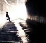
7-21. Left Manker Flat at 7pm to have a look at the moon from atop Baldy. Used Register Ridge and made it to top in 2.5 hours. Fun. Always amazing when it's over 100 in the valley below during the day but with a little wind at the top it can still get chilly where you want to get moving.
Went down Ski Hut Trail. All going good til just after the Ski Hut we went down a very used trail and missed our trail to the left. Hiked about 5 mins when I knew we went the wrong way due to steepness. Backtracked and found the right turn at a cairn. Back to the car about 130am. Nice hike.
My question is, Where does that trail go? I do SHT a few times a year and never got lost and didn't remember seeing that trail or a cairn before. Does it link back up with the main trail had I followed it? It didnt seem like it.
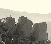
One other thing, have hiked Baldy a lot. Never saw a Bighorn sheep. Saw one sprinting across the top about 2 mins down from peak.
D
Went down Ski Hut Trail. All going good til just after the Ski Hut we went down a very used trail and missed our trail to the left. Hiked about 5 mins when I knew we went the wrong way due to steepness. Backtracked and found the right turn at a cairn. Back to the car about 130am. Nice hike.
My question is, Where does that trail go? I do SHT a few times a year and never got lost and didn't remember seeing that trail or a cairn before. Does it link back up with the main trail had I followed it? It didnt seem like it.
One other thing, have hiked Baldy a lot. Never saw a Bighorn sheep. Saw one sprinting across the top about 2 mins down from peak.
D
I think I know the spot you're talking about, its when you're still right above the creek and the trail narrows with some small rocks to hop around before you make a sharp left and leave the rim. I think its more of a gully then a trail that people use to get down or up to the creek bed. There are plenty of people that hike along the creek. A little further down there are also use trails that lead towards the Gold Ridge Mine but that's about 1/2 mile before the Ski Hut.
-
roncruiser
- Posts: 2
- Joined: Fri Jul 15, 2016 11:53 am
Thanks for the replies everyone.
It'll be warm starting our hike even at 0530 Saturday morning. Cooler as we climb.
Thanks again.
It'll be warm starting our hike even at 0530 Saturday morning. Cooler as we climb.
Thanks again.
I did Baldy last weekend, descending along the Ski Hut trail. I can't remember how long it had been since I'd been there, maybe a month. There are some new metal signs on the summit and in a couple more spots between the summit and the ski hut. In addition to these, along that same segment of the trail, there are maybe 20-30 extremely unsightly yellow arrows spray-painted on rocks, apparently to show people where the trail is. I don't remember seeing either the signs or the arrows last time.
The metal signs seem like something that the forest service would have done -- they're fancy and obviously a pro job that would have taken some money and expertise to construct and place. The yellow arrows seem more like something that an extremely clueless busybody would have done because he thought that everyone was too clueless to navigate in the wilderness, and he didn't mind defacing a large area of the mountain with graffiti.
Anyone have any more information about what's up with the arrows or when they appeared? Please reassure me that the forest service isn't idiotic enough to have carried out this kind of vandalism.
The arrows are the product of some idiot hiker. The Icehouse Canyon trail was similarly marked a few years ago with white and orange stripes. Volunteers removed a lot of those tags with electric Dewalt wire brushes, but remnants remain. It's tough to get rid of paint. There was another incident where some fool was seen numbering the switchbacks on the Mt. Baden-Powell trail. There is one group of hikers who feel the need to improve the forest.
If you aren't angry enough already, then read this report of major vandalism in Death Valley National Park:
http://www.death-valley.net/forum/viewtopic.php?t=23029
If you aren't angry enough already, then read this report of major vandalism in Death Valley National Park:
http://www.death-valley.net/forum/viewtopic.php?t=23029
I would be interested in getting together a group to try to undo the damage. A lot of the arrows are on small rocks, and I have already turned some of those over so the arrows didn't show. Most of the rest are on rocks that are larger but could still be flipped with a crowbar. I only recall a few cases where the arrows were on huge boulders. These were mostly in the talus field at the foot of the bowl. If you know the people who own the electric brushes, maybe those could be done that way. Or as a less complete fix, they could be painted over with gray paint.
Some dates I could do are Oct. 2, 9, or 29.
I would love to join you, but I moved to Florida last year. I will always have a place in my heart for the Mt. Baldy trails. Dewalt is a line of battery powered construction tools. They are common on construction sites, but probably are not owned by many individuals. One of the businesses that rent construction equipment may have them available.
I tried to learn more about the Icehouse Canyon vandalism. This blog post seems to suggest it happened around 2007-8. This post has photos of what it looked like in 2010. This discussion makes it sounds like it was still there in 2012. I couldn't find any info on who cleaned it up or when. It would be interesting to talk to them.
Anyone else interested in getting together a work party to clean up the yellow arrows, say on Oct. 29?
I'm putting out feelers to people I know through Sierra Mountaineering Club and SCMA.
Anyone else interested in getting together a work party to clean up the yellow arrows, say on Oct. 29?
I'm putting out feelers to people I know through Sierra Mountaineering Club and SCMA.
The trail is partly in the San Bernardino National Forest and partly in the Angeles National Forest, but SBNF tells me that ANF manages the whole trail. I talked to the district office in Glendora, and they suggested I talk to an ANF person named Freddie Duncan, basically to make sure that there wasn't already some other group planning to do this cleanup. (There is a "trail builders" group or organization, and I guess groups like the Sierra Club often do this sort of thing.) I left a voice mail for Duncan.
I also came across this meetup group, which seems to be active on this sort of stuff, so I applied to join. It's run by someone named Kim Carroll, and I noticed that Freddie Duncan also seems to participate on a volunteer basis.
I also came across this meetup group, which seems to be active on this sort of stuff, so I applied to join. It's run by someone named Kim Carroll, and I noticed that Freddie Duncan also seems to participate on a volunteer basis.

The San Gabriel Mountains Trailbuilders might have some equipment that could be brought to bear. I know they've done some trail work in Icehouse Canyon recently, so they do get over to the Baldy area even though their main focus appears to be Crystal Lake and surrounds.
Fred, who used to post here, works with the SGMTB and might be a good contact. I'm going to shoot him a message.
HJ
Fred, who used to post here, works with the SGMTB and might be a good contact. I'm going to shoot him a message.
HJ
Excellent, thanks, Hikin Jim! The person I spoke with at ANF also mentioned that group.
I've been looking at info online about wire brushes. If I'm understanding correctly, the wire brush isn't a whole separate tool, it's just a drill bit attachment that goes in a regular drill. The brushes are fairly cheap, about $7. But we would need to buy or borrow an electric drill, presumably one with a lot of torque and long battery life. These seem to run about $80-$400, and I would guess it's the high-end ones that would have enough battery life for our task.
I've been looking at info online about wire brushes. If I'm understanding correctly, the wire brush isn't a whole separate tool, it's just a drill bit attachment that goes in a regular drill. The brushes are fairly cheap, about $7. But we would need to buy or borrow an electric drill, presumably one with a lot of torque and long battery life. These seem to run about $80-$400, and I would guess it's the high-end ones that would have enough battery life for our task.
Greetings, Fred from the Trailbuilders -- thanks, Jim, for letting us know about this problem on Facebook.
Let me see if we can get crews in there with Kover Kote and paint brushes to cover up the spray paint that remains, we will need to see if we have volunteers who are willing to brave this heat.
Does anyone have GPS coordinates for the start of and the end of the spray painted arrows? Usually if we can get GPS, we can bring up Google Earth and plan for trail maintenance as well as spray paint mitigation.
The material we use is Kover Kote, when it dries it looks like natural rock, it's got a rough surface and it blends in so it's not as ugly and annoying as other methods of covering up spray paint usually are.
If anyone plans to hike up any time soon (like next weekend, October 1st or 2nd) and would like to cover it up with Kover Kote, would you please email me at fred@sgmtrailbuilders.org and I will bring Kover Kote to you along with a paint brush? All you must do is add 50% water and the mortar mix / ash / finely-ground gray paint flakes mixes well and an be applied easily.
If not, we'll try to get crews in there and get it done.
Fred@SGMTrailbuilders.Org
This problem has been studied, there are academic research papers, clinical studies of people who have been cited for doing this, the people who do it really do think they're being helpful.
When one year there was the 100 mile endurance run, someone spray painted numbers on boulders and trees, we're not sure if they were mile markers for the person's use or whether they were used to station photographers, but whatever the motivation for that was, it also was not malicious, the person probably thought they were being helpful.
Some of the studies I read years ago found that even some of the people who had been cited for doing this had read Leave No Trace and agreed with it.
[cross-posting my email to Fred]
> Does anyone have GPS coordinates for the start of and the end of the spray painted arrows? Usually if we can get GPS, we can bring up Google Earth and plan for trail maintenance as well as spray paint mitigation.
I haven't worked out GPS coordinates, but it's on the section of trail that starts from the summit of Baldy and runs down along the Ski Hut trail to the rubble field at the bottom of the bowl.
> If anyone plans to hike up any time soon (like next weekend, October 1st or 2nd) and would like to cover it up with Kover Kote, would you please email me at fred@sgmtrailbuilders.org and I will bring Kover Kote to you along with a paint brush? All you must do is add 50% water and the mortar mix / ash / finely-ground gray paint flakes mixes well and an be applied easily.
That sounds super easy. I had been working on organizing a group to do the work Oct. 29. However, if it's really as simple a one-man job as you're describing, I could go out and do it either this Friday, Sep. 30, or Sunday, Oct. 2. Since I haven't got experience doing this kind of thing, I want to make sure we're accurately estimating the amount of labor. It's a huge amount of paint -- I would estimate 20-30 yellow arrows spray-painted on rocks, along a long section of trail. In your experience, do you think I could get that done solo in a day?
If you think it's going to be more work than that, then we might want to do it Oct 29. I already have four volunteers for that date.
Thanks, Ben, I got your message via email and replied. If you and maybe some of your hiking friends want to attack that annoying spray paint, absolutely that would be epic times 12, I'll bring you a bucket of Kover Kote if you want to have enough material to last and want to cover spray paint where you find it, or I can bring you a smaller container with more than enough material to cover 20 or 30 arrows. I'll also bring paint brushes and 3 coffee cans if you have people enough to use them.
When similar graffiti appeared on the Icehouse Canyon trail, it seemed to be high up on trees and rocks, and the speculation was that the people did it so that they could go there in winter and not get lost because the trail was covered with snow. However, this new graffiti on the Ski Hut trail is almost all low down near the ground.SGMTBs wrote: ↑ A lot of times people do see it being done but they don't feel empowered to speak up and condemn or stop the person. It is usually done by someone who is not a long-time hiker who feels insecure and uncomfortable hiking, even with friends, so they spray paint the way they went so they feel safe knowing how to get back down, usually with a "background story" running in their heads about how they're helping other hikers stay safe and not get lost by their act of "charity."
I ran into a guy once lower down on the Ski Hut trail who did seem to have embodied the kind of insecure/rationalizing psychology you're describing. This was at the spot where you leave the road and start up that steep hillside, with switchbacks leading up to the metal trail register. He had a pick axe in his hand and had just finished widening the switchbacks. He was very indignant because he'd complained to the forest service about how the switchbacks were narrow, and he perceived them as dangerous, but the forest service hadn't done anything about it. So he decided that for other people's safety, he needed to go out there and widen it. It wasn't actually disfiguring the landscape like the spray painters have been doing, but it was totally unnecessary IMO, since the foot tread was plenty wide enough to walk up safely if you watched your feet.
And it's true that I didn't feel empowered to tell him he'd done something unnecessary. He had already done it, it wasn't that horrific anyway, and I didn't really take the time to stop and process it mentally, because we were just passing each other on the trail.
Fred Rice is going to drop off some Kover Kote at my house during the week, and I'm going to go up this weekend and see if I can just get all the arrows covered in one day of solo work. It sounds like a lot less hand labor than using a wire brush, and Fred thinks it sounds reasonable to try to knock it off as a one-day solo project. I'll see how it goes. I have three other people who volunteered to help on Oct. 29, and if it turns out that I can't do everything, I may still ask them to come help me on that date as well. I've also sent an email to Freddie Duncan at the Forest Service to see if he thinks there are any objections to this plan.
It's why there are trail boss training sessions going on. People want to help, which is good.
No problem! We delivered the Kover Kote about an hour ago.
If we get informed about trail problems and spray paint, it gets fixed faster than calling the Forest Service.