
Gabrielino Trail (Big Santa Anita - West Fork - Arroyo Seco)
-
PackerGreg
- Posts: 623
- Joined: Sat Sep 12, 2009 9:31 pm
If you go up The Arroyo, steer clear of the bloated, stinky, rotting, sand-encrusted corpse of the socialism salesman. If you make it past the flies, the creek runs free and clear.

That's what happened in Rubio Canyon. Rubio had some nice falls which were buried by a bungled attempt to blast a platform for a water line. There was all kinds of debate how to restore the canyon and who was going to pay for it. Ultimately, mother nature took care of us after some heavy rains.
For $1M/foot, I'd probably just live with the dam.
HJ
-
Uncle Rico

- Posts: 1386
- Joined: Thu Mar 20, 2008 7:48 pm
Last Sunday I encountered a shitload of bees as I transitioned onto the Gabrieleno Trail where it splits from the Sturtevant Trail near Sturtevant Camp. There is a seep or some other water source at that location which may have been the attraction, but there is also a downed log on the other side of the wet area that the bees may have colonized/might be colonizing. Honestly, I couldn’t tell what the deal was, but I didn’t feel like tempting fate during swarming season. So I found a less unpleasant work-around that involved crab-crawling up a very steep and loose embankment some 20 yards up-trail from the bees.
Anywho, if you’re in that area, you may want to proceed with caution.
Anywho, if you’re in that area, you may want to proceed with caution.
-
Breabonnie
- Posts: 50
- Joined: Fri Jan 13, 2012 11:18 am
I hiked there and saw the down log but not the bees on an earlier hike just prior to spring. So this must be a new thing. Thanks for the "heads up" about it.
-
Sitting Bull
- Posts: 39
- Joined: Wed Aug 07, 2013 2:12 pm
Yesterday I attempted to hike to Royal Gorge from Gould Mesa Campground. After Nino Rest Area and Paul Little Picnic Area, we ended up at Brown Mountain Dam. I searched in vain for the turn off to continue on the Gabrielino trail.
I am going to attempt it again, but has anyone hiked this stretch recently? Am I missing something? Where is the turn off? I did see one fork, but ended up right back at the dam after following it.
I am going to attempt it again, but has anyone hiked this stretch recently? Am I missing something? Where is the turn off? I did see one fork, but ended up right back at the dam after following it.

I was there maybe 2 years ago. The trail splits off to the right immediately before the Paul Little picnic area. The fork is right behind the ruined bathroom. There was a "trail closed" sign there, but the trail was passable all the way around the dam, until it rejoins the river. I ran out of time, so didn't continue further up. In any case, this area is mapped well in openstreetmap:
http://www.openstreetmap.org/#map=16/34.2374/-118.1824
http://www.openstreetmap.org/#map=16/34.2374/-118.1824
I was up there a month or two ago and it's passable. The trail is right where Dima says, but concealed under piles of deadfall and other debris. The trail is navigable, but hasn't been worked since the fire. There are a pair of minor washouts you have to skirt or cross. You climb the hillside, pass the dam and as the trail descends back towards the creek you enter an oak grove and the trail eventually disappears into a bunch of poison oak.
If your goal is to reach the Royal Gorge, it remains a long way up canyon from there and from the little I've seen, travel in the canyon bottom above the dam is a bit of a romp through the bushes. It would probably be a long slog through all the sandy sediment and debris backed up for about a mile or so above the dam.
Maybe descending the Gabrieleno from Switzer's is worth considering? I recently hiked it to the saddle above Long Canyon and the trail was in good condition up to that point. Not sure what kind of shape the descent into Long Canyon is in. Or you could follow the Bear Canyon trail and just continue down the creek from the junction with Bear Canyon.
There's a pour-off in the Royal Gorge that presents an obstacle. There used to be a rope off to one side, but who knows what things are like down there now.
-
Sitting Bull
- Posts: 39
- Joined: Wed Aug 07, 2013 2:12 pm
I do know that there was a big announcement re. opening of most Station Fire closure areas as of Memorial Day Weekend over on Modern Hiker. I wonder if that includes the Gabrielino. I'd like to hike it down from Switzer's area or even Red Box.
-
andthewalrus
- Posts: 21
- Joined: Tue Jan 03, 2012 8:23 pm
I know "somebody" who tried the hike to royal gorge last year from Gould Mesa. A lot of stream walking to end up about 1/4 mile shy of the gorge with a large, bushy tree blocking a narrow section. The limbs were too thin and springy to climb on and too thick to climb through. "They" tried until getting bit or stung by something, swearing loudly, and turning around. Bring a machete or at least long sleeves.
-
Herping Hiker
- Posts: 6
- Joined: Tue Jun 04, 2013 1:32 pm
It's now open up to where Ken Burton connects to it but not beyond it (north).
-
hillbasher
- Posts: 61
- Joined: Thu Sep 27, 2007 8:58 pm
Hey Psyko, did you ever find out any info about this?
No, haven't had a chance to check out that section yet.hillbasher wrote: ↑Hey Psyko, did you ever find out any info about this?
I did do a loop starting/ending at Chantry today. For the most part the trail is in good shape where I hiked today. Took the Gabrielino trail all the way to the junction with Kenyon-Devore and hiked that to Wilson. Down the Mt. Wilson trail and took the ridgeline to San Olene instead of Winter Creek back to Chantry.
The Gabrielino trail is pretty rough between Devore and West Fork trail camps. Passable, but lots of scrambling up, over, around, and through deadfall, blowdowns and snags in that section. Lots of Poison oak in the shady areas starting to encroach on the trail in some sections. The rest before Devore and after West Fork were in pretty good shape. A couple of fallen trees across the trail here and there, but nothing like the other section.
Ran the section between Red Box and Valley Forge this morning as I was on a loop starting/ending at Eaton Saddle. Trail was in really good shape, water was flowing really well with a few stream crossings. Passed a few people hiking back up to Red Box after staying at Valley Forge or West Fork Campground.
Valley Forge from the bottom up to Eaton Saddle was a different story. Very overgrown with a lot of stuff encroaching the trail. Fortunately only saw a couple of isolated clumps of poodle dog on that section.
Valley Forge from the bottom up to Eaton Saddle was a different story. Very overgrown with a lot of stuff encroaching the trail. Fortunately only saw a couple of isolated clumps of poodle dog on that section.

Thanks. I tried Valley Forge awhile ago after a rain. I got drenched by the damp, overhanging brush. Then I noticed some poodle dog and gave up and turned around. Wasn't in the mood for PD.
Sounds like the PD is mostly gone now. Guess I'll give it another shot.
It's actually not in bad shape, just overgrown due to all the vegetation getting a super dose of rain this winter. The majority of the trail follows an old road bed up the hill so the slope is never really too terribly steep. It's fairly shaded as well, except for a few sections that got burned during the station fire. A little time with a set of loppers and a machete would go a long way...
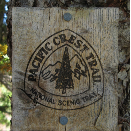
Someone should try to get the Forest Service to completely open Gabrielino Trial from north of old Oakwilde Camp area to Switzer junction. This trail is supported by the US National Trail system and should have all means to get that done. This section of trail has been closed since the Station Fire and has a USFS sign stating "Trail Closed To All Users" which seems to be because of heavy overgrowth and flood debris. The Gabrielino Trail was a 28 mile diverse trial starting at JPL parking lot (now resident streets) to Chantry Flats the parking lot at the end of Santa Anita road. It is sad that the US Forest Service is under staffed and low budgeted but this is an historic trail that needs to be restored for the preservation of our ancient trails that have been experienced by many past users.
I see from your "reopen" link that the USFS status is open for horseback but it doesn't mention hiking.
Besides I didn't see any trail beyond the sign which was marked along the way with pink plastic ribbon.
The questions, is there still a trial somewhere or just bush whacking?
I remember you use to follow the canyon a little further up then the trail started climbing out of the
canyon on the north side up to Switzer junction.
Yeah, they aren't much into clarity. According to their site, the Burkhart NRT also appears limited to horseback riding, when that's obviously not the case.
It's been a couple years since I was on the stretch between Oakwilde and Switzer. But back then it was rough but passable on foot.The questions, is there still a trial somewhere or just bush whacking?
I'm planning a day hike of the entire trail in one shot in a few weeks for giggles. I'm going to head up this weekend and scout the section between Switzer and Oakwilde to see how things look on the ground. I'll report back what I find while I'm out there.
-
tallsquirrel
- Posts: 25
- Joined: Thu Nov 16, 2017 6:37 pm
Hiked from Chantry Flats to Devore. Stayed overnight. Chantry Flats is a zoo (as always). Parking lot was full when we arrived @ 6:30 am. Flush toilet was overflowing in mens room. Paid for parking at the pack station. Packs of boy scouts and Korean hiking groups mulling about made me think the trail and camp would be crowded.
Fortunately it was not the case. Saw very few people past Studervant Falls. Only one camper at Spruce Grove. Only one other camper came to Devore after dark. Otherwise no one else there on a holiday weekend. Awesome! Lots of water in West Fork and in Santa Anita Creek. Trail is covered in huge acorns.
There is a fire break at Newcomb Pass that is not on the map and made the junction a little confusing. Otherwise, trail in great shape. Saw three deer hunters at the pass that left cigarette butts and an empty bag of chips on the ground
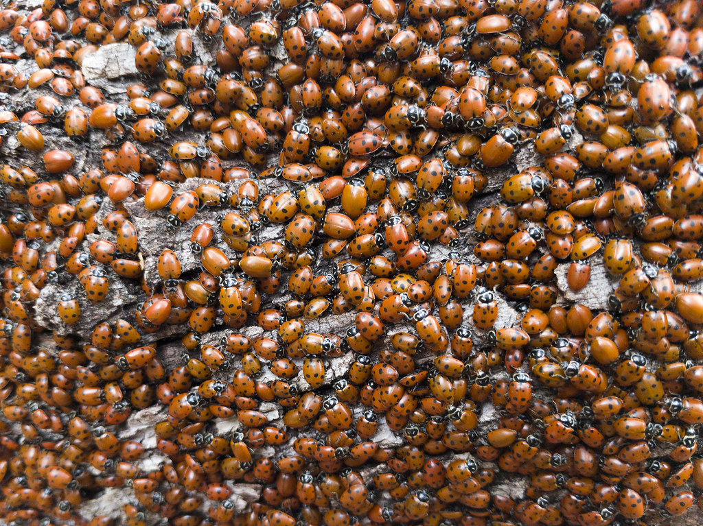
Things came up that put the kibbosh on my checking out the section between Switzer and Oakwilde previously. I did however manage to go out for a run on Sunday morning and covered the section of the trail between Red Box and the Kenyon-Devore trail while covering a loop from Eaton Saddle. Between Redbox and Valley Forge was in really good shape, no water though. Between Valley Forge and Kenyon-Devore it was in good shape overall, but there were a couple of trees that died in the fire that finally lost their battle with gravity and had fallen across the trail. I saw two people coming up the stone steps to redbox that had camped somewhere the night before. Other than those two folks, I didn't see a single soul on the trail portion of the rest of my 12 mile loop. I did however see a TON of ladybugs clustered on logs near the Gab/Kenyon-Devore split:
Did a little searching and found this recent trip report - https://www.trvrsapparel.com/blogs/so-c ... st-to-east From his report it sounds like the section between Oakwilde and Bear Canyon Jct is clear. Going to try and check it out this weekend.
Finally went out today and saw for myself. Trail is clear for the most part Between Oakwilde and the Bear Canyon Jct. Someone has been back there doing a lot of work clearing the log jams and brushing. The trail still needs a lot of love on the tread before it's ready for prime time, but I think that will come.
-
Uncle Rico
- Posts: 1386
- Joined: Thu Mar 20, 2008 7:48 pm
I was out at Oakwilde on Saturday. Ran into a guy and a gal from the Forest Service working the trail. They said they had made a clearing at Oakwilde and told me that a group was coming up the Arroyo that night to camp and then work the section between Bear Canyon and Oakwilde on Sunday. Another group was going to start from Switzer and work the other direction. That last section should be totally clear and "open" in the near future. At least that the way it sounded.
The Forest Service posted this on FB:
Then people started questioning whether the Switzer to Oakwilde segment was still closed. An hour later the FS replied:
Is it legal for the FS to permanently close a trail without a closure order in effect? Even with temporary closures during fires they will post an order online. Must we now visit FB comments to receive the "official" will of the almighty FS?
-
Tom Kenney

- Posts: 351
- Joined: Sat Sep 29, 2007 7:51 pm
Deadfall that was there 2 weeks ago between Kenyon-Devore junction and West Fork CG has been cut, but there is a fairly large new downed tree from the recent storm, about 0.5 km west of West Fork CG. Since this section has been worked, as well as Kenyon-Devore, I'm guessing the deadfall between Red Box and Kenyon-Devore has also been cleared.