
I'm sorry for the lateness of this report - we went nearly five months ago! But that's what happens when real life gets in the way of a trip report. Hopefully the forum will forgive me.
Day 1:
It was about a five hour drive from San Diego, and we arrived at the park around ten in the morning, heading in from the south on Highway 178. My wife, Vicki, had never been here before, so we had to hit all the important tourist spots. First Stop: Badwater
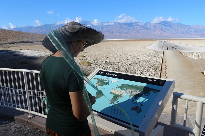
Looking at one of the informative signs at Badwater
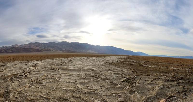
We decided that we needed some exercise after sitting in the car for so long, so we took a walk with all the rest of the folks, about a half mile onto the salt flats. All the people spread out once they reached the white salt, so that better photos could be taken. Very important. Too bad there was no cell signal or the instagrammers would have been in Heaven.
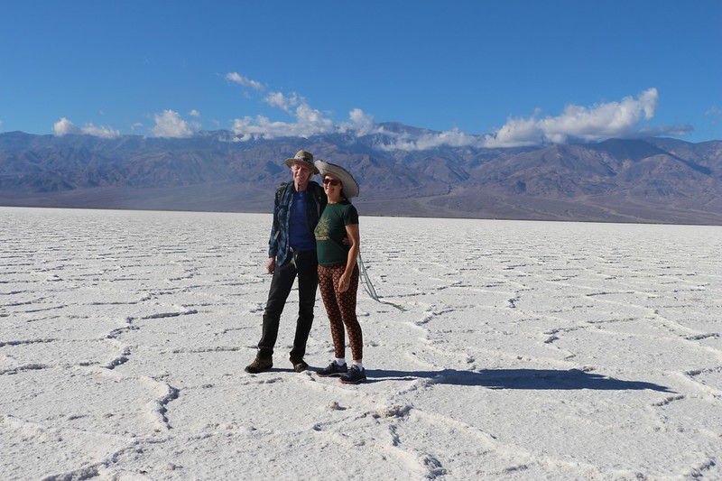
Vicki and I posing on the salt at Badwater, with snow-dusted Telescope Peak in the distance.
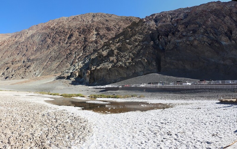
View of the bad water itself, with the Sea Level sign on the hillside to the right
We continued driving north and saw the sign for the "Natural Bridge" and Vicki wanted to check it out. So we did. It was another short hike, up a dry wash, and the bridge itself was very large, but was more a glued-together lump of sand and rocks than a solid stone bridge. But it was fun enough.
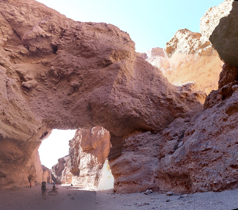
Panorama view of the Natural Bridge
Next Stop: Artist's Drive, a must-see for everyone who visits the park. There were very colorful mineral deposits in those hills. We imagined that they'd look even better when wet, but it only sprinkled a bit the night before.
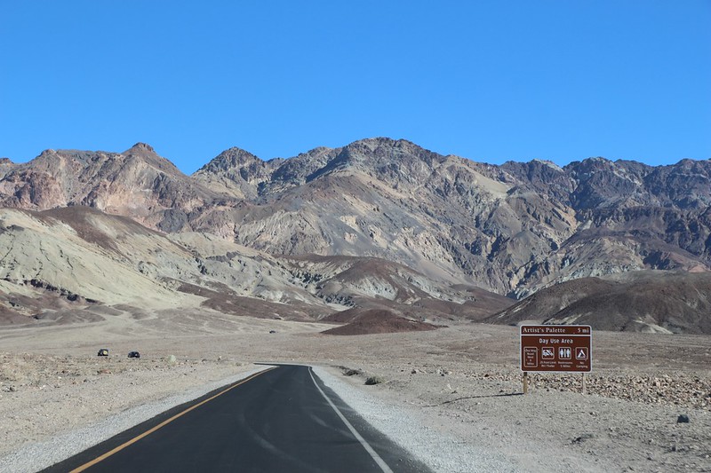
Driving on Artists Drive
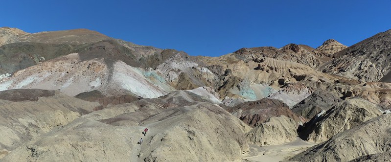
Colorful mineral deposits
Then we stopped at the Furnace Creek Visitor Center and paid our entrance fee. We checked out the museum, and asked a friendly Ranger about the slot canyon that was so dark you need to wear a headlamp. She told us that it was called Sidewinder Canyon, and that we'd already passed it, way back before Badwater. Bummer. So we decided to do that on Sunday, on our way out of the park. Then we continued north to the next touristy location.
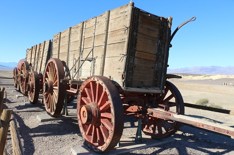
Twenty Mule Team wagon at the Harmony Borax Works
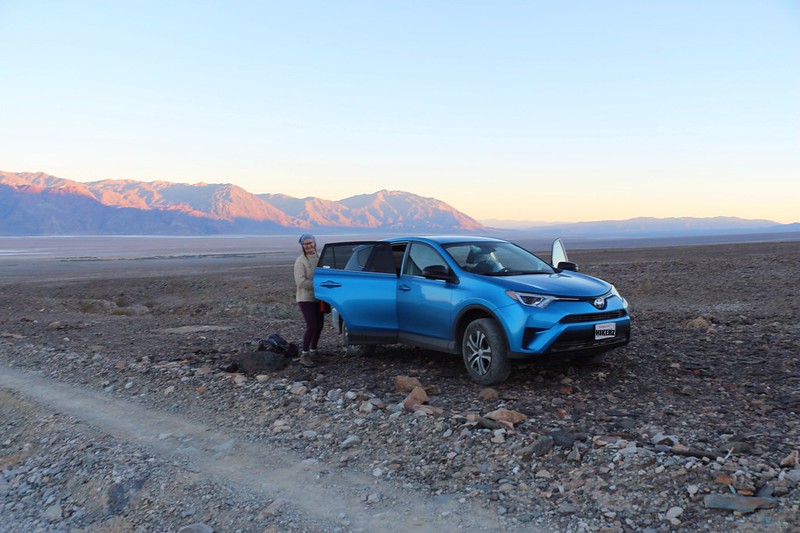
We turned left on Highway 190, and headed southwest to Stovepipe Wells, where we filled up on gas. On this trip, we weren't driving our trusty Toyota Corolla. We decided to rent a Rav4 with All Wheel Drive. I'd been doing my homework and was thinking about buying one of them, but only if it had the clearance and the guts to deliver us to remote trailheads on poorly-maintained Forest Roads. And my other criterion was that we could sleep in the back. I wanted to be able to do a bit of Stealth Camping at those same trailheads, so that we could arrive at night, get some actual rest, then start hiking at the crack of dawn. If we liked it, we'd buy one, and it would become our backpacking/retirement vehicle. This trip was a four day Test Drive.
Mesquite Flat Sand Dunes from Highway 190 near Stovepipe Wells
Now, there are plenty of places to camp for free in Death Valley, but nearly all of them are miles away from the highway, and from anything remotely "touristy." So, on a friend's advice, we headed west on a long dirt road to Marble Canyon. It was already getting late in the afternoon, and the sun sets early in late November, so we barely made it to a good camping spot before sundown.
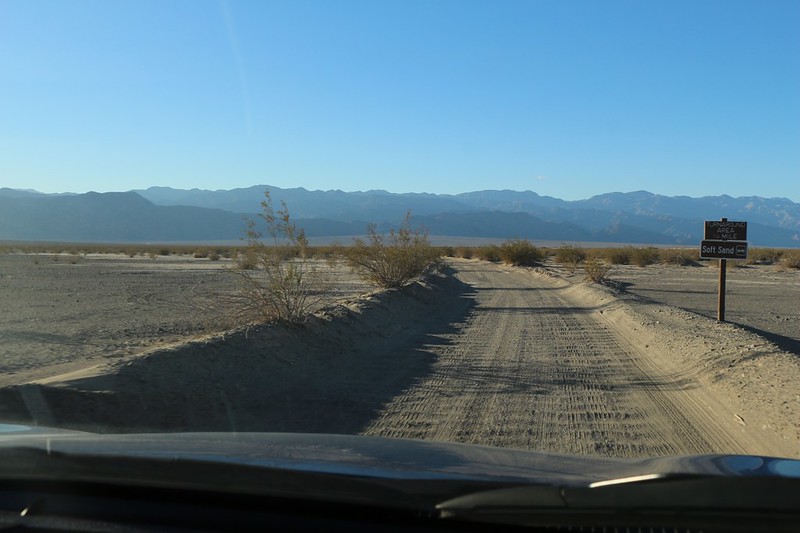
Heading west on the flat sandy road to Cottonwood and Marble Canyon
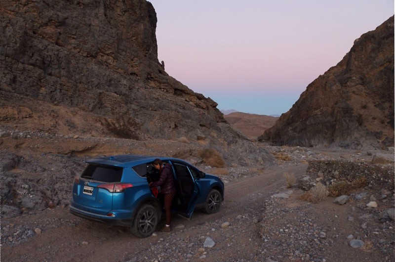
We made a right in Cottonwood Canyon and headed into Marble Canyon, where we found a spot to camp
On advice from the internet, we bought a cheapo twin air mattress from Walmart for eight dollars. It was eight inches thick and was a perfect fit in the back of a Rav4. I was glad that I had pre-inflated it using my shop vac at home. I got the bed ready while Vicki cooked dinner, and we enjoyed a mellow meal in a peaceful canyon far from all the tourists. Just the way we liked it.
Day 2
Well, we slept just fine in the car, and we both fit in there OK as long as the front seats were tilted forward, so that was a win. We couldn't sit up all the way, thanks to the ridiculously thick mattress, but that didn't matter much. We'd get a different mattress if we decided to buy one of these cars.
Panorama shot of sunrise from our camp
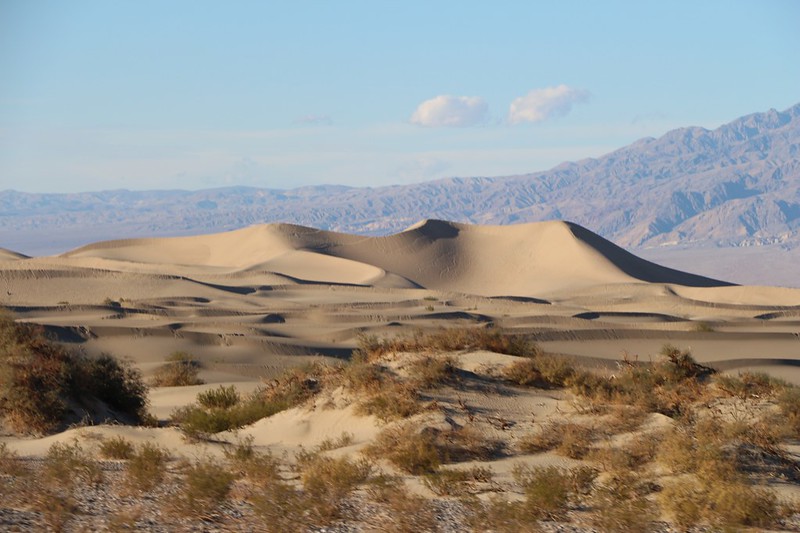
We packed up and headed back out to the highway near Stovepipe Wells, then headed east to the Mesquite Flat Sand Dunes. It was still early, and there was plenty of parking. We walked out onto the loose sand and took some photos, but we knew that hiking further out there would be tiring, so we headed back to the car.
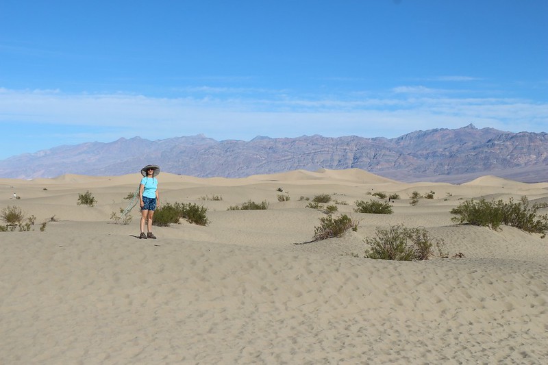
It's a long hard slog to get deep into the Mesquite Flat Sand Dunes
Then it was time to do some serious driving. We headed north on Scotty's Castle Road. We had places to go and craters to see.
Looking back at the Mesquite Flat Sand Dunes as we head north
Long but beautiful drive on Scotty's Castle Road
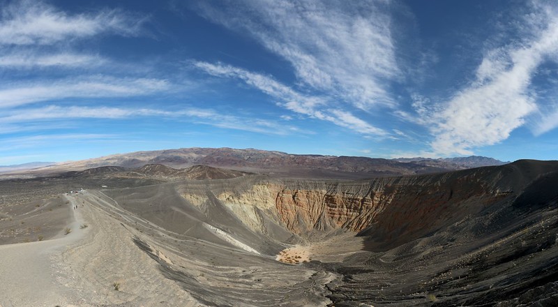
We parked at Ubehebe Crater and got out of the car. It was a bit breezy and cool up there. We took some photos and decided to climb up the trail along the rim and check out Little Hebe Crater, too. There were a lot of high cirrus clouds in the sky that day and the panoramic photos were improved with the addition of extra blue and white.
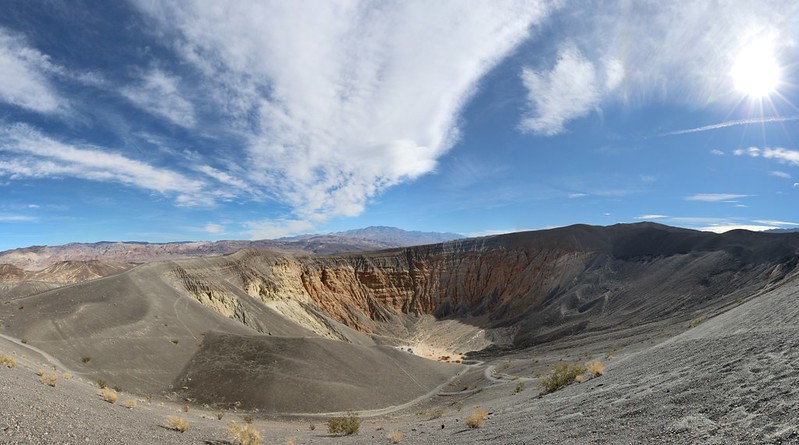
Panorama view of Ubehebe Crater from the parking area
Ubehebe Crater and the trail back down to the parking area
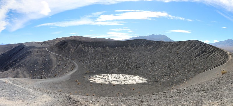
Little Hebe Crater
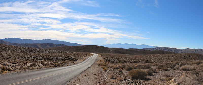
Since Scotty's Castle itself was closed due to damage from a flash flood, our next stop was Stovepipe Wells again. We decided to top off the gas because we'd already driven over a hundred miles since yesterday afternoon. And you never want to run low on gas in Death Valley, where there is almost no cell phone service. Then we headed south on Emigrant Canyon Road, which climbed and climbed, all the way up to and over Emigrant Pass.
Emigrant Pass looking west
Before the road could descend all the way down into the Panamint Valley, we turned east on Charcoal Kiln Road and began climbing once again. The paved road soon turned into dirt and on we went. We parked at the Charcoal Kilns and got out to stretch our legs. They were fun to go inside, because of the excellent echoes.
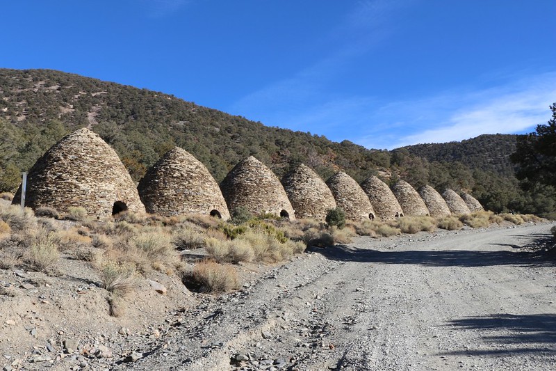
We arrive at the Charcoal Kilns
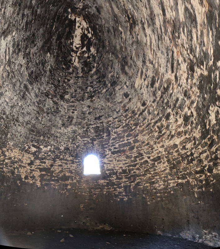
Ultra-wide (and tall) panorama shot from inside a Charcoal Kiln. That's soot from 1879.
And that ended the touristy part of our day. We continued on the dirt road (which became one lane and very rough) all the way up to the Mahogany Flat Campground. This was also the parking lot for the Telescope Peak Trail. There was still a bit of snow on the north-facing slope of the road from the previous storm, but the car didn't notice it at all.
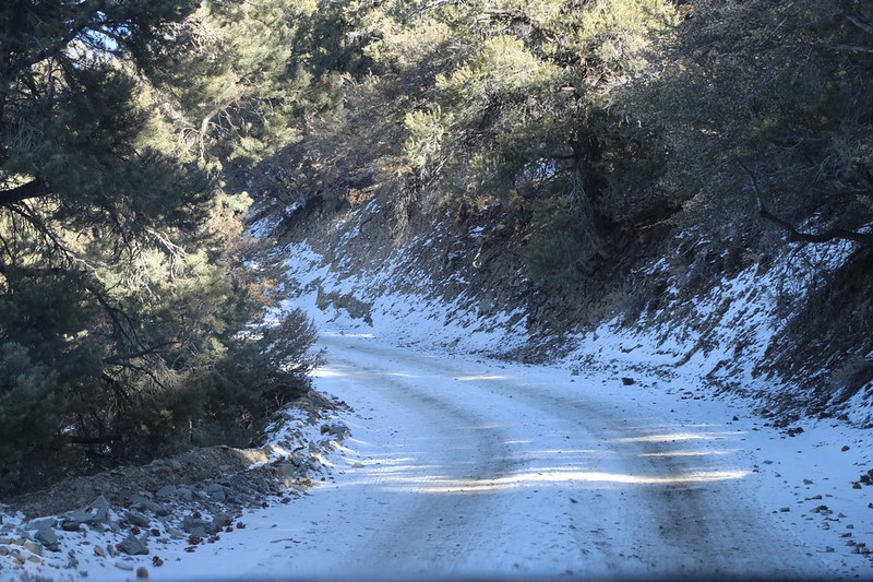
We continued driving higher onto a snow-covered section of the road
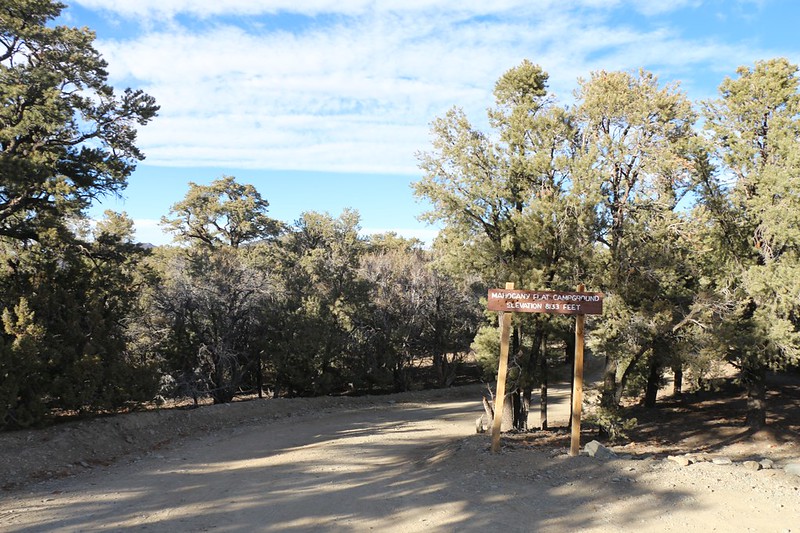
Mahogany Flat Campground sign - elevation 8133 feet
We parked in the trailhead parking lot and took a walk into the campground. It was already completely full. So we decided to put the car to its intended use: Stealth Camping at a trailhead. We cooked our dinner near the car and ate it as the sun set. Then we climbed into our cozy sleeping bag and hoped that no rangers came by to knock on our windows.
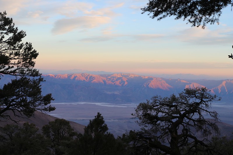
Sunset light on the Black Mountains to the east above Badwater
Day 3
We woke up early after a ranger-free night, and it was cold out there. There was frost on the ground. We met another guy who had slept in his Subaru, and some other folks arrived up the road from the lower campsites. We dressed in layers, ate some breakfast, and grabbed our gear. It was time to hike! No more of this car-driving nonsense!
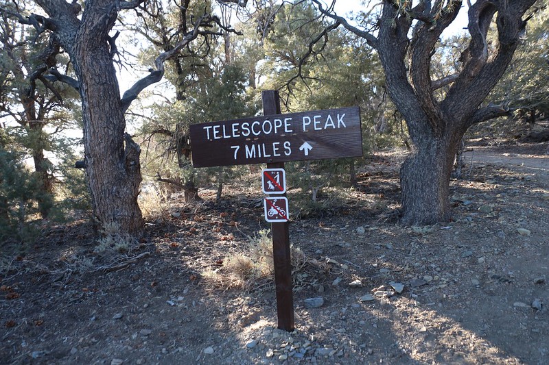
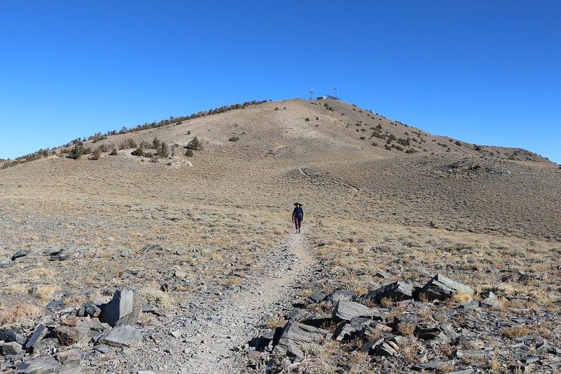
Telescope Peak Trail sign at the trailhead - 7 miles to the summit
The trail climbed steadily, heading due South, and we began to warm up. There were lots of views out to the east over Death Valley, and we even hiked on some residual snow for a short stretch. I was glad that I'd left the microspikes in the car.
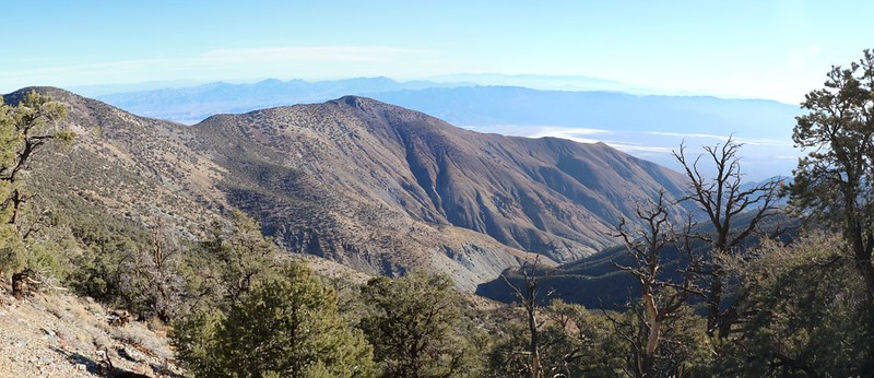
Panorama shot northeast toward the Colville Ridge, with Hanaupah Canyon down below
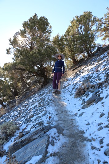
Vicki hiking on the snow-covered trail
Eventually, the trail crossed over a ridge and began to head west, directly toward the main ridgeline of the range. Telescope Peak finally came into view, and it was obvious that it still had a dusting of snow on its northern slopes.
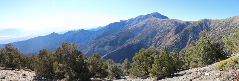
Panorama view of Telescope Peak from the trail as we climb toward the ridgline
When we got to the ridgetop, we suddenly had a great view West toward the snow-topped Sierra Nevada, just like the park's website said we would. We saw Mount Whitney and Langley, and even took a hike off trail until we could see around the corner, northwest, all the way to White Mountain Peak. I've been on all three of those summits, so it was cool seeing them again.
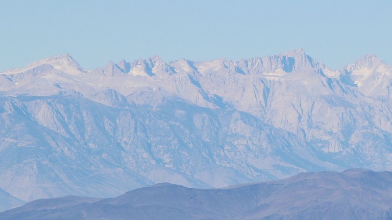
Zoomed-in view of Mount Langley (far left) and Mount Whitney (right of center)
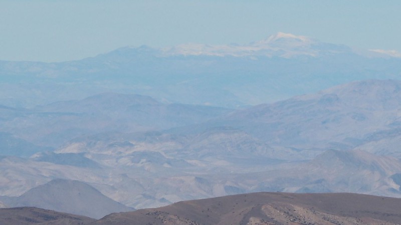
Zoomed-in view of White Mountain Peak - 117 miles away!
It was also incredibly windy up there! And the wind was cold. The late November sun didn't have a chance against that wind. We put a bunch of layers back on, then continued hiking up the main trail.
Rogers Peak and radio towers
It didn't take long before we got to a spot where we could also see Badwater. This was truly what I had come up here for. I took a look at Vicki and she was beginning to get frozen. She doesn't hike uphill very fast, and it was already noon. We were less than halfway to the top of Telescope. It looked like it might be a good time to reconfigure our day.
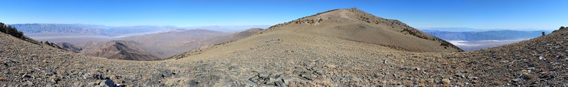
Wide panorama from where we could see both the highest and lowest points in the 48 states
We headed east and found a secluded spot behind some low pines, just below the north ridge of Bennett Peak. Then we took a long break and relaxed. I told her that we'd come far enough, and she was much happier. She's a trooper, but fourteen miles and 2500 feet of climbing in windy conditions was more than she could deal with. We would have gotten back to the car in the dark. Not worth it. Five miles and 1500 feet would have to do. Maybe I'd bag Telescope some other year.
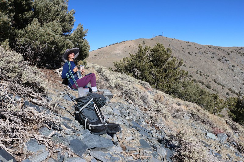
We found a spot out of the wind and ate lunch, with Rogers Peak in the background
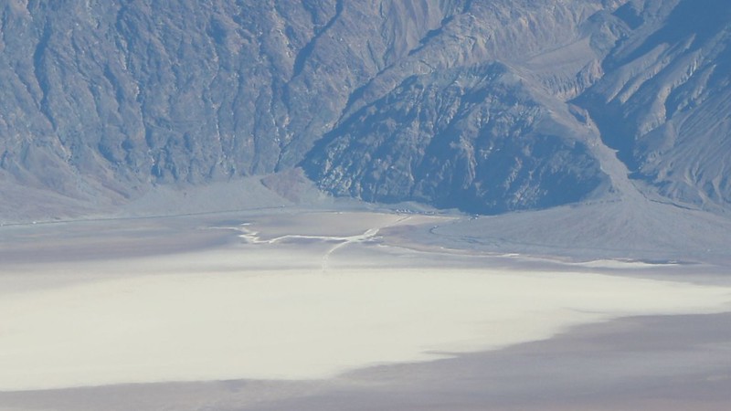
Zoomed-in view of Badwater, 17 miles away down in Death Valley
We got back to the car and headed on down the mountain. We drove back to Stovepipe Wells and discovered that their tiny, two-pump gas station had run out of gas! It was a seriously busy weekend out there. But we still had enough for now. We had to have enough. Somehow.
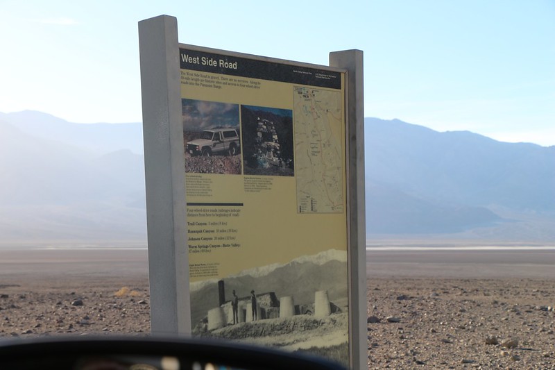
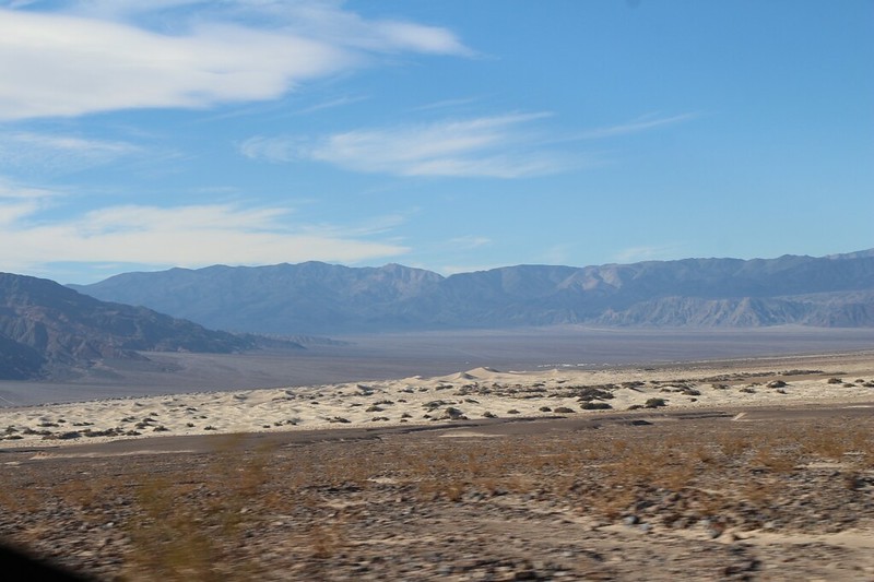
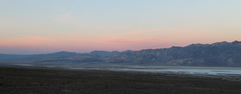
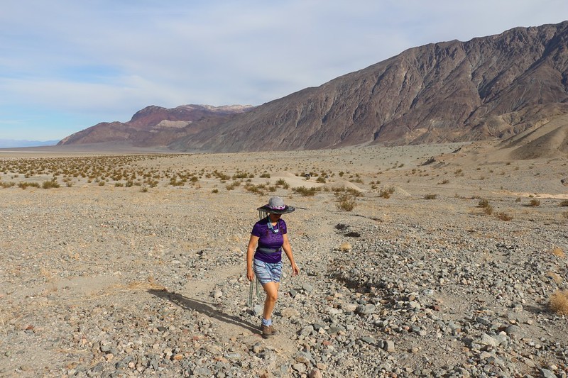
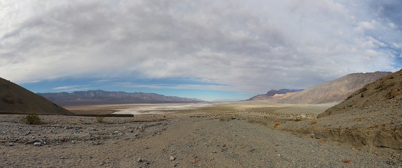
We drove back to Death Valley and decided to camp somewhere just off the West Side Road
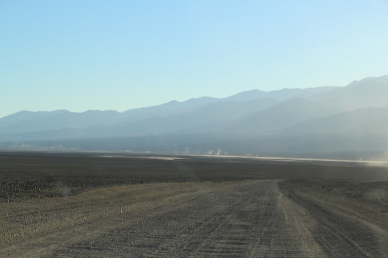
The West Side Road heads all the way down the big valley, on the west side, naturally. See those dust clouds?
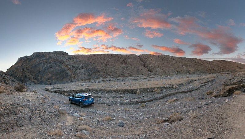
We found a spot to camp just as the sun was setting along Hanaupah Canyon Road
We ate dinner and enjoyed the view of the big valley. Badwater was somewhere across the way to the east, and Telescope Peak was uphill to the west. We were able to see the spot where we ate lunch, high above us, and we were sure glad to be down here where it was warm. We made the right decision to abort the hike. All we had left to check out this weekend was Sidewinder Canyon, and we'd get to that first thing in the morning.
Sunset panorama from Hanaupah Canyon Road looking northeast across Death Valley
Day 4
I woke up at dawn and went outside to take some photos of the sunrise. There was a constant cool breeze blowing south down the valley. So I got back in the car. No need to be hasty, after all. Maybe we'd wait for the sun to rise over the mountains. As it turned out, I had deflated the fat air mattress the day before and instead substituted our two backpacking air mattresses. That five extra inches of headroom made all the difference! I was able to sit up and function almost like a human being in there. I was getting much closer to buying one of these cars.
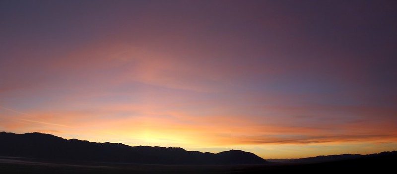
Colorful Sunrise Clouds from our camp
It was too windy out there to bother cooking breakfast, so we drove away instead, back north on the West Side Road. Along the way we stopped and checked out the salt flats in the center of the big valley.
Panorama of high clouds over Telescope Peak from the West Side Road
It looks like a river of salt running down the center of Death Valley
We drove a bit further north to Furnace Creek and topped up our gas, then stopped at a roadside picnic table in the shelter of some tall tamarisks and cooked up some breakfast. Sitting at a picnic table was a true luxury for minimalist backpackers like us. Almost "Glamping."
Then we headed south, all the way down past Badwater, until we arrived at our next destination.
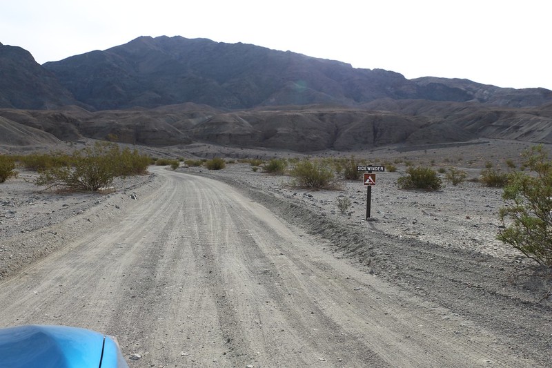
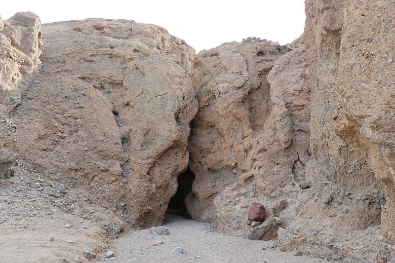
Sidewinder Canyon road and sign - the best slot canyons are up the wash on the far right
We put together some snacks and water and started up the canyon. It was absolutely not marked in any way. The only sign we saw was the one by the road. Unless you spoke to the ranger like we did, you would never know how to find the actual Sidewinder Canyon. And you'd never know which side canyon was the best slot canyon to explore. I think they did this on purpose, to keep down the number of lost tourists.
Vicki hiking up the long sloping wash into Sidewinder Canyon
I got out my phone's Gaia GPS app. I had the Open Cycle Map and Open Hiking Map layers working at that time, as the USGS and USFS layers didn't show the trails here. Thank goodness for modern technology. It saved us a lot of trial and error. And it got us to slot canyon two.
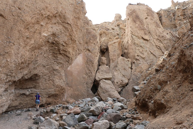
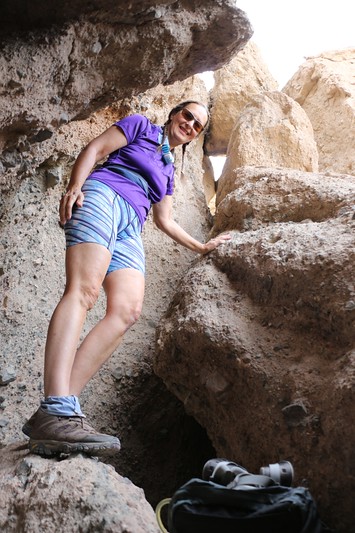
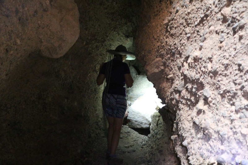
Vicki tentatively exploring Slot Canyon Two - look at those chock stones!
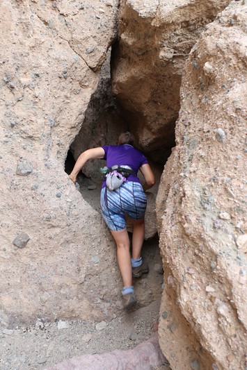
Vicki sneaking in under the chockstones
It's a tight fit and you have to scramble a bit to get into the canyon
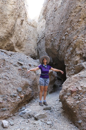
Success! We weren't entirely certain that we were in the right place, but it was looking good, so we continued onward up the side canyon.
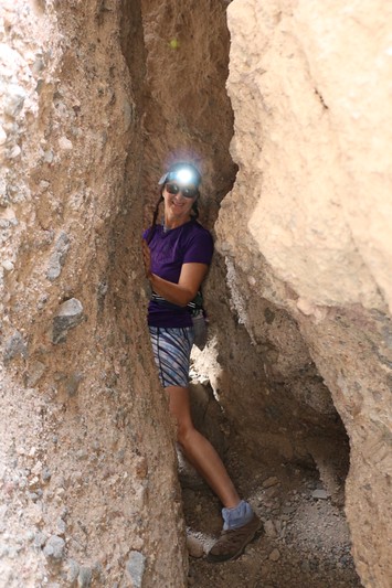
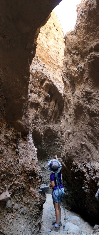
Vicki pre-emptively turns on her headlamp as we hike deeper into Slot Canyon Two
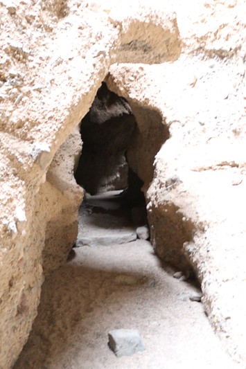
We head into the first of the darker sections
We needed our headlamps in this section. Fun!
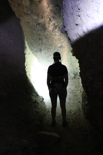
Vicki's silhouette in the light of her headlamp as we hike through the dark section
Vertical panorama shot showing how deep the slot canyon truly is
I've got to admit that this was probably the coolest part of our entire trip thus far. Totally worth it.
Looking back down Sidewinder Canyon as we head uphill to Slot Canyon Three
Even though it wouldn't be as fun as the dark slot, we wanted to check out all of the slot canyons. Slot canyons are fun, let's face it.
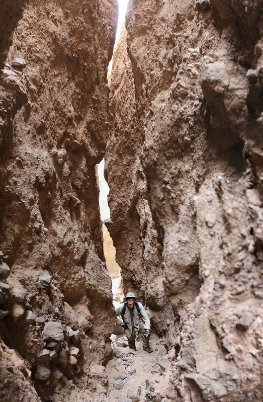
The entrance to Slot Canyon Three
Vertical panorama as we hike into Slot Canyon Three
It was a long canyon, and quite good. On our way back out of number three we met a couple of young guys heading in, so we told them about squeezing in under the chockstones. Hopefully they made it to the best canyon. Then we headed back down to slot canyon one.
It was getting hot so we hiked back down the main canyon on the shady south side
Vicki enjoys a cooling breeze as we hike up Slot Canyon One
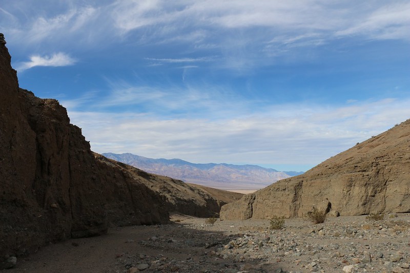
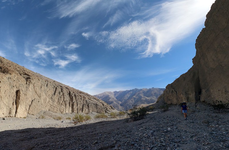
Panorama shot looking north up Death Valley from the mouth of Sidewinder Canyon
We headed back to the car in the sun, glad that it was downhill. It was already 2pm, and we decided to eat our lunch as we drove. We knew that traffic would be bad heading south into L.A. on Sunday of Thanksgiving weekend, but we also didn't feel like waiting until evening and getting back to San Diego at midnight. We both had work the next day. Sometimes you have to deal with life head on.
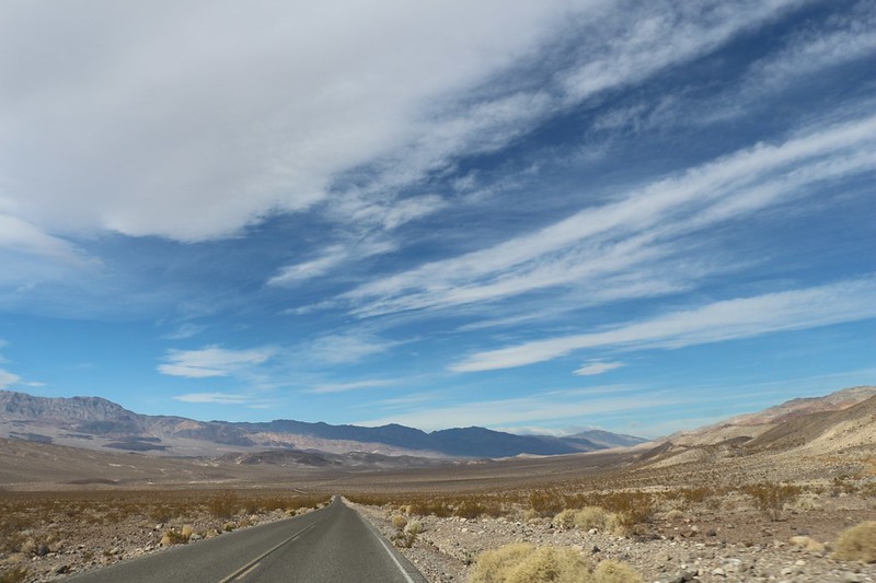
But at least we could enjoy the last bit of driving out in Death Valley on the way.
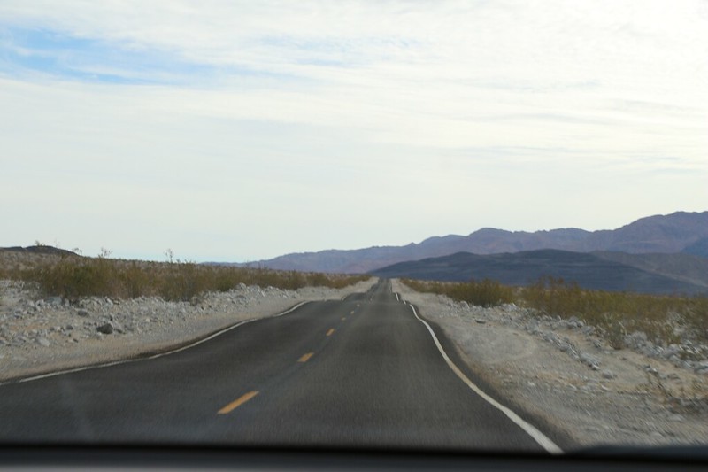
Highway 178 in Death Valley has lots of dips that are fun to drive fast and float your stomach
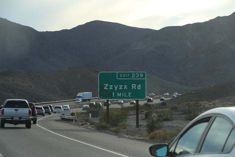
Heading home on I-15 in the Thanksgiving Day weekend traffic as we pass the whimsical town of Zzyzx, CA
For a ton more photos and videos see my Flickr Album Page
For a topo map with our GPS Tracks see my Caltopo Page
And if you are retired and have nothing better to do, read the much, much longer Trip Report on my website/blog/interwebz page.
Happy hiking!


