So when a long weekend came around and the weather looked reasonable, Kris and I made a loose plan, and showed up at the park late on Thu night. The plan was to make two loops: Titus Canyon on the day 1 and The Racetrack, Saline Valley, Eureka Dunes on the next 2-3 days.
We started riding North from partly up Daylight Pass road. This is paved. As expected, there are cool rock formation. At Daylight Pass:


We crossed the CA-NV border (no CA signs, but both "welcome" and "good-bye" NV signs), and turned off pavement onto Titus Canyon Rd. This is soft and somewhat washboarded, but not terrible. The road is straight until it reaches the Grapevine mountains, where the sand and washboard disappear. We climbed about 2000ft up to Red Pass, an area with very red rock.


Past this you descend to the Leadfield town site

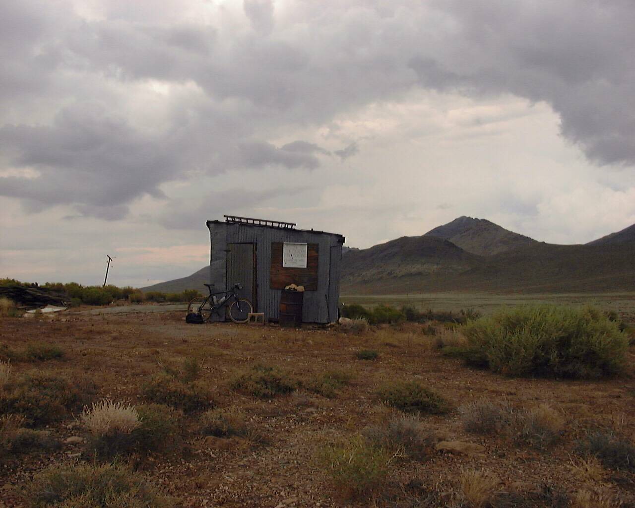
This is an old mining ghost town. A few buildings, some adits, and piles of tailings remain:


Apparently Titus Canyon road was build specifically to access the town. The interesting part of the road begins immediately below the town site. This is a narrow canyon just wide enough for a dirt road. In fact, only downhill traffic is allowed here.


There's a working spring in the middle somewhere. It's next to the marked petroglyph site, and is fairly obvious. I got a flat in this canyon. After installing the spare tube, I flatted THAT a few minutes later. Then I used all of my patch kit and half of Kris's trying to get either of the tubes to hold air. The patches just wouldn't hold. Eventually (after 7 patches, I think) it held enough to leak slowly-enough to get us back to the car. We rode ~ 25 miles and gained ~ 3000ft at the end of the day to complete the loop. All the patching business used up a lot of time, so we finished in the dark. 62 miles total ~ 4500ft gain, ~ 27miles unpaved.
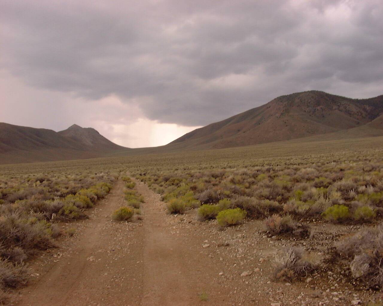
Next day the first order of business was to figure out what to do with the air situation. We went to Beatty, and were told that the nearest place to buy some tubes was 75 miles away. A convenience store in that town did have a VERY el-cheapo patch kit, that I bought. This turned out to be magical. I was able to patch both tubes, and they held. So late in the day, we cautiously started the big loop. The plan was to try to get to Eureka Dunes with my questionable tubes, and if that was a problem to return the same way. Initially the road is straight, and slowly climbs the northern end of Death Valley. This starts at ~2000-3000 ft.

The road is somewhat soft and somewhat washboarded, but not terrible. A storm was brewing South and West of us


For a while we were outrunning it. We arrived at Crankshaft junction (near the end of Death Valley), and took a hard left to climb up into the Last Chance range. The climb (2000ft I think) was steep, but the road condition was much better.


It rained on us for a bit on top, but only for maybe 20 minutes. At the top is a big mining site. Based on the yellow rocks and the smell, I'd guess this was a sulphur mine

The steep descent to Eureka Valley was paved (!) and took no time at all. Then the pavement ended (just the descent was paved), we turned left, and soon the dunes came into view

The road here isn't paved, but is in GREAT condition. We were flying, and the 10 miles to the dunes took no time at all. Camp at the primitive campground at the dunes. 42 miles. Maybe 2000ft gain. Pretty much all unpaved.
In the morning we climbed up the dunes a bit. They're BIG. Kinda like Kelso Dunes.

My tire still held air and we were able to bum some water from another camper, so we broke camp, and continued down the road. Here the USGS "4WD" road starts, and the park service maps call out "deep sand". They aren't kidding: the road in the valley around the dunes is REALLY soft. But that lasts only a few miles. Then you leave the valley floor, and climb up Dedeckera canyon towards Steel Pass. For jeeps this is very technical towards the canyon mouth (and there were lots of them here). For bikes, it's fine. The road is soft-ish, but there's no washboard.

After a while you can see the dunes behind you

We climbed ~ 2000ft. I startled a very jumpy rattler

Then we rounded a corner to get a first glimpse of the Inyo Mountains. The big thing in the middle is New York Butte.

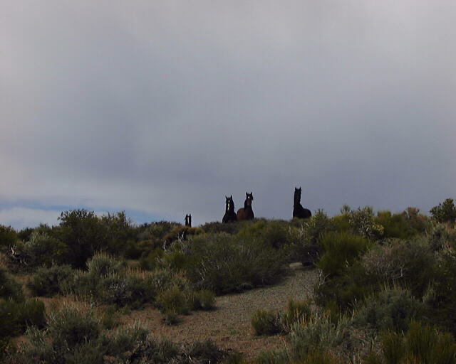
Then there was a long, steep descent to Saline Valley. Here the road is made up of rocks. So it's "soft", but not with sand; it's sort of a large gravel. My tires were marginal, but I guess it worked. This road surface continues on Saline Valley floor. We came up on a burro, and looked each other in the eye for a while. Then he started making burro noises and walked off.

Eventually we arrived at the Upper Saline Valley warm spring. This is lightly developed: there's a nice rock+concrete pool in a cluster of palms, surrounded by a burro-proof fence. Nobody here. A few miles down the road is the middle spring. I got another flat, and my triumphant re-entry into relative civilization was walking with my bike, carrying my bags. The naked dudes soaking in the pools were not impressed. I swapped out the tubes, and was good to go. Here the road improves, and there are people and many more vehicles. The road becomes smoother and wider. But also softer, and more washboarded. So not a clear win for bikes. A bit further down the road is the lower springs. These are most developed and have the most people. Most of these people are naked, so no photos. There's a palm oasis, a number of pools, a dish-washing area with the hot spring water plumbed into a tap. There's a lawn and a fish pond sourced from a cold spring. The camp host goes by "Lizard Lee". He would like you to know that there're to be "no drums past 10pm". Because "this isn't burning man". This place is in the middle of absolutely nowhere. We filtered the tap water, and hung out for a bit. Needed to put more miles behind us to stay on schedule, so didn't camp here, or take a dip. Next time. Below the springs the road passes Saline Dunes, so it's really soft and really washboarded. It was also really windy, so the descent felt like a climb. At the foot of the Inyo Mountains is a junction with the "main" road, and we took a left, towards the salt lake. It actually had water in it

The salt tram towers are still there

And the tram route up the mountain could still be made out

The wind was punishing, so we eventually made camp off the road somewhere. 52 miles. ~2000ft gain. All unpaved.
We camped in a small drainage to shield from the wind. This seemed like a good idea, but then it started raining, and then it seemed like maybe a bad idea. It rained for about 3 hours at night, but then it stopped, and nobody got flooded out. In the morning the wind and rain were gone, and the Inyos had a fresh dusting of snow

After 800ft of climbing, we found our turn, and rode across Saline Valley towards Lippincott pass, and the Racetrack.


The road across the valley is rough. Up the pass the road surface is good, but it's REALLY steep. There was lots of walking.


Eventually we were on top, barely above the Racetrack.


Note the healthy snow cover on Tin Mountain.
Hardly anybody here. The sailing rocks were here, though. The surface was still wet in places, so we just saw the few on the edge. The road out towards the pass to Death Valley is all soft, and very VERY washboarded. It was slow going, but eventually we made it to the pass. This is at ~ 5000ft. The Joshua trees like it here.


On the other side was a fast descent back down to Ubehebe Crater, and a few more miles to the car. 44 miles, ~4500ft gain.
So this was a very long way of saying that "Taco was right".