Eastern state high points

Archived TRs for ranges outside California.
Post Reply
User avatar
JeffH
Posts: 1148
Joined: Sun Nov 28, 2010 7:09 am

Post by JeffH »

I had to be in the Baltimore area so I took advantage of a holiday prior, flying out on July 4 and renting a truck for the weekend. I camped out a few nights and managed to summit another five states which brings my total to 20.
A delay at BWI kept a bunch of planes in the air too long and I was concerned that Greenbrier State Park would be closed when I arrived, fortunately there was still a staffer in the office to give me the pass for my reserved campsite. In the morning I walked to and around part of the lake, but the road was calling and I had to leave - big day scheduled with Pennsylvania, Maryland and West Virginia planned. Anyone who has been in the area might recognize that summits here are much different, since the mountains are covered with trees and expansive views are rare. The first three peaks on this journey were in rather obscure places, mostly requiring gps maps just to get into the general areas. The hikes were not long either, as Pennsylvania and West Virginia have parking area near the summit. Driving was interesting, as torrential rains happened off and on for part of the afternoons. I did meet a family while on the Maryland trail, I also saw them in West Virginia and the next day in Kentucky. It was a dad with three daughters, they drove up from Texas to visit these places of cultural significance. Cool activity!

Day 1 Stats:
PA - Mt Davis, 3213 feet, .5 mile hike since I took the scenic trail
MD- Backbone Mountain or Hoye Crest, 3360 feet, 3 mile round trip hike from the highway
WV- Spruce Knob, 4863 feet, .5 mile hike around the summit observation tower


Pictures

Sign on the road in SW Pennsylvania
DSC04418.jpg


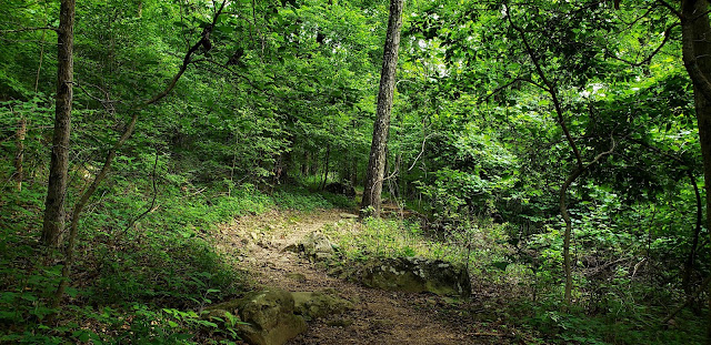
Trail to the top of Mt Davis
DSC04421.jpg


Mt Davis summit rock
IMG_6347.jpg


Maryland high point trail marker
DSC04457.jpg


The trail to Hoye Crest is next to private property but is well marked with these HP signs painted on the trees
DSC04464.jpg


Standing at the top of Maryland
DSC04482.jpg


About 50 yards from the summit is a marker showing the MD-WV border
DSC04484.jpg


Reaching the first day highest point in West Virginia
DSC04514.jpg


Observation tower at the summit
DSC04521.jpg


Despite pouring rain on the drive and walk to here, the clouds parted enough for a pose at the top
IMG_6350.jpg
"Argue for your limitations and sure enough they're yours".
Donald Shimoda
User avatar
JeffH
Posts: 1148
Joined: Sun Nov 28, 2010 7:09 am

Post by JeffH »

The second day was mostly driving, actually over the three days I put 1300 miles on the big Dodge. After spending the night at Summit Lake campground in the Monongahela National Forest, I headed out for a very long trip on a lot of two-lane roads into Kentucky. Lack of cell coverage didn't help when I got to the little village of Lynch. Surrounded by little peaks and winding roads, it was hard to tell which direction I should head. I drove around until I got enough signal to see a map, then I could follow my pre-printed directions. This site is on private property, however the landowners recognize the importance for quests like mine and allow access. Since it was raining once again, it was actually nice to have 4WD going up the bumpy dirt road although the weather kept me from spending a lot of time outside too. The observation tower here is not available now, as the ladders leading to the first two levels have been removed and I certainly wasn't going to scale the angle bars up the sides. This is another place right on the border, as the road is located between the Virginia and Kentucky welcome signs.
After that adventure, I drove over the mountains and through the woods to Virginia, where I was misled by bad reading of my directions. This forced me to drive another 50 miles out of the way and made the hike a little more interesting since I was racing daylight to get back to the trailhead and then find a place to sleep. Mt Rogers is right next to the Appalachian Trail, reached via a short spur. Once again, without a marker people wouldn't visit since the trees don't allow any view from the summit. I guess I can now say I am an AT hiker, since I was previously on it in TN, NC and the previous day in MD. This part of the AT, like many others, goes up and down so much and is so rocky that it was hard to make up any lost time. I got to the summit in 1:40, and thought I would take about an hour coming back down which would leave me about 45 minutes of light to find a campsite. Unfortunately it took 1:30 to get down and I found a campground in the dark and slept in the bed of the truck.

Day 2 stats:
KY- Black Mountain, 4145 feet, 50 yard hike
VA- Mt Rogers, 5729 feet, 9 mile round trip hike


Pictures

Part of the Odyssey completed here, another picture taken in the rain
DSC04552.jpg

Observation tower at the summit along with plenty of other paraphernalia
DSC04556.jpg


Summit register and benchmark
IMG_6352.jpg


Trail to Mt Rogers in Grayson Highlands State Park, which was a $10 admission fee
DSC04568.jpg


Helpful signage
DSC04578.jpg


Since it is the AT there are lots of white blazes - I don't know how to reconcile that with LNT... Better than a bunch of cairns?
DSC04634.jpg


Mt Rogers still in the background, uphill and downhill on this hike
DSC04588.jpg


Finally getting close
DSC04604.jpg


Summit pose
DSC04612.jpg


Grayson Highlands has a lot of wild ponies, they are used to manicure the landscape - definitely friendly with hikers
DSC04615.jpg
"Argue for your limitations and sure enough they're yours".
Donald Shimoda
User avatar
Girl Hiker
Posts: 1297
Joined: Fri Apr 04, 2014 7:46 am

Post by Girl Hiker »

Nice TR andd pics. Looks like Mt. Rogers was the most exciting peak to bag.
User avatar
Sean
Posts: 3716
Joined: Wed Jul 27, 2011 12:32 pm

Post by Sean »

Thanks! Are you sure that family wasn't stalking you? That would have freaked me out.
User avatar
JeffH
Posts: 1148
Joined: Sun Nov 28, 2010 7:09 am

Post by JeffH »

Sean wrote: Thanks! Are you sure that family wasn't stalking you? That would have freaked me out.
Pretty sure..... I thought it was cool that they did this stuff together. It's kind of a gimmick to chase them but still fun to meet others that do the same things. I don't know that I would have the patience to drive that far with three youngsters, although I remember my family vacations (six kids) were often spent on the road in the Travel Queen.
"Argue for your limitations and sure enough they're yours".
Donald Shimoda
User avatar
tekewin
Posts: 1189
Joined: Thu Apr 11, 2013 5:07 pm

Post by tekewin »

Always fun to see high points in different states. You knocked 5 off the list. 10% on this trip! How many do you have total?

MD and VA were real hikes. You don't look overjoyed in those summit photos.

I picked up the Arkansas high point, Signal Hill, over the 4th when I was visiting family. It was a 2 hour drive and a 20 minute hike that I did in street clothes. The trail looked like some of the ones in the east you posted. This was my third state high point. I have CA, TX, and AR. It's not an official goal for me, but I'll pick up whatever I can.

Image

And I didn't look overjoyed at the summit...

Image
User avatar
JeffH
Posts: 1148
Joined: Sun Nov 28, 2010 7:09 am

Post by JeffH »

I think it was the rain.... Well, in Virginia it was also the humidity. I had so much sweat it was dripping off the brim of my hat.
I'm now up to 20 states. Looking at Nebraska and the Dakotas maybe in September since I am going to drive up to Seattle, I could make it a big loop. Only one of those is a hike and that's just seven miles.
In no particular order:
CA, AZ, UT, ID, NV, NM, OK, KS, IA, RI, TN, NC, SC, PA, MD, WV, KY, VA, CO, TX
"Argue for your limitations and sure enough they're yours".
Donald Shimoda
User avatar
Uncle Rico
Posts: 1386
Joined: Thu Mar 20, 2008 7:48 pm

Post by Uncle Rico »

JeffH wrote: In no particular order:
CA, AZ, UT, ID, NV, NM, OK, KS, IA, RI, TN, NC, SC, PA, MD, WV, KY, VA, CO, TX
I grew up in UT but never made it to Kings Peak. I regret that. Did you do it as a day hike or an overnight?
User avatar
HikeUp
Posts: 3826
Joined: Thu Sep 27, 2007 9:21 pm

Post by HikeUp »

Looking forward to your TR from Alaska. ;)

Cool stuff.
User avatar
tekewin
Posts: 1189
Joined: Thu Apr 11, 2013 5:07 pm

Post by tekewin »

Borah and Kings both look like epic hikes. I've heard that Granite in Montana is a serious beast, may not be possible as a day hike. Rainier is another serious mountain, freaking cold. I have a friend who has all states but Alaska, and has failed twice on it. Last try, his partner got frostbite on both hands. He says the third try, IF he makes a third try will be as part of a paid expedition. Denali is about two orders of magnitude too cold for me.
User avatar
JeffH
Posts: 1148
Joined: Sun Nov 28, 2010 7:09 am

Post by JeffH »

Uncle Rico wrote:I grew up in UT but never made it to Kings Peak. I regret that. Did you do it as a day hike or an overnight?
tekewin wrote:Borah and Kings both look like epic hikes.
I did Borah and Kings back in 2009. Borah was the hardest descent of all the highpoints I've done, as it's really steep and the wind was blowing sand into us nearly the entire way. The Atomic Burger at Pickle's Place afterward was nice.
Kings was the first backpack trip I had done since I was 11 years old (36 years earlier). We stayed just short of Dollar Lake and went over Gunsight Pass in the morning, taking the 'shortcut' over Gunsight Peak and avoiding the drop into Painter Basin. On the return we went straight down the chute next to Anderson Pass, which knocked another mile or so off the round trip. Got back to Henrys Fork early enough the third day to have lunch at the Red Iguana in Salt Lake City. Great molé!
"Argue for your limitations and sure enough they're yours".
Donald Shimoda
User avatar
headsizeburrito
Posts: 279
Joined: Wed Nov 15, 2017 1:18 pm

Post by headsizeburrito »

Sounds like you had a fun adventure in my current part of the country, nice report! You are certainly right about the lack of views in the region. I really like how green everything is this time of year but the lack of exposed peaks and high points means limited opportunities for views and a lot of stuff becomes samey. The Appalachian Trail is call the "green tunnel" for good reason!
Post Reply