Social distancing at the Sespe Hot Springs

Archived TRs for the Los Padres National Forest.
Post Reply
User avatar
dima
Posts: 1303
Joined: Wed Feb 12, 2014 1:35 am

Post by dima »

So I finally got some free time to do a bigger trip. Given the circumstances, somewhere remote would be good. Wesweswes and I chatted about it, and settled on visiting the Sespe hot springs from Dough Flat. This is a 12-mile-one-way route on a rough trail, so it seemed like a fit.

We showed up in Fillmore on Sat, and drove up Squaw Flat road. The internet said there would be some sort of seasonal closure, but the road was open all the way to Dough Flat. Road is decently-good dirt. There're some washouts, and some muddy spots, but pretty decent mostly. About 0.5 miles before Dough flat is a steep and potholed spot that my car had trouble with, so we parked there, and biked the last bit to Dough Flat. A storm just came through, and there was a decent waterfall right next to the road here.

Initially, the trail is a very old dirt road, so it's pretty clear with a slow climb. Surrounding rocks are cool

Image

Image

Image

The entirety of this route is in the Sespe Wilderness, and it's deep-enough to get light visitation. So the trails are rough in spots, and the signage is old. Surprisingly, all trail junctions do have signs, with varying degrees of legibility.

Image

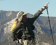
We went left. The snowy thing is the back side of Cobblestone peak, I think:

Image

Capped oil well?

Image

After ~3 miles we arrived to Cow Spring. The map says this is the beginning of the "stone corral", a super cool rock formation. This thing alone would be worth the trip. The rock is composed of many alternating light and dark layers. These have been eroded over time in various ways, revealing interesting patterns. Sorta like wood grain.

All the creeks are flowing well. The stone corral creek breaks through here, and you get a nice series of cascades:

Image

Image

And there are rocks

Image

Image

Image

Image

Image

The balls are maybe 3ft tall. There's a benchmark here somewhere too

Image

Alright, there's a gentle descent here, until the geology changes, and the terrain drops steeply into a canyon

Image

Switchbacks. Narrow, overgrown trail. Everything's passable, but it's definitely a long sleeves kind of place. You drop ~ 1000ft to a trail junction and the floor of Alder creek

Image

Here there's officially a trail, but it comes and goes, and there's definitely an element of route finding.

Image

This goes on for a mile or two, until another junction

Image

We climb out on another overgrown trail, gain ~500ft, then drop about 500ft to Sespe Creek, past where Alder creek flows into it. Here was some sort of cricket/locust that was either laying eggs or being born or molting, or something

Image

He had no interest in moving, so I took my sweet time taking photos. There's also another benchmark here somewhere

Image

Eventually there's another junction

Image

My understanding is that Devil's Gate is a long ways away on a very technical canyoneering route through the Sespe. Anybody know why this is even signed?

We found an artifact

Image

ID? And then we got to cross the Sespe. Twice! It was maybe 3ft at the deepest point.

Image

At this point you just walk up Hot Spring Canyon to the springs. We got there right before sundown, set up camp, and enjoyed the springs. The hot spring is way too hot, and flows from two clefts in the rock wall

Image

Fortunately, there's a more traditional creek flowing in this canyon as well, and the two mix to a more reasonable temperature. Helpfully, somebody left a shovel here to make it easy to move dirt around to shape the pools and to regulate flow (and temperature!)

The place is pretty big, and really nice.

Image

On the ground are lots of suspicious footprints and suspicious droppings

Image

And looking up, we found the culprits

Image

I counted 16. And one on the right is collared. I climbed one of the ridges in the morning to get a good top-down view

Image

The hot springs area is the canyon directly beneath. The next ridge carries the Johnston ridge trail. Past that is... Hines? Topatopa? Looking North is some other big something

Image

The next day we retraced our steps. It was supposed to take less time, but that didn't happen. This place is great! Hardly anybody here, mostly existing trail, cool rocks, lots of water (at least right now), rivers, sheep, hot springs.

Has anybody done any other routes in the area? I'm seeing several descriptions of canyoneering the Sespe below here. Supposed to be pretty gorgy and waterfally.

Wesweswes, got anything to add?
User avatar
Uncle Rico
Posts: 1386
Joined: Thu Mar 20, 2008 7:48 pm

Post by Uncle Rico »

Oooooh, nice trip boys. Remote area. I've only been as far as Stone Corral. Nice to see what the area looks like as you drop into Alder Creek.

I've always been out there in the middle of summer so I've never seen water at Cow Springs. Pretty cool. I was told that thing you refer to as a capped well is a weather station.

What was the condition of the Alder Creek campsite? Serviceable?

Ant Camp and Saddle Skirt were cleaned up last summer by Christopher Lord and Reece M. http://christopherplord.blogspot.com/20 ... -camp.html

I tried getting to Ant late last summer, but had to turn back before dropping all the way to Aqua Blanca due to a late start. 19W18 was clear enough then, but there was brush and the trail was faint in places, especially right after the split from 20W11. Could be overgrown in spots now.

Stillman and Jack Elliot walked the section of the Sespe from Piedra Blanca to Fillmore back in 2012. TR here: http://davidstillman.blogspot.com/2012/ ... lanca.html
User avatar
Gene
Posts: 196
Joined: Mon Dec 26, 2011 7:54 pm

Post by Gene »

The, "Capped oil well?" is a rain and snow gage.
User avatar
dima
Posts: 1303
Joined: Wed Feb 12, 2014 1:35 am

Post by dima »

Gene wrote: The, "Capped oil well?" is a rain and snow gage.
Ah, cool. I believe that. There aren't any instruments on this thing, but I can believe somebody comes by to see how much rain or snow has accumulated.

There was water everywhere this time, and I can easily believe that this is abnormal. Rico, what did you think of the stone corral? The Alder Creek camp is minimal. It's two clearings on either side of the river. Here's one:

Image

Any particular reason to go to Ant camp? Anything over there?
User avatar
Uncle Rico
Posts: 1386
Joined: Thu Mar 20, 2008 7:48 pm

Post by Uncle Rico »

The stone corral is kind of neat. It's funny, because I have a couple of the same pics that you do.
28_Stone Corral.JPG
26_Forest Service Benchmark EM 22.JPG

Don't know for sure whether there is any particular reason to go to Ant Camp. It's there. And it's in the Agua Blanca drainage which I haven't visited. So that is good enough reason for me. I don't believe it sees many visitors on account of it's remoteness.
User avatar
Taco
Posts: 5992
Joined: Thu Sep 27, 2007 4:35 pm

Post by Taco »

I used to spend time out there from 2004-08 or so. I’ve descended Tar Creek Falls with a rope, but didn’t continue it as a loop, which might hit Devils Gate or Hell’s Doorway or whatever it’s called. That looks like a cool route, but it’s closed now for them burdz.
User avatar
wesweswes
Posts: 54
Joined: Tue Feb 12, 2019 10:59 pm

Post by wesweswes »

Supposedly there are some cave paintings around ant camp, but we did not investigate.

I would strongly recommend not doing this hike in shorts... very overgrown in parts.

The campsites along alder creek are great, but it was hard not to push on to sespe hot springs.

Those rocks and the lichen by cow springs are really amazing! Worth a trip just to there (about 3mi one way).

Re this approach via the dough flat trailhead: the website said the gate (2 mi before the trailhead) was closed, but we found it open. The johnston ridge approach from the north near mt. pinos has seasonal closures for the winter weather since it is higher elevation (8-9mi), and the more typical approach from piedra blanca to the west is a 16 mi slog with many a stream crossings. They're all pretty neat trails.
User avatar
Girl Hiker
Posts: 1297
Joined: Fri Apr 04, 2014 7:46 am

Post by Girl Hiker »

Nice Report. I love the rock formations and the rock with the cool spirals. How cool to find two benchmarks.
User avatar
tekewin
Posts: 1189
Joined: Thu Apr 11, 2013 5:07 pm

Post by tekewin »

Nice that you guys pulled off a pretty big trip in the middle our current mess. It would actually be a good time for me to make a trip to Los Padres. Traffic is always a big negative for me coming back, but it would be relatively better now. I know state park lots and camps are officially closed, and some national parks, but what about Los Padres?

That rock is so weird.
User avatar
dima
Posts: 1303
Joined: Wed Feb 12, 2014 1:35 am

Post by dima »

The order is here: https://www.fs.usda.gov/lpnf

"Developed recreation sites" are closed, but everything else is open. Including (explicitly) trailheads.
User avatar
bsmith
Posts: 119
Joined: Wed Oct 28, 2009 7:36 pm

Post by bsmith »

sweet trip, especially finding the gate open and not having to walk to dough flat. i mean we're all walking but why walk extra if not necessary?

how was the section dropping down into the sespe 500' ? i recall it had been problematic - big washout - in that area.

hear any cats at the hot springs? i understand they can be quite vocal and unnerving during the night, considering how far you are back in you are.
User avatar
wesweswes
Posts: 54
Joined: Tue Feb 12, 2019 10:59 pm

Post by wesweswes »

I've been to sespe hotsprings 3 times now and never heard cats. There ARE however biting flies that produce many an itch about 2 days later
Post Reply