
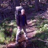
There have been no trail reports in a while so I'll write up one that I would've normally never put up. Goat Peak is in the Santa Monica Mountains just east of Temescal Canyon. The easiest trailhead would be at the top of Chatauqua Blvd. but based on recent reports it appears that this access is closed. After finishing this hike and seeing people exit from this section of the trail I am unsure what is the reality but it doesn't make too much of a difference as you're in the Santa Monicas so you probably want to maximize elevation gain and mileage anyway. I started from Temescal Canyon and went up the middle of the canyon just as you get to the retreat center there is a trail that shoots up the east side of the canyon known as Rivas Canyon trail. This trail is blissfully unused with me only passing one pair of hikers at 8:30 AM on a Sunday. When you reach the top of the ridge you can see the alternate start at Chatauqua and Rivas Canyon below you to the west.
You will see the obvious north ridge and a use trail shooting off from the main trail and a trail sign telling you to stay right. Go up this firebreak on the left and connect with the main ridge and another firebreak that connects from the east. You then come to two bumps that you can either go over or use trails have been created to contour around them. From here you have I believe three bumps before you get to the top of the obvious high point Peak 1,729 aka Goat Peak. The last section even has some slight scrambling. The naming of Goat Peak is so apocryphal that it isn't worth mentioning. There is a large sign-in can which is so LA with a dime bag of weed left in it for another type of natural high.
From here the trail continues north with two faint side trails to the right. One goes back on the ridge separating the Backbone Trail from your ridge and another is a supposed shortcut to that trail. I will try those out at a future time for another loop I have envisioned. For this day I continued along the trail/firebreak which is now more level through a more brushy section. You actually hit a higher point then Goat Peak just before you connect with the Backbone Trail out of Will Rogers at 1,755 feet. Abruptly you come to the end of the ridge and get dumped out on the main trail.
From here I reversed course and got to the bench where views of the ridge you just hiked and Goat Peak are apparent. You have two choices from here. Either follow the west side of the ridge on the main trail or continue on the ridge over all the high points back to Will Rogers. I stayed on the ridge which was much more enjoyable and rough but easily passable. Finally you reconnect with the trail and get closer to Will Rogers and the hordes of horrible 1%ers.
From Will Rogers, right near the pay kiosk the Rivas Canyon trail starts and inauspiciously takes you around houses and to the bottom of Rivas Canyon Road. The trail continues as you cross the road at the end and continue up canyon. After another two mansions you finally get away from the developments and are in a very cool canyon. There is a lot of poison oak but you get a surprising isolated feel with a beautiful oak covered canyon. There are some signs of humanity with some unsightly spray paint but overall it is really nice. Because the trail is so short and doesn't really go anywhere it is also little used. Finally after going up canyon for a bit you switchback up the same ridge that took you to the Goat. The ridge gets confusing at the top with lots of trails branching off so try to continue moving west to avoid getting off track and then you will hook back up next to the original firebreak you started up.
This was a delightful hike in the middle of civilization and also allowed for some remoteness which was unexpected. The hike was probably around 9 miles or so with a decent gain of 2,500 or so with all the ups and downs.
Goat Peak Aka High Point

I haven't found any weed, but I once found a small 50ml bottle of whiskey in a peak register.
Much better than those stainless bottle openers on Ontario, Timber, and Telegraph, that only make you wish you had a beer.
Does anyone know the history of those openers? Sounds like something HikeUp might do. ?
Much better than those stainless bottle openers on Ontario, Timber, and Telegraph, that only make you wish you had a beer.
Does anyone know the history of those openers? Sounds like something HikeUp might do. ?
My hiking trip reports: https://hikingtales.com/

LOL. I leave nothing and take nothing. An opener is one of the 10 essentials, not just on a hike, but in life. I carry one on my keychain. Sometimes I even let other people use it!jfr wrote: ↑I haven't found any weed, but I once found a small 50ml bottle of whiskey in a peak register.
Much better than those stainless bottle openers on Ontario, Timber, and Telegraph, that only make you wish you had a beer.
Does anyone know the history of those openers? Sounds like something HikeUp might do. ?
It's an EKCO product that I bought at a Stop-n-Go convenience store in 1981, I beilve. Still have it.
I separated the can opener from the bottle opener and put the bottle opener on my key chain.
https://www.madeinchicagomuseum.com/sin ... oducts-co/
I separated the can opener from the bottle opener and put the bottle opener on my key chain.
https://www.madeinchicagomuseum.com/sin ... oducts-co/

Also used to be one between the ski hut and the ridge on Baldy Bowl trail. The post and opener are long gone.jfr wrote: ↑I haven't found any weed, but I once found a small 50ml bottle of whiskey in a peak register.
Much better than those stainless bottle openers on Ontario, Timber, and Telegraph, that only make you wish you had a beer.
Does anyone know the history of those openers? Sounds like something HikeUp might do. ?
"Argue for your limitations and sure enough they're yours".
Donald Shimoda
Donald Shimoda
-
Girl Hiker

- Posts: 1297
- Joined: Fri Apr 04, 2014 7:46 am
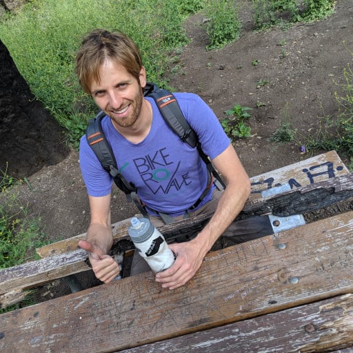
Thanks for the report HikeUp but where are the pics? we love pictures at least I do 
this is a very cool hike with a great view, particularly for me since I live within ez bicycling distance to the trailhead at temescal. Plenty of options for variations once you summit to go back through will rogers like the OP describes, or just go back the same way if you're in a hurry.