Friday, I played hooky from work and went on an adventure with teke. We originally had wanted to hike Hines Peak and Cream Puff from the eastern terminus of the Nordhoff Ridge fire road, but the forest service closed the road during the forest shut-down which then bled into the usual seasonal closure. So we were forced to change plans. We decided that San Rafael Peak, deep in the Sespe Wilderness, was a worthy alternative.
We met early at the entrance to Grade Valley Road and then made the 10+ mile bumpy drive on the washboard dirt road to the Johnston Ridge Trailhead. Grade Valley was empty except for a bunch of cattle that tried to keep up from our objective. The superior beings that we are, we dispatched the dumb beasts with ease to arrive at the trailhead around 8 a.m.
Grade Valley Road
Cattle Drive
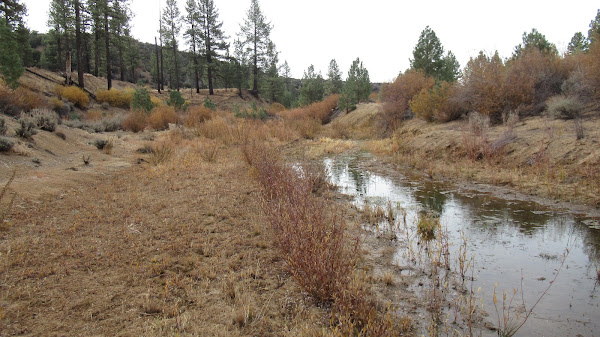
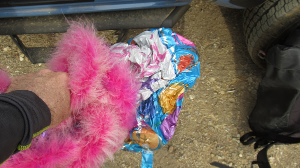
From the parking area, we traversed southeast on a well established trail, skirting Mutau Flats (private property - presumed owners of the cows) to the immediate south, losing about 200' elevation in the process. About a mile in, we crossed Mutau Creek (still flowing) and continued southeast through nice, open country dominated by mature evergreens. Here, teke found a mylar balloon with a pink boa that he reclaimed on our way out. Unfortunately, I didn't get a pic of teke wearing the boa.
As we continued, the trail took a more easterly tack and began climbing a minor drainage to a saddle at the 5,729' contour. The path was in surprisingly good shape with only minor encroachment by brush here and there. At the saddle, the trail continues east dropping into the Little Mutau Creek drainage, but here we turned south and started cross-country over a series of bumps that ultimately lead to San Rafael. The Sierra Club states that the navigation here is difficult, but we found it to be pretty straight-forward for the most part. A fairly obvious use trail is visible most of the way and we just followed that, but at the third bump we lost it briefly which resulted in us getting too low on the northeast flank. That caused us to have to make a steep climb back up to the main ridge to correct our navigational blunder.
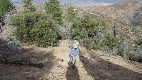
Teke in his element
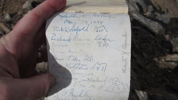
After a final, steep climb, we were finally atop San Rafael. There we found a rock-pile with a summit register dating back to 1974. We entered our appearances as we swatted away pesky hornets that appeared out of nowhere, probably because we also broke out some snacks. This peak doesn't see a lot of action. The entry immediately before ours was 10 days earlier, The entry before that was several months back.
The summit of San Rafael has expansive 360 degree views. Cobblestone, Devil's Heart, Topa Topa, Hines, Chief, Reyes, Haddock, Thorn Point, and Pinos are all clearly visible as is the Sespe Creek drainage thousands of feet below. We spent some time at the summit eating, drinking, checking messages (we had signal surprisingly), and generally lolly-gagging (word from the past) before retracing our steps back out. On the last bump before we rejoined the trail proper, we managed to get off course again and had to bash through a thicket of spikey brush so we could intersect with the saddle. Teke let me go first here to clear the path somewhat being the nice guy that he is.
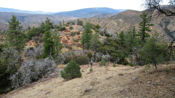
Hot Springs Canyon, Johnston Ridge, and Nordhoff Ridge
Cobblestone from Summit (distant center-right)
Summit pano - teke really isn't that chunky. He was just moving.
Devil's Heart and Topa Topa
Thorn Point. Reyes and Haddock in distance - center right
On the way out, we collected some trash that we saw coming in, including 2 more mylar balloons (sans boa), a couple of plastic water bottles, a beer can (Tecate - at least drink some decent beer if you're going to despoil the wilderness for Christ's sake), a smoked salmon package, and a gross used tissue.
We talked about hitting Lockwood Peak on the way out, but days are short this time of year so we left it for another time. Mileage was roughly 11.2 with approximately 3,400' of total gain.