White Mountain Peak on bikes

Archived TRs for desert ranges.
Post Reply
User avatar
dima
Posts: 1304
Joined: Wed Feb 12, 2014 1:35 am

Post by dima »

Taco and I like the mountains, and we like riding bikes. So yesterday we took a trip that ticked both of these boxes: we rode our bikes up to the top of White Mountain Peak. This is the 3rd-highest peak in the state: 14.2k ft tall. And there's a dirt road that runs to the peak, making riding up possible. Initially we were planning to do a BIG ride: start down at Big Pine, at 4k ft, and ride all the way up. In addition to the huge gain, this would involve carrying tons of water (there's none on the mountain), and starting in the middle of the night (100+ temps down in the valley during the day). And this would be a ~50 mile-each-way route. Just thinking of this was making me tired, so we decided to cut back on the ambitions a bit: we camped at Grandview campground at 8.5k ft on Monday night, and stated riding early in the morning on Tuesday.

Initially this is a nice sparse forest of piñon and juniper or something. Climbing up, the ancient bristlecone pines start at 9k or so. The pavement ends at 10k, at Schulman grove, about 5 miles after the start. This is a desert area, and the mountains feel similar to the ones around Death Valley. At 10k and above there're some sparse trees, but mostly it's sagebrush and wide-open views

Image

The peak isn't visible until you're fairly high up, and with each new vista we were wondering if any of what we're seeing is the high point. I now know that a sliver of the peak is actually visible in the last photo. Pretty cool views all around

Image

Image

Image

The dirt road is initially in good shape, although quite washboarded. Naturally, as you climb, there's fewer and fewer plants. This is at ~11k ft:

Image

Image

Eventually, you crest a climb, and get the first clear view of what is obviously the peak

Image

We're not almost there. The rocks composing the peak are different from what we've been riding through. The peak is very black and red (my camera washed the colors out a bit). Getting closer...

Image

Image

The road is VERY indecisive. It constantly gains and loses elevation: you spend a lot of time between 10k and 11k. The public car access ends at a locked gate at ~11.5k ft. Past that the road gets a bit more chunky, and continues to the Barcroft laboratory, 2 miles later (12.5k ft). This looks very much like what a facility at the end of the Earth should look like.

Image

You can keep going.

Image

Above it gets much more chunky, and you would need a capable vehicle with a capable driver to drive further. Or you can walk or bike. At 13k is a plateau with no trees, but with lots and lots of fat marmots.

Image

Image

The road stays indecisive. Here's Taco "ascending":

Image

At 13k the final push to the summit begins: there's a set of switchbacks that climb up the ~1k ft to the top. This is a VERY chunky road. We walked our bikes pretty much the whole way. Awesome views on top.

Image

Image

Image

Image

Image

There's a building at the top

Image

The huge register box already has an old eispiraten sticker on it. There's a benchmark

Image

And I found this ship-in-a-bottle just below the peak

Image

There was an impressive-looking dust storm in Nevada.

Image

We could see a really bright light in the distance. It turned out to be the tower from the Crescent Dunes solar field, 64 miles away (at the center of the image; click to see the full-res original):

Image

The internet says this facility isn't operating, but if what we're seeing is the tower, then either this is a "broken-clock-is-right-twice-a-day-situation", or it's back up.

The descent was faster than the climb, but due to all the up/down it still took forever. We got back just before sunset, and Taco could descend the paved road from 10k all the way down to Big Pine, at 4k.

Even starting at 8.5k ft, this was hard. The stats (net gain of 6k over ~ 30 miles) are deceptive: the road rolls a LOT, and our gain was more like 10k. The road surface is great for where it is, but it's still rough, and an mtb is strongly recommended. And the altitude effects are a factor too: Taco did well with it this time, but I had trouble on top. I brought 7L of water, and used about 5L of it. I can't imagine what you'd need to start at the bottom without using water caches.

I was thinking of this one for a while, and am pretty happy we were able to finish it!
User avatar
Taco
Posts: 5992
Joined: Thu Sep 27, 2007 4:35 pm

Post by Taco »

I will add some points:

-If done by driving to the locked gate at the furthest point you can drive, this would be significantly easier. If you have a mountain bike and wanna try it, I suggest doing it that way. If you're super-bike-mans, going from where we did at Grandview at 8,500 is good, or Big Pine if you wanna be super duper big mans. I'm glad we did it via Grandview.
-I had a big bike tour planned for this year but had to cancel because I got a new job. Riding up White was a goal, and I would be doing it from Big Pine, probably camping up on the mountain. I had planned to camp near Silver Canyon Road so I could leave most of my stuff there and go light to the top, then bomb down to Bishop. I would've thus done this full on badass style from 4,000ft to the top, but only out of necessity. What is and is not 'enough' on a ride is relative, and I'm glad Dima talked me out of that route. I am hard headed and often only see things one way. I like how we did it, and I got to descend to Big Pine, so it was like getting a huge bonus.
-I would suggest a mountain bike with suspension for this route, as well as about 6 liters of water, a meal, and a buncha snacks. We brought 8-9 liters of water or so each and I had 2+ left when we ended. Water is one of the heaviest things you carry on a bike, but I never feel bad ending with more water. I think a hardtail is fine, a full suspension would be very fast and fun on downhills but limit your water/cargo capacity. If I could have any bike just for the dirt part, it would be a lightweight hardtail with wide tubeless tires (up to 3"), a dropper post (excellent for descending from summit!), lowwww gearing, and the ability to carry 3-4 liters on the bike. Then, a small pack on your back for other water and bits.
-Temps were comfy, 60-70's and 50's near the top with occasional strong winds. Protect yourself from the sun, drink water often to avoid AMS, eat small amounts often, etc.


Dima and I split at the very tippy top of the paved section on the way back, around 10k. He went to the car to pack and drive down and I aired my tires back up, cleaned drivetrain, and began what was easily one of the most amazing descents of my life. Descending paved roads as fast as I can is one of my favorite things in life, and this one gave me 6k of loss with practically no traffic and awesome, expansive views. The descent to the 168 on White Mtn Rd is super fun. I suggest you have wider tires than a typical road bike, as there are big 'cracks' in the pavement, which are smooth so they're not a huge deal but if I were on 25-28mm tires I feel I could've eaten it, and would have to bunny hop the joints each time. There are a handful of em near the top of the descent, and a few sprinkled here and there the rest of the way down.

I think 700x40 is the ideal size for a long range paved road speedy bike you cover enormous distances with comfortably while still bombing mountain passes. I am on 650x48, so those cracks aren't a big deal at all, I just don't lean on em but I don't hafta jump em. Since this was my first time descending this road, I didn't haul ass, I just went regular fast. None of the corners appear to be decreasing-radius or anything tricky, so nothing 'snuck up on me'. I am pretty cautious so I didn't worry about eating it. There is obviously no guardrail and if one was to crash off the edge, they could fall for a very, very long distance and probably die and nobody would find you or evidence of your bits for a while.

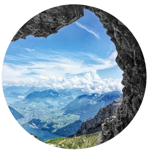
The views are amazing, and I started around 1930, so the sun wasn't in my eyes and the light coming across the Sierra to my right was awesome. Super beautiful. There was a couple hanging out at the viewpoint not far from the top and I screamed past them with my brakes squealing on corner entry, and I got my lean on and stunted on em. They didn't see me until the squealing brakes made em look and I boned out. Super tight. Right afterwards was an awesome view to the right, looking down the mountain at some of the corners below. One of the corners reminded me of the super steep switchbacks on Baldy Road above Ricehouse Canyon, so I applied a lotta brakes and took a sorta late apex/recovery line exiting wide. I take more recovery lines on descents I'm unfamiliar with so I have more room for error if I come in too hot. I descended Pikes Peak from the summit to the pits at 9k and crashed into our work truck cause I came in too hot once, and I think of that a lot. I also nearly creamed a Ford Focus on that descent. Amazing ride, that was.

There are some flatter parts before reaching Grandview, so I was only doing about 21mph there. I spotted Dima packing the car up, so I felt comfortable knowing he was behind me in case I had a crash or a mechanical on the way down. Knowing you have help takes a lot of the stress away. The road continues down until you hit a short and low angle climb, followed by a mostly straight but fast descent to the 168. It was getting a little darker, but there was a full moon, which is just absurd that so many good things lined up for me on this descent.

Nobody was on the 168 so I (gently) ran the stop sign, giving someone a heart attack somewhere, cursing cyclists. There was a little bit of nearly flat riding down to the west before the downhill began again, and I would go through the canyon. The first section is straight, and then it dramatically turns left into a super fun series of corners that I want to hit again and again. The canyon is narrow here, not in a crazy spectacular way, but in such a way that it forces the road to turn tightly as it runs to the south before turning west again. The road then enters this amazing narrow gorge with a tall rock wall on the left with striking green lichen. This section is a single lane, and I was lucky nobody was coming cause this allowed me to bomb down it very fast. The approach downhill gives sufficient line of sight to determine if traffic is ahead. I wanted to take a photo, but I didn't want to interrupt this awesome descent. You exit the gorge with a tight left right sequence, and the road straightens a bit all the way to the valley floor. It continues to serve up awesome high-speed corners with no surprises, allowing you to smash out at top speed. There is one dip where you go over a crest and cannot see the road beyond the crest, but it is straight after the crest long enough that you can just go straight and you'll have full traction for cornering left once you're over it.

There was a headwind blowing up the canyon, so I wasn't able to go as fast as possible, but I still managed 43mph at times. With no headwind and a 53t crank in place of my 46, I think I could manage a pretty impressive speed, maybe 50 something. I'm not very aerodynamic so perhaps some changes in that department would gain me a handful of miles per hour. The road keeps flying down this canyon straight at the Eastern Sierra as if on a bombing mission in Star Wars, and the terrain becomes more deserty and gets warmer, straightening out as the canyon widens and you leave the mountains. The terrain flattens out and you exit the last of the drainage, turning left and then right and slowing naturally as the grade eases. It was 80 something degrees when I hit the valley floor just as it was getting dark, and I had to begin pedaling towards the 395 where I took a break and waiting for Dima for about 30 minutes or so.

Truly an awesome descent. If you like bombing down awesome mountain roads, this is way up near the top of my list. Please go do it. If I could pick a bike for it, I would have a road bike with excellent hydraulic disc brakes favoring modulation over pure power, 700x38-40mm slicks set tubeless to a relatively high pressure so you don't get much bounce, slightly wider handlebars with ergo bends in the drops with extra padding there, 53t crank with 11t cassette, and maybe no big bag on the front like I had ;), and no headwind. My back, arms, and hands were sore before I hit the bottom, so it was a long descent that really made me happy. Unforgettable.

Thank you Dima for letting me bomb this descent. I doubt I would've ever have been here without you, and having you do what we did so I could ride it was awesome.

Some numbers from my Strava:
75.91mi 10,233ft gain
Average speed 7mph, max 44
Moving time 10h 50min, elapsed time 14h 41m

My total has a longer mileage and higher speeds than Dima because of my extended descent, adding 20 some miles.

If done from the valley floor to the top and back, the totals are 94 miles 15,775 gain 10,315 loss.
User avatar
Taco
Posts: 5992
Joined: Thu Sep 27, 2007 4:35 pm

Post by Taco »

Some pics fo yo eyeballz
Paved descent
Paved descent
Summit
Summit
Bike and Ike
Bike and Ike
Barcroft
Barcroft
Endless moon bike
Endless moon bike
User avatar
HikeUp
Posts: 3824
Joined: Thu Sep 27, 2007 9:21 pm

Post by HikeUp »

Good on ya!
User avatar
Uncle Rico
Posts: 1386
Joined: Thu Mar 20, 2008 7:48 pm

Post by Uncle Rico »

Nice ride boys.
User avatar
David Martin
Posts: 85
Joined: Sun Nov 08, 2020 7:08 pm

Post by David Martin »

Amazing ride and trip report! That's a fantastic area. I've just been as far as Bristlecone (which is well worth seeing) but that's quite a road, and I really enjoyed seeing your photos of the rest of it, up to White Mountain. Don't think I could ever make it to the top but I'll keep the downhill ride in mind next time we road-trip around there with the bikes.
User avatar
dima
Posts: 1304
Joined: Wed Feb 12, 2014 1:35 am

Post by dima »

So, we were going to go see the bristlecone groves on the way back, but the climb took way longer than expected, so we didn't actually go do the normal tourist thing. Are the trails in the groves worth doing?
User avatar
Sean
Posts: 3716
Joined: Wed Jul 27, 2011 12:32 pm

Post by Sean »

Thanks for the report. Cecelia and I did a short hike through the Bristlecones. They are pretty cool, if you're into old, gnarly trees.
User avatar
tekewin
Posts: 1189
Joined: Thu Apr 11, 2013 5:07 pm

Post by tekewin »

Awesome bike ride!

I appreciate all the detail on the road. It's a cool looking mountain and worth doing some day.

This is tempting for me since I've had my MTB for over a year now. Still not great, but comfortable on most trails. My general impression is that biking is harder than walking and easier than jogging. So biking would be harder than hiking it, and with elevation effects, maybe much harder. You've given me something to think about. Maybe the answer for me would be to bike the lower part and hike rest.
User avatar
Taco
Posts: 5992
Joined: Thu Sep 27, 2007 4:35 pm

Post by Taco »

I always looked at it as easier overall since you can usually ride the downhills, not doing any work. More efficient and easier for covering longer distances. I always wanted wheels on my ruck, and now that’s a reality.

If set up right I wouldn’t consider a bike harder than walking. Once you’re in shape and used to it, it’s pretty much the same, you just go faster and cover more ground.
User avatar
Hikin_Jim
Posts: 4686
Joined: Thu Sep 27, 2007 9:04 pm

Post by Hikin_Jim »

tekewin wrote: Awesome bike ride!

I appreciate all the detail on the road. It's a cool looking mountain and worth doing some day.

This is tempting for me since I've had my MTB for over a year now. Still not great, but comfortable on most trails. My general impression is that biking is harder than walking and easier than jogging. So biking would be harder than hiking it, and with elevation effects, maybe much harder. You've given me something to think about. Maybe the answer for me would be to bike the lower part and hike rest.
I'm nowhere near the stud rider that El @Taco is, but, like Taco says, wheels are efficient, particularly downhill. It might be harder going up -- maybe -- but it's way faster and easier going down. Typically though when I've been hiking uphill, the MTBers are slowly passing me on the way up. And totally blowing my doors off on the way down. If there's high miles involved, then a bike is often the better choice. Of course, if the technical nature of a ride is over one's skill level, then a-hiking we shall go.

One gets a nice breeze as one rides simply due to the movement of the bike through the air. This can make hot days a wee more tolerable, but of course a slow climb in the hot sun is still a suffer fest. The other nice thing about a bike is that you can attach heavy things (like water) to your frame not your back. If one can manage to leave one's back unencumbered, one stays considerably cooler. And then there's e-bikes...

HJ
User avatar
Taco
Posts: 5992
Joined: Thu Sep 27, 2007 4:35 pm

Post by Taco »

We don't talk bout them eeeeeee-bikes round here pardner! ;)
User avatar
Hikin_Jim
Posts: 4686
Joined: Thu Sep 27, 2007 9:04 pm

Post by Hikin_Jim »

You just ain't as old and fat as I am. ;)

Hey, how's that TT Contrail working out these days? is that thing still holding up?

HJ
User avatar
Taco
Posts: 5992
Joined: Thu Sep 27, 2007 4:35 pm

Post by Taco »

You get a pass for an ebïke, Jim, due to you being you. Other lesser apes will be reeducated.

The tent is great! I love it. Haven't used it in a while but I love it when I do.
User avatar
Sean
Posts: 3716
Joined: Wed Jul 27, 2011 12:32 pm

Post by Sean »

I'm waiting to see an e-unicycle on the trail. I once saw two unicyclists in El Prieto and thought they were nuts.
User avatar
Taco
Posts: 5992
Joined: Thu Sep 27, 2007 4:35 pm

Post by Taco »

Ahhahahahahahahhaha E-unicycles. The day I see that is the day I walk away from civilization.

I was joking with the boys about mountain unicycling up some dumb terrain, I dunno what yet.
User avatar
Sean
Posts: 3716
Joined: Wed Jul 27, 2011 12:32 pm

Post by Sean »

Taco wrote: I was joking with the boys about mountain unicycling up some dumb terrain, I dunno what yet.
The Sam Merrill to Echo is pretty dumb, and you can scream at all the slowpokes, "Unicycles coming through!" Then you can do tricks on the ruins.
User avatar
Hikin_Jim
Posts: 4686
Joined: Thu Sep 27, 2007 9:04 pm

Post by Hikin_Jim »

Taco wrote: Ahhahahahahahahhaha E-unicycles. The day I see that is the day I walk away from civilization.

I was joking with the boys about mountain unicycling up some dumb terrain, I dunno what yet.
I was out here in the OC near the Quail Hill Trailhead, and ... an e-unicyclist came by. He was decked on in a crash helmet and all sorts of stuff. Looked like a pretty heavy duty uni. Don't see the attraction myself.
Edit: It looked something like this: http://ws-na.assoc-amazon.com/widgets/cm?l=as1&f=ifr&o=1&t=tapatalk02-20&asins=B093WY7411
"Only" $2,000. ?

Glad the TT Contrail is working out. TT makes some nice stuff.

HJ
User avatar
Taco
Posts: 5992
Joined: Thu Sep 27, 2007 4:35 pm

Post by Taco »

Sean hahahahahahahaha stunting on the ruins. Hahahahahahahhaha I love it!

Jim, that's a one wheel or whatever they call it. I see em on my commute. I always make fun of em in my head. I know, don't judge people or whatever, but damn dude people will do anything to avoid exercise. Pave the way for the robots! Saw my legs off so I can be hoverman and ride a dumb electric scooter and get made fun of by random dirtbags.

Arright I'm done for now

No wait, this one dude I see is covered in blinking lights. I would do everything in my power to be invisible on one of those. Remember the shame of riding a moped? I miss those days, days of truth. It's not about GIT GUD anymore, it's all fat acceptance and the CCP trying to take away our precious bodily fluids.
User avatar
HikeUp
Posts: 3824
Joined: Thu Sep 27, 2007 9:21 pm

Post by HikeUp »

My fluids. I keep.
User avatar
Hikin_Jim
Posts: 4686
Joined: Thu Sep 27, 2007 9:04 pm

Post by Hikin_Jim »

HikeUp wrote: My fluids. I keep.
For me, it kind of depends on how much beer I've had that evening... ?

HJ
User avatar
Hikin_Jim
Posts: 4686
Joined: Thu Sep 27, 2007 9:04 pm

Post by Hikin_Jim »

Taco wrote: people will do anything to avoid exercise.
"Among the US population... 34.1 million adults aged 18 years or older—or 13.0% of all US adults—had diabetes (Table 1a; Table 1b)."

I'm sure it's unrelated. And hey, only 34 million people. Glad it's not a serious problem...

HJ

Link: https://www.cdc.gov/diabetes/pdfs/data/ ... report.pdf
User avatar
Taco
Posts: 5992
Joined: Thu Sep 27, 2007 4:35 pm

Post by Taco »

General Turgidson
Post Reply