Sean and I gathered a crack-team from amongst some long-time posters on this board to go higher and deeper in the area than I had yet explored, with the goal of making the Oat Mt summit from the north side, which I have never heard of anyone doing. We found out why!
I took few photos because everyone else was doing a great job of it, but here is some prose:
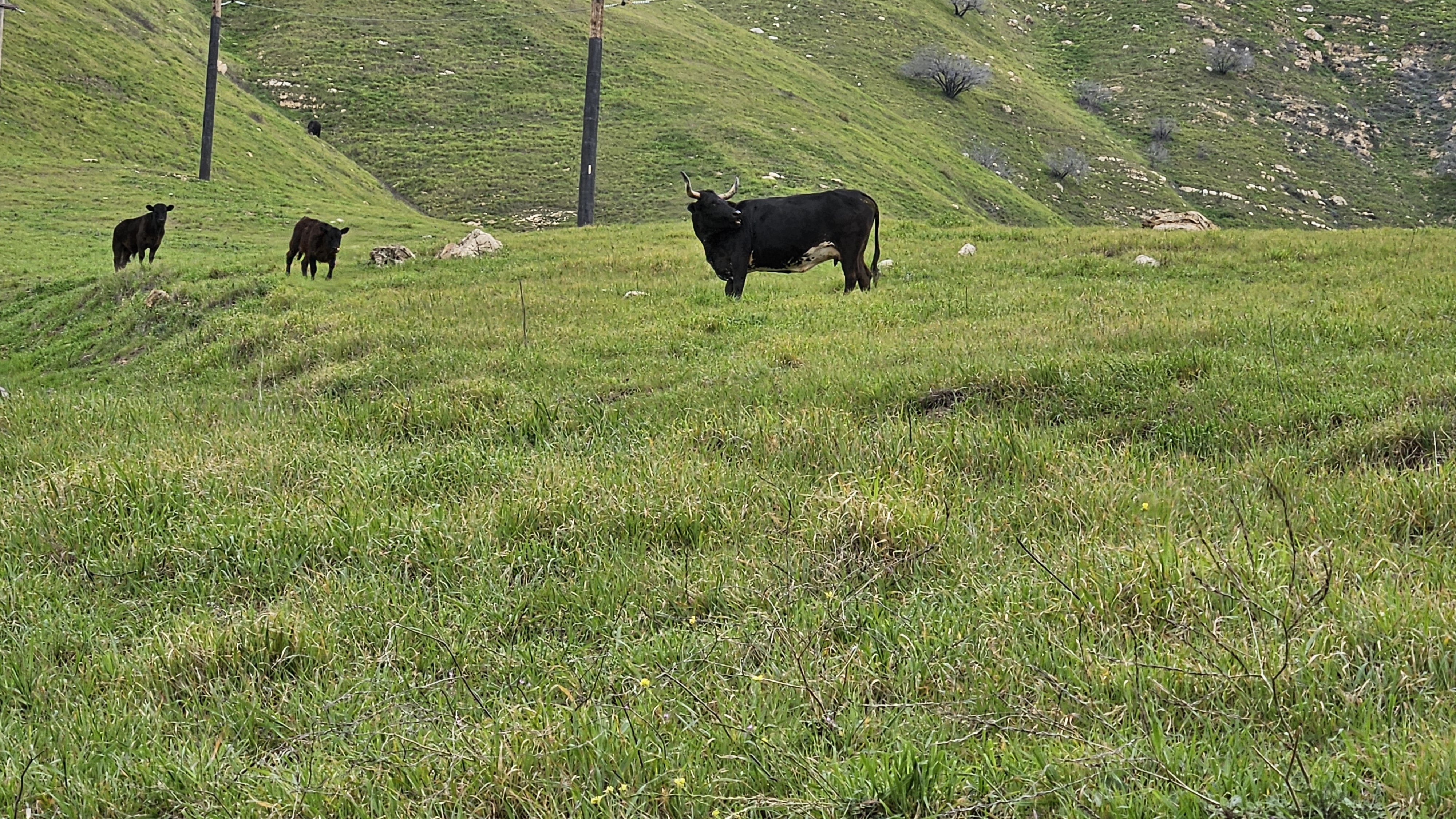
First it was up into the beautiful Rice Canyon, one of my favorite canyons around Los Angeles, a classic California landscape of wild-flower meadows dotted with ancient Oaks. What I hadn't seen before was the water as high as it was - usually a trickle, but yesterday we were rock-hopping and making wide jumps to get across the swollen freshet. Sean ditched his shoes entirely and Jeff opted to just walk right through.
I enjoy planning my hikes carefully; its what I do during the week when I can't actually be hiking. Planning a hike is sort of an exercise in daydreaming. So that is to say there was a specific spot I wanted to leave off the trail to scramble up a narrow ridge, so I halted the group, we took out loppers and strapped on gloves, and headed west out of the canyon and into the unknown. I always love that moment! I will mention we had a few spots on this hike that required lopper work, but it was never thorny, being mostly sage, Toyon Berry, some shrub oak, and only a few Yucca now and then. None of that brutal Bucktorn you get in the Gabes!!
The narrow ridge circled a 'sub-canyon' of Rice which featured dramatic cliffs in the Modelo formation, a spot that had caught my eye on Google Earth. As we rose above the trees along the ridge and the cliff edge, Matt and I bounded ahead for some cool photos across the canyon. While posing for those photos turns out we were both standing on a hibernating baby rattlesnake hidden in the sage!
Views opened up and we nerded out identifying peaks in the distance, a sometimes heated debate I always love to participate in. The view of the Gabes from the west was one many in the group were less familiar with. Love a new perspective on an old friend.
We hacked through some thick, dusty white sage and then it got steep before we reconnected with a use trail up on a higher ridge. This briefly became class-3 scrambling up siltstone. Everyone was a champ with it.
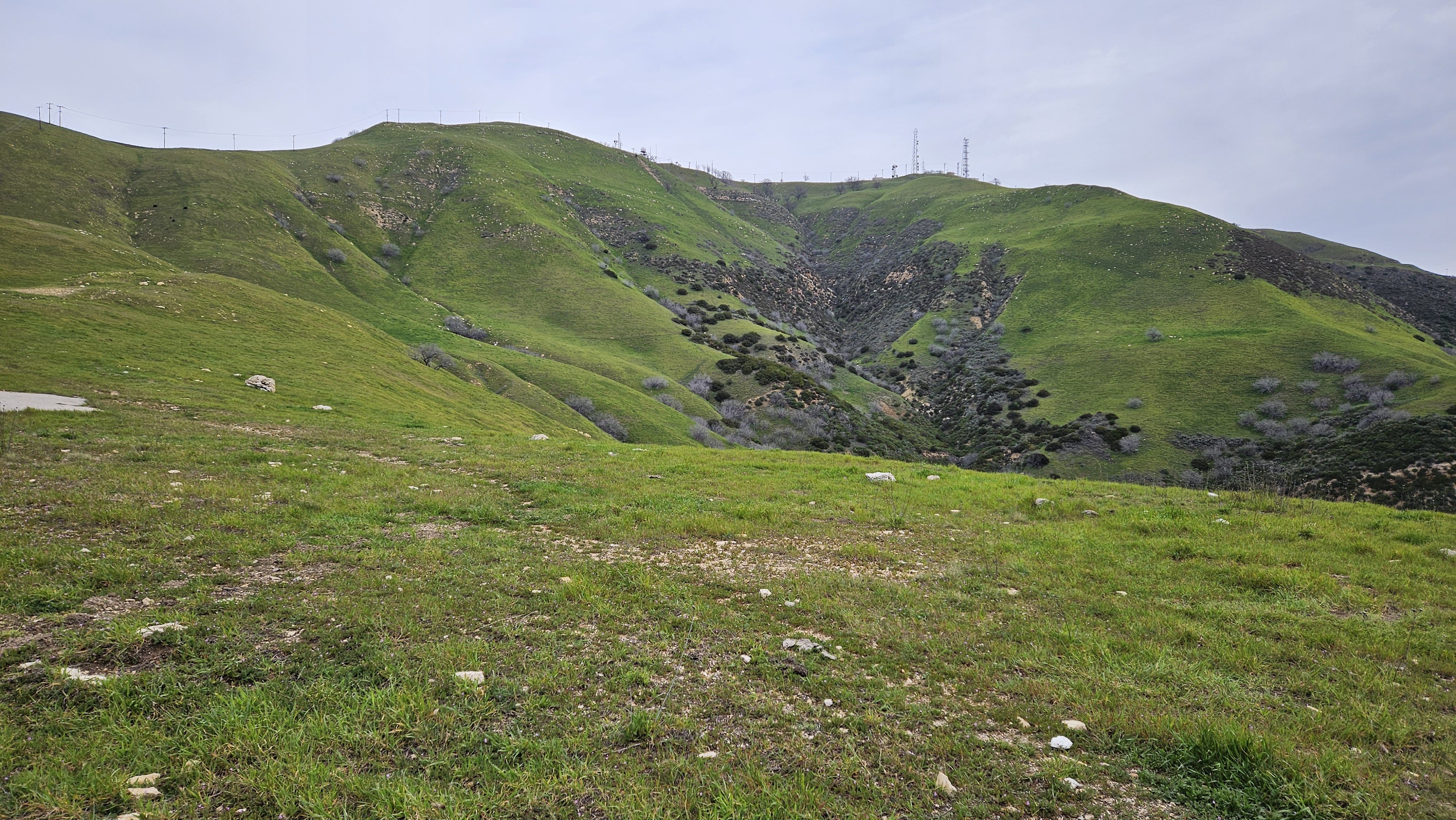
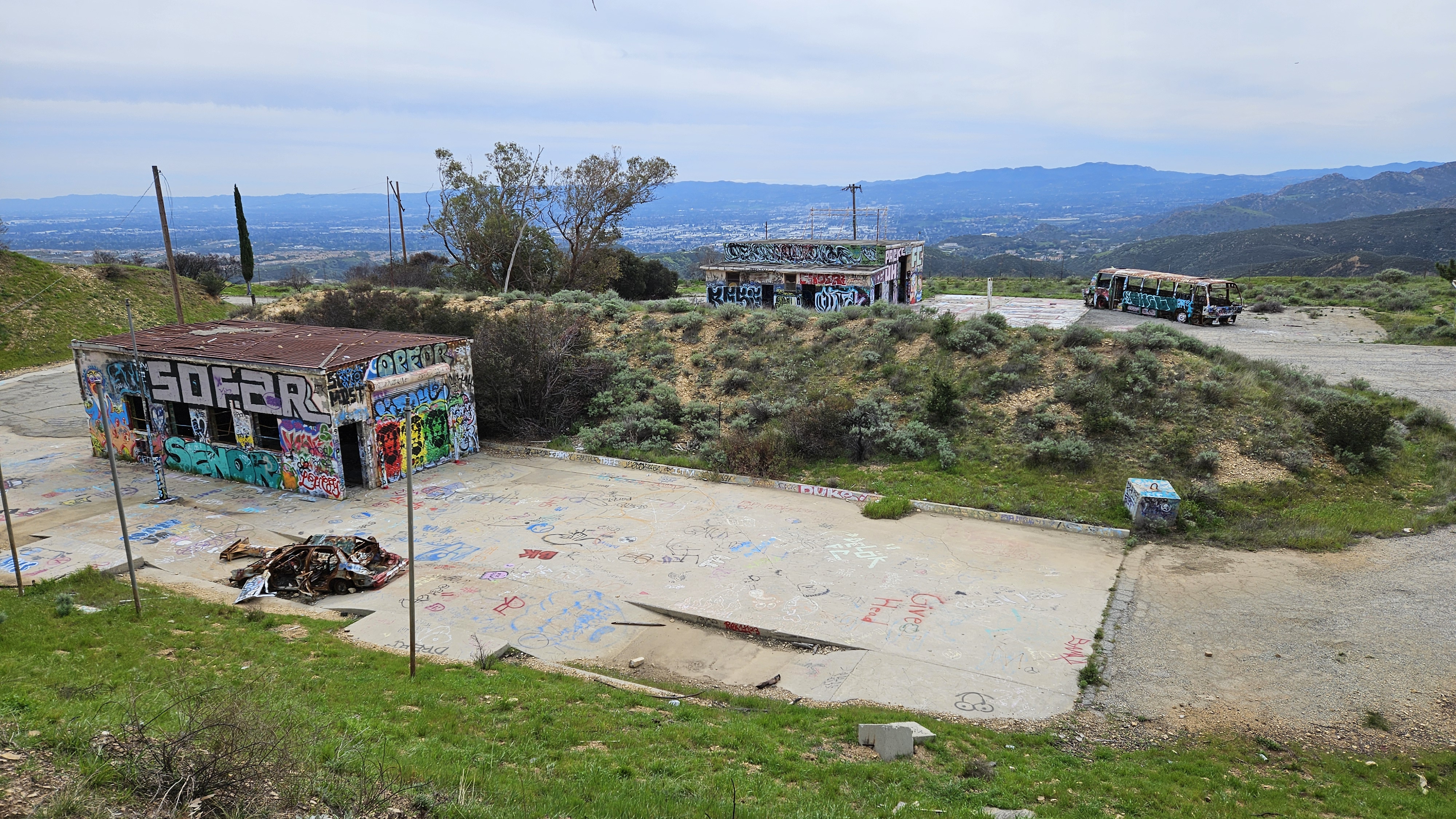
Back on a rough but very followable use-trail at the top of Rice Canyon, we headed west along a scenic thin and bumpy ridge-line past a flagpole and some nice new benches built in 2020 with a summit register. I can't find a peak name for this anywhere - does anyone know a name for this? The trail is not on alltrails and surprisingly obscure considering the work someone put into it.
It looked intimidating from afar, full of craggy sandstone outcrops, but we nonetheless began working our way along the ridge lining the east end of Towsley Canyon to achieve point 3469 and the Oat Mt ridge. The brush became thicker, and we quickly learned the best bet to avoid the jungle was to stick to the crest of the ridge. Going was slow but we eventually made it to point 2866, and it was on the saddle north of here that the ridge narrowed to only a few precious feet while plunging downwards in what could readily be considered a class 4 scramble on Towsley Formation siltstone, and an eroded/eroding one at that. Someone had affixed a black rope to a shrubby oak, but it looked in rough condition itself, having likely been there a few years, and the oak shrub it was tied to wasn't all that secure looking either. Some (older) members of the group instantly decided this the end of the line. Some (younger) members of the group investigated a little further but came to the same decision. It was sheer cliff for a couple hundred feet down into Towsley Canyon to the east, and west into Rice Canyon wasn't much better. It was an impassable ridge. No way along it, no way around it. Now I know why no one has done this before. Oat Mountain would win this round, but I vow to tackle it again from a different approach.
Meanwhile, tekewin was on the opposite south side of Oat Mt, attempting to meet us from the other direction - I'll let him tell his side of the story!
We cleared space on the tiny summit of 2866 for a lavish grilled cheese feast courtesy of Jeff, and Uncle Rico heroically carried up a glass handle of cinnamon goldschläger we shared. I couldn't think of a better spot to celebrate my birthday!
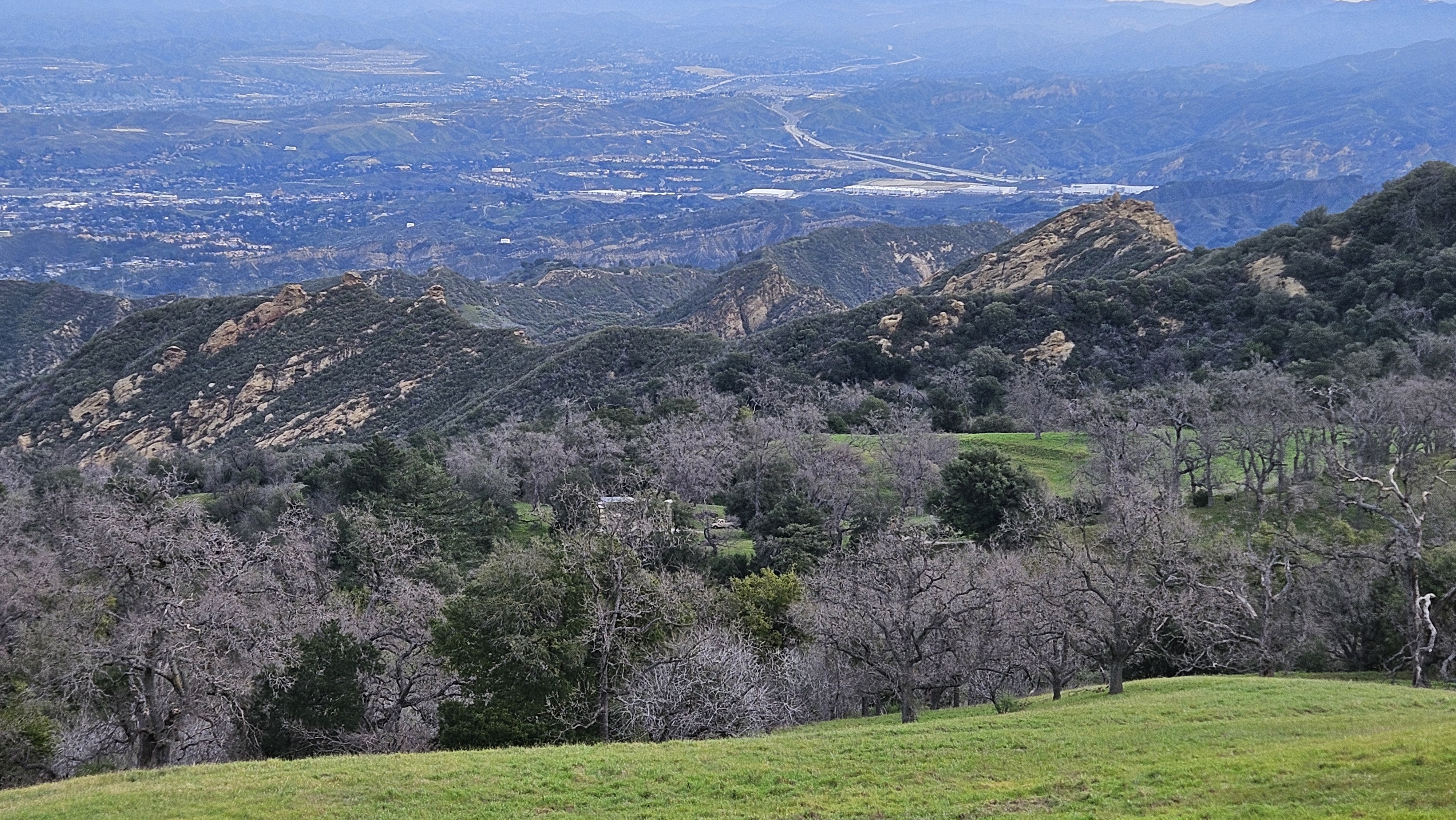
Having done a fair amount of cutting on the way there, it was a breeze to scramble back retracing our steps, turning west to fully encircle Wiley Canyon along more ridge lines, with fantastic views of the charismatic Towsley Canyon, dramatically demonstrating the violent faulting of multiple synclines and anticlines that form the Santa Susanna Mtns. Yet another hidden gem just outside LA....
We eventually connected with the Towsley Canyon Loop trail and were amongst the "filthy casuals" for the first time that day, winding down into Wiley Canyon past fallen picnic tables to check out the oil seeps that make Wiley Canyon the worst place to fill your water bottle in SoCal. Geologically speaking very cool though! The intrusive volcanic pluton of the San Gabes can't give you this....
We made the annoying but necessary road walk back to our cars, and closed our loop after 7 hours of adventure. I loved this hike. It was a terrific birthday present and it was the community here that gave it to me. Much gratitude. Can't wait to return to hopefully conquer Oat Mountain for good!!!! Maybe for my 39th birthday?
7.08 miles distance, elevation gain 2,304 ft